About real clouds, weather, cloud seeding and science autobio life stories by WMO consolation prize-winning meteorologist, Art Rangno
Another day with Altocumulus clouds, and what else? The usual: aircraft-produced ice canals
They seem to go together every time we have Altocumulus clouds; aircraft flying through them create holes or canals! Have been photographing this phenomenon since the early 1980s, and I have not seen it so consistently occur every time there was a flake of Altocumulus around as has been the case here this winter! Its likely because our Altocumulus clouds have mostly been so cold, having temperatures lower than -15° C. Mid-level Altocumulus clouds can range in temperature from well-above freezing to below -30° C.
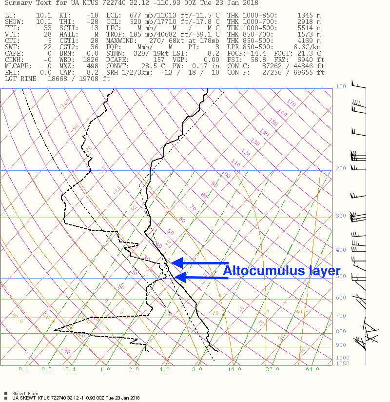
What was unusual about yesterday afternoon, if you caught it, was that you could make out the aircraft producing the “high temperature contrail” (aka, APIPs), a four engine prop aircraft flying just under the bottom of the Altocumulus layer. Even if you see a contrail in the Altocu, you can almost never make out the aircraft type for sure because its too high or in the clouds. But, because of our cool spell, those cold Altocumulus clouds were lower than usual, around 15,000 feet off the ground, or near the 500 millibar pressure level. The temperature at the bottom of this layer was -21° C. See annotated NWS sounding, courtesy of IPS Meteostar, below:
The National Weather Service sounding launched from the U of AZ about 3:30 PM, near the time that the “high temperature” contrail was being produced. A slight amount of Altocumulus was over and downwind of the launch site.
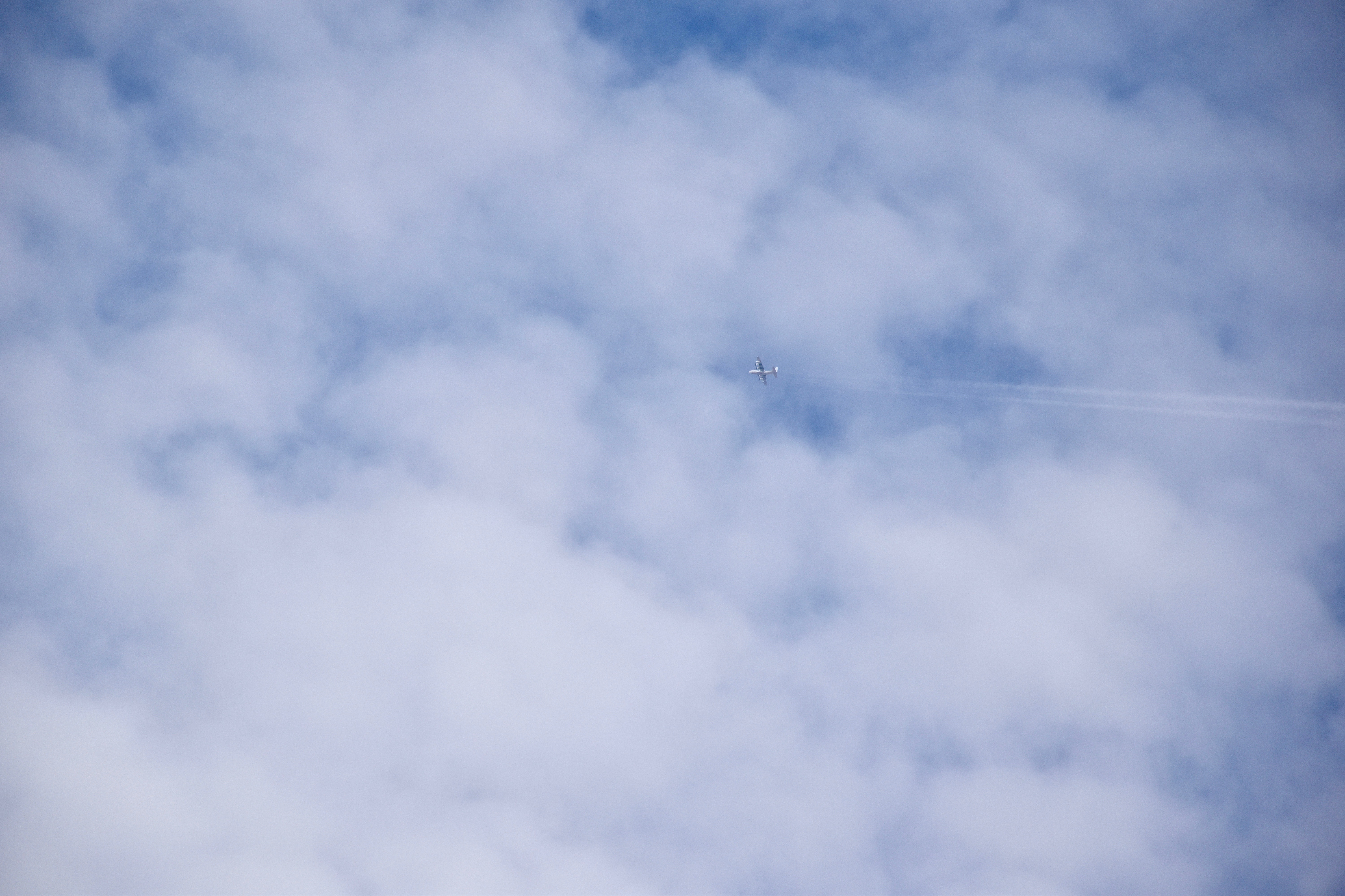
Here’s your aircraft shot, full size so’s you can really zoom in and see those engines:
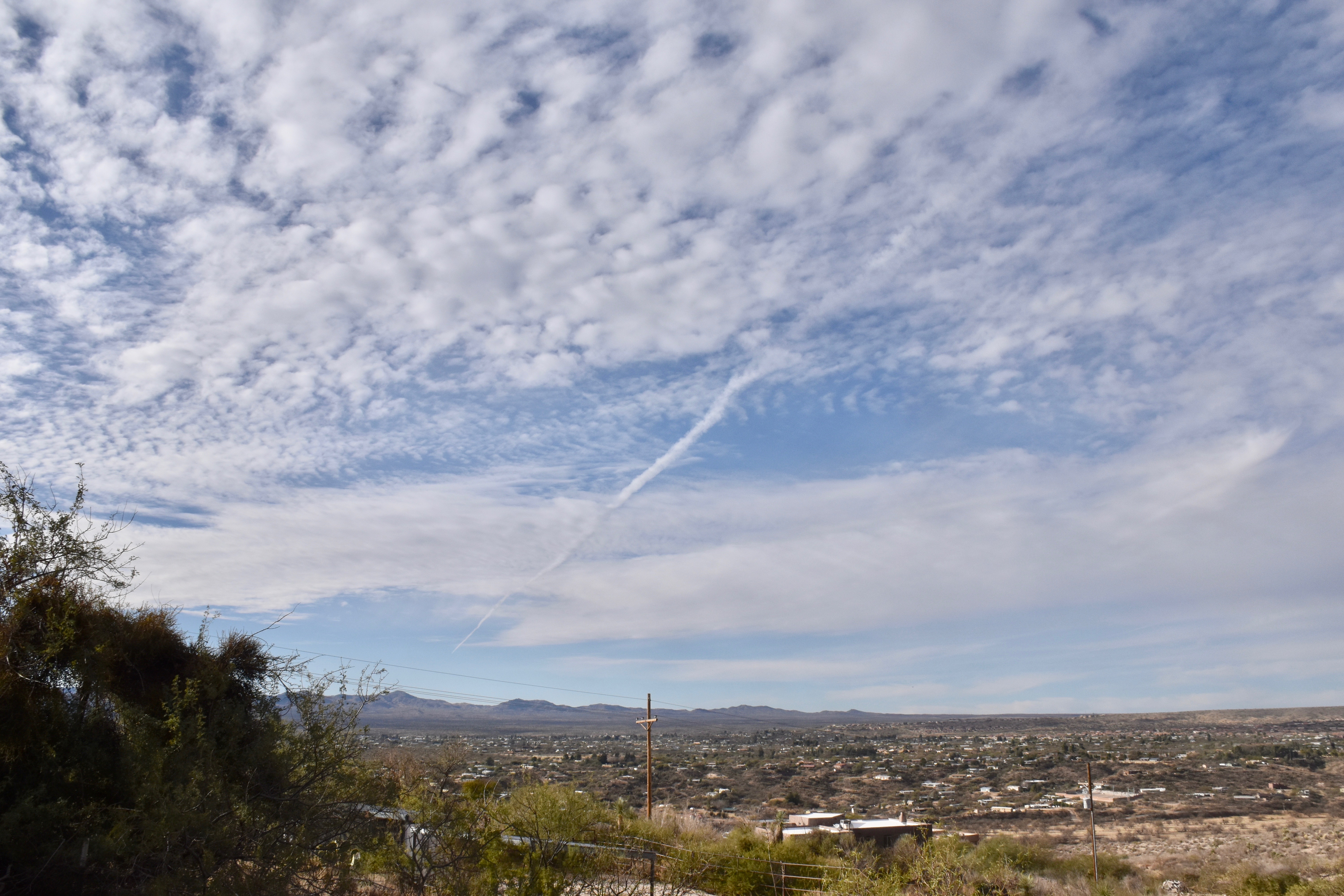
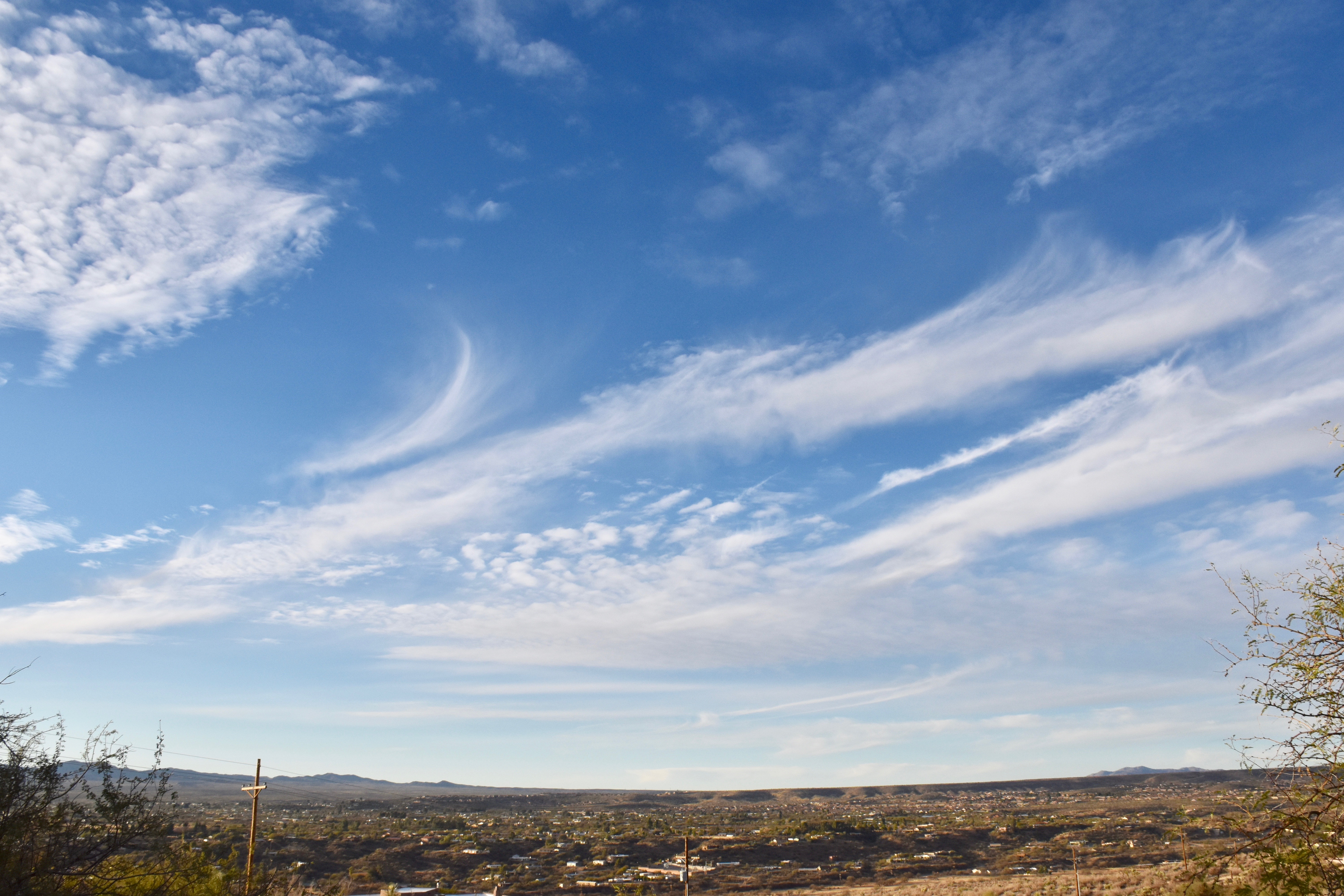
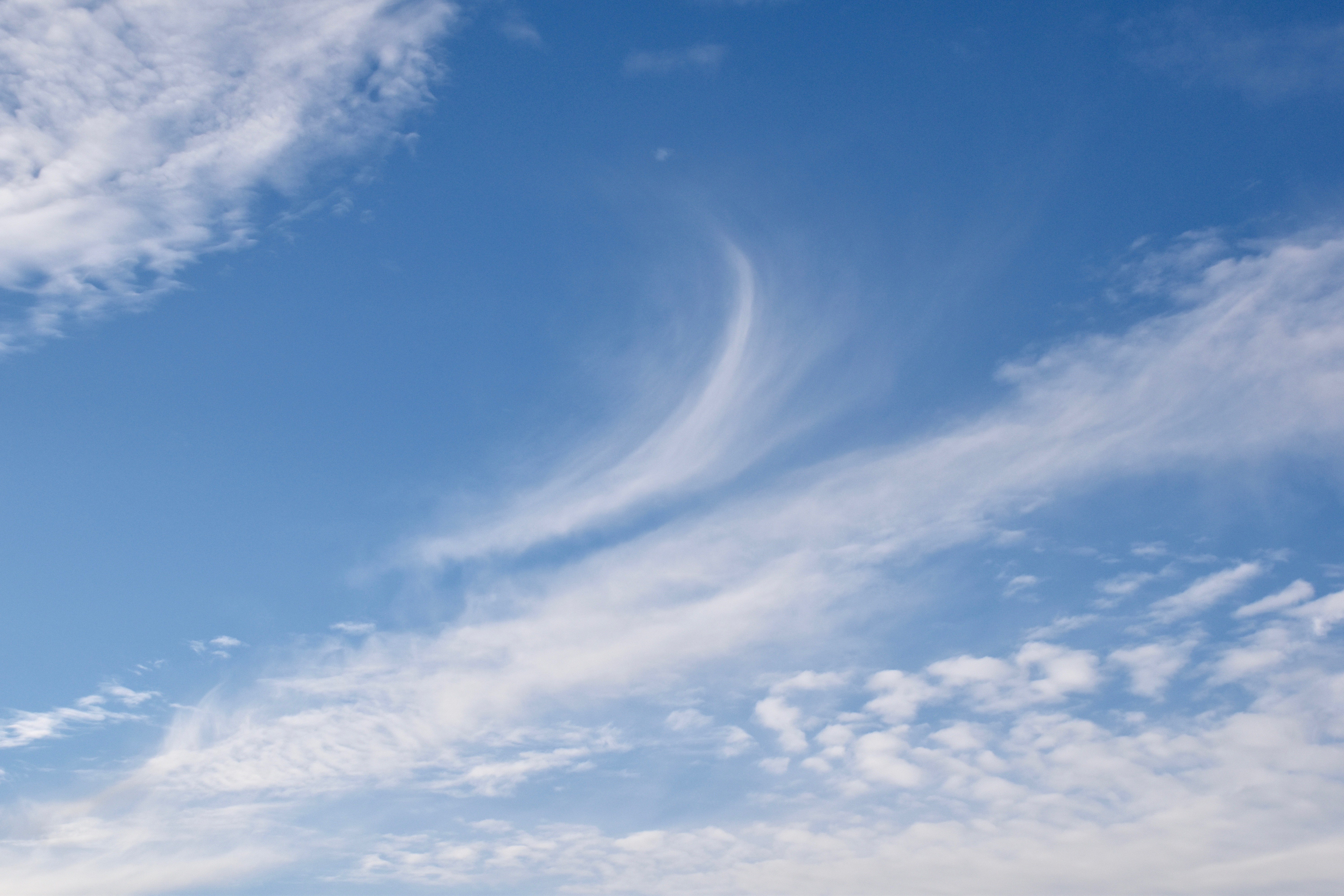
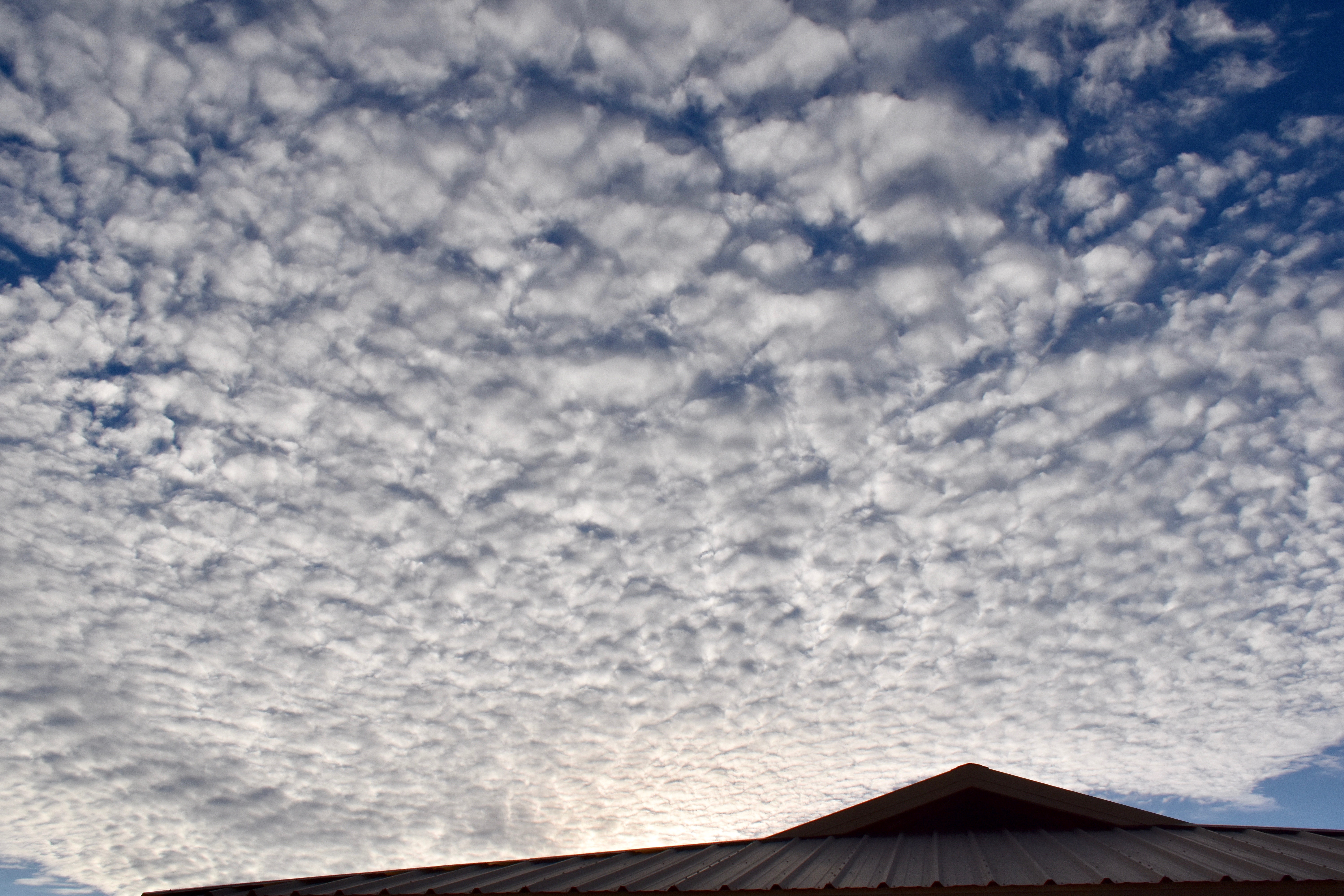
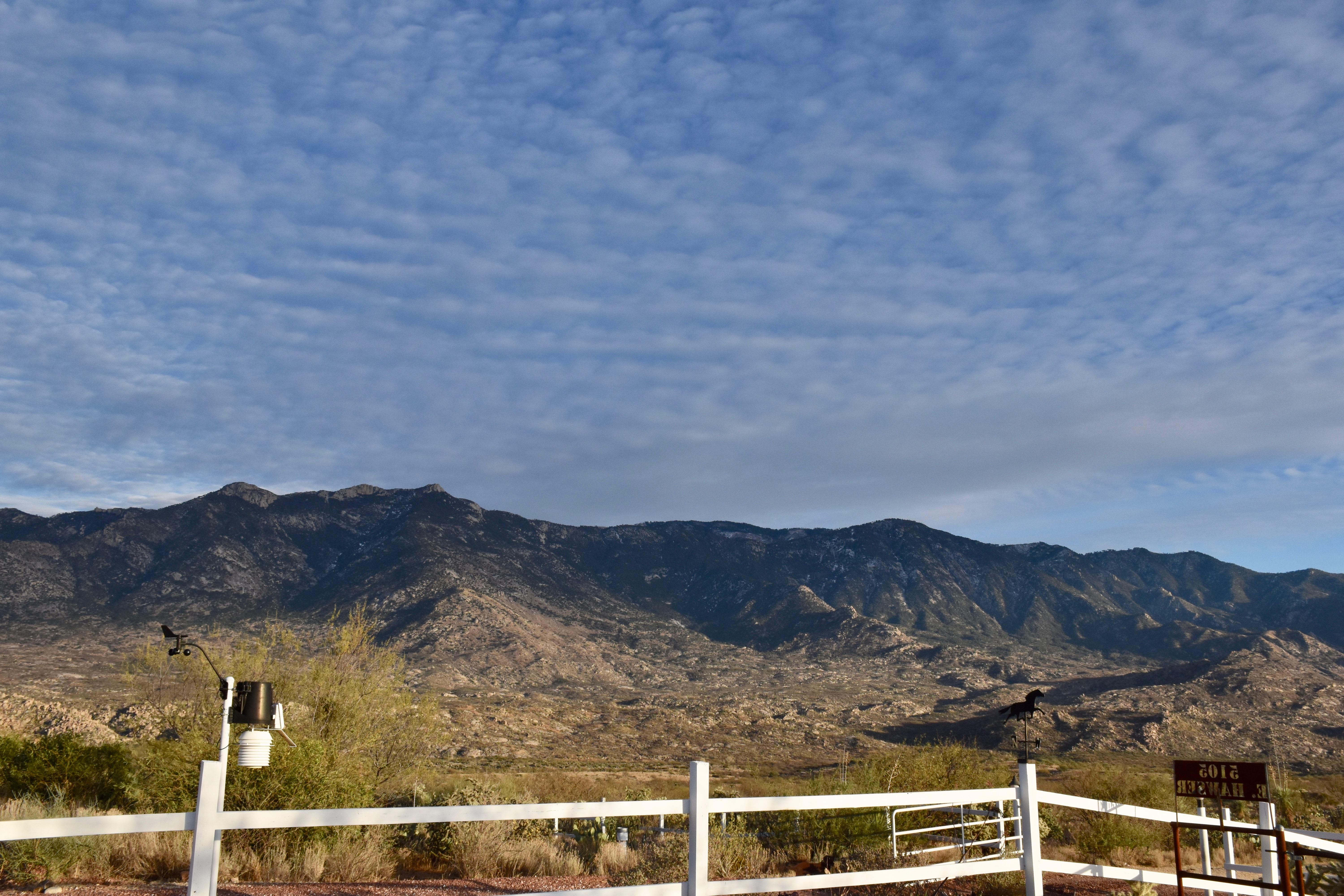
3:37 PM. A four prop engine aircraft flies just below (maybe 100-300 feet is all) the base of the Altocumulus layer and left a LONG contrail.3:37 PM. The long contrail behind that plane. Note that it goes into clear air; cloud droplets not required. Looks exactly like a normal contrail, those produced by jets at temperatures lower than -35°C when the air is moist.3:44 PM. That contrail now extended from horizon to horizon. it appeared that he climbed through this layer on the way out. The broadening with visual evidence of ice is in the upper right hand corner.4:16 PM. Now the classic ice canal is obvious in our Altocumulus layer. More aircraft produced ice is present as well.4:16 PM. Zooming in on a segment of this canal shows that while its completely ice, there are no virga trails showing. Am guessing that those prop engines produced prodigious numbers of ice crystals via prop tip cooling to below -40°C, where homogenous nucleation of ice occurs (producing prodigious concentrations of ice crystals, maybe tens of thousands per liter in the immediate lee of the prop tip). Here the crystals have spread out due to turbulence, but there are just too many competeing for the available vapor to produce crystals big enough to have much of a fall speed.5:12 PM. Due to the low windspeed at cloud level, just 15 knots or so, this ice canal was visible for more than an hour and a half. It was remarkable how close to natural Cirrus looked at that time. It would be almost impossible to assign this ice to the level of the Altocumulus. Check the close up, next.5:12 PM. Cirrus uncinus homogenitus (I’m not kidding. that would be the name for this Cirrus, having been produced by man (well, or a woman pilot, of course).5:13 PM. Unperturbed Altocumulus perlucidus translucidus (the latter, little or no shading due to thinness of elements).5:14 PM. Shadow drama on the Catalina Mountains from those Altocumulus clouds, made even more interesting by the presence of a weather station in the photo.
S
5:58 PM. The setting sun illuminates that last bit of the aircraft-produced ice canal (“homoCirrus” on the right). This was probably the longest viewing time for any such event over one location, again due to the light winds up there.
The weather ahead, WAY ahead
Not a single model run since two days ago has produced a big trough in the SW US, in complete opposition to the interpretation of spaghetti ensemble output at that time. This would be, IMO, one the greatest busts of all time (not for me, of course), but for spaghetti ensembles (I was only foretelling what they told me), spaghetti considered to be one of the great forecasting advances of all time when computers became powerful enough to produce them in a timely manner.
If we believe these later model runs, it will be relatively hot and dry here, not cold and wet, as was suggested here.
But being of a stubborn nature, Cloud Maven Person is not yo-yo-ing on his forecast just yet. Surprises are almost certain in these model runs, since spaghetti still supports troughing beyond 10-12 days… Standing by for model yo-yo-ing….
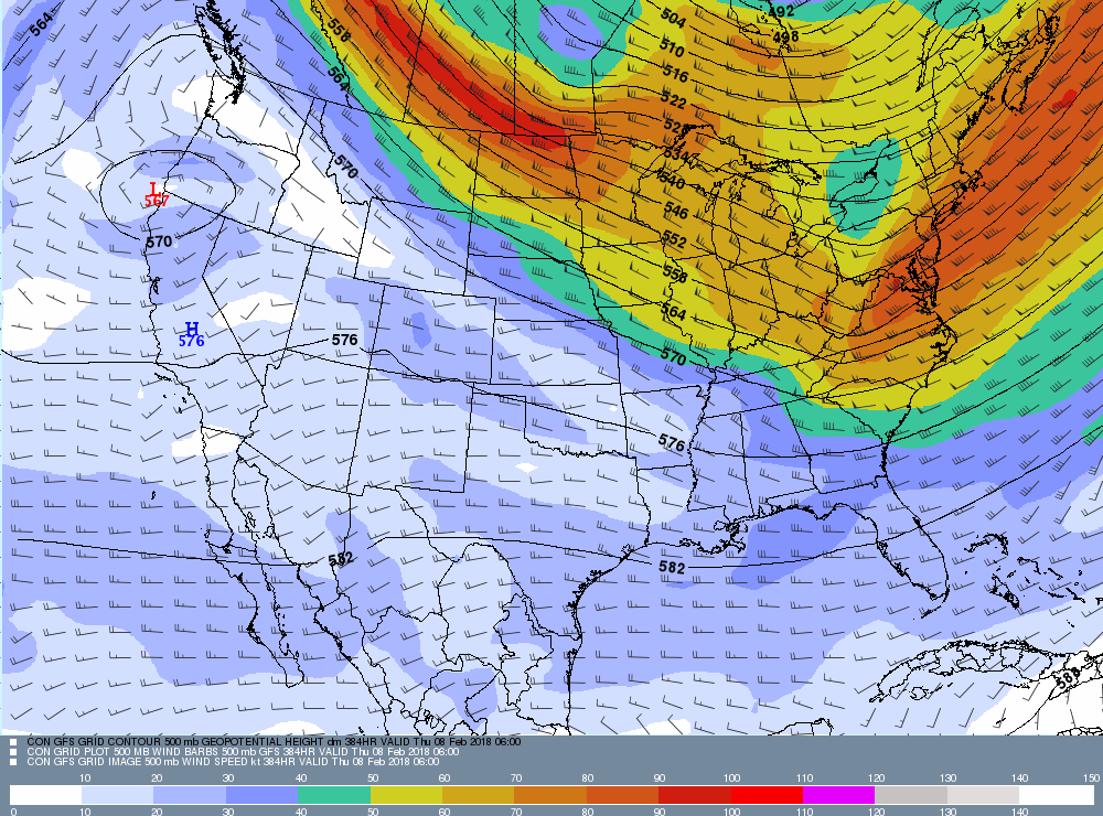
A laugher (???) below from our very latest computer run (from IPS Meteostar again). This map in incredible in the lack of jet stream activity over most of the US!
This 500 millibar map is based on global data from 11 PM AST. last evening. Its valid for February 7th, 11 PM AST, way out there. This is a remarkably quiet map for wintertime in the US! Can it possibly be right? Hope not, at least in our area.
The End
By Art Rangno
Retiree from a group specializing in airborne measurements of clouds and aerosols at the University of Washington (Cloud and Aerosol Research Group). The projects in which I participated were in many countries; from the Arctic to Brazil, from the Marshall Islands to South Africa.
I’ve about had enough spaghetti here, Art! It’s about time you had some down there. Over 7 inches of rain for the month here so far, and more to be coming.
Hah! Man, the models are showing another several inches up there in the next week, too, as you know. Remarkable, really, even for your area. I’m sure there’ll be some mud slides in the Pac NW.
a