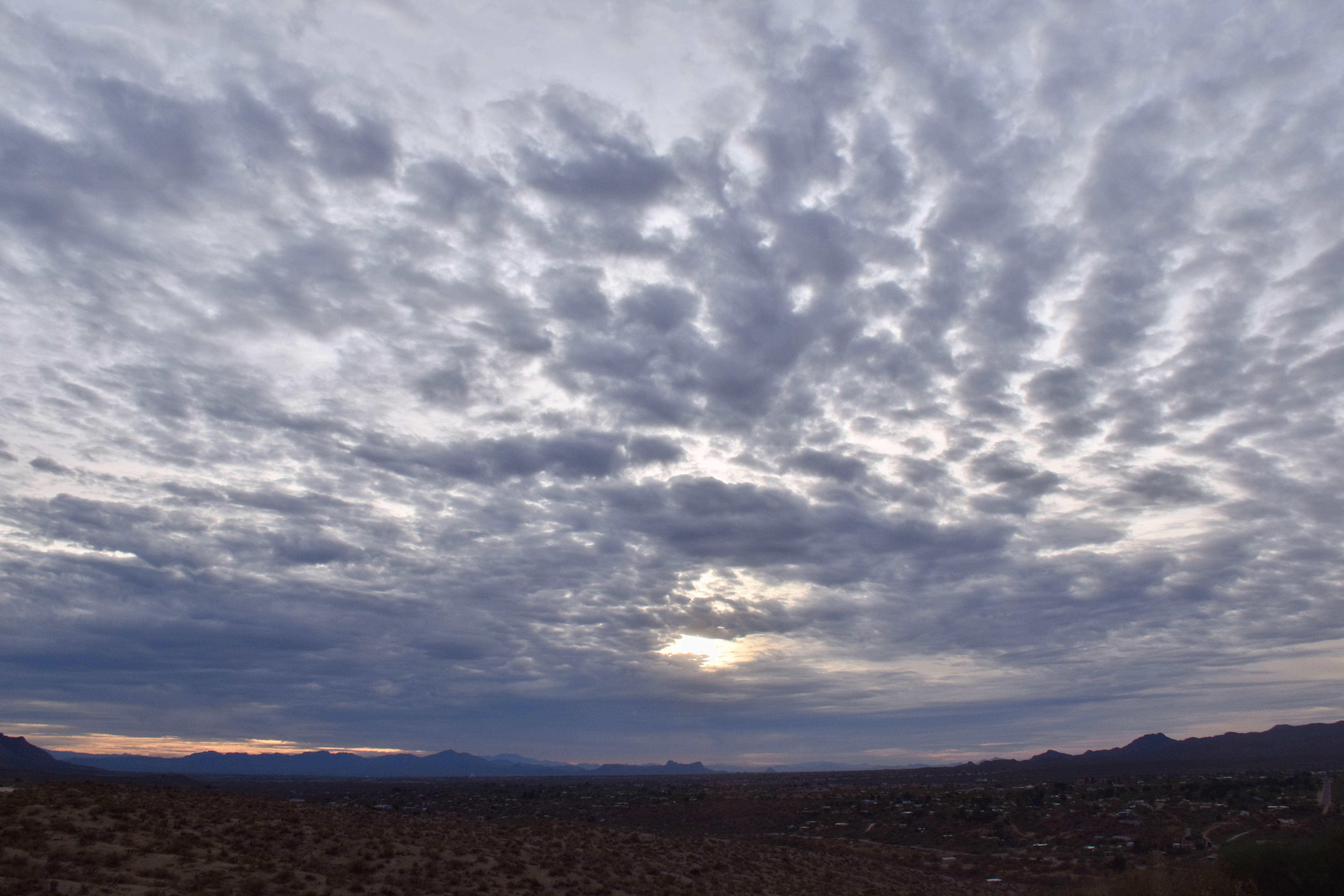
A swatch of Altocumulus perlucidus translucidus (sorry, that’s the way we talk around here) passed over Catalina early yesterday afternoon, each “unit” nearly perfectly evenly spaced with its fellow cloud element creating a brief period of cloud awe for those Catalinans (or is it, “Catalina-ites”? “Catalinians”? Who knows, who cares?). Here it is, in case you work indoors and missed it. It was truly a fabulous sighting!


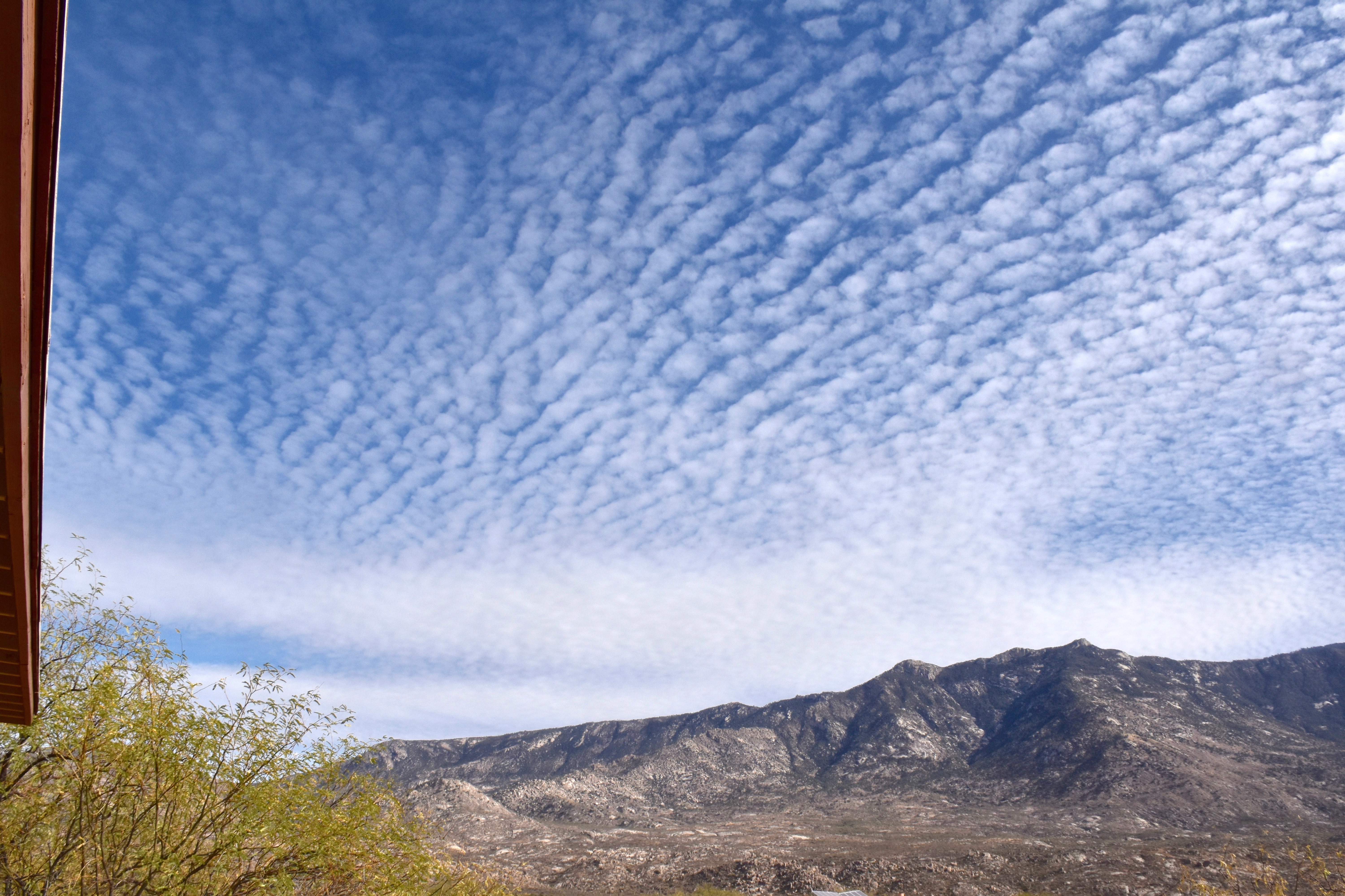
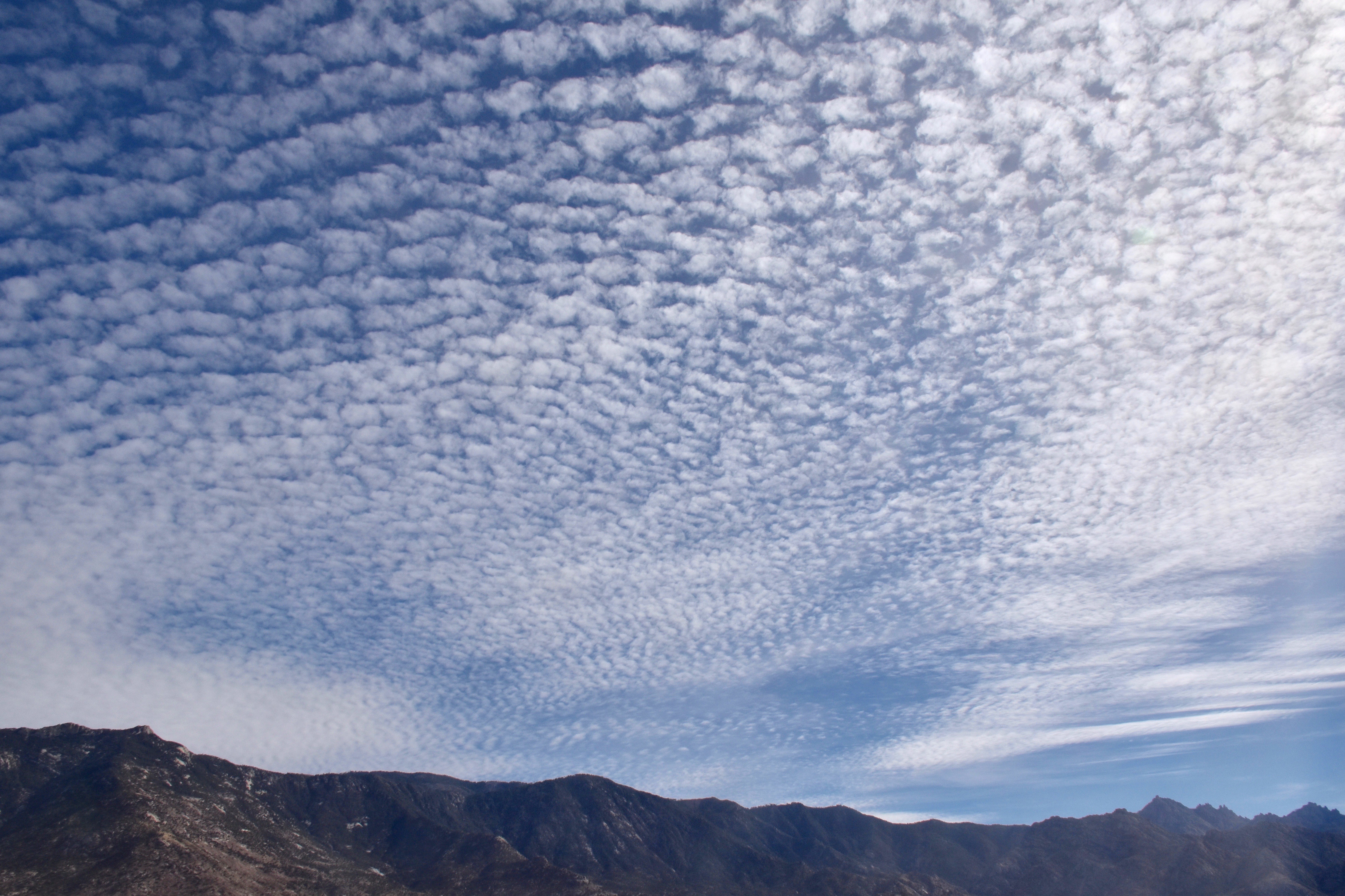
The afternoon was marked by a melange1 of middle clouds:

The weather just ahead
The local TEEVEE met men are, of course, pounding out the good news rain is just ahead for Catalina. Looks like, oh, 100% chance to CMP (Cloud Maven Person) starting after midnight Tuesday to Wednesday. How much?
This is a potent, but fast moving trough. Maybe will have only 2-4 h of rain with the passage of the cold front and its rainband. But, coming from the sub-tropics, should have a appreciable rain band with it.
I would expect rainrates to reach “moderate” as the heart of the band goes by for a coupla hours, anyway. Moderate rain is defined by the NWS as 0.1 to 0.3 inches per hour. So, only two hours of moderate rain should be at LEAST 0.2 inches, and most likely more.
We’re thinking here that there’s a 90% chance of more than 0.15 inches, and a 90% chance of less than 0.70 inches. So, averaging those two leads to a best estimate in CMP’s opinion of 0.425 inches! Wow. Nice.
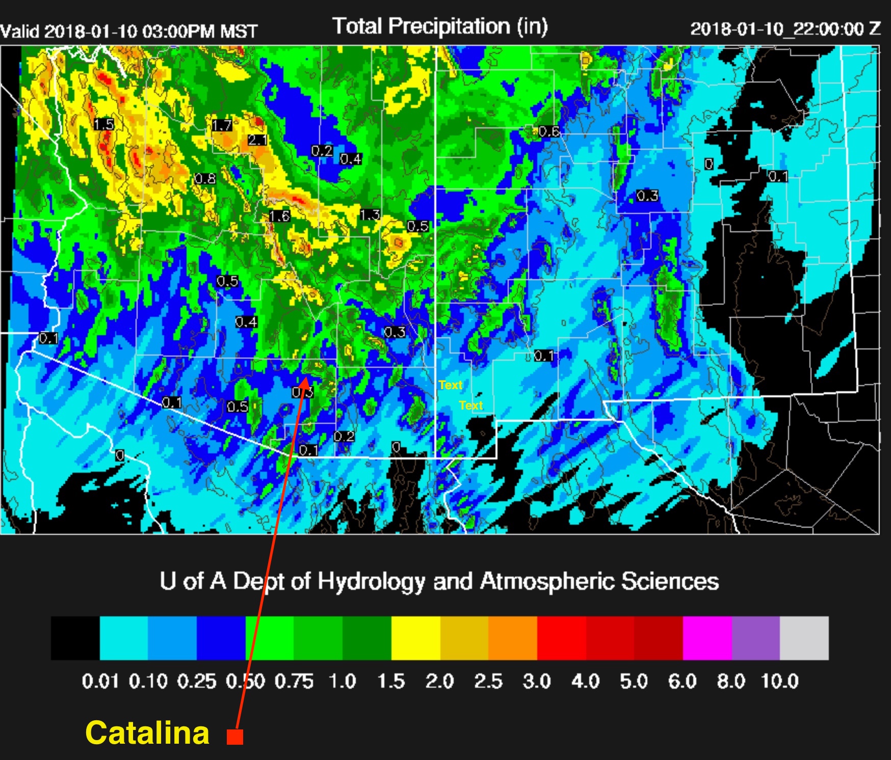
Now, I will look at the U of AZ nested model and see what it thinks. Kind of game we play here, seeing how a seat of the pants forecast, made over a coupla minutes, measures up to a computer model with billions if not trillions of calculations:
The weather way ahead
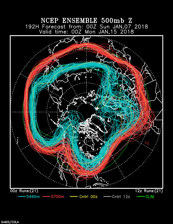
After the nice rain just ahead, we have to get through the week-long dry spell before we move into a new stormy regime. First, a spaghetti depiction of the ridge after our nice storm:
Here’s what’s been exciting for a few days now, and below, from last evening’s global model output:
Let’s see what the actual and very latest model run from IPS Meteostar has for us:


How much these coming rains can benefit our spring wildflower bloom and spring grasses I don’t know, but I sure hope they can resuscitate what otherwise will be a dismal spring.
Expecting a snow event during the “new regime” that takes over after mid-month, too. Be ready!
The End