About real clouds, weather, cloud seeding and science autobio life stories by WMO consolation prize-winning meteorologist, Art Rangno
Drizzle and Stratocumulus bonanza
No, this is not about Bonanza, the TEEVEE show, “Hoss”, or any of those ranching people, though that might be more interesting than a blog about clouds, gray ones. First of all, the word, “bonanza” would be capitalized (its not on my view of this edit, FYI) if this was a blog about it. Second, there was no “Bonanza” episode about Stratocumulus and drizzle, another clue.
Your cloud diary, for those of you still reading this blog:
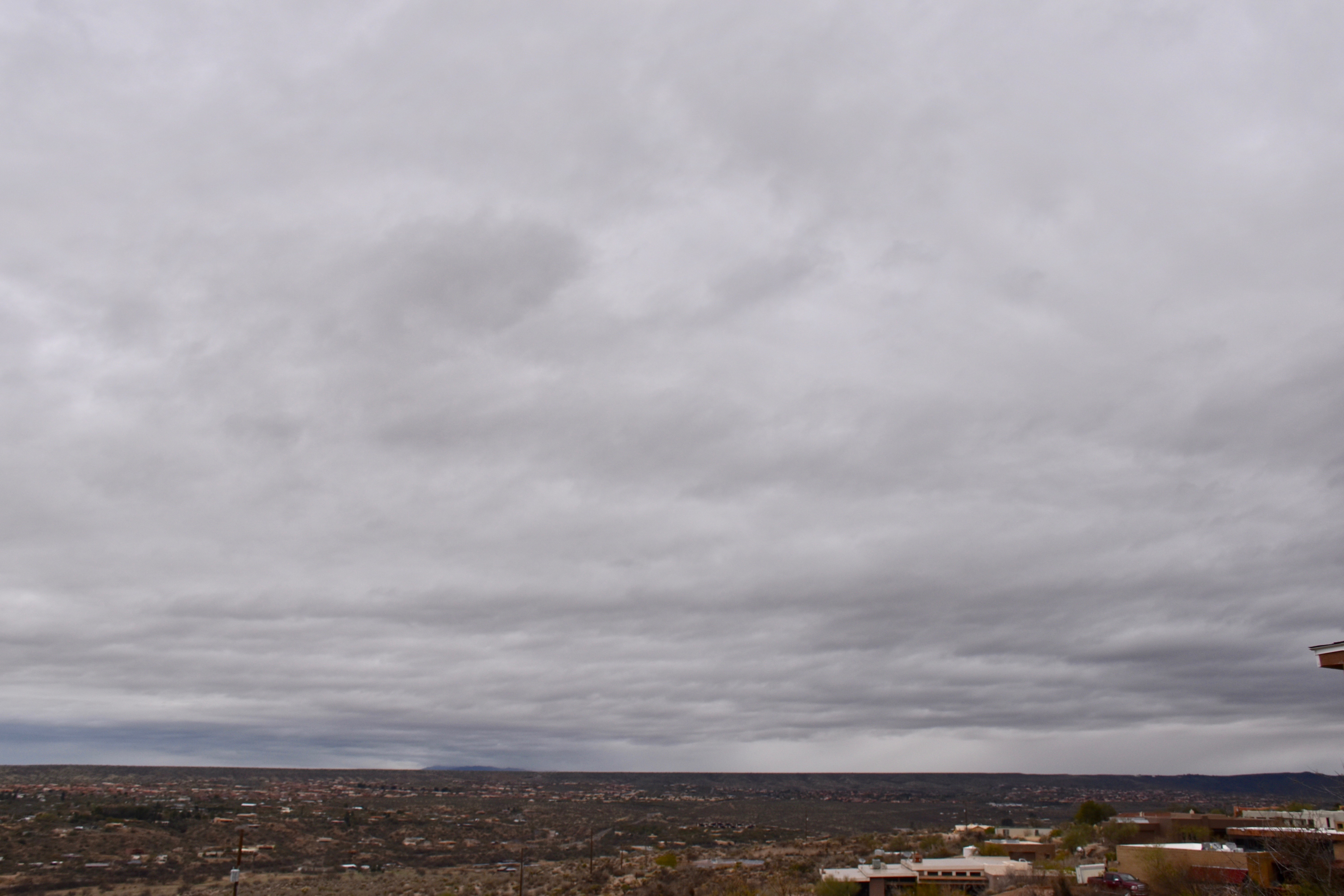
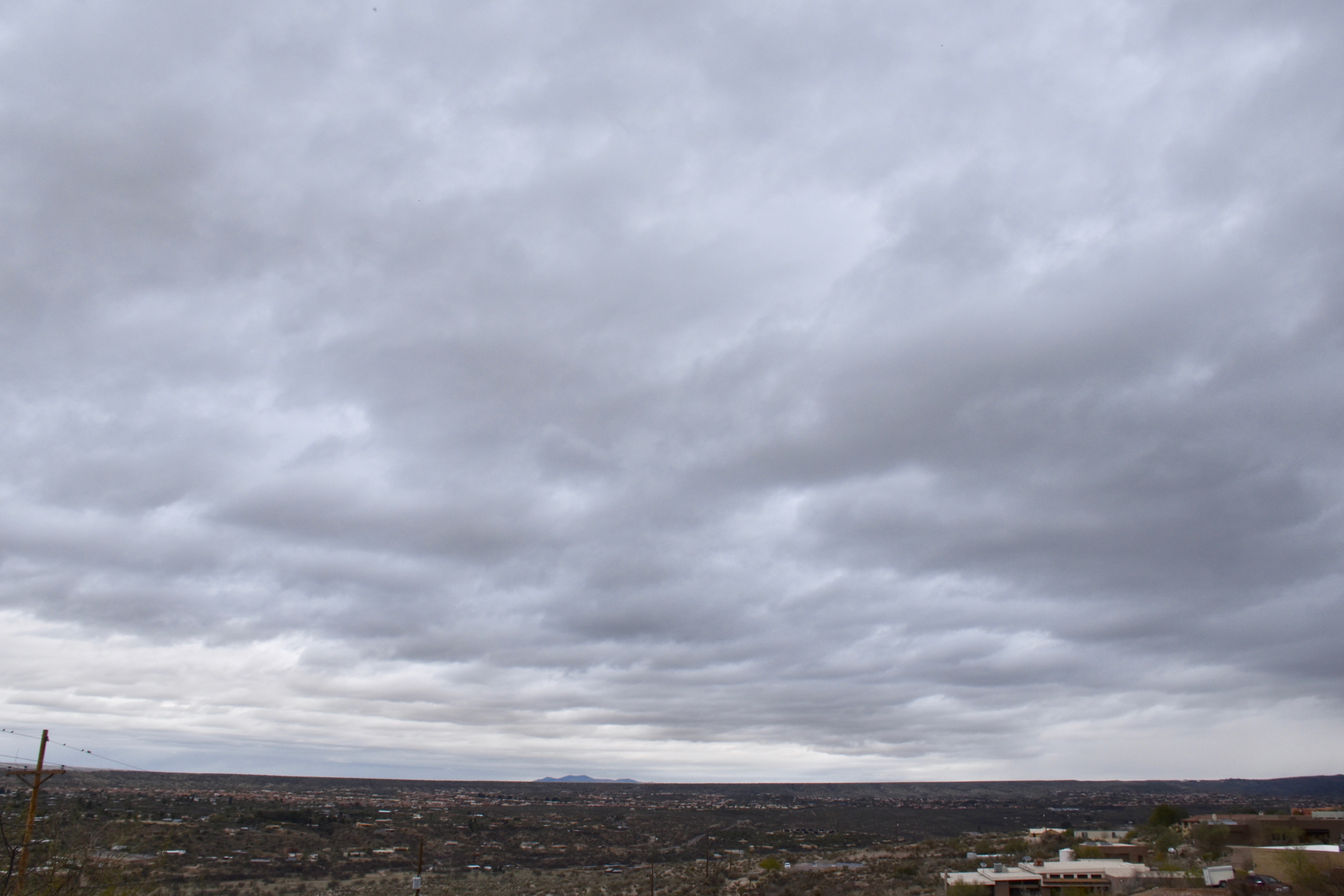
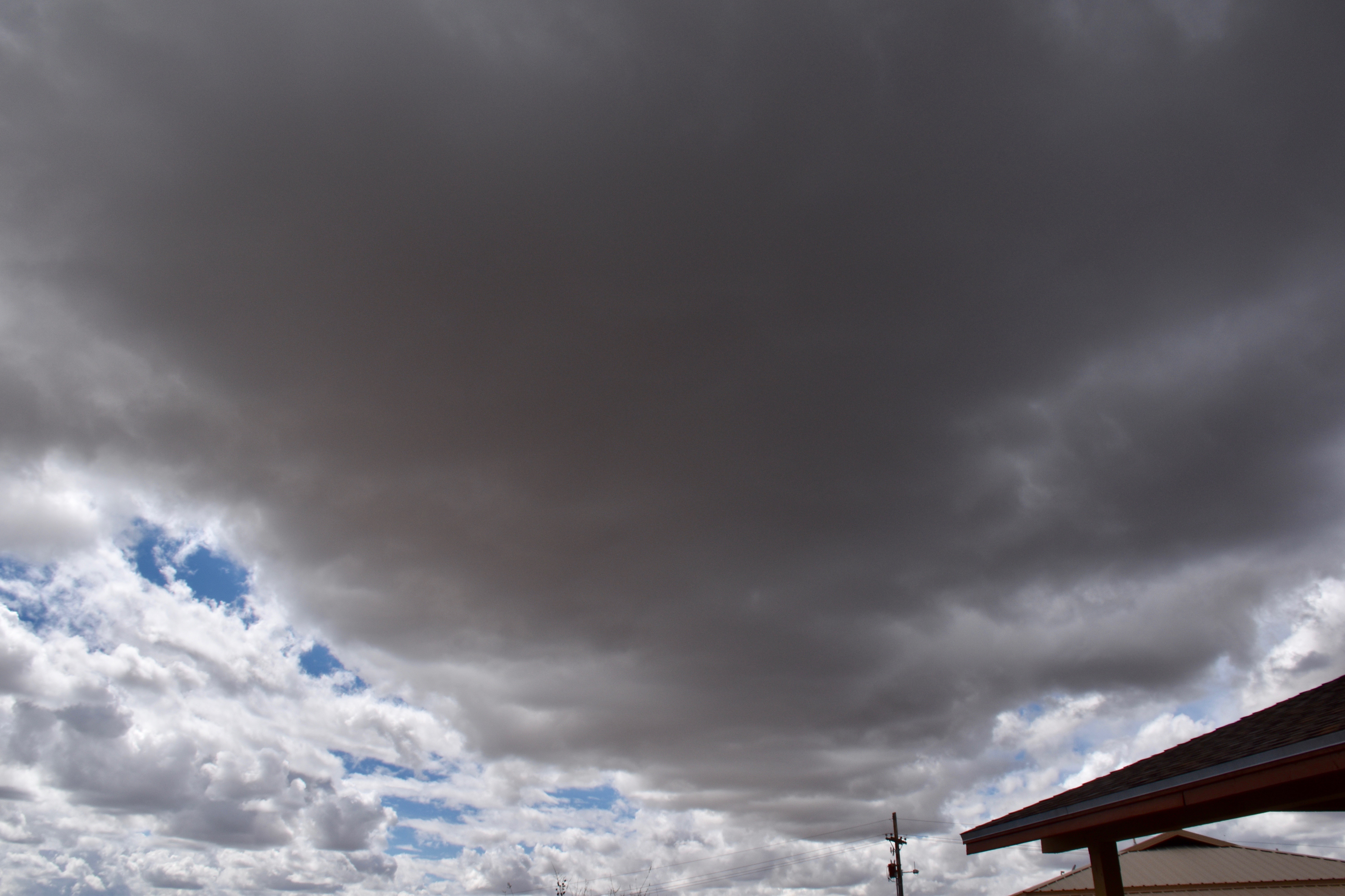
8:34 AM. An orographic layer of Stratocumulus tops Sam Ridge while a separate higher layer covering the whole sky sits on top of it. Neither one seem to be able to produce precip, ice or “warm rain”–precip without ice.8:34 AM. Stratocumulus. Light rain is falling from them on the horizon. What does it mean? Those clouds over there are just that bit thicker, tops higher and colder. Could be a warm rain (no ice involved) or a case of “ice multiplication”, a still continuing mystery in the cloud and precip domain where more ice forms in clouds than we can explain. Mostly occurs when the cloud top temperatures are higher than -14°C to about -4°C. Ice crystals can be in tremendous concentrations in such clouds but we don’t know quite why yet. So, models that forecast rain and snow, as good as they are today, could be that bit better if they could accurately the ice in clouds in that cloud top temperature range I just mentioned a few paragraphs ago. That’s probably the biggest payoff for really understanding how ice forms in clouds. At the University of Washington, me and Peter Hobbs were reporting that the consensus theory on how ice formed in clouds was not capable of explaining what we were finding in the clouds we sampled with our aircraft. There was too much ice in clouds, and it appeared too fast. We were on the outside looking in and our whole body of work was criticized as being wrong by two of the great professors of ice-formation in clouds, Alan Blyth and John Latham in 1998. They used our names in the title of the article, too, “the glaciation papers of Hobbs and Rangno.” I sent a copy to mom. This is what happens when you’re not part of a consensus, you eventually get criticized royally because no one believes you, they think without commenting about it that your work is bogus. At the same time, it was truly GREAT that Blyth and Latham took time to look into all of our work since we scientists don’t do enough of that kind of thing, look into the work of others we suspect might be wrong. But over the years, the concensus about how ice forms in clouds has weakened and new factors are being touted as important players like drizzle drops that fragment or explode when they freeze because at certain temperatures an ice shell develops on the outside of a freezing drop, and then when the water farther in freezes and tries to get out because it wants to expand, it breaks the ice shell, and maybe spicule or ice splinter comes out helping to produce extra ice we call secondary ice particles since they didn’t form on an “ice nuclei”, something we have a though time measuring anyway. Fragmenting drops as they freeze has been known about for decades, but now its being thought that maybe a lot fragments result, not just a few as was thought before. So those extra ice crystals end up creating concentrations of ice crystals we can’t quite explain in clouds here even in 2018, such as those ones over there that were raining north of Saddlebrooke to bring us full round in this photo. Caption too long? Let us not forget that this site originated the practice of novella-sized captions. I think many of you forget that a picture is worth a thousand words of caption, too. Here, we’ve only managed a few hundred.10:13 AM. Still raining way over there NE of Saddlebrooke and Bio2 if you look carefully, lower right. Can there be a better “classic” photo of Stratocumulus? I don’t think so. Cloud bases still running about the level of Sam Ridge, or about 3,500 to 4,000 feet above the ground.10:05 AM, maybe. Stratocumulus clouds spewing drizzle precip roared out of the west in a band, now enveloping the Catalinas toward Pusch Ridge. Drizzle is pretty rare in Arizona, so I hope you noted it in your diaries yesterday. Means the clouds overhead have low droplet concentrations, and the larger drops are greater than about 30 microns in diameter, which are those sizes that when they bump together they can coalesce into a much larger drop that collides with more and more drops to form ones that can fall out of the cloud instead of just hanging around up there not doing much. We call that process the “collision-coalesce” process of rain formation, or “warm rain” process, one that doesn’t involve ice. The formation of ice almost never results in drizzle, hence (is that still a word?), why CMP thinks it was a warm-rain process yesterday over there. Also, drizzle is often think enough to make it look like its a snow shaft, which is what we see over there, too. But we know the freezing level was really high yesterday, so it can’t be snow over there. Nor are the clouds Cumulonimbus ones that CAN produce dense shafts.
Well, let’s move ahead to sunnier conditions, those pretty scenes we see on the mountains when a storm begins to clear out.
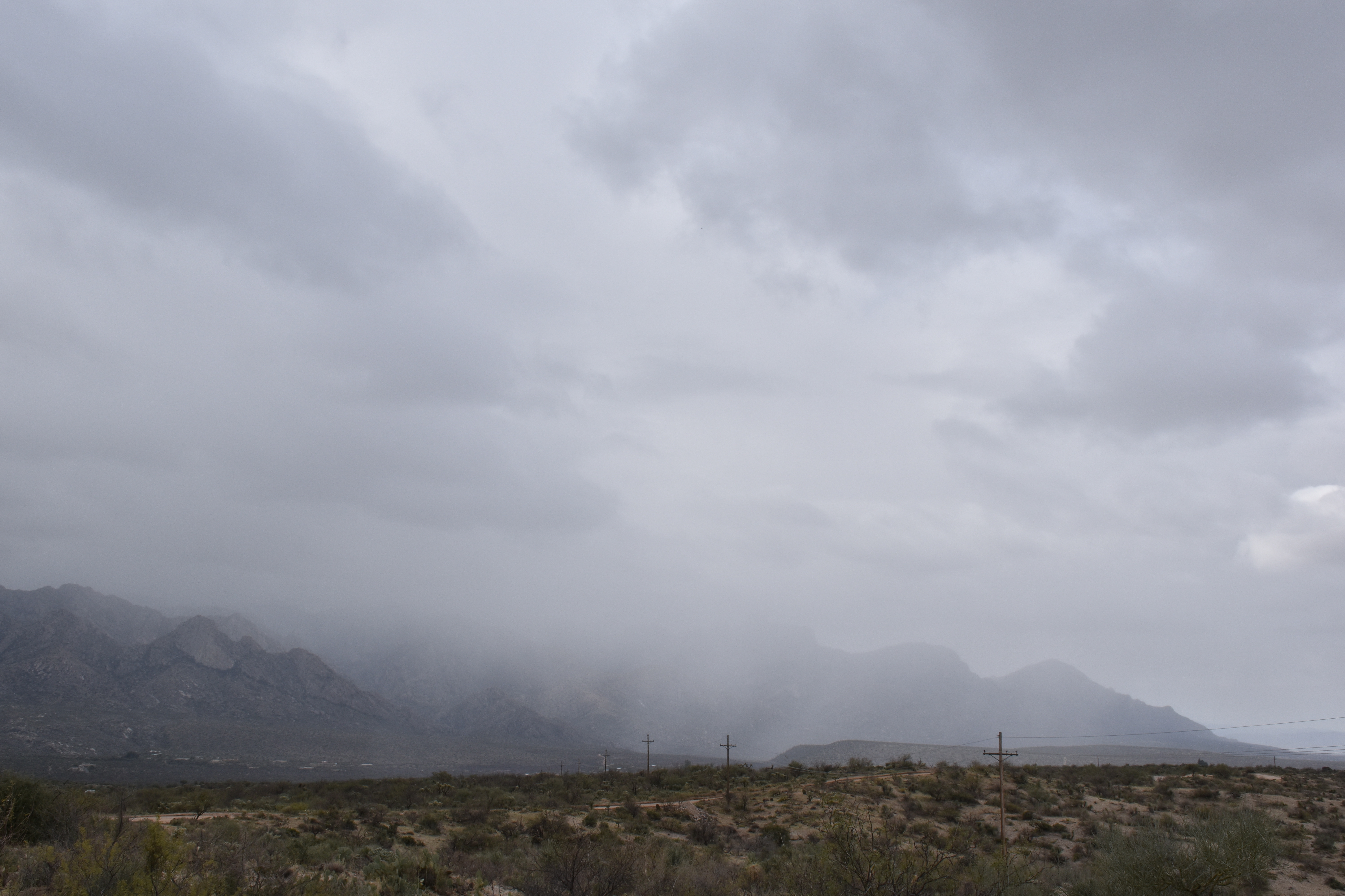
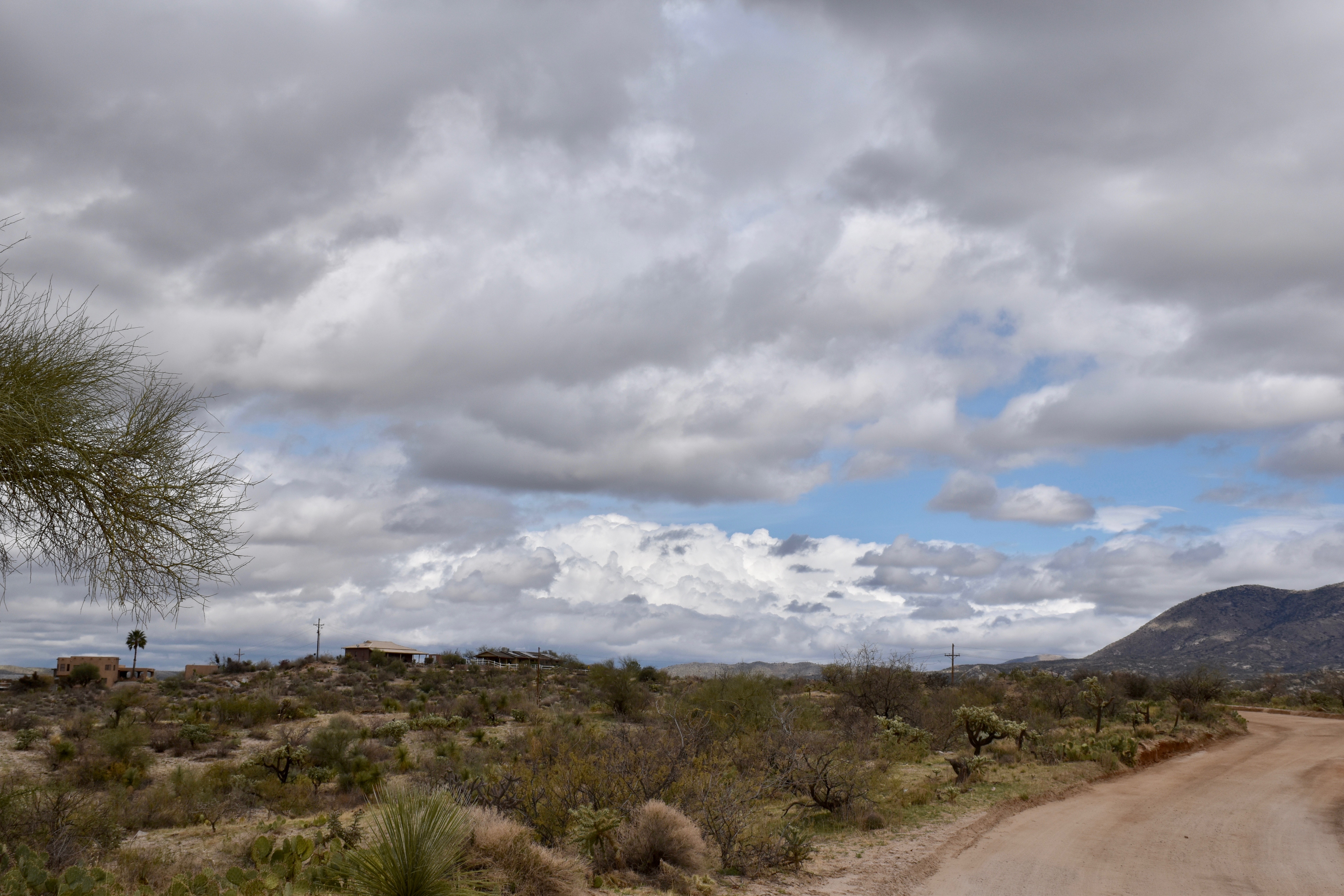
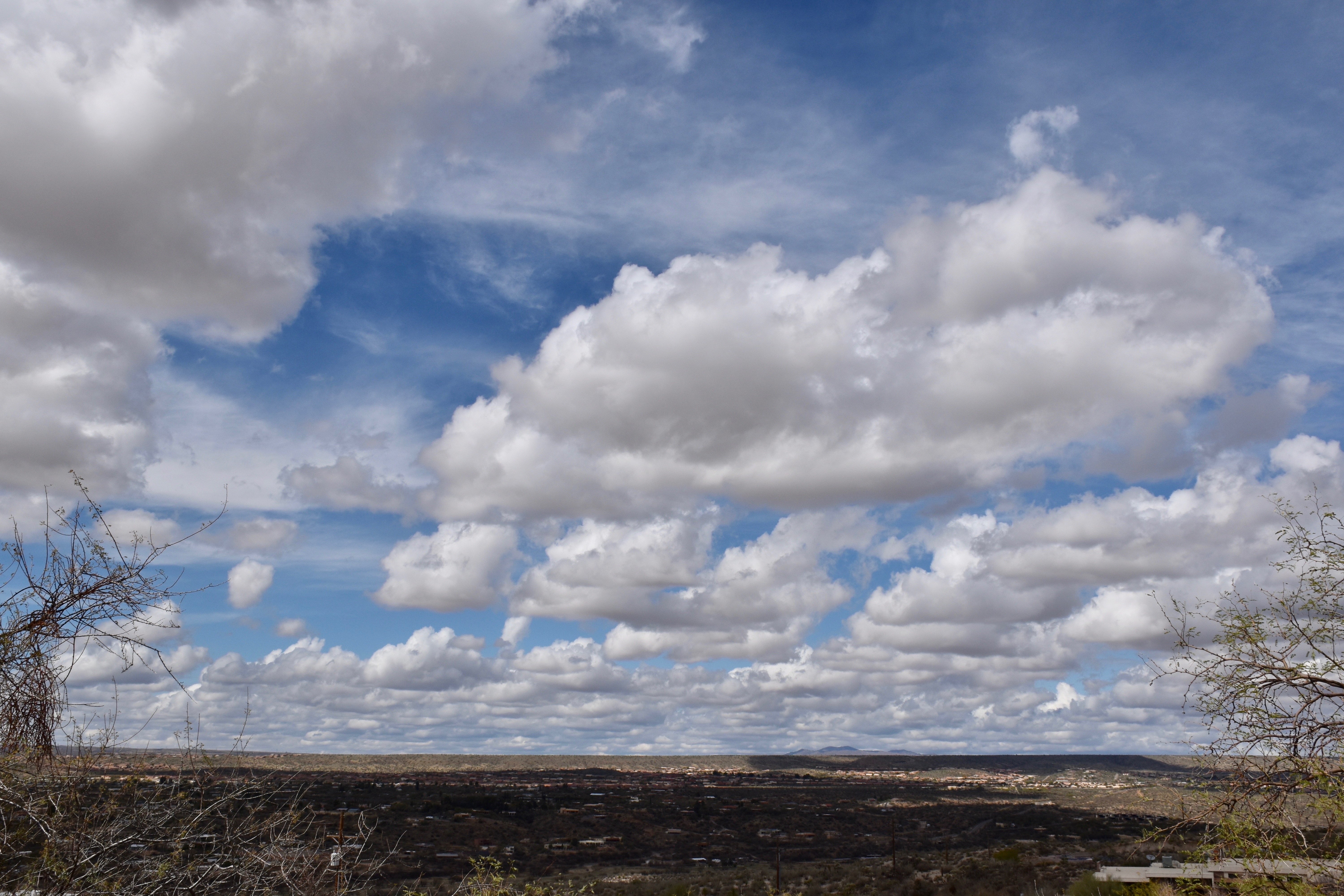
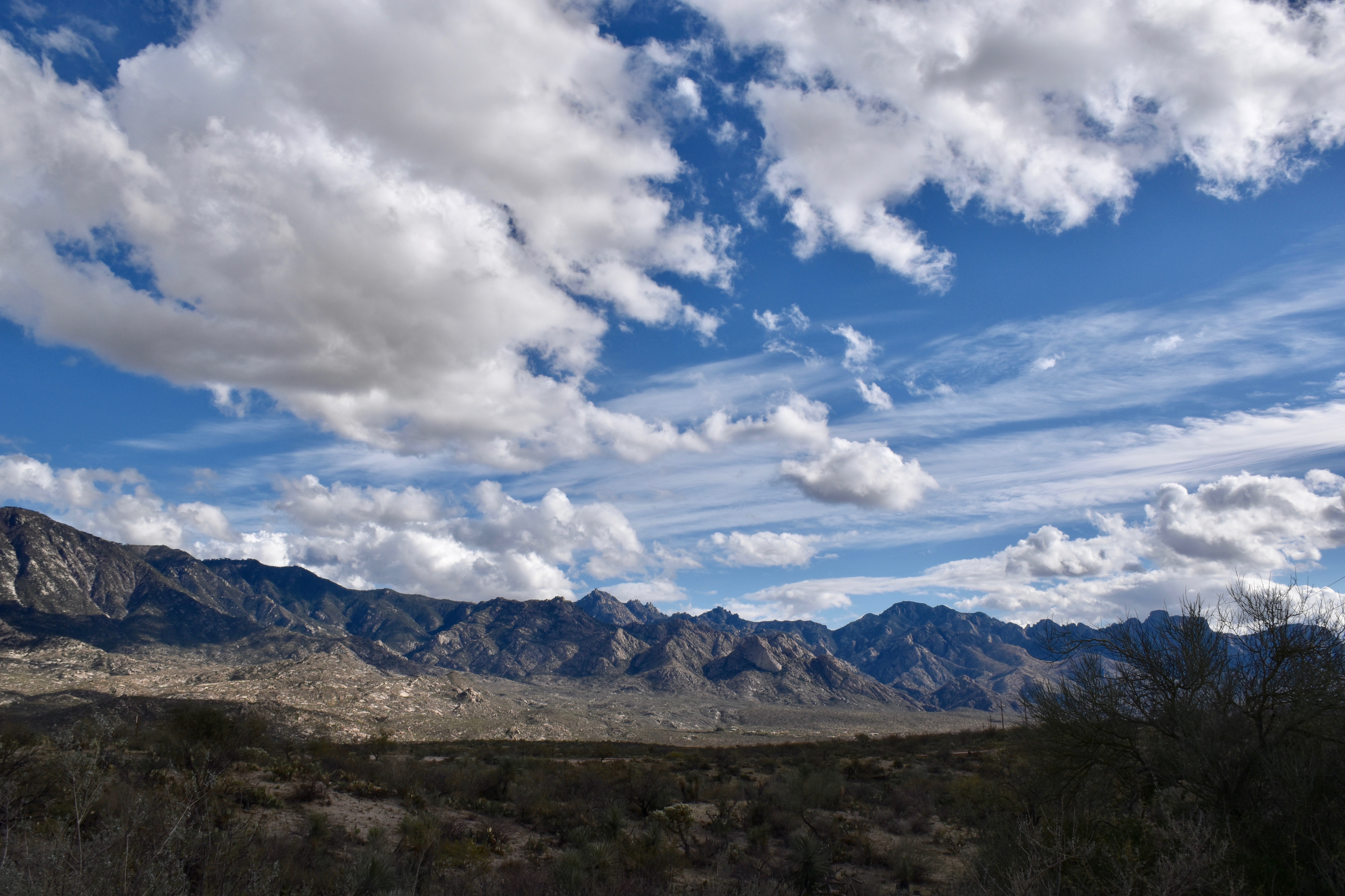
12:27 PM. As the Stratocumulus broke up, you got a glimpse of the deeper clouds north of Oracle that had been, and likely were still raining. Estimating depth here at about 2 km, or 6600 feet. With bases at 4,000 feet above ground, that would put the tops at only around 11,000 feet, too warm for ice since it would barely be below freezing at that height. Will check now to see if that statement is true. Actually, the soundings from the U of AZ make it a little more ambiguous than what I was thinking about too warm for ice formation, and so there’s no point in showing those soundings where people might question what you just said.1:19 PM. So pretty. I am a lucky man to see scenes like this so often.1:29 PM. A cloud street with this fat boy formed off the Tortolita Mountains and it passed overhead of Catalina! I wondered if some big drops might fall out since it would be a Cumulus congestus if you could see it from the side, and with “warm rain” having fallen earlier, there was still a chance that the drops in this guy, toward the tops, would reach sizes where they coalesced into drops.1:29 PM. Nice. One of our photo niches is cloud bases, and here’s one of the best. Am waiting outside for big drops, not Godot. Can’t go inside because they might only fall for a few seconds or minutes, it surely won’t be shaft. And what if no rain had fallen earlier? I might need to report a trace.1:41 PM. It wasn’t too much longer the drops began to fall, finally thinking to get a photo in case no one believed me that rain had fallen from that cloud.2:11 PM. Cumulus humilis and Cu fractus are all that remain of the gray skies of morning.3:59 PM. Just enjoy.6:37 PM. The sun, completing its weary journey around the earth, finally goes down.
The End
PS: The agonizing delay from typing then seeing words appear 5-10 s after you stopped typing, disappeared when I jettisoned Firefox for Safari. So, all these months of agony, were due to a Firefox bug, not a WordPress or GoDaddy hosting service problem. Unbelievable. This problem I think began when I downloaded the latest version of Firefox, which also came loaded with pop up ads and web site diversions it previously was free of. Dummy me never connected it to the venerable Firefox web browser. So, Firefox has been trashed from this computer!
By Art Rangno
Retiree from a group specializing in airborne measurements of clouds and aerosols at the University of Washington (Cloud and Aerosol Research Group). The projects in which I participated were in many countries; from the Arctic to Brazil, from the Marshall Islands to South Africa.


I’m enjoying seeing all those clouds in your area, Art. They’ll be back here soon enough: we’re going to have rain tomorrow.
Glad you liked them, Roland. Suddenly most of the problems I was having entering a blog have disappeared! Try to enjoy your upcoming rain….
a