Purpose of this post of ancient, unfinished work with the humorous title: Could it inspire someone to continue it in a more sophisticated way than I have?
Named climate/weather influencing “oscillations” have become so numerous in the scientific literature (e.g., Atlantic Meridional Oscillation, Arctic Oscillation, Pacific Decadal Oscillation, El Niño-Southern Oscillation, Atlantic Oscillation, Quasi-Biennial Oscillation, Madden-Julian Oscillation, etc.) one is tempted to ask humorously, “Doesn’t everyone have one?”
Well, I do, but this research is incomplete. And it may ne bogus, illusory; it seems to lead to a dead end. Still, “we” journey on, hoping these early findings, incomplete as they are and needing to be updated, will nevertheless bring someone a Nobel Prize in meteorology. (Also still waiting for some kind of science prize or medal from Israel for the work I’ve done there in exposing faulty cloud seeding results and descriptions of non-existent clouds supposedly ripe with seeding potential (Rangno and Hobbs 1995, Rangno 1988). But, as the Prunes sang, I had too much to dream last night.
https://youtu.be/-xRRT92Fpgs
Let us begin this story from the beginning. Let us explore how a gigantic amount of work, consuming work, really, thousands of hours of personal effort, can lead to a dead end. Maybe.
The oscillation story begins in an undergraduate climatology class I took at San Jose State College in the late 1960s. Each of us was assigned to do a climate research project. I chose to do something on Los Angeles Civic Center rainfall, something I had been charting since childhood. I graphed the days with measurable rain over the period of record for the Civic Center going back to the 1877-78 “rain season.” In California, the period of July 1 through June 30 is deemed the “rain season.” That was the way rainfall data were presented in the newspapers. The California “rain season” is similar to the water year precipitation totals widely used in the western US for the period of October 1 through September 30. If you are a meteorologist in the West, the calendar year is generally eschewed in place of rain season or water year since the latter capture the character of whole winters and better account for snowpacks in mountains.
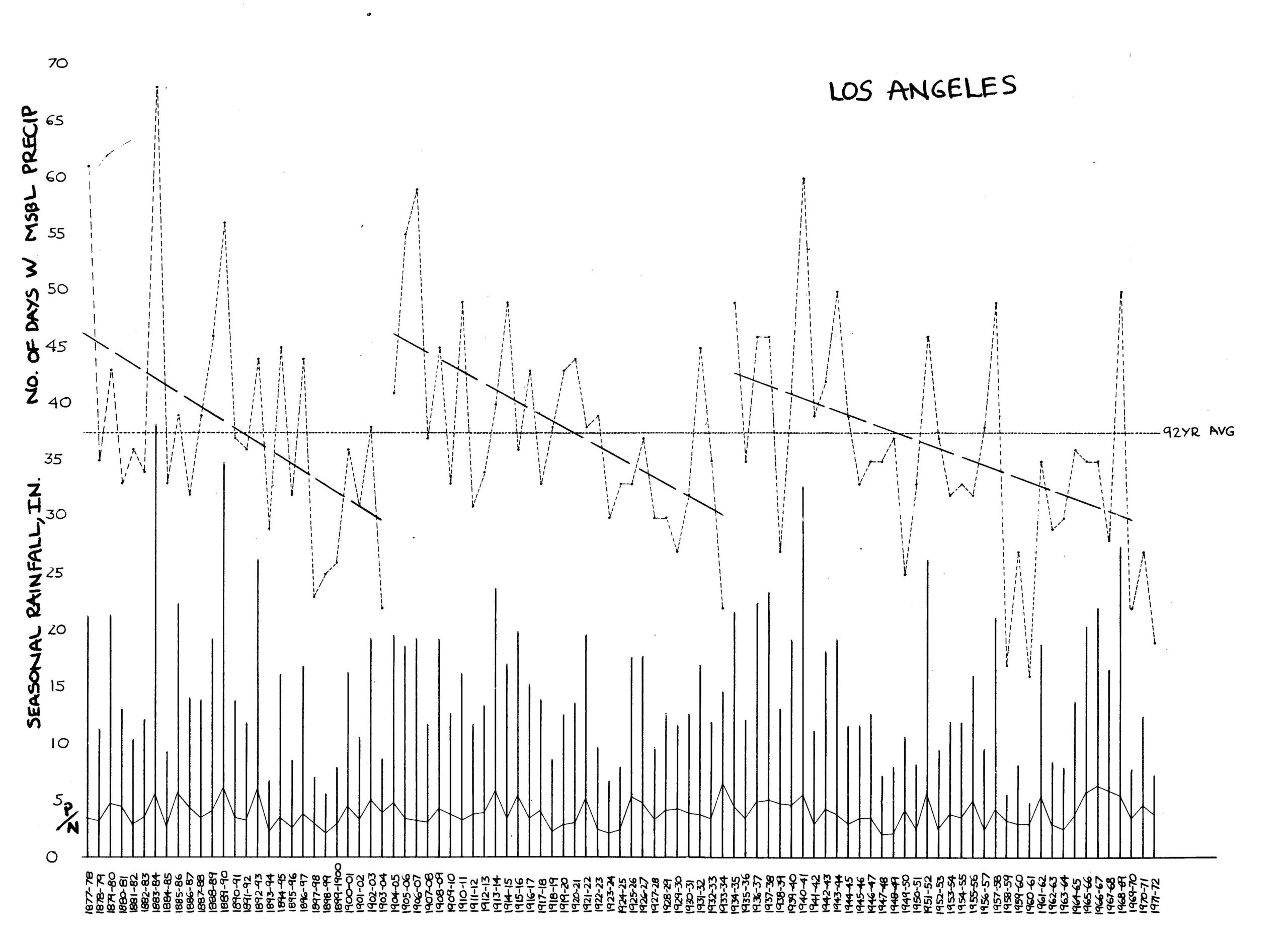
I saw an interesting phenomenon in the plot of days with measurable rain; there appeared to be an “instability”; a jump to much wetter conditions after a decades long trend of declining days with measurable rain. After reaching what appeared to a minimum of days with measurable rain, there was a sudden jump in the next season to one having considerably more than the average. But, it wasn’t just one season that had many more days with rain! It was most of the next ten rain seasons that had above average days with rain. This had happened in my plot on three occasions; the season following 1903-04, the season following 1933-34, and lastly, the season following 1976-77. Namely, it wasn’t just a one-shot wonder, a season long singularity.
I was EXCITED! So excited I eventually sent my Los Angeles Civic Center plot to a famous professor of climate and weather at Scripps Institution of Oceanography, Prof. Jerome Namias. I had read his papers in the Monthly Weather Review. (I had begun subscribing to this journal when I was 13 years old. By this time I had seen that these same three jumps had occurred at San Luis Obispo, Santa Barbara, and San Diego. There was no evidence of this phenomenon at San Francisco; it faded to the north.
If you’re a Los Angeles or Southern California “precipophile” like me, you might well guess immediately why I wasn’t so much interested in rain totals as with days with measurable rain. A couple of huge storms can hide the character of a whole rain season, but the character of a rain season would be called out by days with rain. An extreme example: on New Year’s Eve, December 1933 into New Year’s Day, 1934, Los Angeles received it’s greatest 24 h rainfall: 7.36 inches! Approximately half fell in December 1933 and a little more than half in January 1934. The season’s rainfall total that year was 14.64 inches, or just about average. HOWEVER, the DAYS with rain was two standard deviations below average! That’s “what done it” for me, that extraordinary rain day and why rain totals might hide the real character of a winter’s rain season.
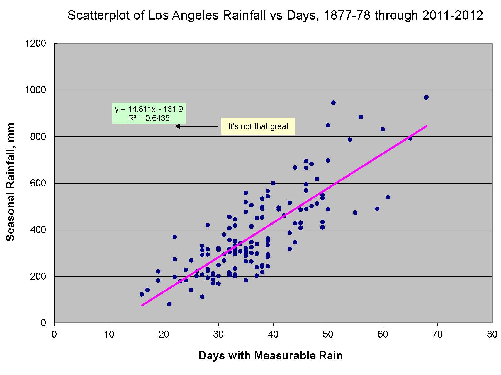
Naturally, there is pretty high correlation between the days with measurable rain and the season’s total. But from day one, I was convinced that the days with measurable rain was a better indicator of circulation changes over the years while rain amounts added “noise.” Here is the correlation between rain amounts and days with rain for Los Angeles Civic Center:
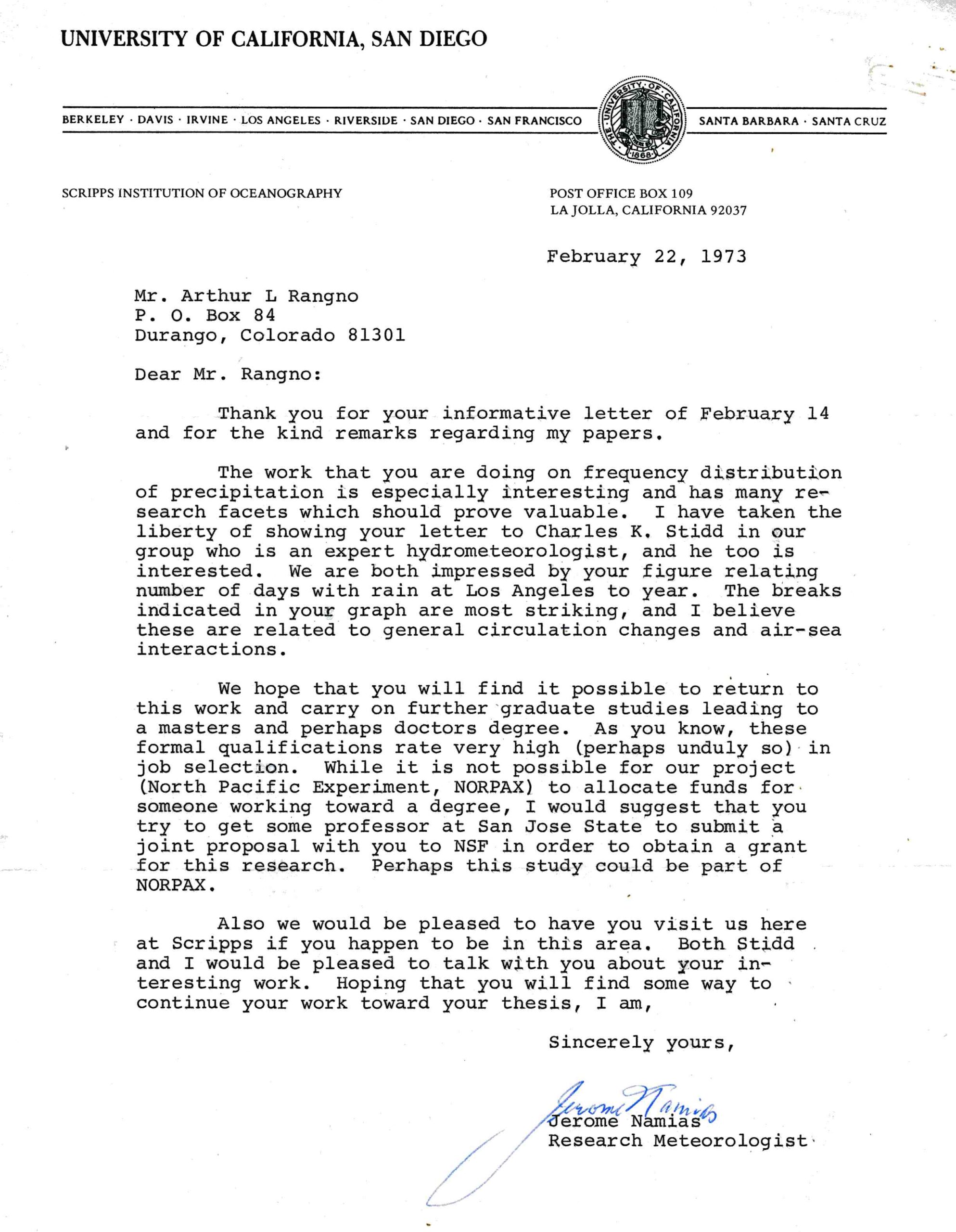
Professor Jerome Namias seemed to be excited, too. Here is his reply to my graph of LA rain frequency over the period of record.
Here’s the plot that started it all and that Namias and Stidd found interesting. It didn’t look like “white noise.”
By the time I corresponded with Professor Namias, I had been hired as the Assistant Project Forecaster for the nation’s largest randomized orographic cloud seeding experiment, the Colorado River Basin Pilot Project. I was living in Durango, CO, where the project’s headquarters were as I continued my research on a possible oscillation.
I was hoping that my work would eventually qualify as a Master’s Thesis from the meteorology department at San Jose State College (despite poor grades in grad school). As an aside to the reader: I had no business whatsoever in being in grad school taking classes like “numerical methods,” “advanced hydrodynamics.” etc. But I loved my campus life in those days of campus trash cans set on fire to protest the war, album protest rock, the marches, the demonstrations, the be-ins, the draft card burnings, to pinch a quote from National Lampoon’s “Bob Dylan’s Golden Protest” parody:
Over the next couple of years I added to my Los Angeles dataset with ones from San Francisco, San Luis Obispo, Santa Barbara, and San Diego. These stations all had records that went back even earlier than the one at Los Angeles. All but San Francisco, whose record exhibited what one might call, “white noise,” exhibited the trend I had seen in the Los Angeles record! It was amazing to see.
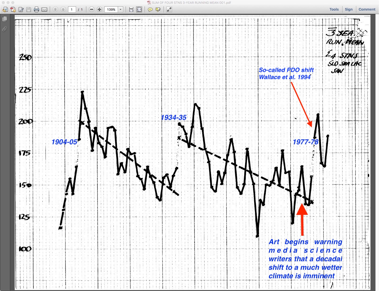
Below is a running, 3-season average for SLO, SBA, LAC, and SAN through the early 1980s. Sadly, I was not paying attention when scanning this original diagram and parts are not shown here, such as the abscissa comprised of the rain seasons. The ordinate is the number of days with measurable rain at these four stations with a running mean of 3 seasons of those totals. It ends with the 1981-82 season, far right. For those in the know, the following season, 1982-83 featured a giant El Niño and that, combined with whatever was going on in what I was charting, produced numbers of days off the chart! I was so happy! The Great Salt Lake was about to overflow, too, from this incredible wet spell that accompanied the shift to a more frequently rainy regime.
Since the rain at these locations is associated with cold troughs in the wintertime westerlies, I imagined that the circumpolar westerlies gradually retracted over the years, then hit some kind of tipping point and sprung back to more a more southerly latitude before beginning the same slow retraction over decades.
In the 1950s and 1960s, the Los Angeles forecast office used the 564 decameter geopotential height contour as a divider of rain; heights at or below that contour was where the rain was and no rain was the rule for heights greater than the 564 decameter contour. This key contour was used as an aid in forecasting rain as troughs approached and entered California.
The last shift to wetter conditions I found happened after the 1976-77 rain season. With the 1977-78 rain season, it became much more frequently rainy along the central and Southern California coast for most of the next seven years.
My California rainfall study ended a few years into this transition to wetter conditions due to two elements: 1) NOAA had stopped publishing the “Daily Series, Synoptic Weather Maps, Part 1, Northern Hemisphere Sea-Level and 500 mb Charts and 2) I got very upset over the misleading cloud seeding literature that was being published in journals and jumped ship into reanalyzing previously published cloud seeding literature for most of the rest of my career almost solely on my own time (e.g., Rangno 1979, Hobbs and Rangno 1979, Rangno and Hobbs 1995).
The NOAA surface and 500 mb charts were important because that’s what I had used to track cyclones across the Pacific for five winter seasons before and after a “shift.” I wasn’t able to do a set of tracks before and after the 1977-78 shift. It was interesting that about 20 years later, the 1977-78 shift I was studying was discovered as the, “Pacific Decadal Oscillation” (Wallace et al. 1994).
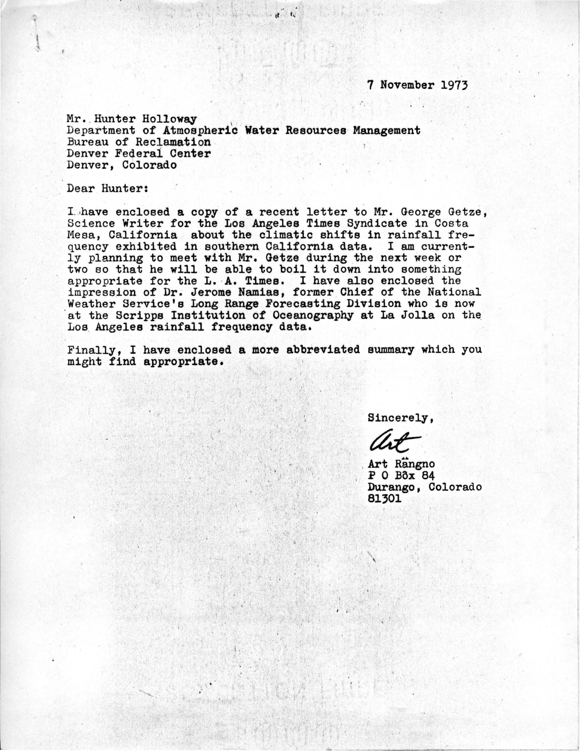
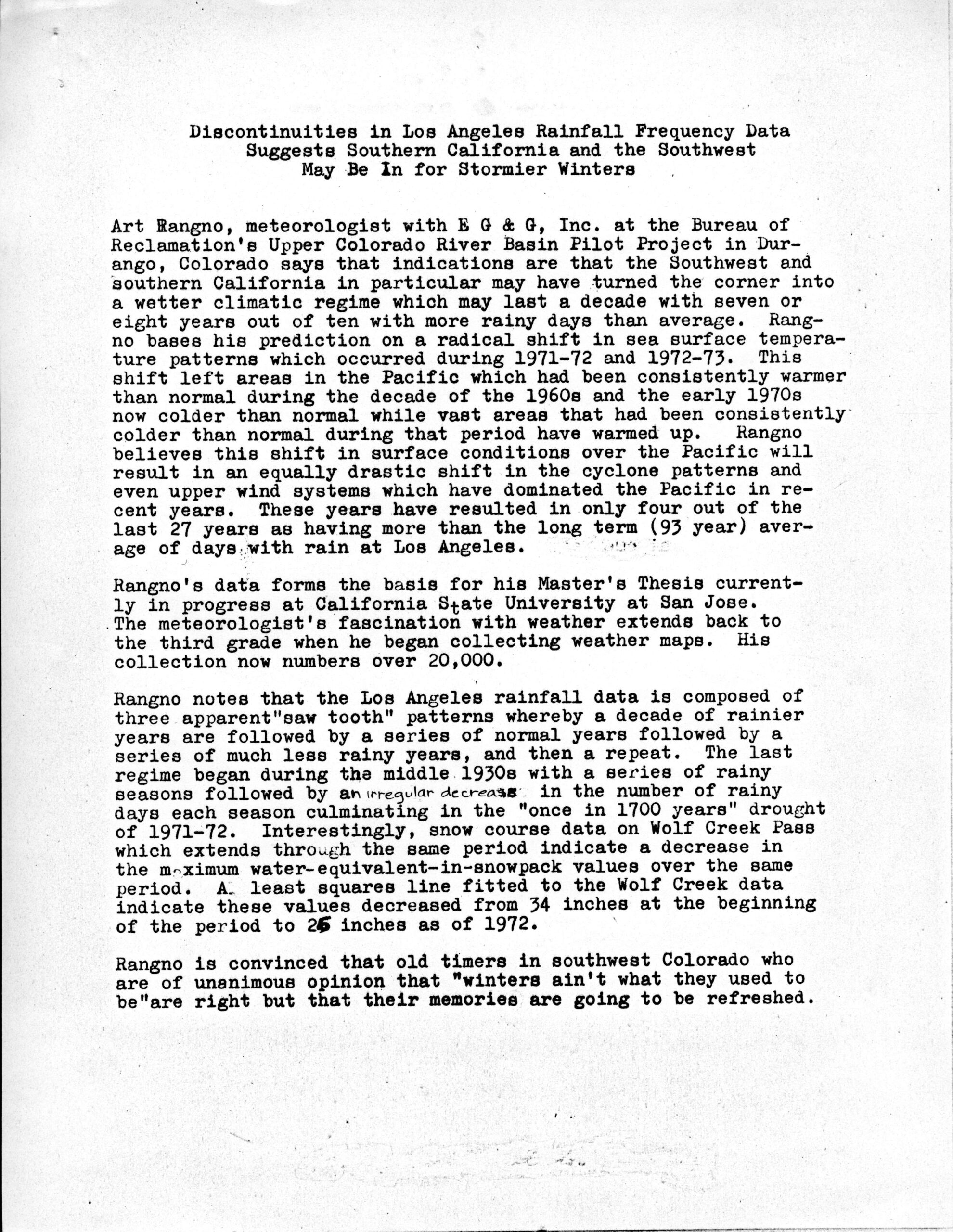
By the 1973-74 rain season I was so sure a prolonged shift to wetter conditions in the SW was on the doorstep that I was writing to the LA Times science writer, George Getz, the BuRec’s PR person, Hunter Holloway (the BuRec was the sponsor of the cloud seeding experiment I worked on), and to the Durango Herald about this coming shift to wetter conditions.
I was a little too early; the downward trend continued through the 1976-77 winter. Here’s an example of those writings, one an audacious, self-written “news release” that follows the letter to Mr. Holloway shown here:
The reason I posted the letter above is to PROVE that I really was anticipating “The Shift” BEFORE it happened:
The additional research I carried out went far beyond the rain day graphs:
Pacific cyclone tracks before and after a “shift,”
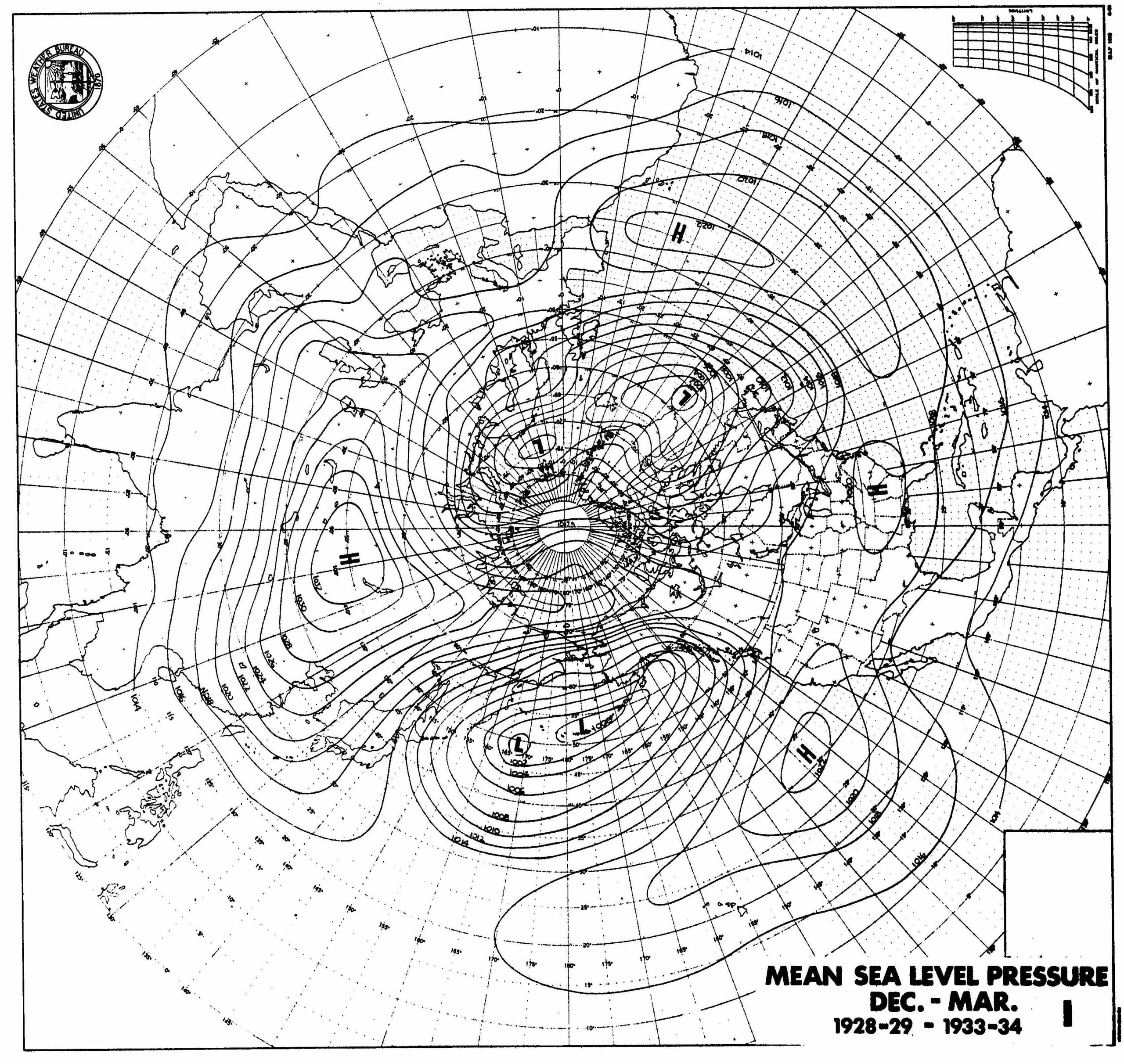
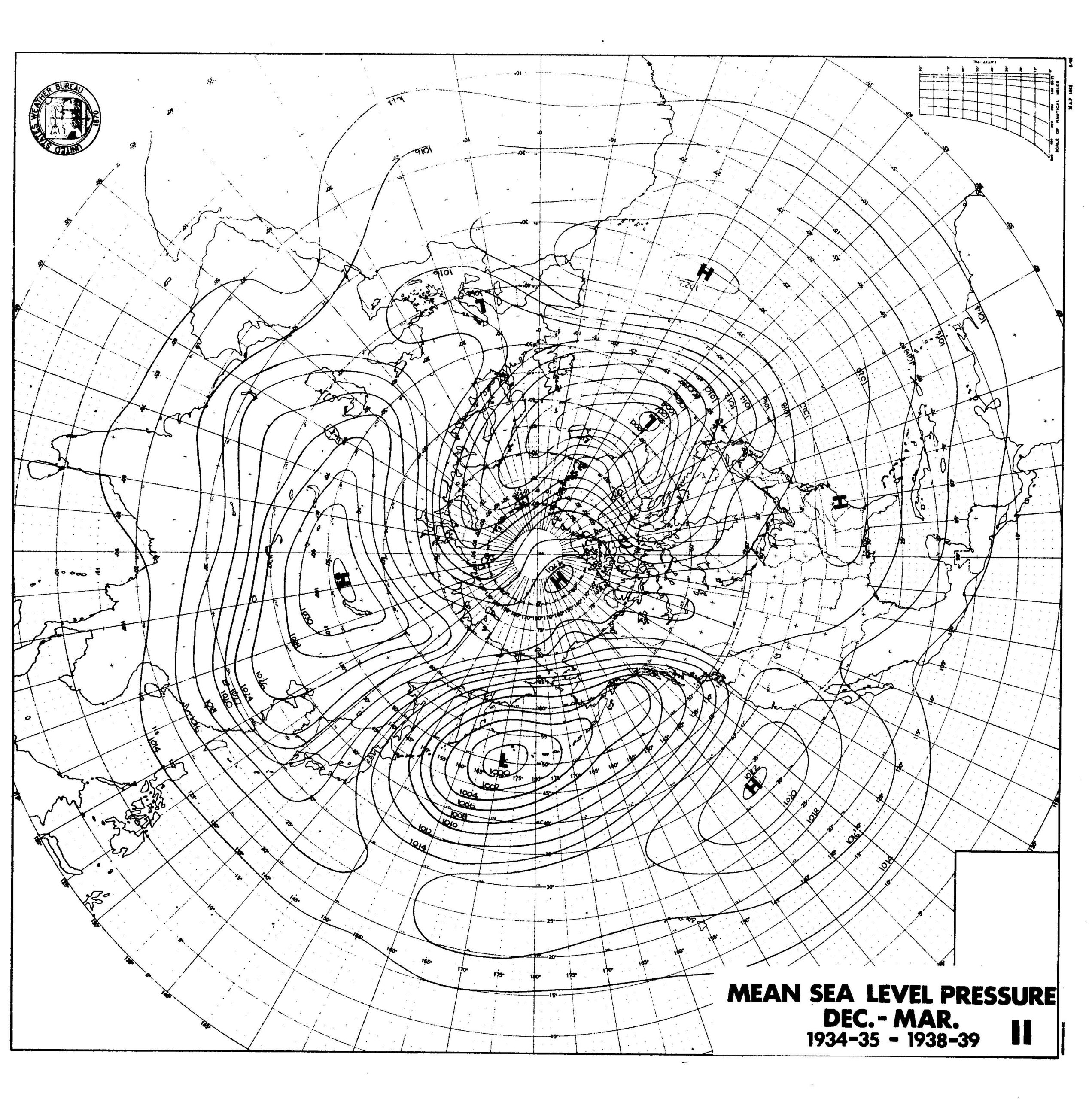
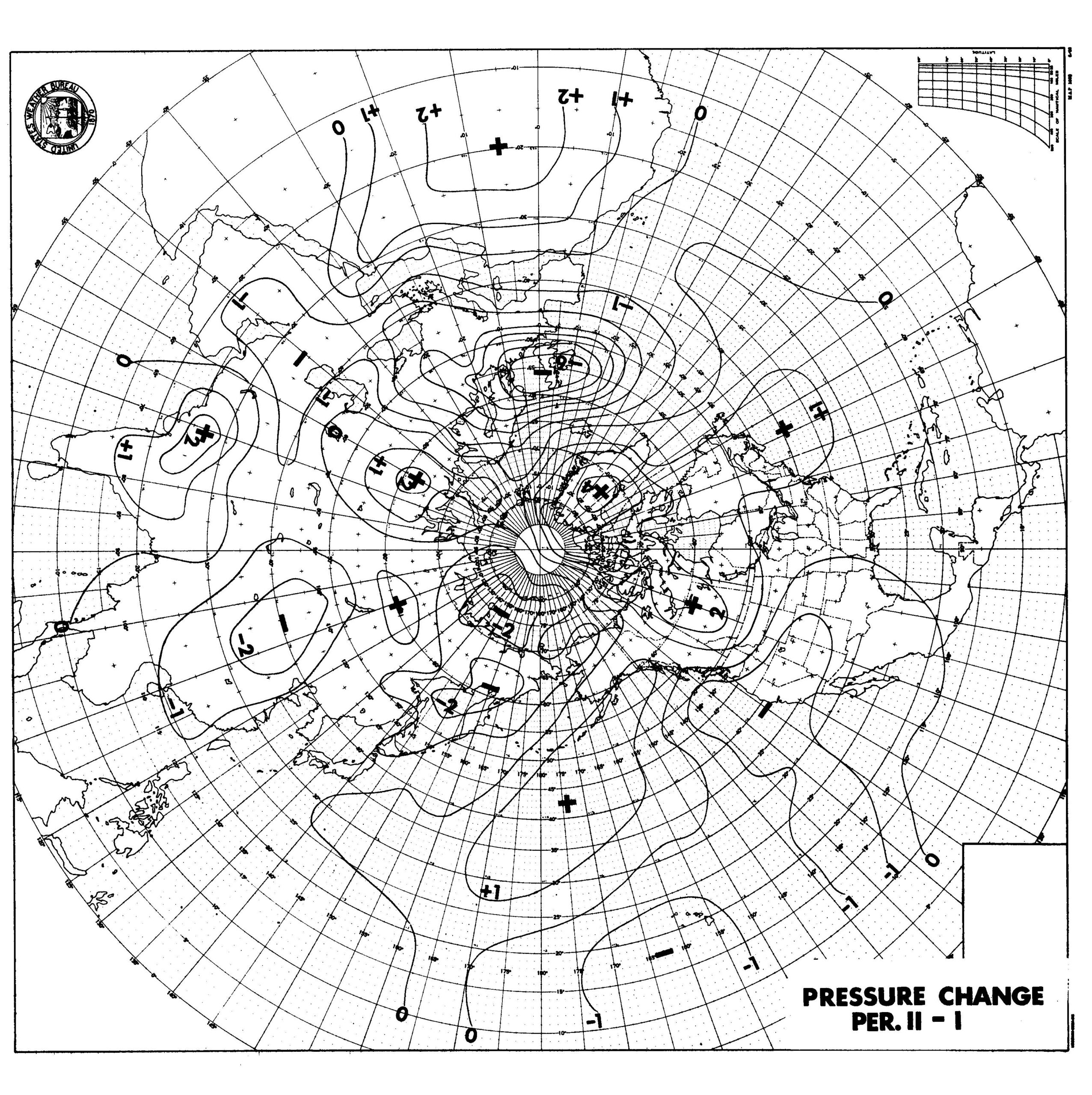
NH average sea level pressures before and after a shift.
Here are the sea level maps for the 1930s, before and after a shift that occurred with the 1934-35 rain season. For those not acquainted with the synoptic charts of that 1930s era it was something of a golden age of ship reports before they disappeared on these maps during World War II. Thus northern hemisphere sea-level pressure and cyclone tracks changes could be reliably charted.
A graphically obtained “delta” map of sea-level pressure changes before and after a shift comprises the third graphic. Not much can be seen to have happened when looking at these average maps for whole December through March seasons due to having semi-permanent pressure systems like the low in the Gulf of Alaska, and the “Pacific High.” I deemed looking at cyclone tracks (the following graphics) as far more useful. Nevertheless, these are never-before-seen-or-done maps by anyone but me. Enjoy:
Strangely believe it, the greatest sea level changes were in the domain of the Arctic Oscillation; in the North Atlantic, Greenland and England. Whodda thunk it? Not much change in the Pac and West, as expected due to persistent pressure fields even in these extremely frequent days with rain and those with many fewer ones. I honestly did not know what to make of this change. Do you? If not, let’s keep moving….
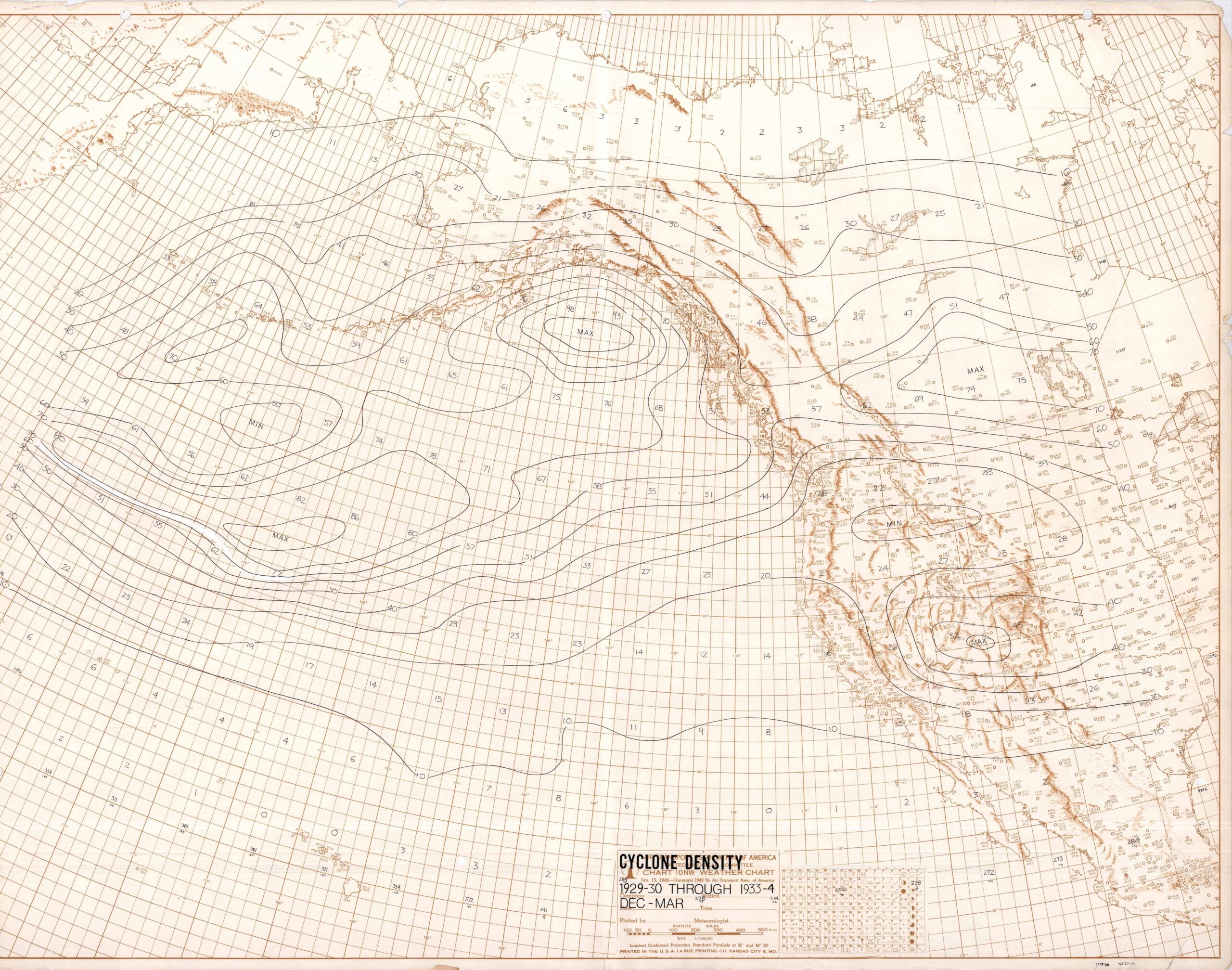
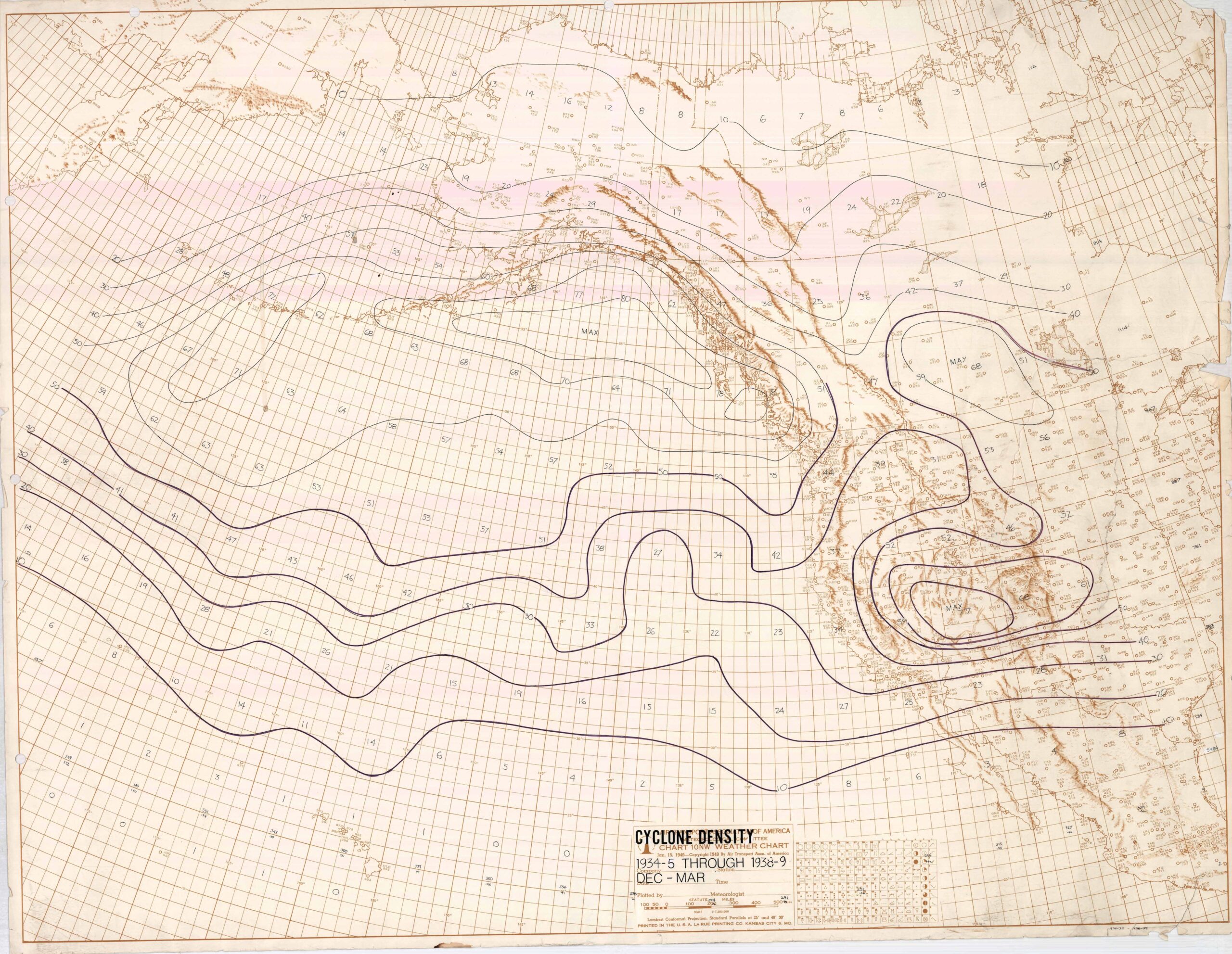
Before doing the sea level pressure maps, I had charted cyclone centers across the central Pacific to the Rockies for the same winter (Dec-Mar) periods as was done above. These charts were much more illuminating concerning the shift that happened in days with rain in central and Southern California:
First, the cyclone track “densities” of the five low frequency days with measurable rain winters preceding the shift. A strong channeling of cyclones was seen during these winters from the lower latitudes of the central Pacific into the Gulf of Alaska and into southern British Columbia to a lesser degree. This suggests the geographically anchored Asia/western Pacific Ocean jet exit had extruded farther east and into the central Pacific. (Upper-level maps are not available for this period.). This was to resemble what happened in the low rain frequency seasons of the early and mid-1970s that preceded another shift.
In the figure below are the tracks following the “shift” to higher frequency rain day occurrences in central and Southern California. The channeling is gone and what appears to be a standard distribution of low centers has replaced it. Cyclones that developed in the western Pacific moved northeast into the Aleutians relatively close to Japan rather than scooting across the lower latitudes of the central Pacific. The difference between these two maps is shown in the final map below this one.
The Delta Cyclone Density Map (pardon the skew):
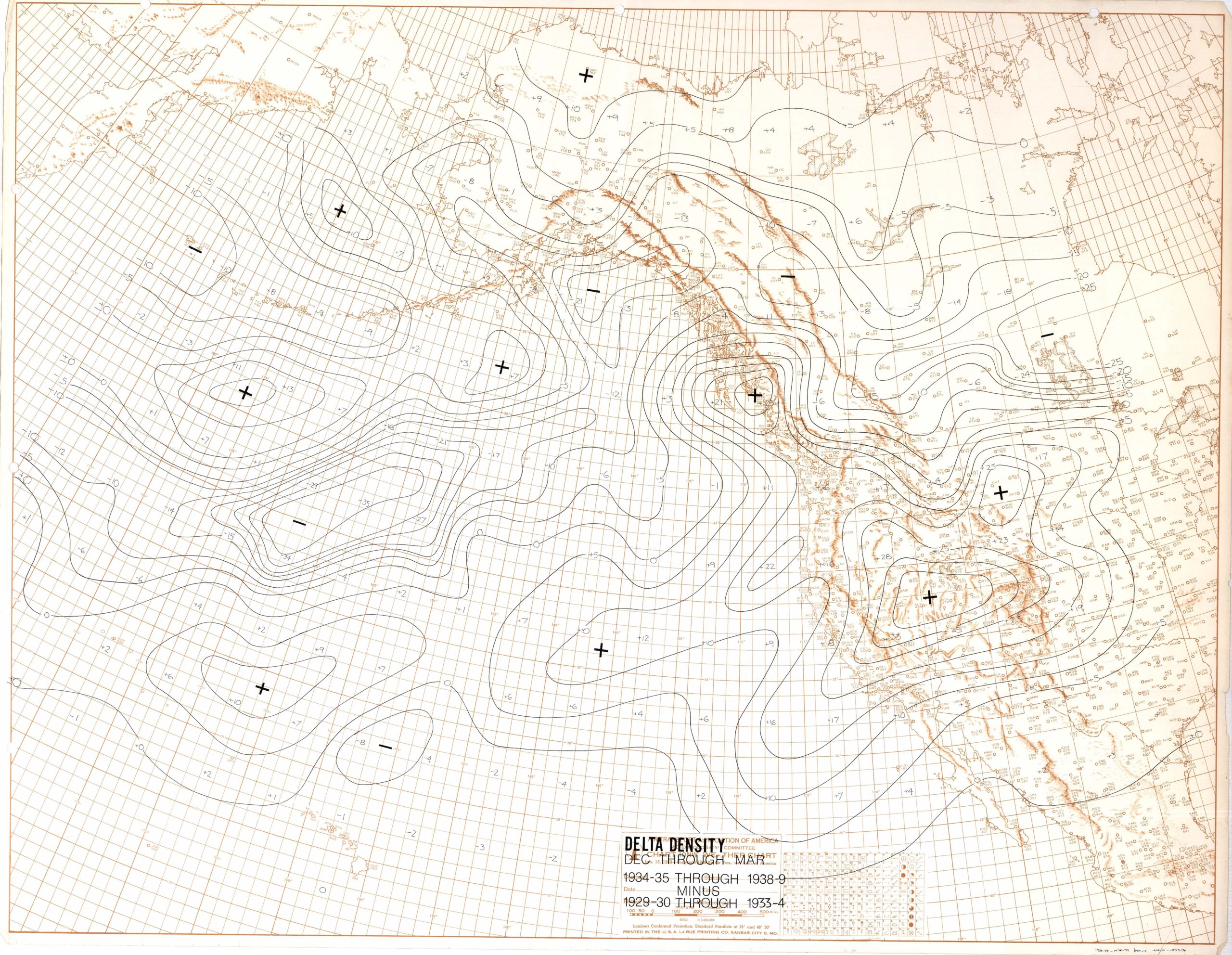 Many more low centers tracked across the extreme eastern Pacific into California and into the Great Basin low pressure cyclogenesis zone in the lee of the Sierras. This map is more illustrative than the sea-level pressure maps of those changes that happened after the shift to wetter conditions .
Questions: Did channeled cyclones disrupt the sea surface enough to cause temperature anomalies in real time or later? Were the El Niños that followed in the late 1930s and early 1940s in part triggered by the lower latitude cyclones racing across the central Pacific? Was this a global change such that Western Europe and northwest Africa saw a shift to wetter conditions after the ones noted in central and Southern California? Data were not available for this period of study (1930s) except in the Middle East for Jerusalem, Israel. There was no indication of a long period of decreasing days with measurable followed by a sudden and prolonged shift to more frequently rainy days.
My favorite answer to, “What caused this shift when someone asked was based on the work of E. N. Lorenz at MIT. Professor Lorenz is famous for bringing our attention to chaos theory where small initial changes in starting conditions can lead to huge differences later. Today, this concept is used to improve forecasts by introducing minor changes in initial data in the models from that observed to see how much difference results in the model predictions.
There need not be an external cause for climate shifts, he wrote. It may just that systems shift in and out of favorite modal types without an external forcing. Thus, the best answer for what caused the shift I think I detected was, of course, “nothing.” See Lorenz (1968, Climate Determinism) in the Amer. Meteor. Soc. Monograph Vol. 8, No. 30, on, “The Causes of Climate Change.” Strangely believe it, there are no papers on CO2 in this Amer. Meteor. Soc. monograph! Mauna Loa measurements of C02 had just begun and so there was no awareness of how it was steadily increasing over the years.
——-
Work to be done?
Bringing the days with measurable rain plots up to date, storm tracks in the 1970s, and investigate whether the 564 decameter geopotential height contour shows a global expansion after the 1970s shift after hemispheric geopotential heights became available (beginning in the mid-1940s). Or is the shift to a high rain frequency along the central and Southern California coast a local phenomenon where a mean upper-level trough recurrs along the West Coast for years at a time? In a cursory check recently, there seems to be no clear recurrence of the prior three shifts in days with rain. Boo.
And lastly, one must ask, is what I have done a “scientific mirage,” and expression used by Foster and Huber (1997) to denote illusory science?
I would like the answer to be a sudden global expansion of the polar westerlies (shown in the average hemispheric latitude of the 564 500 hPa geopotential height contour that accompanies a shift, something like the “Bond Cycles” observed in historic ice core data: a “reset,” if you will, after a long, long period of withdrawing ever so gradually over the decades. Perhaps our gradually shifting climate to a warmer one has done something to interfere with this “shift” phenomenon?
An obstacle that arose in later years was that climate station at Cal Poly, San Luis Obispo. whose record started in 1868, started having missing monthly data that never showed up in the “Delayed Data” section in NOAA’s Climatological Data in the June and December issues. Eventually, NOAA dropped even having a “Delayed Data” segment in the June and December issues! Boo on that! Santa Barbara, whose record also went back into the 1860s, too, had missing months that never were reported. I remember how discouraged I was when these events happened and thought about giving up. How can stations whose records go back into the 1860s (!) suddenly have incomplete records where observers don’t file reports with NOAA? Where was the California State Climatologist? Asleep at the wheel, I suppose.
Maybe you, one of my two readers, will take this research up to see if it goes anywhere?
Sincerely, Art “I’m dreaming” Rangno. :
Caveat: My grad advisers at San Jose State and a professor at the U of WA were unimpressed with these works.
