High cold ones that are headed this way in a curvilinear path. Image was made at 5 AM AST, annotation later.
That means that a deep Altostratus overcast will be in place by tomorrow with a load of virga and sprinkles, not really much rain since the bases will also be cold and…high. Top possible rain amount from these high cold ones is a tenth of an inch, but more likely will be traces. Chance of a trace in the area? Oh, about 99% IMO.
But that’s not our full rain destiny.
On the horizon, only a week from now, is the likelihood of a significant rain. Check the models and the spaghetti:
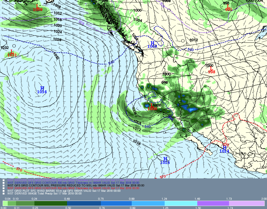
Valid at 5 PM AST, March 16th. You don’t need the precip prediction for this day when the 500 millibar pattern is like this, the core of the wind at that level south of Tucson. Its not a sufficient criterion for rain, but a necessary one in the cool half of the year. (Only about 5% of the rain in TUS falls outside of this criterion in the cool half of the year.
Here’s the rain prediction which I have not looked at until posting now to make the point you don’t need to look at it:
Where the model thinks it will have rained in the 6 h prior to 5PM AST on March 16th. I hope you’re happy now.Valid at 5 PM AST March 16th. Blueish lines of cold and rain (546 decameter geopotential height contours) way down the Cal coast, and somewhat bunched (confidence indicator) for a major trough to affect all of Arizona, keep the current greening underway.
Would say the chances of measurable rain from this “incoming” are at least 90%; i. e., virtually certain. (Note that “virtually certain” is not the same as 100% certain, but its damn close.)
Problems with hoster and connections to hoster continue–must wait seconds to see what I’ve typed, then have to go back and correct the gibberish. So, not doing much as a result.
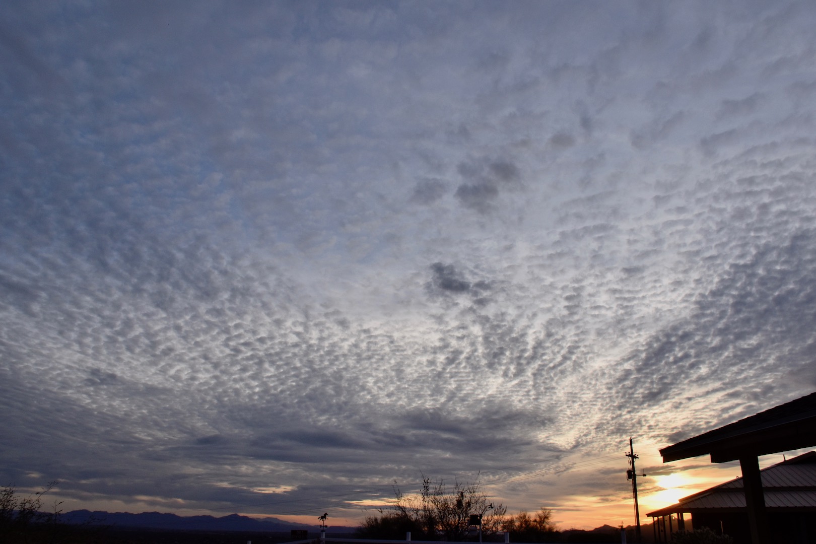
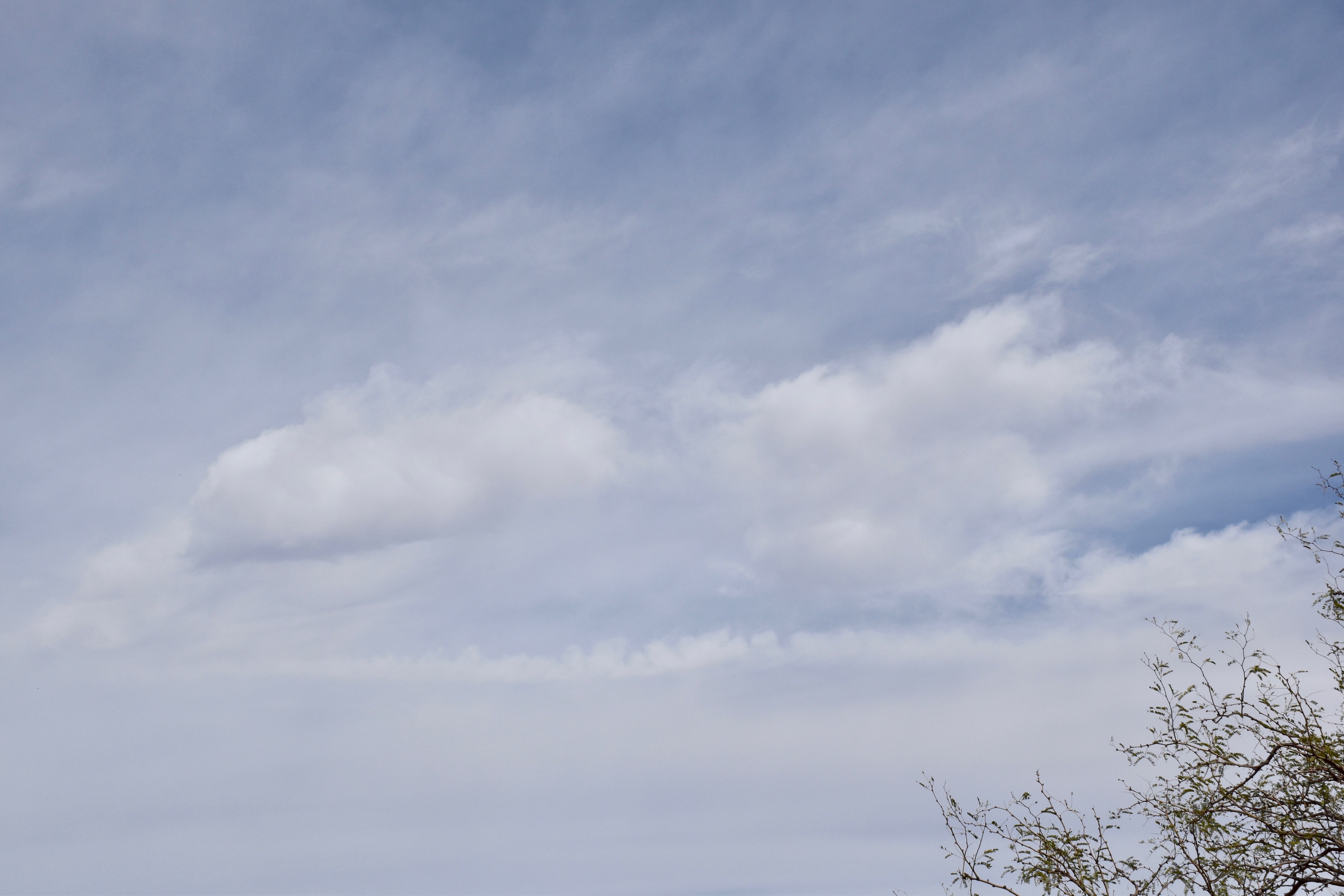
But here are a couple of cloud shots from yesterday anyway:
6:17 PM. Altocumulus perlucidus appearing to spread out, though likely a perspective tomfoolery. Thin Cirrostratus above.6:39 PM.
Addendum: Coupla of days ago saw the rare “Cumulo-cirrus” clouds, ones that appear to be Cumulus but are fakes, up at Cirrus-levels. You might call them Cirrus castellanus. I feel these are worth sharing so that the young cloud maven person doesn’t embarrass himself or herself when making a cloud call to friends and neighbors, as you would do. They occurred on March 7th between 11:30 AM and Noon. Can you tell, upon “zooming big” that these are mostly ice clouds? If droplets were present they were there for only a short time, thus (is that still a word?) indicating that these rag clouds were at very low temperatures.
Some sounding detective work below
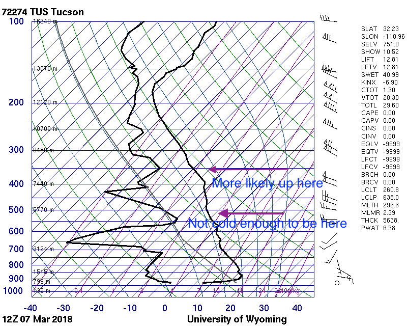
The 5AM AST sounding for March 7th. The sliver of moist air at 16,000 feet above sea level is not deemed the source of those rag clouds.5 PM AST, March 7th sounding with writing on it.
In particular, those Altocumulus clouds, “cold” Cirrocumulus (ones that transform to ice immediately), and those “Altocumulocirrus” clouds combining with scenes of “regular” cirriform clouds. Lots of interesting sights to have seen yesterday. All these the result of marginal moisture aloft and strong winds, up around 100 mph at the highest Cirrus levels.
Let us begin as cloud maven folk by examining the late afternoon sounding launched from our Wildcat balloon launching machine at the University of Arizona, courtesy of IPS Meteostar:
The temperature and humidity profile obtained from a weather balloon launched at about 3:30 PM yesterday afternoon from the U of AZCats with some suggested cloud levels. The Altcoumulus level is in doubt. the others are pretty straight forward. Notice how high those little Cu were yesterday afternoon, about 16,000 feet above sea level, or about 13,000 feet above Catalina, with bases at a cold -13°C or so. No ice came out of those, though. Likely droplets too small, or short-lived.6:45 PM. A very narrow line of Altocumulus castellanus and floccus virgae approaches Catalina.6:46 PM. Let us exercise our curiosity and examine this element in more detail below.6:47 PM. Altocumulus floccus virgae. Another example of how the top of a storm, as here, can be composed of droplet cloud while the ice that forms in it falls out below. Here, the extreme dryness underneath the Altocu prevents long trails. The ice crystals wither so that they have almost no fallspeed soon after they have fallen out, leaving a flat bottom of tiny ice crystals. When you see tiny cloudlets like this spewing ice, you KNOW that the temperature has to be extremely low, and colder than -30° C (-22°C) would be a good starting guess. Actually, guessing “-31.3° ” would be more impressive to your friends or neighbors…. It was a pretty scene, that’s for sure.5:37 PM. Pretty iridescence occasionally erupted in newly formed Cirrocumulus, newly, as within seconds or in the last minute when the cloud droplets are extremely tiny, less than 10 microns in diameter. You don’t see iridescence in clouds with droplets much larger than that. And, it has to be pretty much overhead to get the best views. Hope you saw those yesterday.5:41 PM.5:43 PM. ??????? These are little cloudlets of ice up at Cirrus levels, but it looks exaclty like a field of normal Altocumulus to the ordinary eye. “Altocumulocirrus”? Without doubt this “ice” composition would be contested by other observers. However, cloud-maven person’s interpretation should be used. Now it is likely that the ice in these clouds first formed on what we deem as “cloud condensation nuclei”, and it might be likely that water saturation was reached. But, if there was an instant of liquid, is certainly transitioned to ice in seconds since the temperatures at Cirrus levels were well below -40° C. I don’t believe this was at the same level as the Altocu shown in the beginning of this writeup, yet it wasn’t as high as the highest Cirrus yesterday (up around the -50° C level).6:07 PM. An example of how complicated the cloud scene was yesterday. The whitish clouds in rolls were icy cirriform clouds, and the delicated clouds were HIGHER Cirrocumulus and Cirrus. Cirrocumulus yesterday was indeed where most cloud schematics put it, at Cirrus levels, though probably half the time its in the mid-levels were Altocumulus clouds reside. So, with Altocumulus-like clouds at Cirrus levels and Cirrocu on top of Cirrus, it was really a crazy cloud day yesterday. At the very top of this photo were Altocu that were immediately ice clouds that might have comprised a separate third level of clouds. Need a Lear jet to get there fast to resolve these many guesses.5:07 PM. Jumping around in time here…. These were some of the best scenes yesterday IMO, those oh-so-delicate patterns in those cold Cirrocumulus clouds, ones that transitioned to Cirrus clouds downwind.5:08 PM. Same patch Cirrocu. Note Cirrus forming in the lower portion of this photo, once Cirrocu. BTW, all power lines should be placed under ground.2:29 PM. Amid some real Cumulus fractus was some Cirrus “cumulus mimicry” I’ve termed “Cumulo-cirrus”. Can you spot the fakes at Cirrus levels? Its pretty hard.2:29 PM. OK, I give up. Here’s a zoomed shot of Cumulus fractus mimicry by clouds at Cirrus levels. Might have been some droplets, too, before converting to ice. These kinds of clouds suggest significant turbulence at this level, as would be in a regular Cumulus fractus cloud.
The weather way ahead
Still looking for that chance of rain before July…. haha
Troughy conditions will actually recur aloft over us over the next few weeks it seems, which means slight chances of rain, but periodic cold fronts passing by, mostly dry ones. Best chance for rain still seems to be around the 20th, plus or minus a day or two, even though mod outputs have backed off that scene. But, we have our spaghetti that tells us the models will likely bring back that threat around the 20th, even if some individual runs show nothing at all or only close calls. We shall see if this interpretation has any credibility at all, won’t we?
Of note, Cal having big April in rain and snow after the gigantic January and February accumulations! Looks like they’ll continue to get slugged by unusually strong storms, off and on, for another couple of weeks. Water year totals are going to be truly gigantic.
As of the end of February 2017. You can see were right about at the average for the Water Year,, but it took some “heavy lifting” in December and January to get there.
Doesn’t look promising for much rain here in Catalina in March, however. No rain in sight through the next 10 days at least.
Let’s check our 7 inches with what’s happening upwind, say, in CALIFORNIA, and see if there’s been any drought relief there, through February, via the CNRFC:
California water year totals through the end of February 2017. Note one station in the central Califorina coastal range is already over 100 inches! There are 20 stations already over 100 inches as can be seen from the table at right. March looks to have substantial rains north of SFO, which will add appreciably to those highest totals. Amazing! You can go to the CNRFC and expand these interactive maps, btw.
As you are likely to know from many media stories last year, Cal was in a drought siege of five straight years, with but got a little relief last year in the northern part thanks to help from the giant Niño, one of the strongest ever.
Alas, it was one that failed to deliver as the big rain producer for the south half of Cal and the SW in general as was expected.
In case you’ve forgotten how bad things were in Cal, let us look back at what was being said, those horrific appearing drought maps, and also how hopeful were were at the time that the Big Niño would take a bit bite out of drought. This is a really good article:
Then, when the Big Niño faded away like maple syrup on a stack of buckwheat pancakes last spring and summer, we were surely doomed for more dry years. And, for a time, the dreaded cold tongue of water in the eastern equatorial region, the so-called, La Niña, started to develop, which would be no help at all for a good rain season like a Big Niño is, usually.
The Niña faded away, too, to nothing as the winter went on, so we really didn’t have much going on in the tropical Pacific to help us figure out what kind of winter rainfall regime we were going to have om 2016-17. Not having anything going on meant winter rainfall could go either way, a difficult to figure out situation for season forecasters.
In retrospect it is pretty astounding how big a signal must have been out there SOMEWHERE that this winter was going to be one for the history books on the West Coast in general, and in particular, for Californians. Californians saw their drought chewed up and spit out in a single winter, including snow packs so high the height of some mountain peaks have been revised. (I’m kidding.)
No one saw such an astounding winter coming.
This winter sure makes one think of the QBO (Quasi-biennenial Oscillation, one up there in the Stratosphere where there’s almost no air (haha, well, practically none)… Did the QBO have a role in this astounding winter; was there a delay in the effects of the Big Niño even without a bunch of convection in the eastern Pac tropics? Doesn’t seem that could be right…
But, William “Bill” Lau, U of Maryland scientist, reported some statistical evidence of such a lag way back in ’88 due to a QBO connection of some kind and ENSO, no physical cause could be discerned, however, not yet, anyway. Lau, 1988, is reprised below for readers who want to go deep:
Sure has looked like the Big Niño WY we expected last year!
Some recent clouds; after all, this is CLOUD maven, not RAIN maven:
I’ve been kind of holding out on you. I dropped my camera and busted it. Its no fun taking pictures when you don’t have a real camera. Still doesn’t work right, but take these anyway:
March 4th, afternoon. Hope you logged this; the rarely seen CIrrus castellanus (almost “congestus” in size) or, informally, “Cumulo-cirrus.”Poppies are out, btw, in case you haven’t noticed. Nice display on “Poppy Hils” just across and southwest of the Pima County Pistol Club, off Bowman.March 4th, late afternoon. Nothing terrifically special in this tangle of Cirrus spissatus (“Cis spis” to cloud folk) but I thought it was just a really nice scene
Moving to the next day, Sunday, that REALLY windy day:
March 5, Sunday morning 6:13 AM. Altocumulus lenticularis alerts cloudwise folk to the possibility of windy conditions although it was already windy.3:55 PM, March 5th. After a day of solid Altostratus overcast with underlying Cumulus and Stratocumulus, a layer of Altocumulus began to move in to add a little more interest to the sky.3:57 PM. Looking to the north revealed that some of the lower Cumulus/Stratocumulus complexes reached heights where ice could form. That smooth region on the bottom and right side of the cloud is a fall of ice from this cloud with a RW- (text for “light rainshower”) if you like to text stuff) right below that. This is not a lot of ice and so you’d be thinking the cloud barely made that ice-forming temperature. CMP doesn’t think it was caused by an ice fallout from that higher layer, which sometimes can happen. Let’s look at the most timely sounding, just to check. From the real Cowboys at the University of Wyoming, this:The TUS sounding which I only now just saw, showing a vast separation between the lower Stratocumulus and the higher layers of Altocumlus and Altostratus on top. Note, too, that over TUS the tops of the lower cloud is not quite at -10°C the temperature we start to look for ice formation in AZ. However, our clouds were NW of that balloon sounding, and it would have been that tiny bit colder, and tops were also lifted some when they passed over the Tortolitas earlier, meaning that the tops of this complex were colder than -10° C (14° F) at some point.
Wow, too much information….after a hiatus in blogging I feel like that Oroville Dam in California, metaphorically overflowing with too much hand-waving information.
6:03 PM, March 5. Its still real windy. Line of virga brought a few drops when it passed overhead at 6:30 PM.6:04 PM. Nice dramatic shot toward Marana as the backside of the middle cloud layer approached allowing the sun to shine through.6:09 PM. Virga getting closer. May have to park car outside to make sure I don’t miss any drops!6:22 PM. SW-NE oriented virga strip about to pass overhead. Drops fell between 6:30 and 6:40 PM, but you had to be outside to notice, which you would have been as a proper CMJ eccentric. You would have WANTED that trace of rain report, maybe slackers would not have observed.6:30 PM. Climax; the great sunset allowed by that backside clearing.
Yesterday, whilst disappointingly dry, no rain fell here overnight was a day of rare cloud sightings, most of it involving the rarely seen, “Cumulo-cirrus1“, a cloud fakery situation where extremely cold (less that -40°Ç, -40° F)and clouds at Cirrus levels appear to be ordinary little Cumulus fractus clouds. I hope you weren’t fooled by those impersonators. You’d be pretty embarrassed at the next meeting when we go over yesterday… Yesterday was, in essence, a test for you, and I hope you passed.
Along with the rare “Cumulo-cirrus” sightings, there were intricate patterns in Cirrocumulus clouds that may have caught you’re eye. However, with the wind aloft being so strong (around 90-100 mph at 18,000 feet) you didn’t have a lot of time to enjoy them.
Yesterday’s clouds
10:01 AM. These were the first “Cumulus” pretenders I saw yesterday, though I suppose the discerning eye might have called them “Altocumulus” as well. When they first formed they look hard and rounded like they might have had cloud droplets. But then within seconds, that brighter look caused by high concentrations of droplets or tiny ice crystals (sometimes called “germs” because they have no particular shape when just formed) fades as the concentrations decline rapidly due to evaporation and mixing with the dry environmental air around them. Eventually, they become transparent. Also notice that you don’t see trails come down out of them. This is likely because the concentrations are so high that competition for moisture keeps all of the ice crystals so small they can’t really fall out.10:01 AM. Zooming in. The brighter ones have just formed. The faded ones are the older ones heading for extinction. Many more shots of “Cumulo-cirrus” to follow. Got kind of carried away, as usual.10:18 AM. Another moist layer shot in, first showing up as Cirrocumulus, though this cloud was in the middle levels, not at Cirrus heights. The fine granulation makes it look higher than it really is. This was probably around 12, 000 feet above the ground, if that. One giveaway was the rapid movement of the cloud itself, and compared to the cirriform clouds above it. If they are near the same levels, they won’t move much at all relative to one another. Anyway, these patterns changed by the SECOND! It was amazing how quickly they devolved into something completely different.10:27 AM. A wid angle view of another incoming group of “Cumulo-cirrus.” The thinnest clouds are the ghostly remains of those clouds. The more compact and brighter ones are the youngest ones.10:27 AM. A closeup of a just formed globule. Everything around it was onece like that but now has the visual attributes of regular Cirrus.10:42 AM. One of the strangest cloud sights ever seen by yours truly, CMP. Here a layer of Cirrocumulus (note fine patterns lower center) passes rapidly underneath those globules of fake Cumulus clouds full of ice.
Explanatory figure below:
11:22 AM. Another patch of fake Cumulus fractus at Cirrus levels comes by. Note the true Cirrus in the background, and was higher than the fake Cu fra.11:36 AM. Was beside myself seeing this! Just incredible!11:38 AM. Just two minutes later! Look what has happened to that puff ball of ice. The turbulence up there must have been tremendous.11:57 AM. Some real fakery here. Ordinary people would have said, “Oh, those are just little Cumulus fractus over our Catalinas.” But not you. You would have chided them in friendly, gentle way, telling them they were WAY too high for Cumulus clouds and are mainly composed of ice, not possible for low Cumulus fractus clouds. You could have also pointed out that the cloud in the upper part of this photos were way below those Cumulus fakeries, and that they about to obscure them as this encroaching layer slid underneath them. Also, try not to be condescending, act superior like you know so much even though you do. You might lose your friend if you do that.11:53 AM. Another zoomed view of one of those icy puff balls, not long after it formed.4:01 PM. Altocumulus opacus underneath a Cirrostratus layer. A great sunset was in the works with that opening to the southwest. Also notice, no ice or virga evident. Guess that the temperature at the tops of this layer, likely only a couple of hundred meters thick, is warmer than -10° C.5:31 PM. Altocumulus opacus at sunset. The height of this layer was about 8,000 feet above Catalina by the TUS sounding, top temperature about -5° C. “No virga, no cry,” as Bob Marley said.
The End
————— 1Though it fits, I made this cloud name up. Probably would be Cirrus floccus, maybe Cirrus castellanus in the humped up cases.


