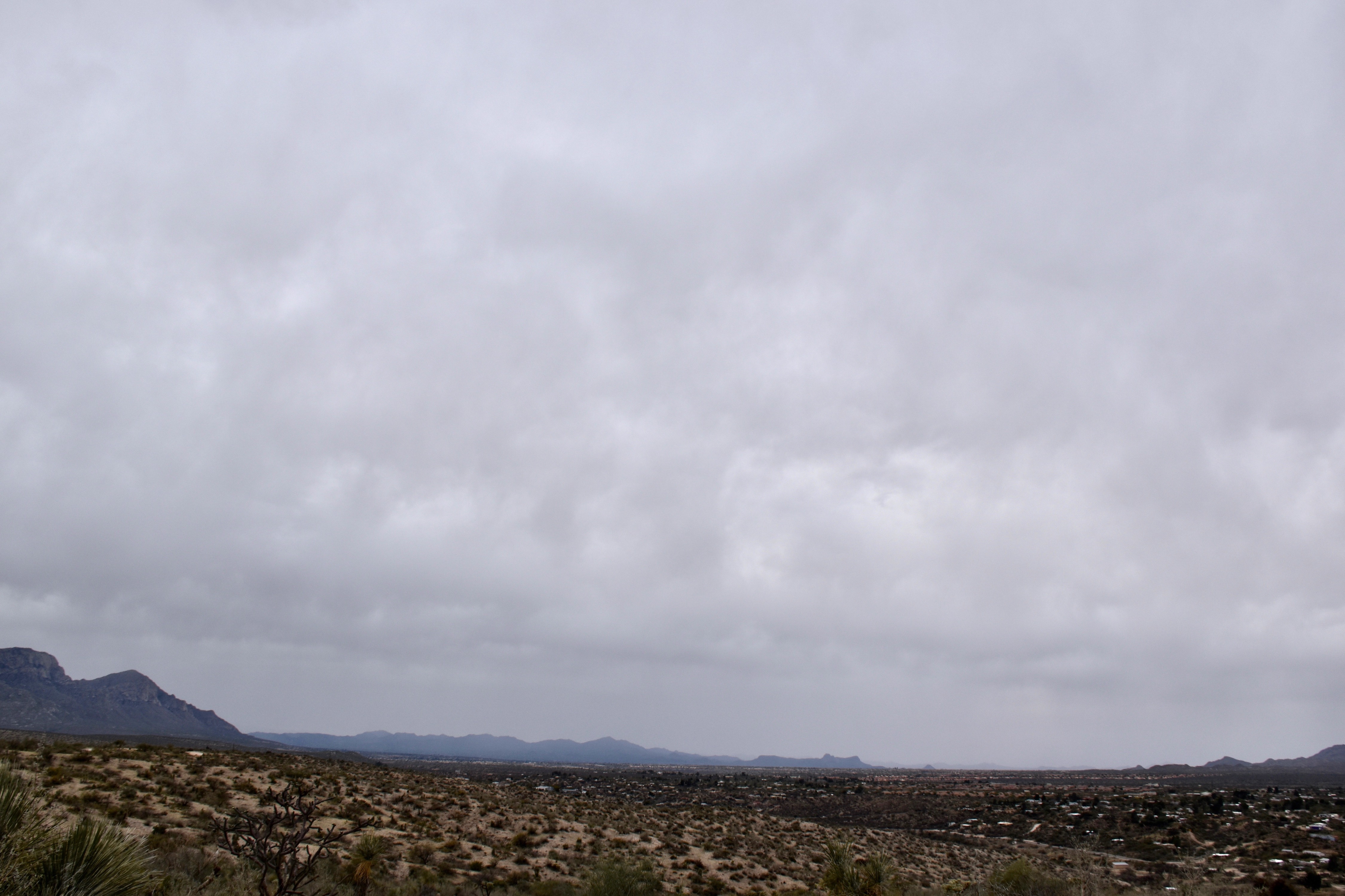
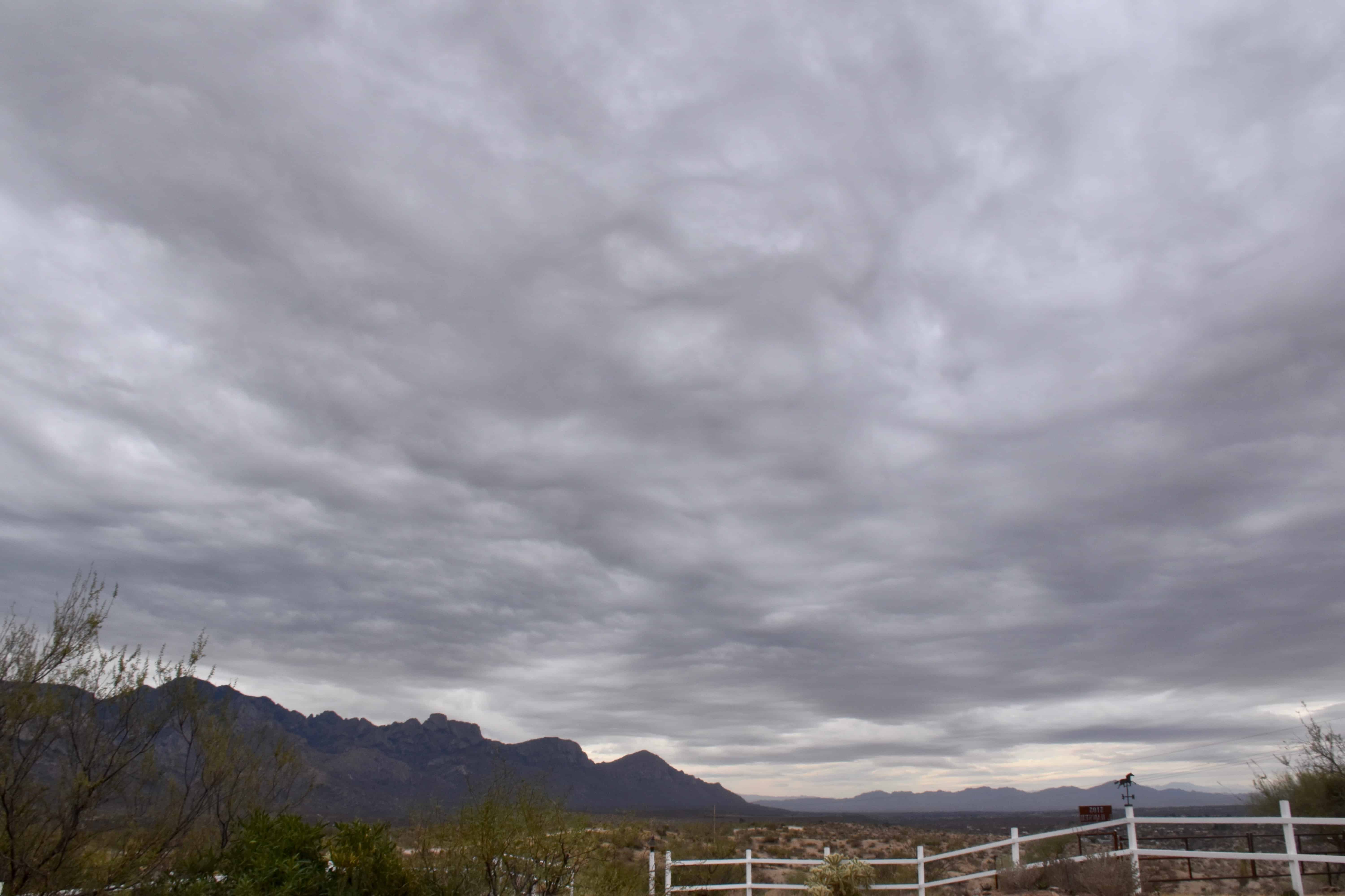
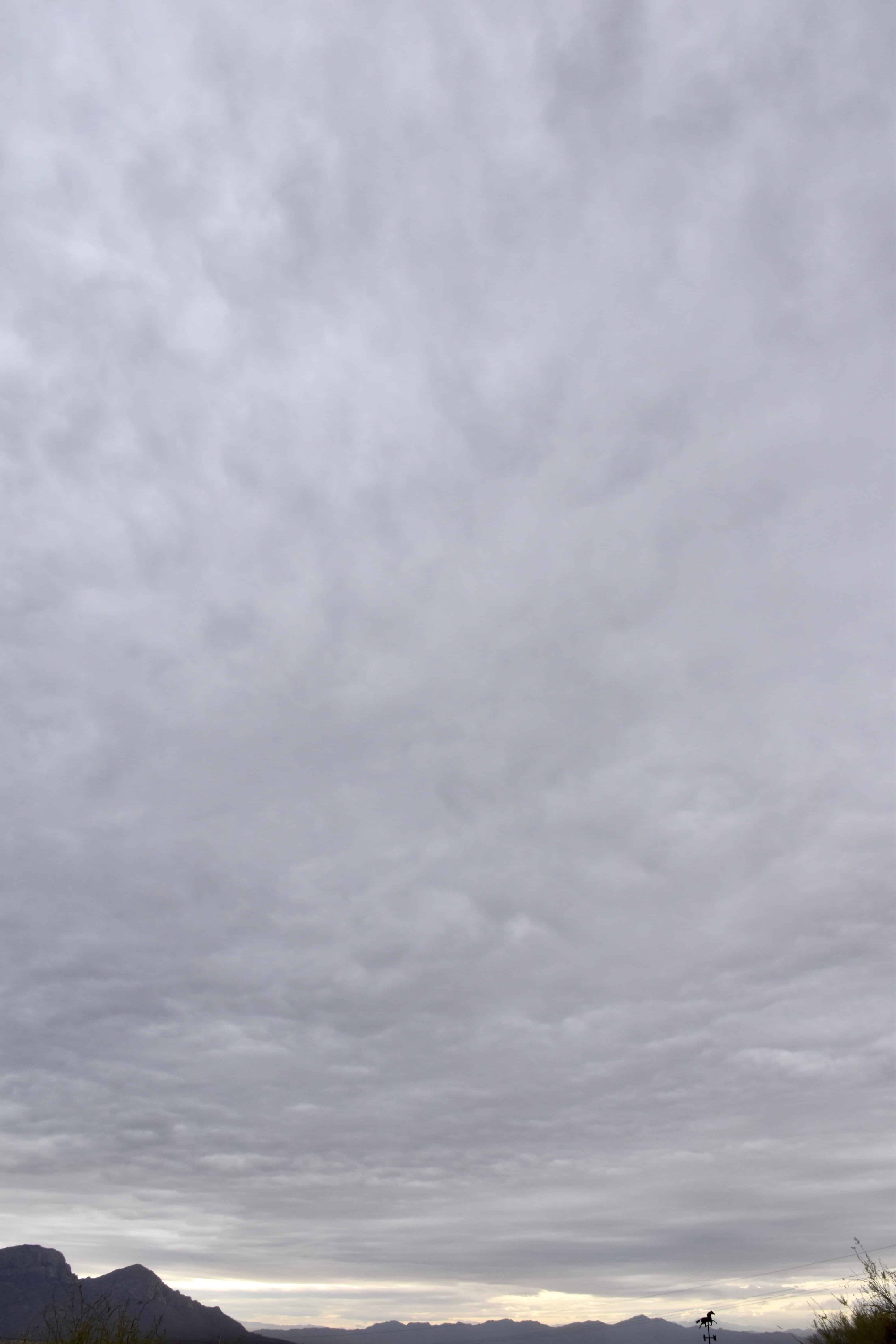
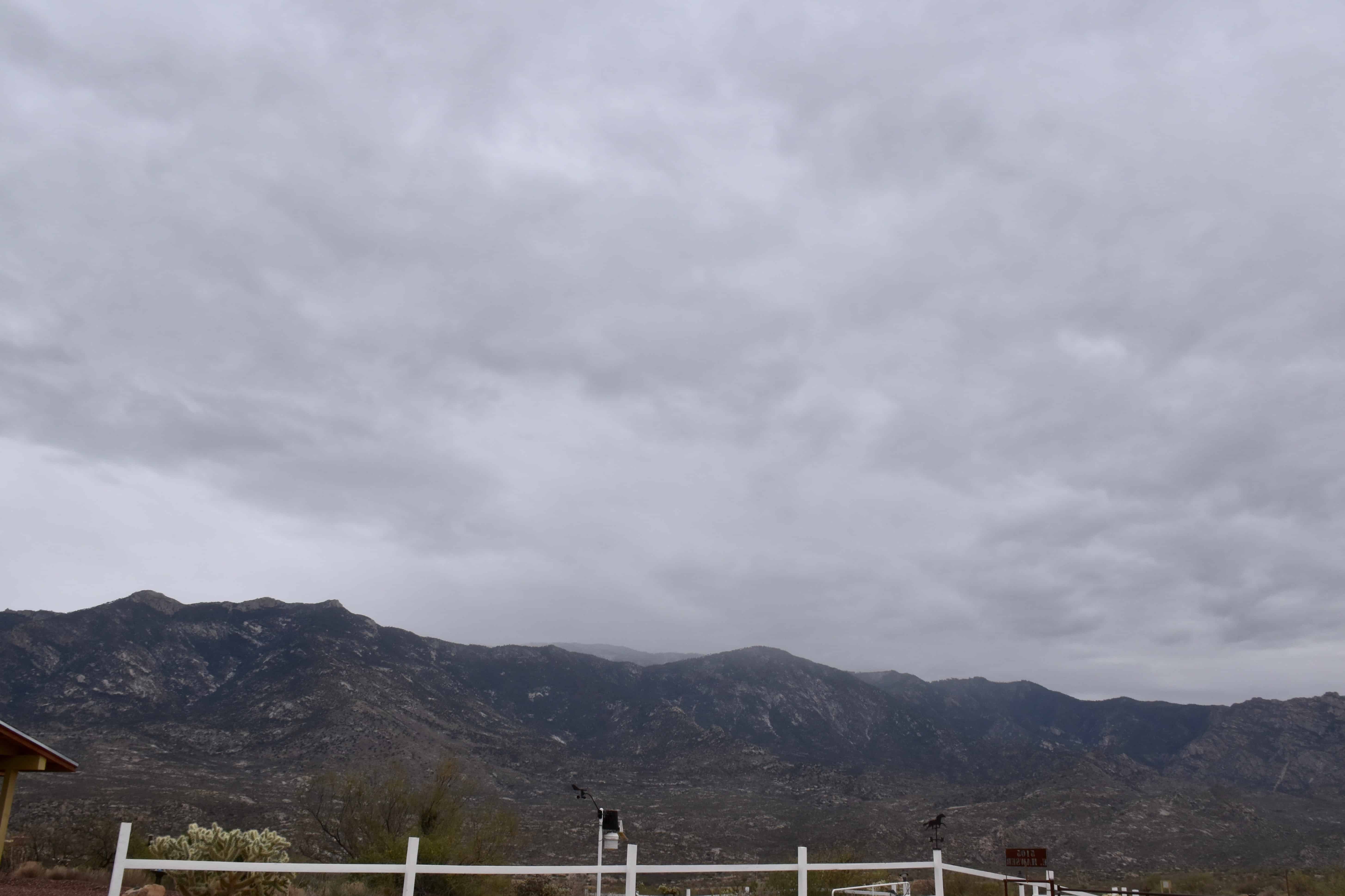
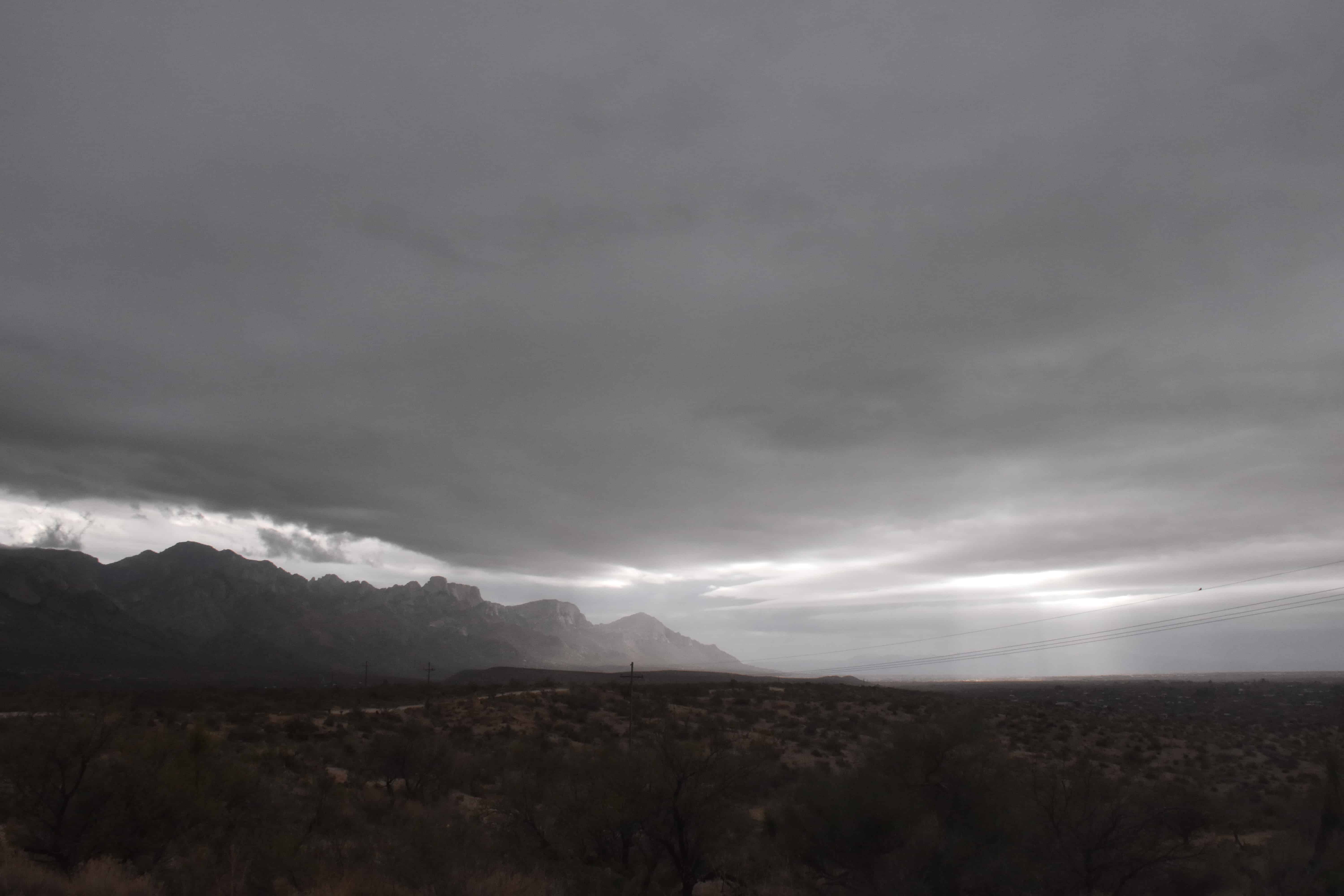
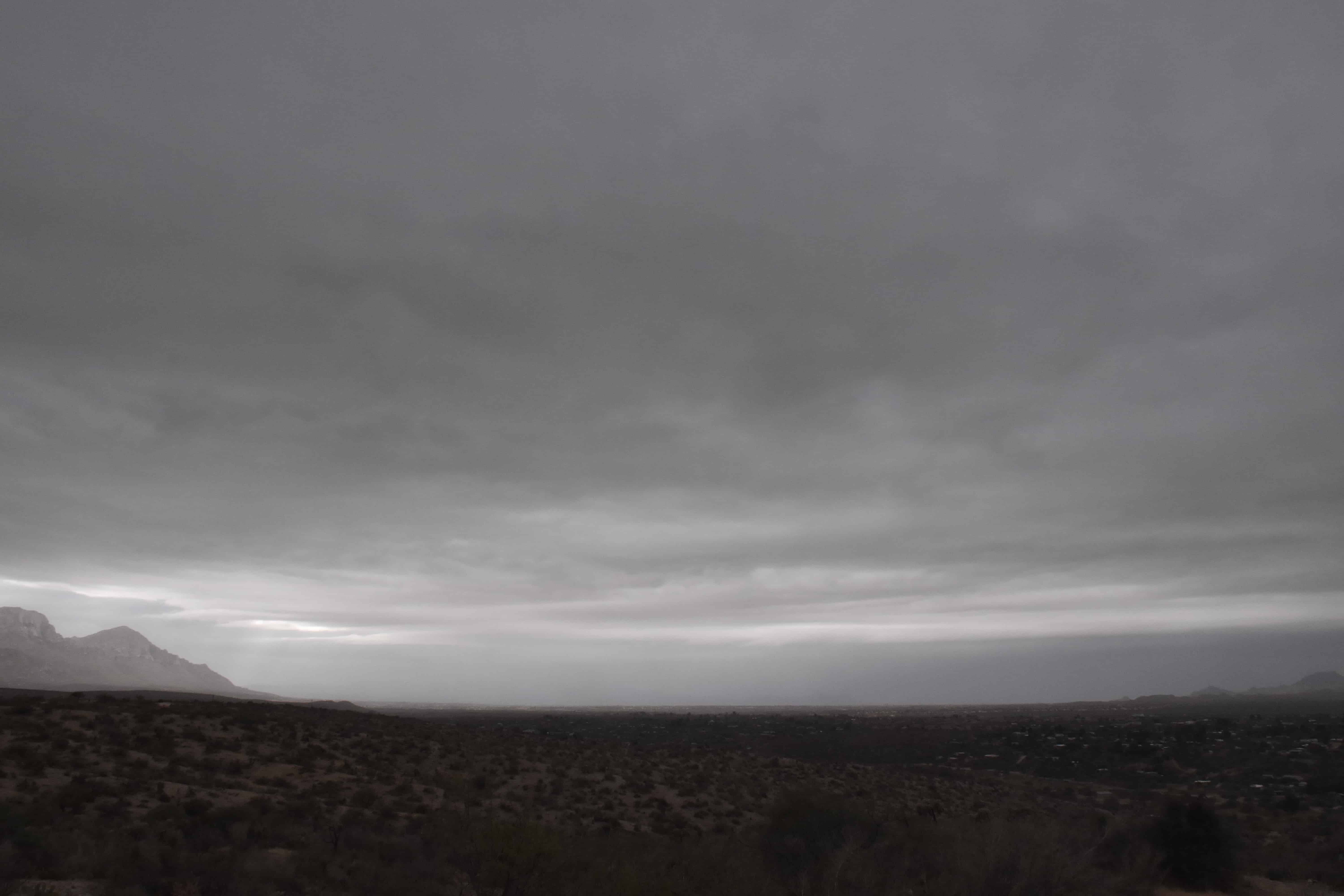
Huh, Sounds familiar. Well, 50 shades of gray is a theme here at cloud-maven.com. Those various shades brought 0.02 inches of rain this morning to The Heights. Here are yesterday’s 50 shades:
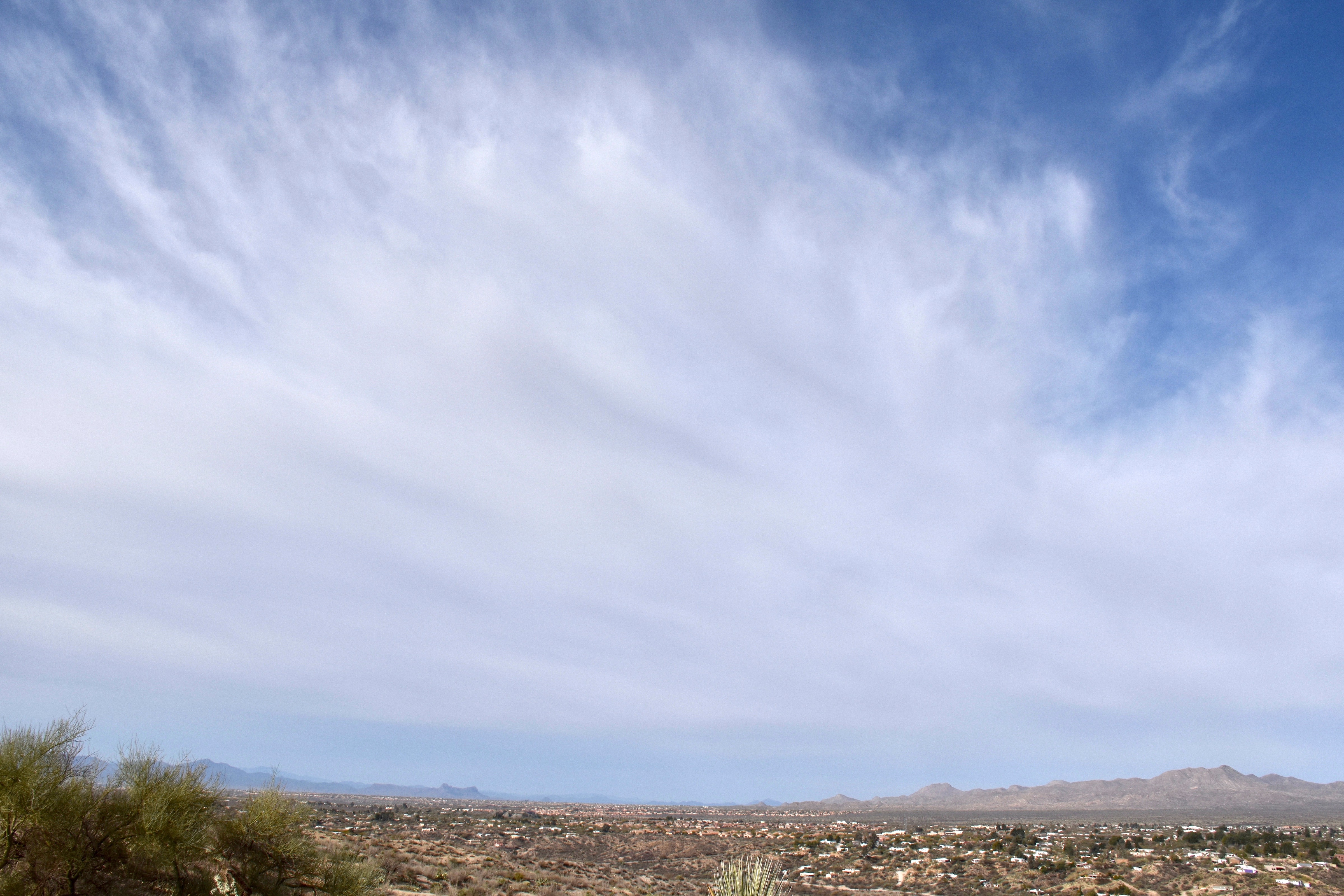
7:58 AM. Massive ice cloud advances on Catalina from the Tropics.
This Altostratus invasion covered the sky within about 15 minutes, and that was it for sun, except some “filtered sun” at times (when this layer is called Altostratus translucidus (the sun’s position can be seen). Its an all ice or mostly ice cloud.
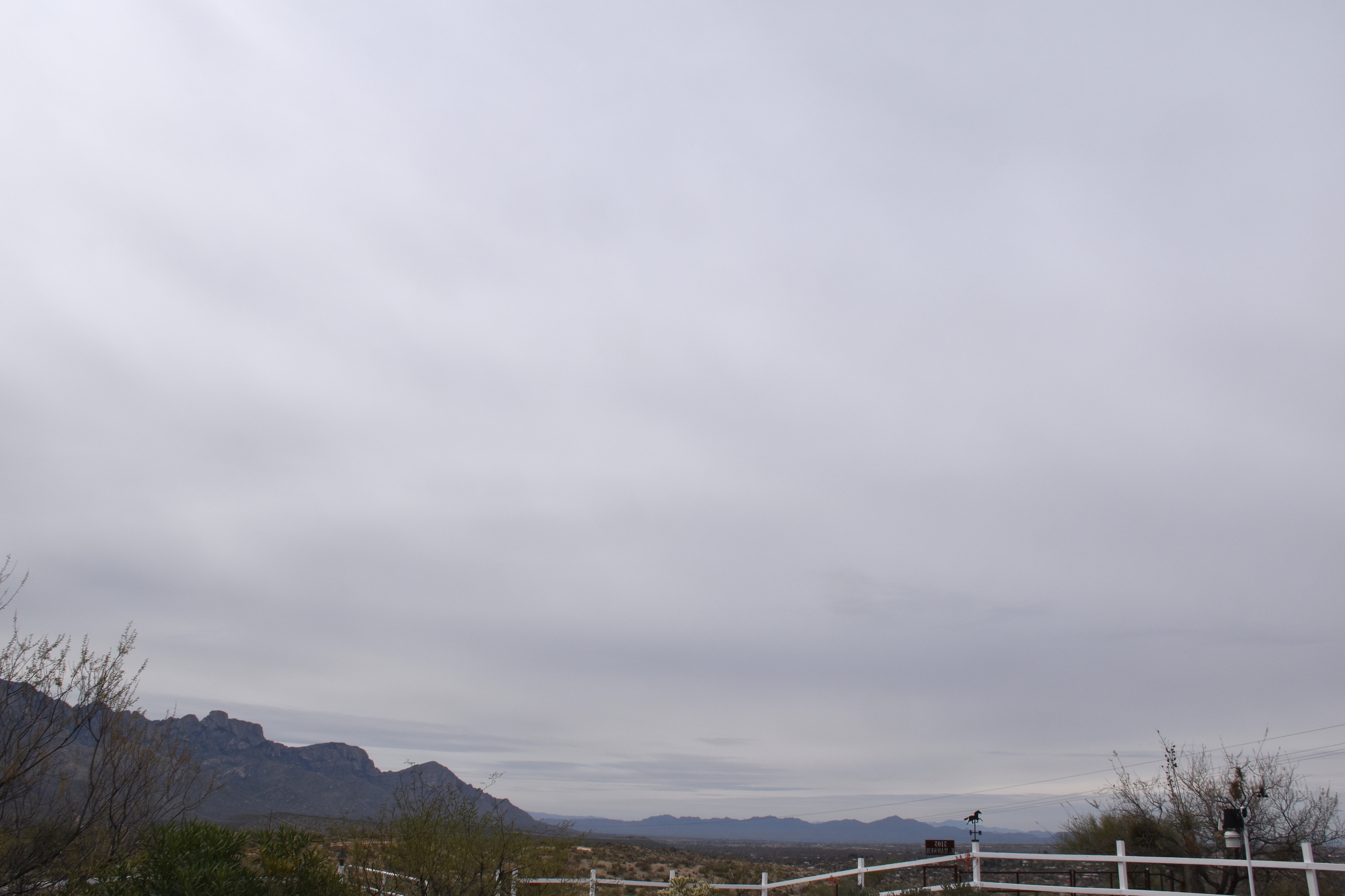
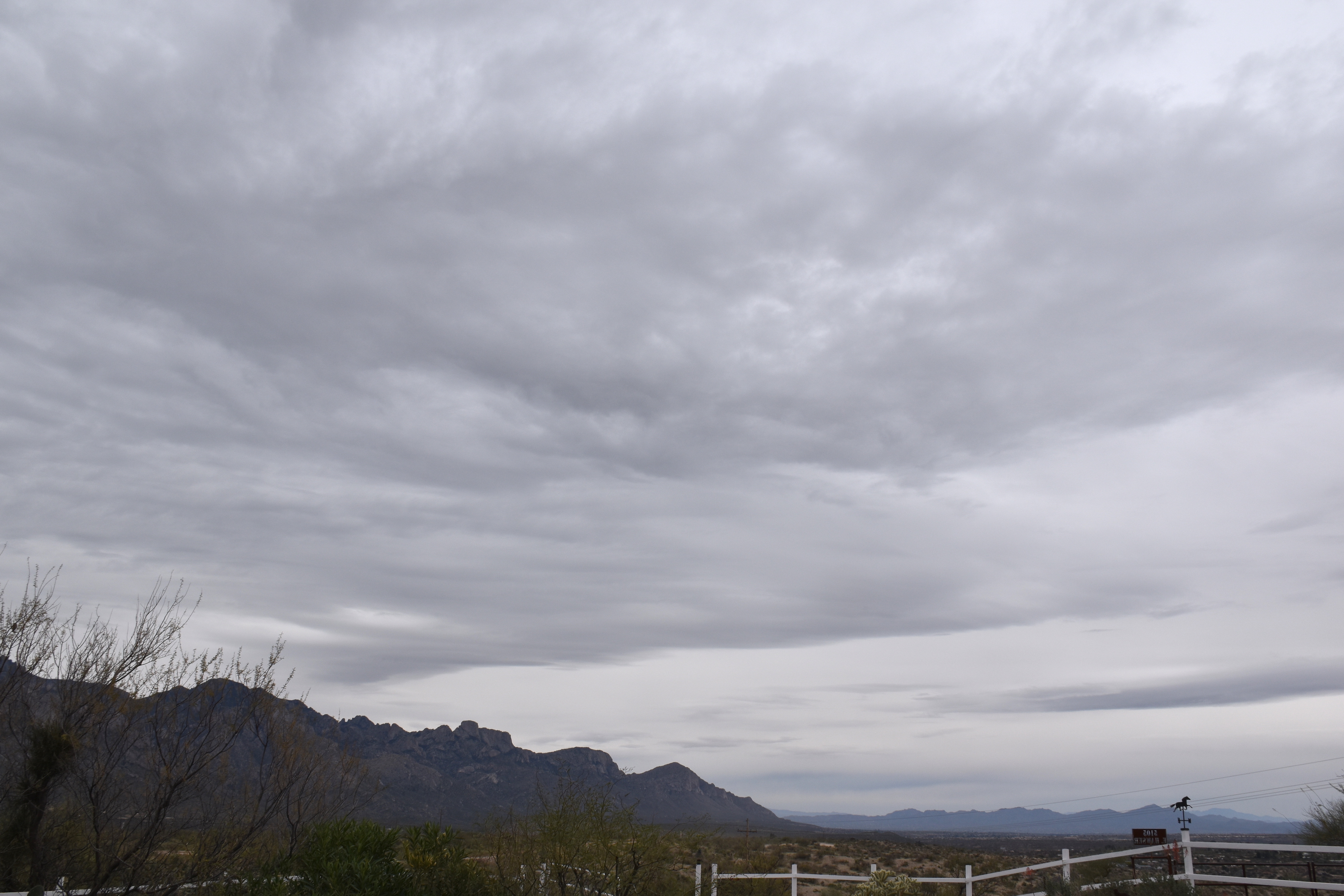
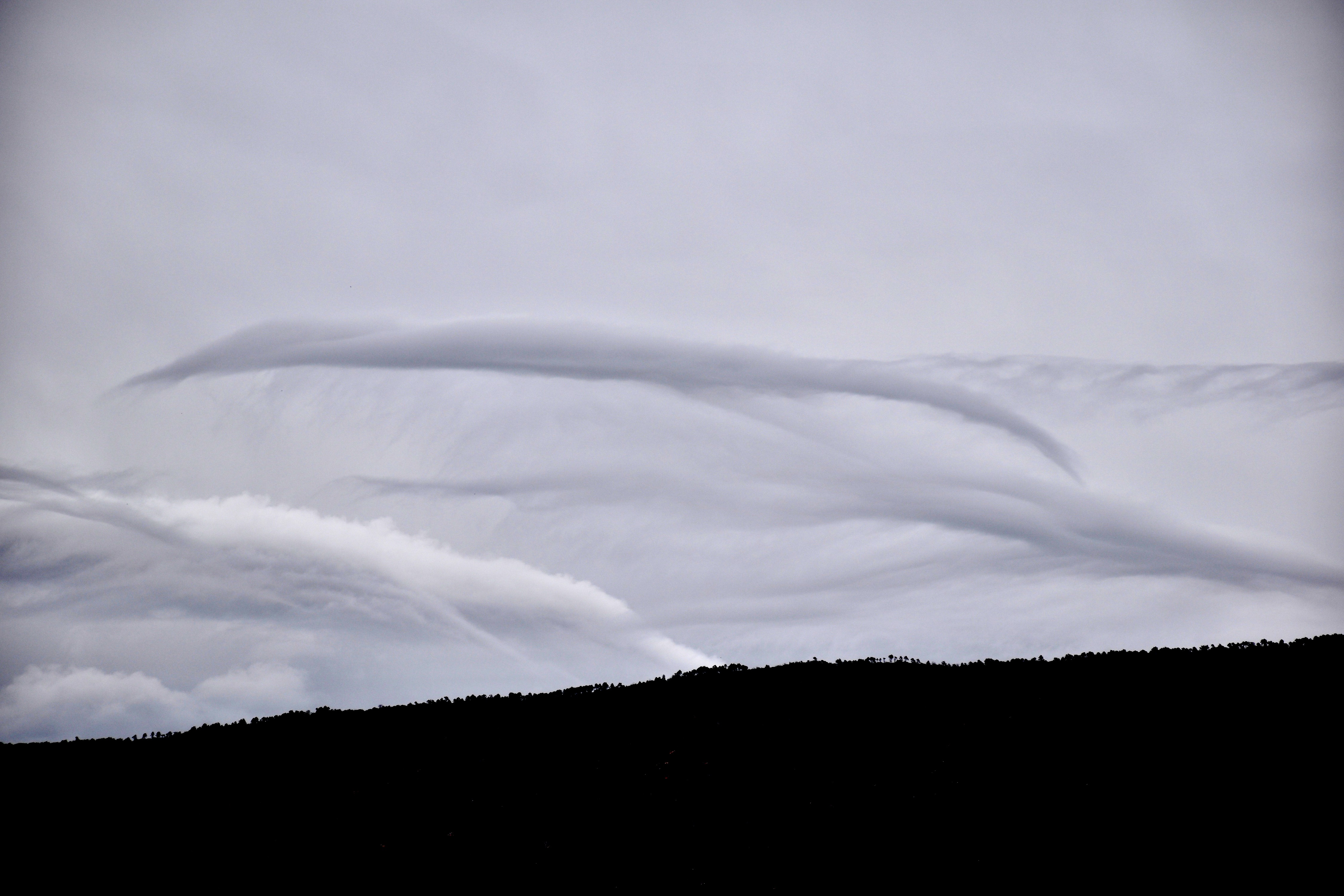
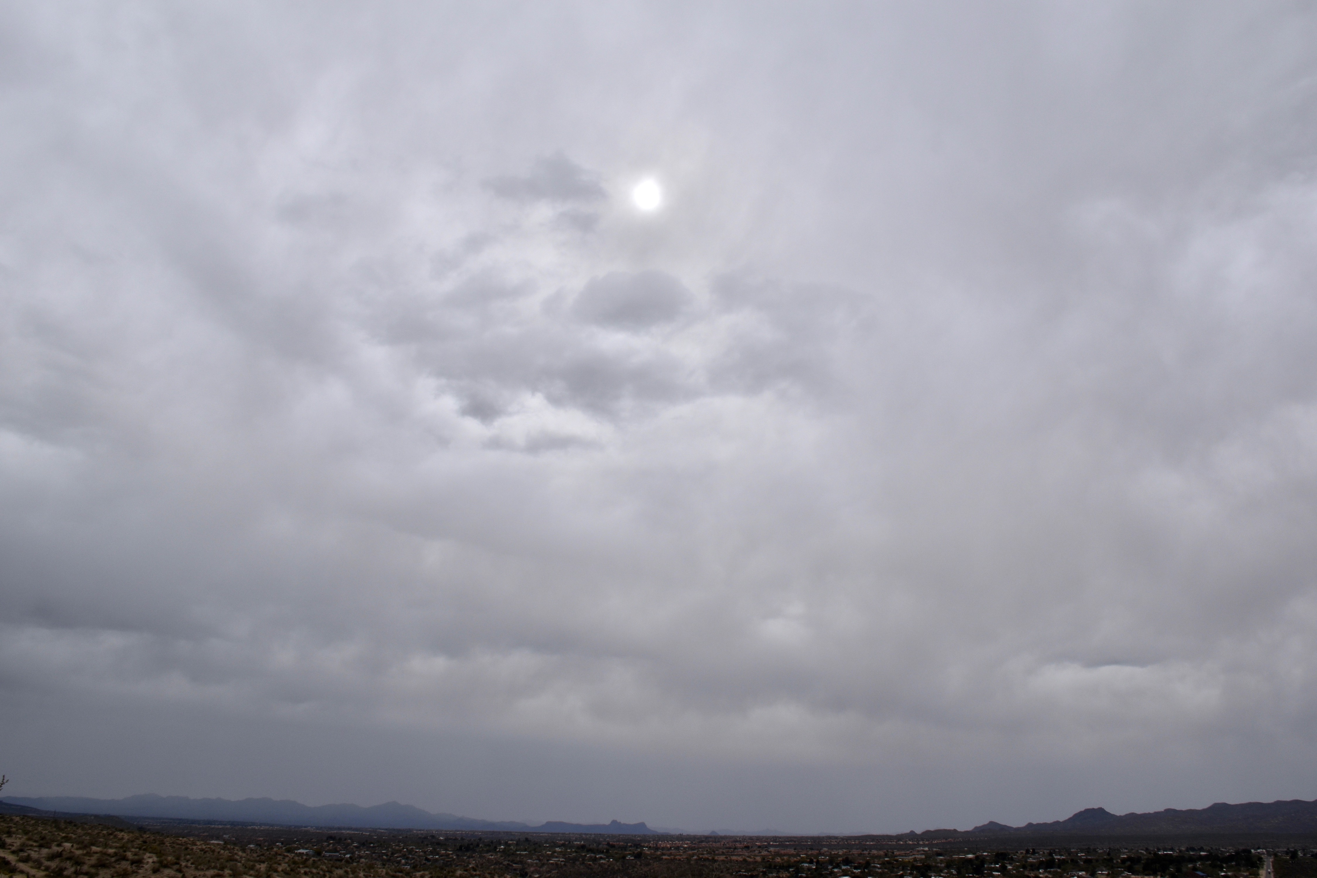
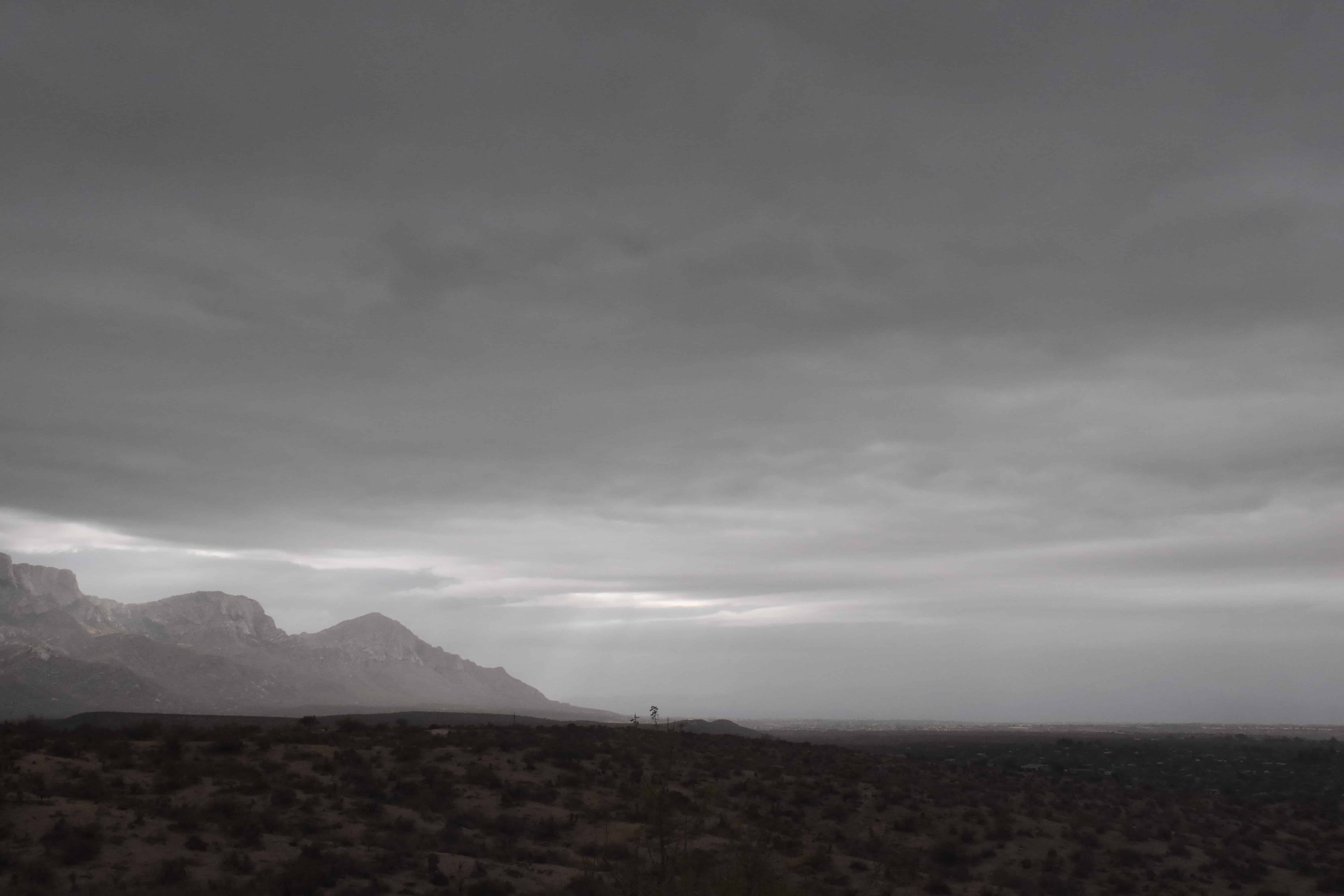
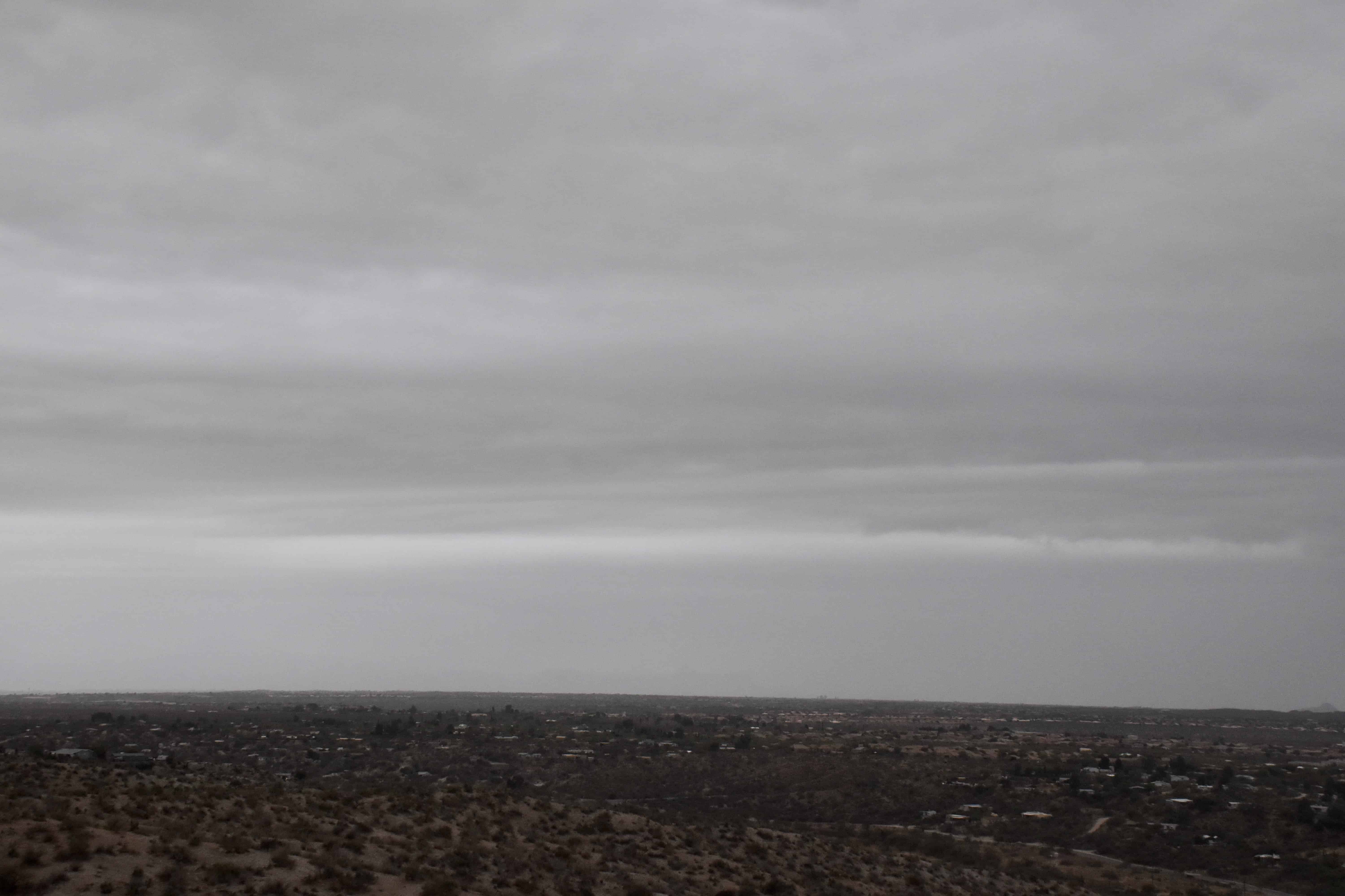
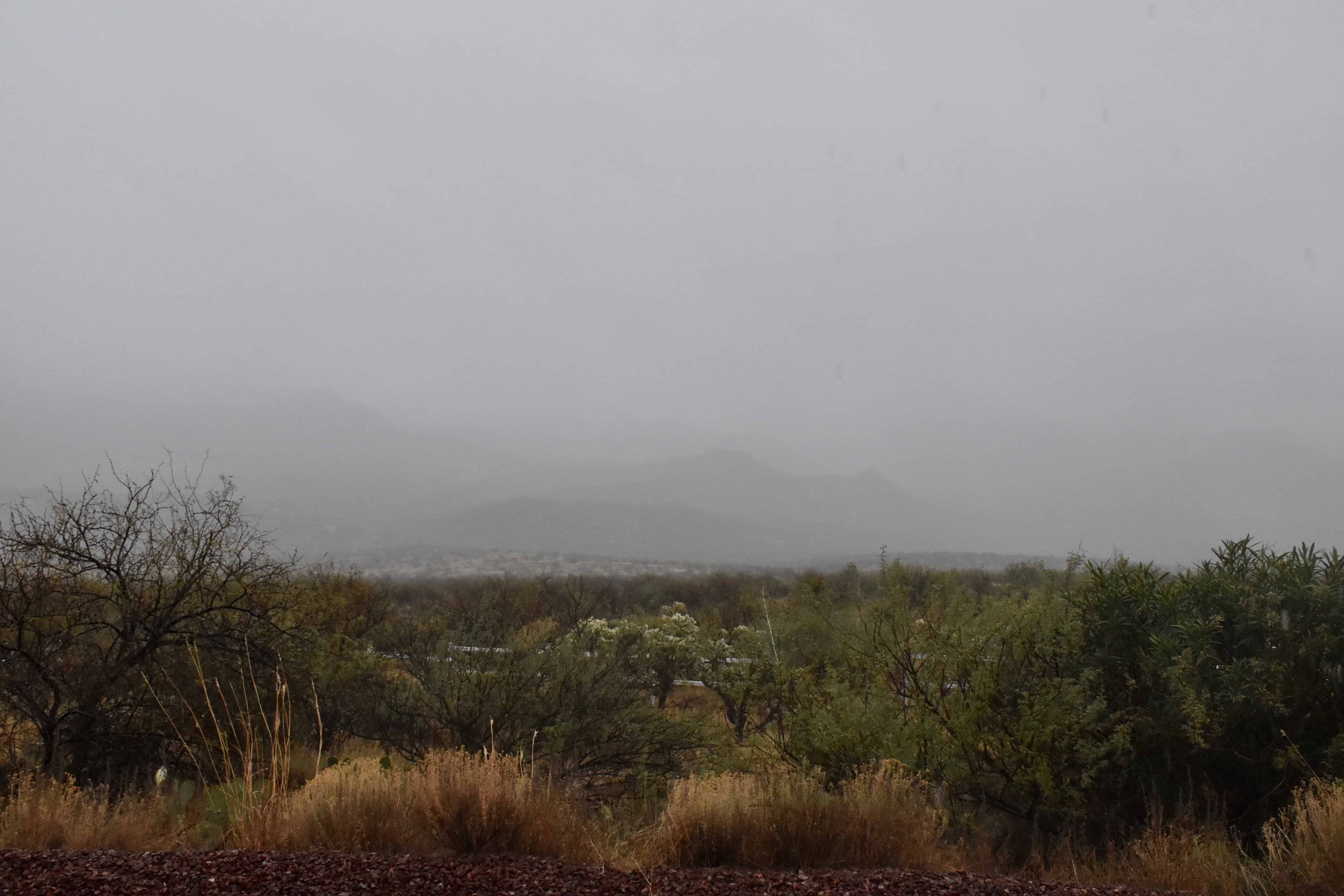
10:58 AM. Altostratus creates a pleasant gray sky.1:26 PM. Lower droplet clouds began to appear, high-based Stratocumulus. The globules are too large to be Altocumulus, though these were based at about 7,000 feet above Catalina, or a little above the height of Ms. Lemmon.1:26 PM. A UFO appears to be soaring toward Catalina with some kind with a trailing spider web. Other lenticular can be seen, this one was truly out of this world. But, from where? What world?1:41 PM. More lenticulars; more shades of gray.3:36 PM. Altostratus is now transitioning to Nimbostratus with lower bases as steady, but very light rain, moves in toward Twin Peaks. What you’re looking at here is mostly virga, and, as the relative humidity increases below virga bases, the virga is able to drop to lower elevations. The humidity is increasing due to gradually rising air that is accompanying an upper level trough. Got pretty wind about this time, too, before calming down. Not sure what that was from except maybe virga falling into very dry air ahead of the rain.3:42 PM. Classic look of Altostratus translucidus. “Opacus” (too thick to see the sun), just ahead. Those darkest areas near the sun are droplet clouds. Most of the scene is ice cloud.4:16 PM. Finally, as very light rain began to fall, we now see the most perfect view of Nimbostratus you’ll ever see. I hope you took plenty of shots of this scene cloud maven juniors! (Nimbostratus, the deep, deep cloud producing steady rain and snow is almost ALWAYS partly or totally obscured by lower Stratocumulus clouds so you can’t really see it. But, not here!
The weather ahead
Pretty much a sure-thing rain (we, unprofessionally forecast at least a 90-100% chance of measurable rain then) will move in late on the 16th or on the 17th. Should be a significant, vegetation-boosting rain, too–by that I mean at least a quarter of an inch–unlike this rain this morning. It looks,. too, like a second rain might move in a day or two after that one. Quite strong support in the ensembles (“spaghetti plots”) for that to happen, too. How great would that be? Very great, of course.
After that, the models are showing even more troughs affecting AZ, but the ensembles aren’t sure about it. Neither am I (CMP).
0.22 inches was, indeed. how much rain fell in the form of drops from Nimbostratus clouds yesterday as a modest little rain band generated by a rapidly moving trough swept through during the afternoon. Regional precip values can be found here. Our local area got the most, up to about a quarter of an inch, as often happens in marginal storms.
Yesterday’s storm marked the beginning of the new, more normal weather regime for southern Arizona, as has been blabbed about here in recent weeks. No more week after week of droughty weather with temperature far above normal, the kind of weather that has marked this whole fall and winter so far! I. e., “Thank you very much, a snowbird might say, but get the hell out!”, the rest of us might conjure up, thinking about the needs of our desert’s wildlife and vegetation.
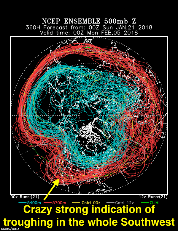
Indications are now that below normal temperatures and above normal precip are ahead for us and all of Arizona in late Jan and early February.
The evidence for these claims?
Below, the stunning, jaw-dropping evidence for this seemingly outlandish assertion in the form of an ensemble (spaghetti) plot generated by NOAA last night. I have followed these charts for almost ten years now, and I cannot remember when such a strong signal (clustering of flow lines) 15 days out has occurred before in our region.
So, excessively excited this morning when I saw it! Its been annotated with excitement text.
This troughy pattern begins to take place on January 30th. Until then, a strong but dry cold front with a lot of wind comes by in a few days, on the 25-26th.
Valid at 5 PM AST, February 4th. You can pretty much count on a trough hereabouts in two weeks. Since the blue lines, the colder portion of the jet stream, do not dip down this way so much, our troughiness likely would be in the form of something we call a “cutoff low.” A full latitude trough extending from the “blue jet” up there in Canada, instead of a “cut off”, would be excessively cold. We probably don’t want that anyway.
Yesterday’s clouds
The whole interesting, if excessively gray story is shown below:
7:24 AM. It was breezy already, and with Cirrus underlain by Altocumulus lenticularis clouds in the lee of the Catalina Mountains, you knew that a storm day was ahead without turning on your favorite TEEVEE weatherman.8:53 AM. With Cirrus and Altocumulus spreading rapidly from the SSW, lenticulars downstream from the mountains, the wind gusting to 25-35 mph, you knew a great gray cloud day was in store!11:32 AM. Before long, an entire sheet of Stratocumulus spread over the sky, making you sure that rain would fall.12:50 PM. First drops begin to fall on Sutherland Heights. That layer of Stratocumulus appeared to be deepening as it approached from the SSW to where the tops were getting just cold enough upwind of us to produce ice and snow that melted into those sparse drops. Not enough ice /snow formed to hide the bases, though, in virga.1:26 PM. Snow begins to fall on the Lemmon.2:04 PM. Lower Stratocumulus clouds begin to show up below the original deck that overran us.
3:16 PM. Pretty and dramatic. Stratocumulus piling up over and upwind of our Catalina Mountains/Pusch Ridge.3:19 PM. Oh, so pretty.3:27 PM. Crazy, I know, but I thought these scenes were so pretty!3:28 PM. As that rain band approached there were some nice lighting highlights.3:40 PM. Here comes that rain band across Oro Valley/Marana.4:19 PM. A truly great scene for a desert; mountains partially obscured in precipitation.4:19 PM. Nimbostratus. Its hard to get a better photo of rainy Nimbostratus than this. Drops coming off the roof, NOT raindrops, can also be seen. This was at the peak of the rain, too! Very exciting.5:54 PM. Sunset Stratocumulus, hold the ice. Yet, that Stratocumulus was cold, way below freezing.
The weather way ahead
The title sums up where we are now. Will we go have more rain? Oh, yeah. But not right away, as you already know.
“Frog strangler”, folk expression from the South for extra heavy rains, btw, which is what we had, except we have toads, not frogs.
Here’s what I think happened to produce 3.36 inches on Sutherland Heights. The winds were from the east at cloud levels. Cumulus spawned off the Catalinas/Mt Lemmon area, but the wind shear brought the tops over Sutherland Heights about the time they got cold enough to form ice, yesterday around -5° to -10°C (higher than the usual temps for ice formation because the cloud bases were so warm. I know what you’re thinking, “huh?” Take my word for it, that’s the way it works; the warmer the bottom of a cloud, the higher the temperature at which ice forms in it. Of course, over the oceans cloud base temperature doesn’t make that much difference… I better quit here on that.
Where was I? Oh… So, leaning out from the mountains is where they began to dump their loads beginning in mid-morning, when updrafts were likely modest. The first one missed Sutherland Heights altogether (except for a sprinkle, but drenched Oracle Road and the Basha’s area. And, likely because it didn’t rain on the east side of the Catalinas until later, those monster turrets kept spawning upwind of us.
The second in this series was a stronger turret, one that could stand more upright against the wind shear and dropped its load on Sutherland Heights. Indicative of stronger updrafts in that one was the onset of thunder, first aloft, then in ensuing turrets shooting upward, increasing cloud-to-ground strokes until it was unsafe to go outside without the thought of being fried.
And of course, the rainrates picked up, and stayed that way as new turrets launched off the same zone of the Catalina Mountains through mid-afternoon. That in itself was remarkable, and if you looked around, you could see that it wasn’t raining all that much either to the north or south of Catalina, and that the rainshafts faded as they trekked across Oro Valley.
The net result, an incredulous 3.36 inches here (3.37 inches in NWS-style gauge here), bound to raise eyebrows concerning possible rain gauge fraud; nothing like it anywhere in the local area! The ALERT gauge on the Golder Ranch Bridge only had 1.46 inches and Samaniego Peak, 1.93 inches! There will be very few days in our lifetimes like yesterday. Go to rainlog.org to see how amazing our local amount was in comparison to other gauges, once again raising the specter of fraud due to an outlandish amount1.
And, again, it was closer to what a REAL monsoon day in India, say, at Cherrapunji, where passing heavy rains are accompanied by the occasional thunderclap. So, in a sense, yesterday you were climatically transported to a land faraway, where tree roots are so big they make bridges out of them…
Some photos of this event, well, too many, really, after all, too many cloud photos is our niche!:
10:03 AM. The MO for yesterday’s rains in miniature. Cumulus launched off around Mt. Lemmon and leaned out over Sutherland Heights as they rose upward. As the tops got higher over us, ice began to form in them, and, down and out it came. Some of the ice, because cloud bases were so warm (about 60°F, 15° C), probably was frozen raindrops.11:08 AM. Only SPKLS so far, but since tallest part of cloud is over Sutherland Heights, some large drops are almost imminent.11:13 AM. Rain begins in earnest.11:27 AM. Shafts intensifying.11:53 AM. Pretty much out of control, just snapping away at this incredible intensity of rain!11:53 AM. One second later. Haha. It was three seconds later!12:37 PM.2:20 PM.3:16 PM. The CDO wash is full, but not huge, where standing waves a few feet high form (as in the 4+ inch dump of September 2015).4:06 PM. The raging Sutherland Wash. Was making a lot of noise down there, mostly from this area near the Cottonwoods where the wall is. You could hear it probably all over Sutherland Heights if you listened carefully. Was raining lightly at this time, OCNL LTG, too.4:06 PM. Another view of the raging Sutherland Wash, probably near its peak.4:25 PM. The lightning from this once proud Cumulonimbus cloud has ended, and now it is resigned to be lightly raining Nimbostratus or Altostratus, I don’t which, but I what I do know is that its, “cumulonimbogenitus”, “Genitus, of course, being one of the books of the Old Testament Bible–you find information like this that you won’t find on other sites.
The End, of a very hurriedly thrown together piece. Got actual work that must be completed soon, something if you read it, it would be so boring you’d want to shoot yourself before you finished it! Sciency stuff. Oh, well, nose to grindstone now.
Former Hurricane ‘Newt’ brought some real humidity, low clouds with unusually warm bases (around 15-20 ° C) to Tucson and Catalina yesterday as its remnant center passed just about over us.
Old Newt was “dragging” here as a tropical storm, aloft it was pretty strong still, brought near hurricane force winds on isolated, high, mountain tops. Mt. Hopkins reached 59 kts from the ESE before the “eye” passed nearby and the winds turned to the west. And in the Rincon Mountains a gigantic 6.39 inches was logged, and a site on Mt. Graham reported 6.43 inches. (Thanks to Mark Albright for these reports.)
While Sutherland Heights received only 0.29 inches in that all day rain, there were eye-popping totals in the Catalinas. Take a look at some of these, Dan Saddle near Oracle Ridge, nearing 6 inches in 24 h! Below, 24 h totals ending at 2 AM this morning, which pretty much covers Newt:
0.28
Golder Ranch
Horseshoe Bend Rd in Saddlebrooke
0.59
Oracle Ranger Stati
approximately 0.5 mi SW of Oracle
0.24
Dodge Tank
Edwin Rd 1.3 mi E of Lago Del Oro Parkway
0.35
Cherry Spring
approximately 1.5 mi W of Charouleau Gap
0.79
Pig Spring
approximately 1.1 mi NE of Charouleau Gap
0.47
Cargodera Canyon
NE corner of Catalina State Park
0.31
CDO @ Rancho Solano
Cañada Del Oro Wash NE of Saddlebrooke
0.39
CDO @ Golder Rd
Cañada Del Oro Wash at Golder Ranch Rd
4.13
Oracle Ridge
Oracle Ridge, approximately 1.5 mi N of Rice Peak
4.25
Mt. Lemmon
Mount Lemmon
1.61
CDO @ Coronado Camp
Cañada Del Oro Wash 0.3 mi S of Coronado Camp
2.17
Samaniego Peak
Samaniego Peak on Samaniego Ridge
5.91
Dan Saddle
Dan Saddle on Oracle Ridge
3.54
White Tail
Catalina Hwy 0.8 mi W of Palisade Ranger Station
3.66
Green Mountain
Green Mountain
1.77
Marshall Gulch
Sabino Creek 0.6 mi SSE of Marshall Gulch
Your cloud day yesterday; we don’t talk about today. That’s for tomorrow.
The day began with one of the great examples of Nimbostratus, that technically a middle -level cloud greeted us at daybreak in what was one of the great examples of the phantom cloud, the true precipitator, usually hidden from view by lower clouds such as Stratocumulus. But, yesterday morning, there it was, “Ns” naked as could be. I know many of you have been looking for a good shot of Nimbostratus to add to your cloud collection for a long time and I could feel the joy out there when I saw it myself. I only took a couple of shots myself, wish now I had taken more of an extraordinary scene.
6:49 AM. Nimbostratus! Note how high the bottom is, a bottom marked mostly by falling precip, usually snow because steady light rain is so relatively transparent.6:52 AM. Looking NNW toward parts of Saddlebrook/Eagle Crest developments. Notice the nice, relatively uniform, blurry gray, the “blurry” look due to falling rain, the perceived bottom, at the melting level, snow is melting into rain. In winter, therefore, the “bottom” or base of Ns, absent lower clouds, appears lower to us because the snow level is lower.
Then, as the light rain here moistened the air hour after hour, low clouds, such as Stratocumulus and Stratus fractus began to form along the mountains, producing some interesting “tracers” of the chaotic air movement over there by the Catalinas under nearly calm conditions. Newt disappointed in his wind accompaniment.
1:41 PM. Stratus fractus clouds lined Samaniego Ridge, Stratocumulus or weak Cumulus topped it, with a higher layer of Stratocumulus above that, That highest layer was once the much deeper Nimbostratus, but now has lost its deep part, so its no longer “Ns” since its not precipitating.1:42 PM. The deep stratocast has departed, the remaining clouds in the foreground are Stratocumulus. The darkening bases on the horizon southwest of Pusch Ridge are where Cumulus and Cumulonimbus clouds filled with rain are piling up, likely due to the light winds coming together down there, maybe in the low center that was once “Newt.”
Later in the day, as the highest, coldest cloud tops associated with those beautiful Nimbostatus clouds moved off to the NE, and our cloudscape became a mix of deeper Stratocumulus with Cumulus and isolated Cumulonimbus cells, they produced true drizzle and misty, visibility-reducing “warm rain”, that rare type of rain that falls here from clouds lacking in ice, began to be observed producing Hawaiian looking rain on our mountains, delicate shafts of rain whose small drops slanted away from the base.
2:32 PM. Misty drizzle and very light rain! When did this transition happen?2:32 PM. Hard to tell the difference here in a photo between the pure, naked Ns, and this lower drizzle,misty rain producing cloud likely topping out well below the freezing level. I’ve seen these transitions before, but I missed this one, where a Stratocumulus deck starts to look a little fuzzy on the bottom as the drizzle, very light rain starts to come out (due to tops rising, drops at the top getting larger, at some point crossing over the “Hocking” droplet threshold of larger than about 38 microns in diameter, where they begin sticking together when they hit). Here, the transition from non-precipitating Stratocu to I-don’t know what has already taken place during between the photos at 1:41 and 1:42 PM. Should drizzly, relatively shallow clouds like these now be termed, Nimbostratus? Or Stratocumulus praecipitatio,to emphasis the shallowness? A question definitely for the cloud philosophers to haggle about. No member of the cloud maven club would be punished for calling this scene one showing “Nimbostratus.” However, the drizzle and very light misty rain should have told you it was from a far different cloud structure than that associated with true Nimbostratus, always a deep cloud with ice in it, often topping out at Cirrus levels.
Here, you might well erupt with, “This doesn’t look like Hawaii, but Ocean Shores, Washington, or some other coastal location along the West Coast on a spring day having Stratocumulus with drizzle!”
You would be correct in that eruption.
Below, an example of drizzle drops on your car’s windshield:
3:50 PM. The tiniest drops you can make out on the window are drizzle drops. I focused on them and you’ll have to click on it to get the full size to be able to see them. I was so excited to see some more of them!
Later, it was to look little more “Hawaiian”, but if you’ve been to Hilo, you know its mostly cloudy all day.
“Warm rain” or rain due to the colllision-coalescence process, is also mainly associated with “clean” conditions, ones low in aerosol particles that can act as cloud condensation nuclei. The fewer the “CCN” the fewer are the droplets in clouds, and the larger the individual cloud droplets are when saturation and cloud formation occur. So, by yesterday afternoon, certainly, it was doggone clean here, no doubt aided by washout in that light rain we had.
Particularly heavy rain with low visibility fell just south of Catalina yesterday afternoon around Ina and Oracle just after 4 pm. However, that rain did not have those HUGE drops that we see from unloading, deep, Cumulonimbus clouds making this observer think as heavy as it was, it may have been due to a Cumulonimbus topping out at less than 20,000 feet, where the temperature would have been too warm for ice. The 500 mb temperature yesterday was a tropical-like -3.7° C on the TUS sounding, almost unheard of with a rain situation here. This, another sign of tropical Newt, since tropical storms/hurricanes have warm cores.
lacking in those huge drops we see in our thunderstorms, this rain likely formed from the “warm rain” process except maybe in the very heaviest rain areas. It was a special day.
You probably noticed how quiet it was; no thunder around, for one thing, indicating the updrafts in the clouds were not very strong, and that was another indicator that the clouds may not have contained ice. Without ice, hail and graupel, soft hail, you don’t have lightning.
The lack of lighting, the all day off and on rain, such as you might experience at Hilo, Hawaii, on the windward side, made it seem like you were in Hilo, Hawaii, or one of the other wet spots on the windward side of the Island.
3:27 PM. Another, to me remarkable misty scene reminiscent of oceanic and coastal Stratocumulus with drizzle and light rain3:52 PM. In the meantime a much deeper cell had developed to the SW of us, down around Ina and Oracle, where an inch and a half of rain fell. Look how the bottom is so close to the ground, like at a temperature near 20° C, about as warm as a cloud base can be here! And the warmer the base, the more water is going up into that cloud! Very exciting scene! Well, they all are to people of cloud maven persuasion.4:24 PM. Into the bursting cloud. Still, drops were not HUGE, as you would expect, but extremely numerous, rain rate over an inch an hour in the heaviest parts. Was taken I around Oracle and McGee, and of course, not while driving. That would be crazy. Only looks like it.6:32 PM. One of the more Hawaiian looking scenes, fine trails of rain dragging along the Catalina Mountains. The slope of the rain coming out absent much wind down low tells you the drops are small, probably near drizzle sizes. And the “shaft” if you will, is diffuse, indicating the small drops are spreading out due to the little turbulence there was making it fuzzy around the edges. Maybe, anyway.
6:25 AM. Altocumulus perlucidus. According to my cloud chart, informally known as “America’s Cloud Chart”, it could rain within 6 to 196 hours. Its quite useful.10:24 AM. Altocumulus opacus. Note the rumpled look of the sky. Indicates that the clouds are rather shallow and composed of droplets rather than a mix of ice crystals and droplets. However, if you strain your eyeballs and look to the horizon, you can see a smoothing and a little virga showing that the cloud tops are rising and they’ve gotten cold enough to produce ice. According to my cloud chart, when you see “Ac opacus” it could rain within 6 to 196 hours.1:44 PM. While the clouds are pretty much the same gray color as in the prior photo, they’re much thicker here and are “Altostratus opacus”. “opacus” because the sun’s position is not visible, though it wouldn’t be in this direction anyway, but to the right. The bottom of this is smooth due to widespread, light falling snow, though it not in a localized area enough to be called virga in this shot. The lack of bunched or heavy virga somewhere tells you that the cloud tops are pretty smooth, too, not a lot of variation in height. The base is really determined by the point that you descend out of this precip, in this case up around 10 kft above the ground over Catalina.4:12 PM. Altostratus opacus praecipitatio or Nimbostratus, either name will do. Recall the quirk in our cloud naming system that makes, “Nimbostratus” a middle-level cloud. The base of these clouds is the general level where the snow falling out has evaporated. Due to bulging tops, and stronger updrafts, a little of the precip was able to fall out because the snowflakes coming out the bottom had grown larger and were able to survive the dry air below cloud base.
Some rain fell about this time in Catalina. Not enough to darken the pavement completely at any time. The main thing to take away from that hour of very light rain is that it was not “drizzle” as even some errant meteorologists call such sprinkles.
You will be permanently banned from attending any future meetings of the cloud maven club if you refer to such rain as we had yesterday afternoon as “drizzle.” Drizzle is fine (200-500 micron in diameter drops that are very close together and practically float in the air. Because they fall so slowly, and are so small to begin with, you can’t have drizzle at the ground from clouds that are much more than a 1000 feet or so above the ground because as soon as they pop out the bottom, those drops start evaporating and fall slower and slower by the second, and in no time they can be gone even in moist conditions. That’ s why its somewhat hilarious and sad at the same time, when, in particular, military sites for some unknown reason, report ersatz “drizzle: (coded as L, or L-) in our hourly aviation reports from clouds that are based at 5000 feet or something CRAZY like that.
This band of Nimbostratus/Altostratus had a backside that approached as the sun went down, and as you know, that clearing let some sunlight enrich and dramatize the views of our beloved Catalina Mountains:
5:39 PM.5:41 PM.
Finally, dessert:
5:47 PM. Rainbow lands on the University of Arizona Wildcat’s Skycenter atop Ms. Mt. Sara Lemmon.5:48 PM.
The amazing rains ahead
Nothing that you don’t already know about, so no use me blabbing about it too much. But in case you haven’t seen it, The Return of Joe Low (after over-hydrating over the warm waters of the eastern Pacific), is expected over the next couple of days, with a little help from another disturbance, to bring colossal rains to eastern Arizona and especially New Mexico.
Below, from our friendly U of A Wildcat Weather Department a model run from yesterday’s 5 PM global data (the Wildcat’s downsize the US WRF-GFS model in this awesome depiction).
Check out the totals expected by the evening of October 23 rd. Stupendous. Usually these totals are a bit overdone, but even so…… Will take a nice bite out of drought.
Precipitation totals expected by 5 PM AST October 23rd. Looks something like a tie-dyed Tee.
For the second time this month, cloud-centric folk had a rare and happy sight: “naked” Nimbostratus, that is, the well-known mid-level1 precipitating cloud layer was present for all to see, but without the obscuring lower cloud decks normally associated with it, clouds like Stratocumulus or Stratus. Time and time again those pesky lower layers prevent one from seeing whose really producing the rain or snow at the ground because when precip is falling, its normally moist enough that lower clouds are present.
Those lower layers are important in enhancing precip because while they aren’t precipitating themselves (though it may seem like it) the drops falling into them from the Nimbostratus higher up, 1) won’t evaporate inside the cloud, and 2), if the droplets in the Stratocu are large enough, some of them will be collected by the raindrop falling through it and it becomes larger, the rain that bit heavier! How great is that?
Its really hard to compare how rare yesterday’s sight of “naked” Nimbostratus was yesterday, but offhand, I would say its about as rare as a professional wildlife photographer2 catching a shot of Cockrum’s Gray Shrew, aka, the “Hairy Packrat” or just “Harry Packrat”, shown below:
Oh, yeah, that Nimbostratus layer sans lower clouds….
12:37 PM. A layer of pure Nimbostratus produces very light, steady rain in Catalina. Cumulostratus3 clouds line the Catalinas below it.
Except for the rarity of the view, not much to see. The bottom is blurred by falling precip, and when its snow, where that snow melts into rain is perceived as the base of Nimbostratus. So…….in the warmer time of the year, “naked” Nimbostratus has a higher perceived “base” than in the cooler time of the year.
There was also another unusual situation, a cloud layer that really has no good name which I will now call from here on, “Cumulostratus.” See below:
12:07 PM. An example of the newly named cloud, “Cumulostratus.” Really there is no existing name that really hits this, maybe Stratocumulus castellanus.
2:07 PM. Kind of fun to see the hide and seek the “Cumulostratus” clouds were playing with Samaniego Ridge and Ms Mt Lemmon, too.
Not much immediately ahead in weather, oh, maybe some scattered showers later Sunday through Tuesday. Nothing really great jumps out of the spaghetti plots in the longer term.
The Canadian model thinks the newly formed desert lands of northern Cal all the way down to “Frisco” will get drenched, beginning in five days or so. That’s good. The USA model, using the same global obs at 5 PM AST yesterday, do not see that happening, but rather just some very light rains. Go Canada!
The End
———————————
1Probably doesn’t seem like Nimbostratus should be grouped with mid-level clouds like Altocumulus and Altostratus, but it is, strangely believe it, as I like to say. On synoptic weather maps it was placed above the station circle, indicating a mid-level or high cloud was present, as a “lazy F”, the character “F” lying on its back. Cloud types are no longer plotted on surface weather maps since today, clouds are mostly detected by machines, not humans. “Rise of the machines.” You know the story.
2The shot here forwarded to me with much excitement by pro photographer, Rick Bowers, of Bowers Photo, who had tried to photograph this vermin for about 20 years he reported.
3“Cumulostratus” is a name I made up because IMO there really is no satisfactory name for the cloud that lined the Catalinas/Samaniego Ridge yesterday.
While on the first day, January 29th, the sun was only blocked by mid-level clouds, the rainy ones on January 30th and 31st provided a rain amount to remember here in the Sutherland Heights (and elsewhere–numerous records broken), 2.28 inches recorded over 24 h ending at 7 AM for the past three days, beginning with the 30th:
0.19, 1.56, and 0.53 inches, ending this morning.
Weeds and wildflowers really happy, as will be free range cattle and horses that get out of their pens in the days and weeks ahead.
———-experimental module———————–
We have an interesting experiment in progress, one we didn’t know we were going to have re wildflowers this spring.
A local wildflower expert on a public TEEVEE station here was quoted as saying that NOVEMBER rain was critical to wildflower displays. Hmmm. OK, but we had a RAINLESS NOVEMBER here!
So, no wildflowers? A limited display? Some key ones don’t come up at all because November was rainless, while October, December and now January had generous rains?
I don’t think so. My take is that everything will be hunky dory. HELL, no one will be able to tell that November was rainless in our upcoming wildflower displays.
But the reader must be advised royally in this editorial side bar, that the writer is a cloud-maven, not a flower-maven as was expert quoted on public TEEVEE.
So, let the experiment unfold before our very eyes! A chance for all to learn things! Ans, how fun is that?
———————–end of experimental module——————
Too, I wonder how often three sunless days have occurred in southern Arizona? Was probably a rare event that these past three days mimicked Seattle or other Pac NW sites west of the Cascade Mountains in winter so well.
BTW, in an important climate note concerning the Pacific Northwest, it rains more in Eugene, OR, aka Duckville, more than in Seattle, in case you’re a football player and are deciding between the Washington Huskies and the Oregon Donald Ducks prior to the upcoming LOI Day, the National Holiday celebrating when high school kids sign Letters of Intent about where they are going to play college football.
And, continuing a high school theme, don’t forget to watch football today; the Seattle Seahawks, who live right next door to the University of Washington Huskies, will be playing in a big game, so maybe you could get some valuable autographs while playing for the Huskies…. Just a thought.
Back to yesterday……
I think the most surprising part was how nearly stationary rain echoes kept giving all day yesterday. So often, where clouds are almost stationary, they just rain out and thin. But it just kept coming, at least here in Catalina. And, as the storm came to a close, the expected sight of a frosty Lemmon appeared late in the day due to the gradually lowering snow level as the clouds suddenly lifted when a dry north wind rushed in. Should be more of that dry north wind today.
No rain in sight now…. Corrals can dry out, which would be good.
BTW, by later yesterday the local washes were running reel good. In case you missed the flows, here are some floody scenes:
1:48 PM. Here a semi-retired Catholic priest in non-traditional garb inspects the CDO wash at East Wilds Road.
1:49 PM. Looking downstream from the CDO wash and E Wilds intersection.1:56 PM. Perhaps you’re a person that has a preference for upstream views of flooding situations. Well, here it is, the CDO Wash looking upstream at East Wilds Road in Catalina. Trying to please everybody here, no matter what your preferences are.
Hiked out to the Sutherland Wash yesterday, arriving about 3 PM to take these docuphotos for you. These were taken near the horse crossing that leads to the “Rusty Gate” and the Coronado National Forest boundary on the east side of the Wash.
Had not seen the Sutherland Wash this big before, in person. Was much higher, though, during the September 8, 2014 event, as deduced from debris piles, when 4-5 inches fell in 3 h.
Yesterday’s cloud
It was pretty much the same one all day I think. We begin our cloud soliloquy with an unusual sighting of pure Stratus, present before the rain moved in again.
7:49 AM. Like a wall painted with Seattle gray paint, available at most fine hardware stores. That is the appearance of true Stratus, and we had that yesterday after dawn. Some fog, too, drifted through. Remember, when its on the ground its called, “fog”, while when its above you the same thing is “Stratus.” Estimated ceiling here, 100 feet.1:08 PM. In the afternoon the Stratus clouds began to break up at times, providing peek-aboo looks at Samaniego Ridge, which was kind of cool. Remember, that the Stratus clouds were not the ones precipitating, but rather the a layer of “Nimbostratus” above them was. However, as you know, a drop falling into a layer of Stratus clouds does not evaporate while it falls through them, AND, can even get bigger if some floating cloud drop can’t get out of the way (those larger than about 20 microns in diameter). So, to continue an educational stream here, while Stratus clouds, and Stratocumulus clouds may not produce precip beyond drizzle, they CAN help increase rain totals when they are present because raindrops are not evaporating when they fall through them, and raindrops may even get larger and the rainfall amount be more than otherwise due to the collection of some of the cloud droplets!
4:14 PM. Its STILL raining! Unbelievable for someone who thought this Nimbostratus layer would rain out and die in place. This is a really good shot of that layer that produced the rain that fell into lower Stratus and Stratocumulus clouds for most of the day. Some connections between the two did occur in the heavier rain areas, The low clouds were completely gone by this time, swept away by a dry north wind.5:15 PM. As the Nimbostratus layer lifted, eventually to Altostratus opacus, if you really want to know, frosty The Lemmon came out showing that the snow level had declined during the day.
You may wish to pleasure yourself with another and very unusual occurrence of fog right now (7:02 AM) coming out of Tucson, heading toward Marana, south Oro Valley. Very pretty scene this miniute. Heading out now to capture on film.
1) The quarter inch predicted/hoped for here fell on Borrego Springs, CA, (0.27 inches) instead. So, it was pretty close. We received a measly trace in the past 24 until we got 0.05 inches just now! Barely made the 0.05 inches, thought to be the least that could fall. So, in humility, will be expanding limits of storms, maybe go with 0-5 inches possible amounts for every next storm. Should hit those.
2) Mods still think more rain is ahead over the next few days, beginning on Thursday. This period of rain has always been predicted to be more than yesterday anyway.
3) As an outstanding weather note for my reader, I thought I would post this photo from a friend in Seattle of the exceptionally warm weather for this time of year they had yesterday in Seattle (60s). A young1 woman at Green Lake in Seattle displays how warm it is by dawning a bikini, near where the present writer used to live. “Smells like global warming”, as Seattle’s own Kurt Cobain1 might have said about yesterday, if he wasn’t dead.
While there have been studies about cherry blossoms and that kind of thing coming out earlier in the spring back East of late, maybe there should be one about bikinis coming out earlier, too. How many weeks earlier in spring than during the Little Ice Age, do we see bikinis nowadays? How long has the bikini season been lengthened? Is it commensurate with lengthening of the growing season? That would be a VERY interesting scientific question to address, one that needs to be fully addressed via graphs and photo documentation. Applying for NSF global warming grant monies now…..
Yesterday afternoon at Green Lake in Seattle. A young woman dawns a bikini! Unheard of in January in Seattle! Thought I would display this full size so that you could see how warm it is. Thanks to Bob S, Ballard District, for supplying this datum.
Yesterday’s clouds
8:31 AM. Rainband encroaches from the south horizon. Flow was from the southeast, but movement of band was to the north. The clouds in the foreground are two layers of Altocumulus. The banded rain cloud moving toward us would be Nimbostratus.11:30 AM. Dammitall, its still not here, and now the rain coming out of the band is so slight you can see through to the other side! Nice birds of some kind on the wires, upper left. Makes me think of that Leonard Cohen song, Bird on the Wire, best interpreted by Judy Collins, of course.
11:31 AM. Lotta birds on the wire. I thought you should see this. Above, Altocumulus/Stratocumulus, with a higher layer of Altostratus.4:08 PM. After the trace and clearing, a new bank of Altocumulus/Stratocumulus and rain band approached from the south. Virga can be seen on the horizon, too. Hope building again for measurable rain.4:19 PM. From the corral, a display of Altocumulus/Stratocumulus lenticulars downstream from the Catalinas. Nice lighting on hills, too.4:30 PM. Cloud maven juniors should have noticed that the lower layer of clouds here (left of center), are LOWER than the clouds that passed over earlier. That means the incoming rainband had a better chance of producing measurable rain though it didn’t.4:40 PM. Another great sign that measurable rain was on the doorstep though it didn’t were these faint Cumulonimbus tops showing up beyond Pusch Ridge. Gettin’ excited here, as you were no doubt. Some pretty hard radar cells came up out of Mexico then.
That’s it. No more photos, no rain last night, either, but in some kind of rain miracle, it has just put 0.05 inches in the gauge! So, the forecast from this typewriter that 0.05 inches was the least that could occur in this “storm” has been verified!
Conditions not ripe for much more, though a few light showers are still upwind. Clouds oughta thin as the morning goes along, with huge breaks in the clouds this afternoon.
Mods suggest more rain beginning as early as Thursday night. This one has more potential for rain here, somewhere between 0 and 5 inches, i. e., only a 10% chance of less than zero; less than 10% chance of more than 5 inches. There, that should do it….
The End
———
Composer, lead singer for that Seattle band, Nirvana. You can see Kurt in a cloud of smoke singing, “Smells like air pressure here“, a Bill Nye parody of the true Nirvana hit where Cobain sings in a lot of smoke, “Smells like teen spirit.” Compare versions.
From yesterday’s 18 Z, or 11 AM AST WRF-GFS model, this behemoth. Seems to be reaching up to grab something! Millions of square miles affected! This is the SAME giant storm you saw predicted in an earlier prog and displayed here yesterday from the prior evening’s run, just more ominous-looking here in the run some 18 h later. Will it happen? Comes and goes in the mod runs, but “spaghetti” hedges it to happen, at least some rain.
Valid on January 21st, at 11 PM AST. Regions of color denote those areas where the model has calculated that precipitation has fallen during the prior 12 h.
In the meantime, we received 0.09 inches here in Catalina/Sutherland Heights last evening, another shot of rain, with more little systems like that one predicted to affect us during the coming week. If you were watching, you saw that you could see blue sky on the NW horizon while it rained steadily, most of the day to our S. Go here to get the Pima County ALERT totals, the greatest about a quarter to a third of an inch.
Cloud bases were pretty high all day, around 11,000 feet above sea level (8,000 to 9,000 feet above ground level). Some boring photos:
1:31 PM. A rain band from mid-level clouds makes it way slowly northward toward Catalina. Altocumulus opacus to the north of the raining cloud; the precipitating cloud farther south is Nimbostratus (few know that the official cloud folk label “Nimbostratus” as a middle level cloud).Winds blasting out of a strong high pressure center in Texas pushed into Tucson, pushing the “usual” city effluent west and northwest into portions of southern Marana and the Continental Ranch development where snowbird and iconoclast climatologist, Mark Albright lives. Today’s word game is, say “iconoclast climatologist” three times as fast as you can.5:11 PM. Both sides of this cloud mass were visible near sunset, the clearing to the northwest beyond the virga can be seen here on the horizon while at the same time to the SSW, you could see the clearing on the south side. Really thought the chances of measurable rain here had ended at that time, but maybe, since 0.09 inches fell later in the evening its not good to say that, make you lose confidence in the things you read here.
Yesterday’s cold front packed a few more rain “calories” than expected…. Kind of wrecked my play on beer in yesterday’s blog title as a way of making fun of it, you know, “Front light”. See rain amounts below.
—————
But before that, a heads up: 1) More rain on way next week, at least a 100% chance of measurable rain during the week, and more storms after that (people will be complaining before long);
2) there are some pretty cloud photos at the very bottom in case you’d like to skip over a lotta verbiage; quite dull writing, hand-waving, that kind of thing about what happened yesterday.
=============
Personal weather station totals as of 2 PM AST yesterday as rain ended from the Weather Underground map. The green and yellow areas are radar echoes, yellow the stronger ones.
The official totals are pretty amazing, too, considering our best model was predicting something like 0.01 to 0.10 inches here in Catalina just before the rain started1. Note below the 2.20 inches at Mt. Lemmon. BTW, we’re now just about at our average rainfall total for December here in Catalina of 1.86 inches and we’ve gotten 1.85 inches so far.
Here’s a truncated rain table for our area from the Pima ALERT gauges (its a rolling archive and so you’d better get there early if you want to see the full lineup of totals for yesterday’s storm):
Pima County Regional Flood Control District ALERT System: Precipitation Report Precipitation Report for the following time periods ending at: 04:14:00 12/14/14 (data updated every 15 minutes) Data is preliminary and unedited. —- indicates missing data Gauge 15 1 3 6 24 Name Location ID# minutes hour hours hours hours —- —- —- —- —- —- —————– ——————— Catalina Area 1010 0.00 0.00 0.00 0.00 0.51 Golder Ranch Horseshoe Bend Rd in Saddlebrooke 1020 0.00 0.00 0.00 0.00 0.55 Oracle Ranger Stati approximately 0.5 mi SW of Oracle 1040 0.00 0.00 0.00 0.00 0.63 Dodge Tank Edwin Rd 1.3 mi E of Lago Del Oro Parkway 1050 0.00 0.00 0.00 0.00 0.55 Cherry Spring approximately 1.5 mi W of Charouleau Gap 1060 0.00 0.00 0.00 0.00 0.75 Pig Spring approximately 1.1 mi NE of Charouleau Gap 1070 0.00 0.00 0.00 0.00 0.67 Cargodera Canyon NE corner of Catalina State Park 1080 0.00 0.00 0.00 0.00 0.59 CDO @ Rancho Solano Cañada Del Oro Wash NE of Saddlebrooke 1100 0.00 0.00 0.00 0.00 0.43 CDO @ Golder Rd Cañada Del Oro Wash at Golder Ranch Rd
Santa Catalina Mountains 1030 0.00 0.00 0.00 0.00 0.47 Oracle Ridge Oracle Ridge, approximately 1.5 mi N of Rice Peak 1090 0.00 0.00 0.00 0.00 2.20 Mt. Lemmon Mount Lemmon 1110 0.00 0.00 0.00 0.00 0.55 CDO @ Coronado Camp Cañada Del Oro Wash 0.3 mi S of Coronado Camp 1130 0.00 0.00 0.00 0.00 0.79 Samaniego Peak Samaniego Peak on Samaniego Ridge 1140 0.00 0.00 0.00 0.00 0.71 Dan Saddle Dan Saddle on Oracle Ridge 2150 0.00 0.00 0.00 0.00 1.34 White Tail Catalina Hwy 0.8 mi W of Palisade Ranger Station 2280 0.00 0.00 0.00 0.00 0.59 Green Mountain Green Mountain 2290 0.00 0.00 0.00 0.00 0.98 Marshall Gulch Sabino Creek 0.6 mi SSE of Marshall Gulch
Hell, there wasn’t any rain in the cloud band west of us when I got up, and so I thought with some lifting, and that jet core at 500 mb slipping southward from southern Cal as the day went on, rain would develop farther south in the frontal cloud band. It did, of course, but still thought it would blow through in 2 h or so, something akin to the models as well. The rain fell for about 5 and half hours! The clearing took place a little before sunset, not in the early afternoon as expected.
So what happened?
I think you and I overlooked a disturbance aloft behind the frontal band. It was sliding SEwd fast from Nevada, catching up to our little frontal band. When those things happen, clouds magically seem to be appearing on the backside of the frontal band, fattening it up, holding its progress back; and the rain areas get bigger. The frontal band was MUCH fatter when it went by TUS than it had been just a 100 or so miles to the west at 4 AM AST yesterday morning. Here are contrasting satellite and radar images for two periods yesterday, before the band fattened up and the second, when it was raining so much here:
Satellite and radar imagery for 4:30 AM yesterday. Sneaky backside disturbance is represented by those clouds near Vegas. No rain echoes west of Catalina, stop along the Pima County line making it look like rain will be marginal here.BY 1:30 PM in this satellite image with radar, the band is twice as wide and there’s rain almost all the way down to Mexico way. Look how those clouds and showers near Vegas have caught up with our front, almost attaching themselves to it in north central Arizona. Lots of times this process of upper air disturbances catching up to a front generates a cyclone along the front as the front widens and begins to kink. I think that’s what happened anyway. Whatever. It was a great confluence of events for us here in Catalina. Think how the wildflower seeds are feeling right now with already an average amount of rain for December, and its not half over, and more is on the way, yay!
If you’re a true C-M disciple you noticed something else yesterday: true DRIZZLE in the rain. Drizzle may be even more rare than snow here. And the thick low visibility rain consisting of smallish drops from drizzle sizes, 200-500 microns (a couple to a few human hairs in diameter) and raindrops just above those sizes for much of the time the rain fell, should have made you start thinking of a warm rain process day. Maybe there was no bright band in the radar imagery during those times, something that happens when rain is ONLY formed by colliding drops that get big enough to fall out; no ice nowhere. In the heavier rains, sometimes when visibility was improved, ice was very likely involved.
The TUS sounding really can’t shed light on this question since the morning was had shallow clouds that weren’t raining yet, tops barely below freezing, and the 5 PM AST sounding, with tops at -10 C (14 F), was a little too late, though that layer that was sampled did produce what appeared to be ice virga in the direction of TUS about the time of the sounding. BTW, its well known that “warm” rain processes that don’t involve ice occur at temperatures below freezing, so the expression is a bit of an oxymoron.
So, without radar imagery over us during the time of the thick rain and drizzle, we can’t say for sure, but it sure looked like it to C-M, which is what you should think as well I think. Thanks in advance for thinking what I think.
Enough of my excuses2, let’s rock and roll with yesterday’s clouds
Your cloud day
7:35 AM. Light rain, looking suspiciously like “warm” rain, clouds not looking so deep, spreads over the Catalinas. Its only gonna get better from here as frontal band leading edge is just across the street over there on the Tortolitas.
8:09 AM. “Oh, what a crummy front, things breaking up already”, you were thinking. Also, “Look at how shallow those clouds are! Terrible.” Sometimes these brief thin spots or clearings are called, “sucker holes.” Hope you didn’t fall for it like I did. (Just kidding.)9:43 AM. W0X1/2 R–F (text for “indefinite ceiling, zero, sky obscured, visibility 1/2 statute mile in very light rain and fog”), rain has piled up to 0.10 inches by this time. But you notice there’s something different about the rain; , its thicker, small thick drops hardly making a splash in puddles, even drizzle drops in it. You begin ask, “Could this be a solely warm rain event?” I think so. Note disappearing telephone poles.12:46 PM. After several hours of rain, flood waters begin to appear. Note mottled surface of this small rain-formed lake, showing that the drops were making good splashes at this time. Rain intensity deemed R (moderate) then. Deemed not a warm process rain at this time due to those drop sizes and less bunching, fewer small drops in between the larger ones, visibility was about 2 miles in rain.
The best scenes of all were when the clouds began to part in the late afternoon and evening sun. I hope you caught these beautiful scenes:
The End
—————————————————– 1Total rain prediction from our best model, the one from the U of AZ with the predicted totals through 3 PM AST yesterday. The model run was at 11 PM AST the evening just before the rain began:
The arrow points to our location, in which only a tiny amount of rain was predicted. Mod doesn’t miss very often by this much, but the earlier December storm had the same mod problem, too little in the model compared to what actually fell here. Gee, new thought… Could it be a poor representation of the warm rain process? Hmmmm.
2Your Catalina C-M did have a correct range of amounts that could fall in yesterday’s storm right up until the last minute. For weeks he was predicting, and staying firm with, 0.15 inches on the bottom, and a voluptuous, if that’s the right word, 0.80 inches potential on the top.


![Desert-Shrew-or-Cockrum's-Gray-Shrew-0002[2]](https://cloud-maven.com/wp-content/uploads/2015/09/Desert-Shrew-or-Cockrums-Gray-Shrew-00022.jpg)


