No NWS sounding from the U of AZ Weather Department yesterday afternoon, so’s we can’t really tell with solid data what the temperatures of yesterday’s frosty clouds were.
However, with a max here in the Heights of Sutherland of 71°F, and with a dry adiabatic lapse rate to the bottoms of the clouds (as is always the case on sunny afternoons with Cu), if we estimate how high the bottoms were with any accuracy we can get that bottom temperature.
You already know as a well-developed cloud maven person that they were WELL below freezing which could see by noticing how far the snow virga extended below the bases of the Cumulus, at least 3,000 feet. and more from the larger clouds later on. So we have something,
Let’s say bases were at 14,000 feet above the ground over Catalinaland–they were way above Ms. Mt. Lemmon at 9,000 feet which you could probably tell. That would make the bases at about 16,000 to 17,000 feet above sea level in the free air, pretty darn high above us.
From a ground level of 3,000 feet, and with the dry adiabatic lapse rate of 5.4°F per 1000 feet, that would make the cloud bottoms a cold, cold, -2°F, or about -17° to -18°C! COLD! Then, tops, of clouds only 3,000 feet thick (about 1 km), would be -28° to -30°C (assuming a mix of the dry adiabatic rate with the “moist adiabatic” rate, given yesterday’s conditions, or about 4° per 1000 feet, “plus or minus.”
Addendum–corrections, hope nobody see’s ’em:
Later analysis and the next morning’s NWS sounding from the U of AZ suggests that bases were closer to -10°C because they were not as high as CMP estimated. Rather they were closer to 12,000 feet ASL. Tops would not be quite as cold, too, more like -25° C and colder in the deeper clouds, plenty cold enough for ice in even the small clouds, and for the long snow virga trails.
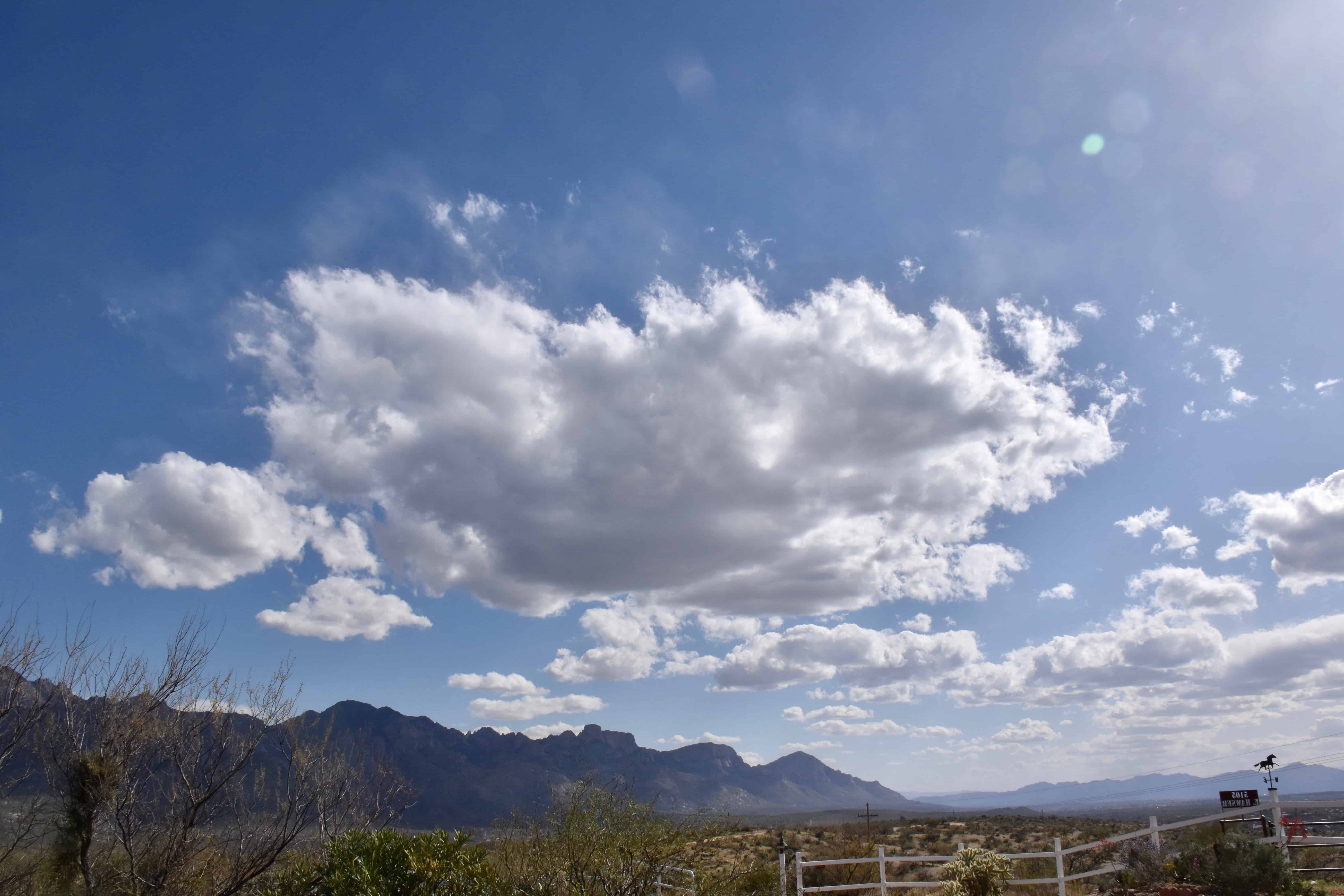
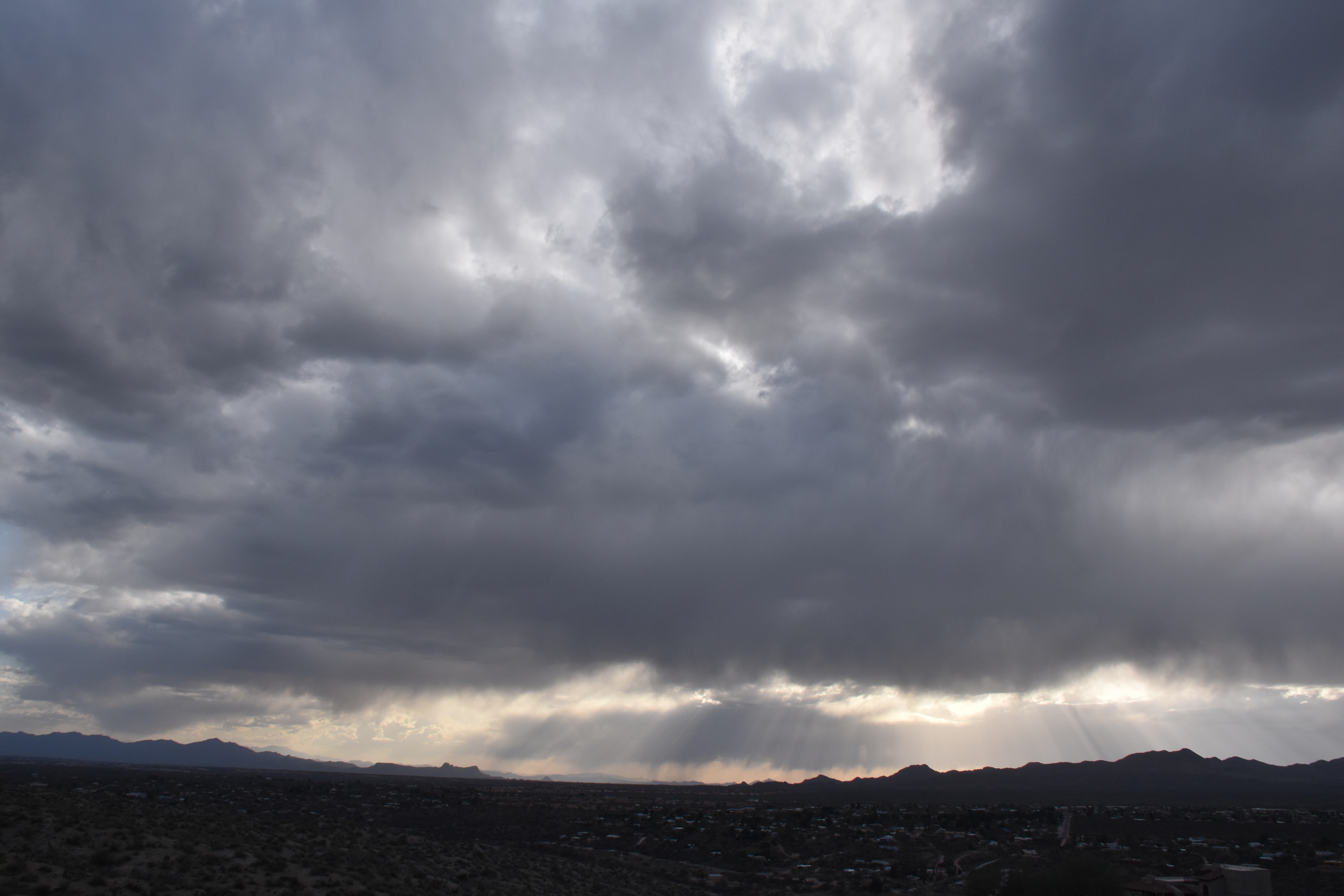
Below, some samples of Frosty the Cumulus (Cumuli, plural):
1:22 PM. Small Cumulus (humilis and fractus) begin to form.
3:40 PM. By mid-afternoon, the slightly fatter Cumulus clouds (mediocris) start showing ice crystals coming out the downwind side, which is what that bit of haze is above the cloud outline.3:41 PM. An ice haze is seen here, too, in the dissipating remnant of a humilis-sized Cu on the left edge, center.4:10 PM. Ice is appearing just about everywhere now as the air aloft cools a little more, and the Cumulus deepen upward some. The clouds are likely no deeper than about 3,000 feet or about 1 km. Tops, using the in-cloud lapse rate, typically a little less than the dry adiabatic rate, would be a frigid -27° C (-17°F) or so, which readily explains the ice-behaving nature of yesterday’s shallow Cumulus. Even deeper clouds formed later in the afternoon and evening hours. This image not left “blank” but has explanatory writing on it.5:23 PM. Raindrops from heavy virga were beginning to reach the ground in several areas as evening approached. Overnight, a few fell on Catalina! These Cumulus complexes were likely more than 2 km thick, 6600 feet) topping out at temperatures well below -30°C (-22° F)
Not much ahead now. Maybe a few more frosty Cu will form today… before things dry out and heat up.
Later yesterday morning, some interesting “Altocumulocirrus”, a rare breed indeed, mocking/mimicking Altocumulus.
Maybe Cirrus floccus would come closest to the true name, but to every eye but that of a genuine cloud maven person, it would be deemed just “Altocumulus”. Check these out to see how good you were–and NO correcting your cloud diaries!!!!
5:47 AM. Two layers are visible, a distant Altocumulus castellanus one, and the higher, much higher, cirriform clouds resembling Altocumulus. If you don’t believe me, the sounding from the U of AZ is below.The TUS balloon sounding for 5 AM AST yesterday. The Altocumulus patches were up around 16,000 feet, and the cirriform clouds around 33,000 feet and at about -50°C (-58°F). Had to cuss that bit because I sensed some doubt out there.6:38 AM. Same cloud layer. Seriously, how can you not call this “Altocumulus”, it mimicks it so well. But these globules are all ice, no liquid water of course anywhere near -50°C unless we believe the reports of Simpson (1963) who purported liquid at -62°C. Nobody believed him though; me ,neither.7:37 AM. Another view of this cirriform layer making a mockery out of Altocumlus. Note that there is that tiny bit of shading, too, in these cloudlets.5:24 PM. The convection leading to cellular structure was still evident pretty much the whole day. Again, we have a problem. Shading like this is not officially permitted with in cirriform clouds except in the “spissatus” species. One would be thinking “Altostratus” here since that cloud is widespread and can have gray shading. When you look at the TUS sounding nearest this time, you find that the moisture is still contained in the upper reaches of the troposphere, where it was in the morning, and that would be in the “etage” for high clouds, 30,000 feet or so above sea level.The TUS balloon sounding for 5 PM AST, May 25th. The temperature of that icy layer ranged from about -35°C on the bottom to -60° C at top, so there would not be any liquid water in it even though is might appear in some places. Where’s my Lear jet? Need to check these things out and in a hurry!
As of the end of February 2017. You can see were right about at the average for the Water Year,, but it took some “heavy lifting” in December and January to get there.
Doesn’t look promising for much rain here in Catalina in March, however. No rain in sight through the next 10 days at least.
Let’s check our 7 inches with what’s happening upwind, say, in CALIFORNIA, and see if there’s been any drought relief there, through February, via the CNRFC:
California water year totals through the end of February 2017. Note one station in the central Califorina coastal range is already over 100 inches! There are 20 stations already over 100 inches as can be seen from the table at right. March looks to have substantial rains north of SFO, which will add appreciably to those highest totals. Amazing! You can go to the CNRFC and expand these interactive maps, btw.
As you are likely to know from many media stories last year, Cal was in a drought siege of five straight years, with but got a little relief last year in the northern part thanks to help from the giant Niño, one of the strongest ever.
Alas, it was one that failed to deliver as the big rain producer for the south half of Cal and the SW in general as was expected.
In case you’ve forgotten how bad things were in Cal, let us look back at what was being said, those horrific appearing drought maps, and also how hopeful were were at the time that the Big Niño would take a bit bite out of drought. This is a really good article:
Then, when the Big Niño faded away like maple syrup on a stack of buckwheat pancakes last spring and summer, we were surely doomed for more dry years. And, for a time, the dreaded cold tongue of water in the eastern equatorial region, the so-called, La Niña, started to develop, which would be no help at all for a good rain season like a Big Niño is, usually.
The Niña faded away, too, to nothing as the winter went on, so we really didn’t have much going on in the tropical Pacific to help us figure out what kind of winter rainfall regime we were going to have om 2016-17. Not having anything going on meant winter rainfall could go either way, a difficult to figure out situation for season forecasters.
In retrospect it is pretty astounding how big a signal must have been out there SOMEWHERE that this winter was going to be one for the history books on the West Coast in general, and in particular, for Californians. Californians saw their drought chewed up and spit out in a single winter, including snow packs so high the height of some mountain peaks have been revised. (I’m kidding.)
No one saw such an astounding winter coming.
This winter sure makes one think of the QBO (Quasi-biennenial Oscillation, one up there in the Stratosphere where there’s almost no air (haha, well, practically none)… Did the QBO have a role in this astounding winter; was there a delay in the effects of the Big Niño even without a bunch of convection in the eastern Pac tropics? Doesn’t seem that could be right…
But, William “Bill” Lau, U of Maryland scientist, reported some statistical evidence of such a lag way back in ’88 due to a QBO connection of some kind and ENSO, no physical cause could be discerned, however, not yet, anyway. Lau, 1988, is reprised below for readers who want to go deep:
Sure has looked like the Big Niño WY we expected last year!
Some recent clouds; after all, this is CLOUD maven, not RAIN maven:
I’ve been kind of holding out on you. I dropped my camera and busted it. Its no fun taking pictures when you don’t have a real camera. Still doesn’t work right, but take these anyway:
March 4th, afternoon. Hope you logged this; the rarely seen CIrrus castellanus (almost “congestus” in size) or, informally, “Cumulo-cirrus.”Poppies are out, btw, in case you haven’t noticed. Nice display on “Poppy Hils” just across and southwest of the Pima County Pistol Club, off Bowman.March 4th, late afternoon. Nothing terrifically special in this tangle of Cirrus spissatus (“Cis spis” to cloud folk) but I thought it was just a really nice scene
Moving to the next day, Sunday, that REALLY windy day:
March 5, Sunday morning 6:13 AM. Altocumulus lenticularis alerts cloudwise folk to the possibility of windy conditions although it was already windy.3:55 PM, March 5th. After a day of solid Altostratus overcast with underlying Cumulus and Stratocumulus, a layer of Altocumulus began to move in to add a little more interest to the sky.3:57 PM. Looking to the north revealed that some of the lower Cumulus/Stratocumulus complexes reached heights where ice could form. That smooth region on the bottom and right side of the cloud is a fall of ice from this cloud with a RW- (text for “light rainshower”) if you like to text stuff) right below that. This is not a lot of ice and so you’d be thinking the cloud barely made that ice-forming temperature. CMP doesn’t think it was caused by an ice fallout from that higher layer, which sometimes can happen. Let’s look at the most timely sounding, just to check. From the real Cowboys at the University of Wyoming, this:The TUS sounding which I only now just saw, showing a vast separation between the lower Stratocumulus and the higher layers of Altocumlus and Altostratus on top. Note, too, that over TUS the tops of the lower cloud is not quite at -10°C the temperature we start to look for ice formation in AZ. However, our clouds were NW of that balloon sounding, and it would have been that tiny bit colder, and tops were also lifted some when they passed over the Tortolitas earlier, meaning that the tops of this complex were colder than -10° C (14° F) at some point.
Wow, too much information….after a hiatus in blogging I feel like that Oroville Dam in California, metaphorically overflowing with too much hand-waving information.
6:03 PM, March 5. Its still real windy. Line of virga brought a few drops when it passed overhead at 6:30 PM.6:04 PM. Nice dramatic shot toward Marana as the backside of the middle cloud layer approached allowing the sun to shine through.6:09 PM. Virga getting closer. May have to park car outside to make sure I don’t miss any drops!6:22 PM. SW-NE oriented virga strip about to pass overhead. Drops fell between 6:30 and 6:40 PM, but you had to be outside to notice, which you would have been as a proper CMJ eccentric. You would have WANTED that trace of rain report, maybe slackers would not have observed.6:30 PM. Climax; the great sunset allowed by that backside clearing.
4:17 PM. Line of spreading out Altostratus translucidus. Many of you might have added, “radiatus” to that cloud name. “Clearly” it is widening as it passes over.
4:00 PM AST. That line of ice cloud looks pretty straight doesn’t it? Imagine how wide a cloud would have to spread, after seeing that Altostratus photo, to REALLY be radiating, spreading out!
As Einstein wrote, “Things are not always as they seem.”
Q. E. D.
Now, for the snow report
…from the Lake Tahoe area (after all, we made a BIG DEAL out of the incredible NWS, Reno, forecast in the prior blogulation):
0822 AM HEAVY SNOW NORTHSTAR 39.28N 120.12W
01/11/2017 M42.0 INCH PLACER CA PUBLIC
NORTHSTAR AT TAHOE REPORTED 42 INCHES OF NEW SNOWFALL IN THE LAST 24 HOURS. 48 HOUR TOTAL OF 78 INCHES AND A 7 DAY TOTAL OF 122 INCHES1.
1This note passed along to the Arthur by Mark Albright.
Looks like a bite has been taken out of the Cal drought this water year, a drought it was said would take years to end! Folsom Lake, near “Sacramenta”, Cal, has risen 30 feet in the past 30 days! Oh, my.
Now for some more of them cloud pictures…
Been holding out as other chores fill up the day:
7:19 AM, Jan 10. Pretty Altocumulus, some Cirrus above.Also 7:19 AM, Jan 10th. Time seems to be standing still, as we look a a cloudlet spewing heavy virga.7:22 AM, Jan 10th, time moving ahead again. Close up of that Altocumulus cloud with virga. Top must have been turreted, colder maybe a half hour or hour before this photo to have so much ice compared to its brethren. That’s the learning part of this sequence. Doesn’t look like an artifact from an aircraft because there is droplet cloud at the top, and not just a clear spot, which usually happens when an aircraft makes ice in a “supercooled” droplet cloud.5:14 PM, Jan 10th. THought this was a neat scene, Cirrus uncinus, the long trail of ice crystals falling behind, the overhead view.12:57 PM, Jan 8th. Makes you want to cry… This Cirrus spissatus is trying so HARD to be a precipitator all the way to the ground, and doesn’t know that those bottom ice crystals are evaporating 25,000 feet above it.
The weather just ahead
U of AZ latest mod output (from 11 PM AST last night) has a substantial rain on the doorstep. Starts here in Catalina Saturday afternoon with projected totals over half an inch nu mid-day Sunday. Check it out:
Totals valid at 11 AM AST, Sunday, Jan. 15th.
HECK, this storm wasn’t even predicted 10=12 days ago! The major weather change was indicated about the 20th, plus or minus a day. Those storms, indicated in the NOAA “spaghetti” plots more than 12 days ago, are still in the pipeline after we have a brief “recovery” from the “surprise” storm about to arrive on Saturday! Yay.
This sequence of storms is so great for the AZ water situation, too, as well as giving it to Cal good again around the 20th as well. No doubt, as the humans we are, the peoples of Cal will be complaining about TOO MUCH WATER!
This will lead to apathy about water issues, you can bet on it! See the well-known “cloud seeding cartoon” about drought and apathy posted so many decades ago in a journal article on cloud seeding by editorial nemesis1, Bernard A. Silverman, J. Appl. Meteor., termed the “Hydro-illogic Cycle”:
Published in 1978, but was around in the cloud seeding culture for many years before that. Used without permission. hahaha I believe it was drawn by the founder of Atmospherics, Inc., Tom Henderson’s daughter. Atmospherics, Incorporated performed numerous cloud seeding operations in the US and around the world beginning in the early 1950s. Yours truly worked for them on several occasions in the early 1970s as a “radar meteorologist” directing seeding aircraft. Later, I became a published critic, mostly with Prof. Peter V. Hobbs, of a number of cloud seeding projects.
The End
——————————- 1Nothing yours truly submitted during the era of BAS as Editor of the J. Appl. Meteor. “got in”, including the benchmark paper reporting that our own aircraft was creating ice in clouds at temperatures as high as -8° C. Three sole-authored papers critical of cloud seeding that I submitted were rejected in 1983 alone! All or parts of them were published years later.
The paper on our aircraft, submitted originally in 1981, was rejected twice before being accepted and published in 1983. The effect was confirmed in experiments conducted in the Mono Lakes area in 1991, by the president of Atmospherics, Inc. mentioned above! Aircraft produced ice particles at unexpectedly high temperatures is a now well-known phenomenon that researchers have to be aware of when re-sampling the same cloud with an aircraft at below freezing temperatures.
Soap box: It really is the editor of journals that determines whether you’re going to get in or not. They know, or should know, those who are going to keep you out or not, those with axes to grind, and those who are more objective. However, let me say this, I like Bernie. Has a great sense of humor. Below, Bernard A. Silverman. You can see the twinkle in his eye:
Bernard A. Silverman, publisher of the journal article containing the “Hydro-illogic Cycle” cartoon at the Cape Town, SA, 2006 WMO award ceremony for achievements in weather modification. He acknowledged in that 1978 article that he was a cloud seeding advocate.
Oh, well. Was expecting at least 0.25 inches a few days ago, and thought maybe a heavy shower last night might pull that expectation out of the trash bucket. Monthly total now up to 0.70 inches (updated after reading NWS-style and CoCo gauges here), still significantly below average (0.96 inches). Not much else elsewhere, either. Double dang.
Mostly Cumulus humilis and flat Stratocumulus yesterday. Was looking for ice as the temperatures aloft cooled during the afternoon and evening, and only as the sun went down was a slight bit of virga visible to the west. That Stratocu deck over us was deepening upward, and began reaching the magic point where ice begins to form, probably around or a little below -10° C (14 °F) in clouds such as yesterday’s. Let’s look at a sounding from the U of AZ (as displayed by IPS MeteoStar) and see what it says about those evening clouds and see if the above is just a bunch of hooey (I haven’t seen it yet, either):
The TUS sounding launched about 3:30 PM from the University of AZ campus. Suggests the cloudy air on that side of the mountains was indeed reaching to -10° C and likely a hair lower in the slightly higher cloud tops. Our tops especially a bit later and being a little northwest of there, were surely a bit colder.
Yesterday’s clouds
9:31 AM. Nice scruff of maybe Stratocumulus lenticularis topped Ms Lemmon, and indication of the lower level moistening that took place overnight with a dry front going by, with another one on the doorstep. Gee, camera lens is dirty.2:45 PM. Not much going on, just a few Cu hum, “two riders were approaching and the (cold) wind began to howl.” Bob Dylan, in “All Along the Watchtower” by Jimmi Hendrix. Nobel Laureate Bob wrote a LOT of songs about weather!2:47 PM. The Mighty Fraidy Cat Zeus, waiting for the weather to change, the Cumulus clouds to fill in. Today’s blog is particularly boring so thought I would spice it up with a [icture of a large (16.2 hands) horse that saw a tire leaning up against a horse fence, twirled around and at a full sprint, as though being chased by a Tyrannosaurus rex, plowed into a clump of tall cat claw acacias and mesquite bushes. The first second of that bolt was really exciting and fun, the second second, not so much. CMP was knocked off in the midst of them, racking up a broken rib, and a lot of scratches that bled profusely. However, with all that blood on his long sleeved shirt as he walked the mighty Zeus back to his corral, also chalked up quite a few “man points” when passersby saw him, I am sure. Well, there was one passerby who didn’t seem to notice as he drove by and I had to scream, “I’m OK! Its nothing, really!”2:48 PM. Nice lighting. I don’t know how many hundreds of these shots I have posted here. I just never get tired of sunlight and shadows on our mountains! Clouds still not doing anything, but its only been a minute since the last report.3:11 PM. Now we’re talking! Those Cumulus clouds are beginning to expand, fill in, transitioning to a Stratocumulus broken to overcast sky, a Stratocast (nomenclature unrelated to Fender guitars), as expected as the next front and trough approached. This was exciting. But when will the ice form in them to give us the first virga and precip?3:53 PM. Looking SW over the Oro Valley. This is really looking good. In situations like this, the clouds are forming as they travel upslope toward the Catalinas, and while they’re not preciping now, its fairly common in the situation we had yesterday for them to start preciping as the tops get chillier and chillier, often with the clearing remaining in place to the SW. That’s what I thought might happen. Things were changing fast at this time.5:15 PM. Virga and light precip were occurring on the horizon NW-NE, and these heavier Stratocu began to virga a few minutes after this. The anticipation? A nice period of light to moderate rain during the early nighttime hours as this deepening and filling in continued. That didn’t really happen. The clouds began to rain lightly here, but it didn’t measure. It was a another band coming through before midnight that produced the 0.08 inches.5:24 PM. I know a lot of you like to see pictures of the sun, so I thought I would post one today. Looks pretty round, a little bigger than usual. Don’t see any sunspots (defects) on it. That’s probably good.5:30 PM. Just after sundown the virga began to emit from this layer just beyond the Tortolitas. Really thought this would lead to a generous rain with continued deepening. Guess that didn’t happen. Probably only the best virga detectors among you saw this little curtains starting to descend from this cloud deck. I’ve added arrows to where those two patches of virga are.
Still looks like a chance for some light showers before the month closes out, but will be hard to get enough to bring the total to an above average value. Dang.
Will update my reader on December’s early cold outlook as new information that agrees with my assessment comes in. Right now, that information is not available.
Here it is. You may need an optical enhancement tool to see the radar echo speck nearest Catalina, and its not the one nearest the arrowhead below, but continue in that direction:
Satellite and radar imagery for midnight last night. Notice cloud blob and radar echoes over and near Catalina, Arizona. I really thought there’d be some drops here as this went over!
You can also check on all the rain that fell overnight in the region here, courtesy of Pima County ALERT rain gauges. BTW, they aren’t capable of reporting traces, so if you see bunches of zeroes, it doesn’t mean some drops didn’t fall somewhere in the network.
Non-verification of this rain can also be found via our fine TUS NWS “storm total” view, 10:30 PM to 4:30 AM this morning:
Regional radar-derived storm total from “rainy cloud blob.” Arrow almost reaches Catalina; didn’t want to cover up a pixel of rain, if there. THAT radar did not pick up the rain I feel must have fallen, so we have quite a conundrum. If you would like to see for yourself how much rain fell last night, go here. Will be looking for drop images in the dust as soon as it gets light, too!
In the meantime, all those rainy cloud blobs to our NW right now (first image) look like they will be able to just make it to Catalinaland after all.
In our last chapter, it looked like the strong cold front would move through tomorrow as just a dry cold one, but now the chances of having a little rain (a wet cold one) have been zooming up. The models have readjusted their thinking and now that critical ingredient, the core of the jet stream (at 500 mb) passing over us ahead of the trough core itself is being predicted.
And with that configuration as the front goes by Catalina, and believe me you’ll know by the 10-15 degree temperature drop, a tiny amount of rain might fall. Also, look for a pronounced lowering of cloud bases to the W-N of Catalina as it gets close, something in the way of an “arcus cloud”, marking the leading edge of the windshift to the N. Could be nice and dramatic looking tomorrow. Those cloud base lowerings are pretty common with fronts here.
How much rain?
Oh, possibilities range between 0 (a complete bust is still possible) to only about 0.25 inches, tops in the “best” of circumstances. But, this keyboard would like to see ANYTHING measurable; that would bring happiness.
There are some more rain blobs showing up in regular intervals in the days ahead for you to think about, as rendered by IPS MeteoStar. Arrows have been added to show you where you are, if you are in SE Arizona:
Valid tomorrow morning at 11 AM AST. Colored areas denote regions where the model has calculated precipitation during the preceding 6 h.
In the storm below, which is pretty much going to happen now, the range of amounts as seen from here, at least 0.15 inches, top, 0.50 inches, best guess, therefore, 0.33 inches (from averaging the two.)
Val at 11 PM, March 1st. Colored areas are those in which the model has calculated that precip has fallen during the prior 6 h.
There’s great uncertainly in whether this last storm will actually occur, so range of amounts are zero to 1 inch. :} See reasons for uncertainty below, besides being too far in advance or our models to be reliable anyway.
Valid Friday, March 5th, at 5 PM AST. Colored regions NOW denote areas of precipitation that have fallen during the prior TWELVE hours. (Mod resolution degrades after about 192 h, and so a coarser view of precip areas is used.)
While a significant storm on the 1st is virtually assured according to spaghetti, this last major event in the panel above is doubtful. See below, in another lesson on consuming weather spaghetti:
Ensemble spaghetti valid for the same time as the panel above, 5 PM AST Friday, March 5th. Not much support for a storm, low confidence is indicated by the LACK of bunching red and blue lines, unlike those off the East Coast, and over there east of Asia. So, while a great storm is predicted in last evening’s model run, prepare for sadness and disappointment as a hedge.
Yesterday’s fine clouds
7:10 AM. A couple of shafts of big virga. Likely a drop or two reached the ground. Could have been caused by aircraft penetrations, or, taller Altocumulus castellanus-like turrets that reached lower temperatures, produced more ice. They look suspiciously like an aircraft artifact due to their very small size.7:41 AM. Nice stack of lenticular pancakes in the lee of the Catalinas. You can see some great lenticular occurrences in the U of AZ Time Laps movie for yesterday. There are also a lot other fascinating things that go on in yesterday’s clouds, too.8:05 AM. Clearly natural virga approaches Catalina. Looked for a drop as it went over, but saw none.8:22 AM. Pancakes downstream from Ms. Mt. Lemmon.8:44 AM. Fairy dusters in bloom!9:07 AM. Doggies, Emma, and little Banjo, sample and inspect water STILL running in the Sutherland Wash!1:46 PM. After a brief sunny period, banks of Altocumulus invade the sky.2:46 PM. Altocumulus opacus clouds continue to fill in, darken.5:40 PM. Muliple layers of clouds stream ahead of sprinkle-producing cloud blob just upwind at this time. Note how the Altocumulus opacus clouds disappeared, leaving lenticular like formations, with a thin ice cloud (Cirrostratus) above.
The End, though I COULD go on and on and on, and then on some more. Its who I am….
5:41 AM: “Tweet” Patch of big virga, sprinkles, now in progress SW of Catalina. Could make for a spectacular sunrise if more of that is around.
5:43 AM: “Tweet”: Banks of heavier, middle clouds and high clouds expected to arrive later in day. Forming off Baja now.
5:45 AM: “Tweet”: Still expecting a trace to maybe a tenth of an inch from that system off Baja by mid-day tomorrow.
5:46 AM: “Tweet”: Major cold front goes through tomorrow night or Tuesday but looks dry now with just a big change in temperature. Izzat more that 140 characters?
5:49 AM: “Tweet”: Still thinking about weather things and what to say next.
5:50 AM: “Tweet”: It wasn’t me that fell off that horse with a riding pal, in case you were worried about me, though I ride in that area.
5:51 AM: “Tweet”: Brain still pretty empty.
5:52 AM: “Tweet”: Still waiting for something to enter brain.
5:53 AM: “Tweet” OK, just thought of a joke. See below.
See arrow.
5:56 AM: “Tweet”: OK, its a sophisticated weather joke.
5:58 AM: “Tweet”: Arrow points to today’s little cloud maker, but mods pretty clueless about where it is from the get go; how funny izzat? Can I tweet and use a semi-colon?
6:02 AM: “Tweet”: Have cameras ready!
6:03 AM: “Tweet” Brain empty again. Reminds me of that song, “Running on empty.” Feels just like that. Maybe that will distract some people while I think of something.
6:04 AM: “Tweet”: I haven’t added anything but will update anyway.
7:20 AM. Altostratus with pouches of virga7:23 AM. Ditto. Ac len is the fine line cloud upper center.7:27 AM. Ditto, pretty much.7:30 AM. Nice lighting (not lightning) for just a few seconds.8:19 AM. Altocumulus trailing snow/virga. Tops, though the coldest part of the cloud, are composed of mostly of droplets at temperatures far below freezing. A few ice crystals form and drop out leaving the supercooled droplet cloud mostly intact.
12:55 PM. Just about the first boundary layer cloud, this a Cumulus fractus fragment. Hope you recorded this event in your cloud diary. Its pretty mandatory to note developments like this if you want to move on to the next level of cloud-mavenhood.
3:03 PM. Those boundary layer clouds, Cumulus ones, were reaching their maximum depth about this time. This would be a Cumulus mediocris, estimated depth 2500 feet or so.5:14 PM. Whilst clouds locally never got beyond the “mediocre” stage, or produced ice under them, to the north where the air was colder aloft, Cumulus clouds were able to grow taller and become Cumulonimbus capillatus (hairy looking with ice) incus (the last term just meaning it has a flat anvil, a flat head.)
5:47 PM. This post sunset shot shows layers/lines of smog at the same level where some flat Cumulus remains are. The smog is so visible because the air is ALMOST saturated near those clouds at their level, and some of the smog particles (hygroscopic ones) have deliquesced, have gotten much larger by absorbing water vapor, or might even be haze droplets where water has condensed on them (“smoglets”). It therefore, by definition, cannot be a “pretty sunset.”
The model rain ahead; two episodes
The low that plunks down off the coast of Baja this weekend from southern California, circles around out there for a couple of days, before deciding to move back over southern California with clouds and rain. If it was a song, it would be The Wanderer. Yes, that fits. Its expected to scoop up a generous helping of middle and high clouds from the deep tropics as extra baggage. The “extra baggage” (model predicted rain) arrives here late on the 26th (Monday) and continues off and on through Tuesday night. The first clouds, of course, high ones like Cirrus, will begin arriving a day ahead of the actual rain, on Sunday.
It is virtually certain that there will be some high-based Cumulonimbus clouds and thunderstorms in these masses from the tropics, though maybe not here. Most of the rain is projected for eastern California and western Arizona where rain is really needed–and how great is that?
However, we should be in for a quarter inch or so, anyway. Last time I guessed limits on a storm, even the lower limit of 10% chance of less than 0.05 inches wasn’t even realized. Pretty pathetic forecast. But, moving forward and forgetting past errors, this one seems to have a similar range of possibilities, the least amount 0.05 inches, the most, 0.50 inches. The chance of measurable rain here in Catalina in this first 36 h storm period is probably, from this typewriter, about 80%.
“But wait! There’s more!” “Maybe!”
A second system floats in right after that and from Jan 29th through early in Feb, and more welcomed showers are possible.
You can check out these prognostications in a more professional way at IPS MeteoStar, this link to the latest model run from 11 PM AST last evening.
In case you didn’t notice, there was a prolonged street of clouds emanating from possibly as far away as Kit Peak, or maybe just the Tucson Mountains. Lasted for a few hours.Happens only on days with relatively shallow clouds (cloud-topped boundary layer) with a little wind, meaning that the thermals from the surface heating ended up being capped by an inversion or other stable layer, and those thermals form clouds in some places. In this case, a long line of intermittent clouds formed from an initial air bump caused by those mountains far to the SW of us. CTBL is more often invoked as a term by cloud folks when the sky is much cloudier in low clouds than these shots from two days ago, such as when the sky is covered in Stratocumulus clouds.
These kinds of streets occur over the same places whenever a day like this comes along. Think of it, especially here in Arizona, as a row of shady air under which you might like to live compared to those areas on either side of this cloud “street.” In Seattle, where the “cloud topped boundary layer” is almost a daily occurrence, you want to avoid being under the cloud street, where it can block the sun, and instead find the clearer slots!
12:14 PM.1:07 PM.3:19 PM. Barely hanging on now, but still present. Dissipated within about a half hour of this shot.
TUS rawin for June 18th, 5 PM AST (launched about an hour and a half before that).
For those sharpies that day and logged in their cloud diaries that ice formed in those shallow Cumulus clouds, they will be a little chagrined by this TUS sounding. This sounding suggests the clouds around the balloon were topping at -8 C, too warm for ice formation in shallow Cu. Let us begin to explain this puzzle by presenting evidence of ice formation in those clouds on the 18th:
4:13 PM. Virga hangs down from Cu mediocris, maybe only a km thick toward Charouleau Gap. Lots of ice visible.
4:13 PM. Overhead view of likely ice vellum between Cumulus clouds. The clouds themselves may well have a few ice crystals, but too few to provide any visual indication except in the clearings between them. Ice crystals evaporate more slowly than liquid drops when encountering sub-saturated air between clouds, and so can be visible a bit longer if present between clouds in marginal situations like this. Confidence level that this little patch is ice and not just haze is about 70-80 percent.
Simple answer to our connundrum; due to lifting of the air as it approached and went over the Catalina Mountains, the tops of the clouds reached those temperature below -10 C where is begins to form. We would guess even closer to -15 C in that cloud in the distance beyond Charouleau Gap due to the amount of ice. Ice increases with decreasing cloud top temperature, but the temperature at which ice onsets can change on a daily basis; higher onset of ice temperatures on days in which the clouds have larger drops in their tops (a phenomenon originally reported by Ludlam in 1952, then re-discovered by Rangno and Hobbs (1988) who did not, at that time, know of the Ludlam finding, and thus, did not cite it. Pretty embarrassing, really. Was cited later in an update, however.
The weather way ahead
Seasonal rains beginning to show up in southern Arizona now on models beginning around the 4th of July as a big anti-cyclone parks itself over the Four Corners area in the latest model run from 11 PM AST last night. Very excellent run.
I think ordinary weather, if a bit of a surprise, needs more shouting! Sincerely, Cloud Maven Person!1
A trace of rain has built up here in Catalina in the pre-sunrise hours today, adding to the month’s total that has been received so far, also a trace.
Wow! This was not foreseen, these little sprinkles. Latest NWS forecast for Catalina is “sunny”, no mention of clouds or sprinkles. CMP, too. Wasn’t thinking that the little stream of moisture passing over us would amount to anything but Ac clouds. See U of AZ satellite imagery here to see stream; not a “river”, maybe just a “creek.”
5:31 AM: Moving ahead! Looks like we’re at the end of the sprinkle clouds, don’t see much upwind. BTW, could you see the clouds that produced the sprinkle? Not as easy as you think. You see, the wind is stronger, much stronger where those clouds are up there, and the rain that falls out trails behind them. So you have to look downwind a mile or two to see the clouds what done it! (ANOTHER few drops here at 5:37 AM!) Three sprinkles now! Those drops must be like HUGE water balloons to those ants out there on the pavement!
Here’s what those sprinkle clouds look like, the ones you missed while you were snoozing, but, as usual CMP is there for you:
5:37 AM. Its raining on the camera. See ice coming out, upper center, slightly to the left? That’s what done the last few drops. But now the cloud that done it is a couple of miles downwind. The earlier sprinkle-causer, is the cloud now beyond Charouleau Gap to the NE.
This morning’s Tucson balloon sounding. Shows bases at 600 mb (14,00 feet above sea level), tops at 20,000 feet, and about -15 C, cold enough for plenty of ice.
Below, the same sounding without arrows:
End of rain chances now, darn, looking at withering clouds. (Last sprinkle, hardly noticeably unless you were outside, 7:20 AM, from an remarkably small cloud, ice not really apparent).
(Interrupted by having to get a flat fixed; Philips head screw in it.)
Yesterday’s clouds
Yesterday was a great day to once again test your ice acumen. Here are examples of only those clouds exhibiting ice except that fat Cu over Pusch Ridge, a pic I took during BP2 at James Kreigh Park with ballplaying friend, Patrick.
6:54 AM. Altocumulus. How’s your ice acumen? Never forget how important ice acumen is! Estimate concentrations and cloud top temperature.
1:10 PM. New kind of cloud. Test your ice acumen: Any sign that ice is ice being produced in these clouds? Never forget how important your ice acumen is, repeated in case you skipped over the last caption!
1:56 PM. If you can find the ice here, you will be awarded an honorary doctorate in cloud maven-ness.
2:36 PM, 101 F, at James Kriegh Park, next to CDO HS, this fat little Cu mediocris over Pusch Ridge, as batting practice gets underway. Batting for CMP was “mediocris.” Lefty Patrick hits the ball over those trees from time to time. (This is baseball, not softy ball, we’re talkin’ ’bout.)
Seems U of AZ mod sees this little moist street over us as able to generate Cumulus and isolated small Cumulonimbus clouds this afternoon. Very nice.
The End.
———————-
1Where would Yahoo be today without that “!”?
2It was 101 F during our 2 h session that began at 2:30 PM. Note to baseball people: the ball goes farther when you hit it when the air is less dense. The air is LESS dense when it is HOT, AND when their is moisture in the air (unless the baseball you’re using is hygroscopic, in which case it might absorb water vapor and get that bit heavier and not go as far. So, its great to practice when its above 100 F!


