While waiting for the chance of rain mid-week next week, I thought I would tell another science story…
How me and Doc Hobbs got into the Guinness Book of World Records
Rain drops bigger than about 5 mm in diameter (only about 0.2 inches) are thought, mainly through lab experiments, to break up into smaller drops before they reach sizes larger than that. Also, they had not been reported to reach sizes larger than that until the mid-1980s when researchers sampling modest Cumulus congestus clouds topping out at only around 14,000 feet around the Hawiaan Islands reported intercepting drops that were 4-8 mm in diameter. This was pretty big news.
Later, while flying with the University of Washington’s research aircraft we intercepted (imaged with aircraft laser probes) drops that were 8.6 mm across and more likely as large as a centimeter, and not on one, but two different occasions separated by a few years. These were larger than the ones reported by the Hawaiian researchers. (Yes!!!! Spiking football now!!!)
First, the award-certificate for those who might be skeptical, and whose display is best part of today’s blog! I mean, really, I could have put 257 worms in my mouth or that sort of tawdry thing, but this was much better, more digestible. Oddly, neither Peter V. Hobbs, my co-author, and I know how we got this Guinness Certificate; it just came in the mail sometime after our article, Super-Large Raindrops appeared in the journal, Geophysical Research Letters in 2004. You know, it wasn’t that great of a “certificate” either. I thought it would be on onion paper, or some other exclusive bond. Instead, it was on something like a cheap, thin cardboard paper. Still…….

The two instances of where these giant drops were encountered were in completely different, contrasting aerosol environments: one in a clean, smog-free, oceanic environment near the equator in the Marshall Islands, and the other under a smoke-filled Cumulus congestus cloud in Rondonia, Brazil, an area where there were many fires where the tropical forest was being burned away. (We were in Brazil 1995 along with other research aircraft to study the nature and extent of the smoke being produced by those awful fires.) Since any rain is thought to be hard to produce in smoky clouds that do not get to the Cumulonimbus stage, giant drops from them was news, too. Of course, many of you out there enjoy photographing images of raindrop splatters on various surfaces as kind of a hobby, particularly as rain begins to fall. Below, is an example from a friend of that sort who prefers to photograph those splatters as they occur on cement as an artform. I think her work is in a local gallery…

So, knowing how much general interest there is out there in rain for desert dwellers, which still might occur on Wednesday or Thursday, is the reason for today’s blog on huge raindrops.
Below is an example of what rain drops look like when they imaged by laser probes on the University of Washington’s research aircraft as we flew through those two instances of giant raindrops. The images of the drops are the shadows of them. As they pass under the wing of the aircraft, some go through a laser beam without being disturbed. The laser shines on photosensitive diodes that get turned off and recorded when they are shadowed. They stay off until the laser beam hits them again, thus recording the dimensions of whatever it was has passed by. You then look at the diodes that were turned off for the tiny fraction of a second that something went through (for our aircraft, around 100 to 120 mph) and get an image of it that tells you whether it was a drop, ice crystal, snowflake, graupel, whatever. Pretty amazing when you think about it. You’ll have to click on it to really see anything.
The large red drops on the left side in the bottom rows are the partial images of the record setting drops. The probe elements were not wide enough to see the whole drop. On the right side is an ellipse fitting routine applied to the raindrop images we recorded that better displays the true size of partially viewed drops. In this case, that algorithm suggested the very largest were about 1 cm (you can use that as a scale for the other ones), but because it is an estimate, does not count in the record books. Only the actual measurized size was considered in the Guinness record. The top two panels are from the Brazil encounter, and the bottom two panels are from the one near Kwajalein Atoll, Marshall Islands.

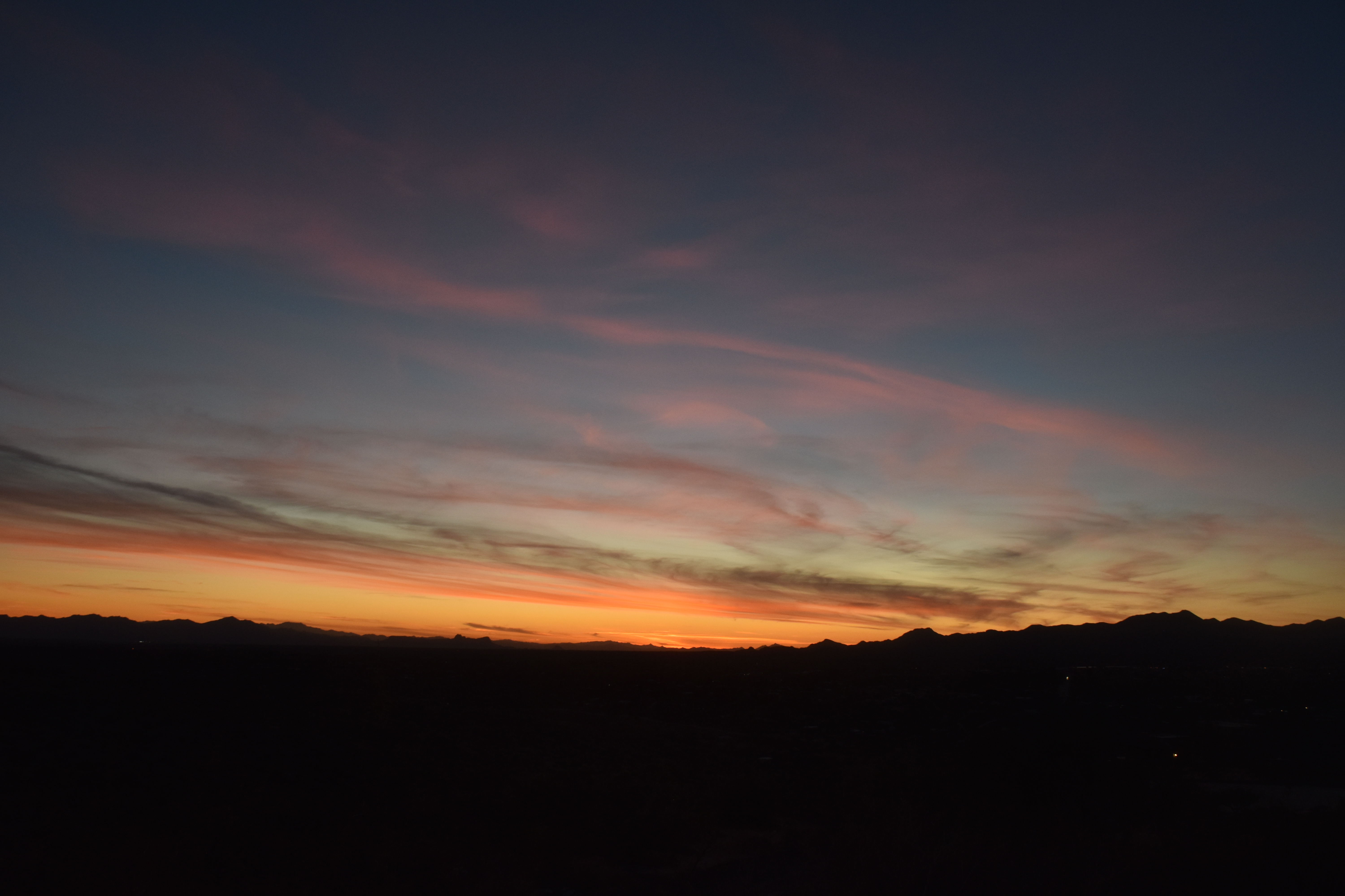
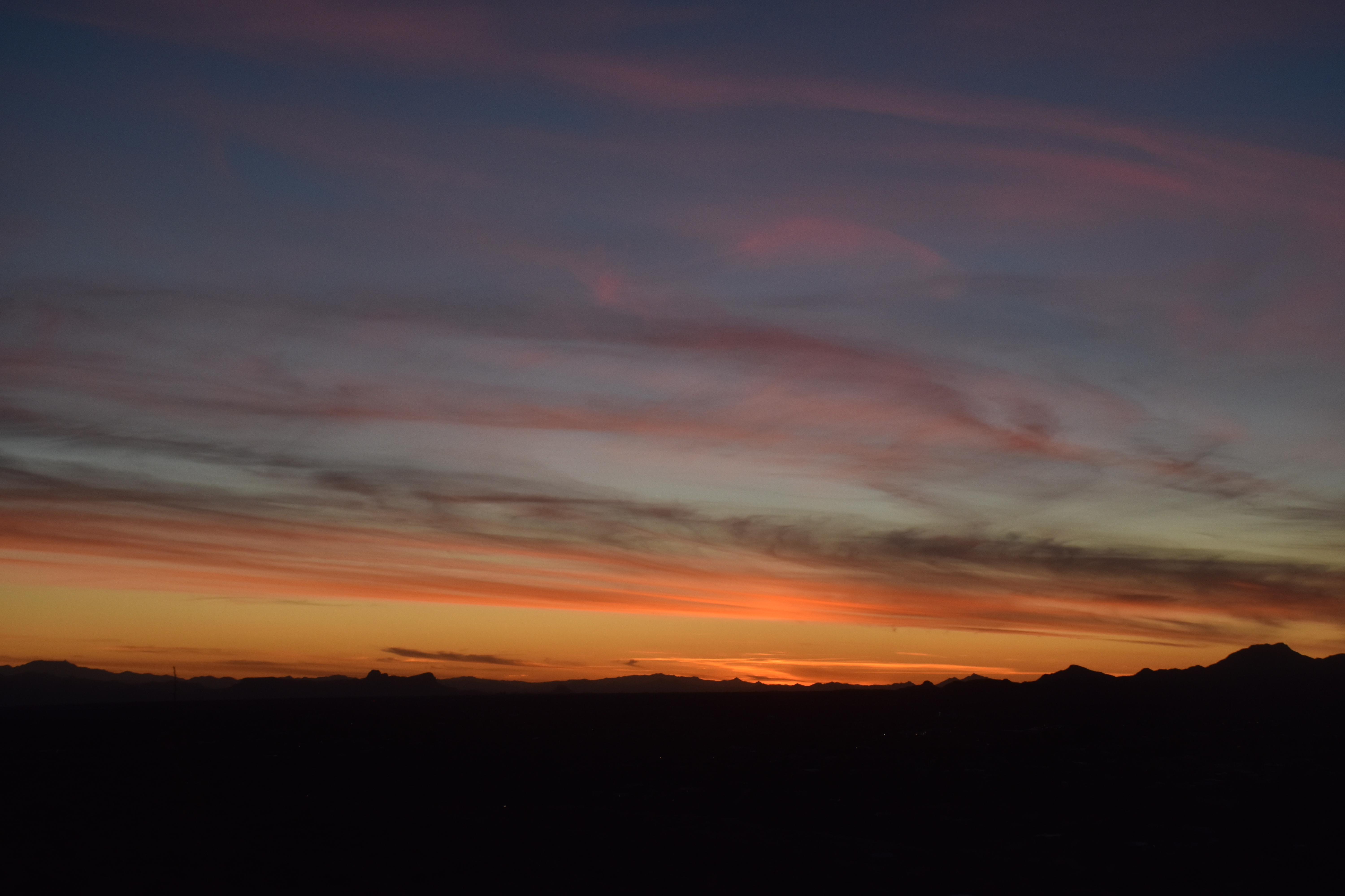
Here are some photos of the two areas we flew in so that you can see how different they were in character. First, Kwajalein Atoll (note the gigantic runway, constructed in WWII, had its own cloud on calm days !). Second, an example of a moderate-sized Cumulonimbus cloud, one similar in size or even a bit larger than the one Mr. Cloud-maven person himself was directing the University of Washington’s Convair-580 research aircraft into, targeting the heavier strands of rain that first falls from convective clouds. It was so GORGEOUS there in Kwajalein! I loved it there. The skies, the sunsets! Oh, my.
Kwajalein Atoll, BTW, is the terminus of the Vandenberg missle launches. As yet another aside, on the TEEVEE there in Kwajalein, there were announcements in big red letters, like the ones for severe weather, that told you when a missle had been launched at Kwakalein from Vandenberg, and when it was coming into the middle of the Atoll (you hoped!) Folks would then gather on one of the Atoll beaches to watch the show. It was so exciting!
As an aside, I have to tell you that one of the charms of that place, run by Raytheon, a name you are familiar with around here, was that you could not own a car, or house, or just about anything else, paid no taxes if you were a permanent employee, etc. You had to have a bicycle for transportation for the most part. It was like the atmosphere of a small (“communist”, hahaha) town (3500 lived and worked there). Everyone went outside and walked or rode down the streets in the evenings. Another charm was that the manager of the Kwajalein Missile Range site had hair down to his waist! It was AMAZING! Both he and his wife seemed to be in their late 30s with two little kids, and told me how much they loved it there! Many others did, too.


Now on to the smoky environment in the State of Rodonia, Brazil, 1995, in the “dry season”, where the other giant drops were encountered. Rodonia, at that time of year and in those days, was a pyromaniacs paradise.
First, the University of Washington’s research aircraft sitting on the runway in Porto Velho, Rodonia, Brazil. By clicking on this image, and looking under the wing on the left, you can see the “Y” shaped probe that imaged the giant drops as they flew by. Other images show the “Green Ocean” in smoke, and some ground shots that show how widespread fire was there. In fact, after a couple of months there, we kind of got “into the culture” and wanted to burn some things up ourselves. Check the fire along the highways! No “Fire Danger is High” signs there! I think its time to reprise Deep Purple’s “Smoke on the Water” (which is just about everywhere else in Brazil, anyway) to get you in the mood for the shots to follow. I will be jumping around now… (Too bad Beethoven couldn’t write songs as good as this, but then he wasn’t that great with words….) The last shot is a sunny day in Cuiaba, a large interior city of Brazil, during the burn season.
As an epilogue it should be pointed out that Brazil is making good progress in controlling the amount of burning compared to that which was going on in 1995.


Below is the region of “pyrocumulus congestus clouds (those due to fires below them) where the giant drops were encountered, near the city of Maraba, Brazil. It was a little different than Kwaj!

The End (at last)


