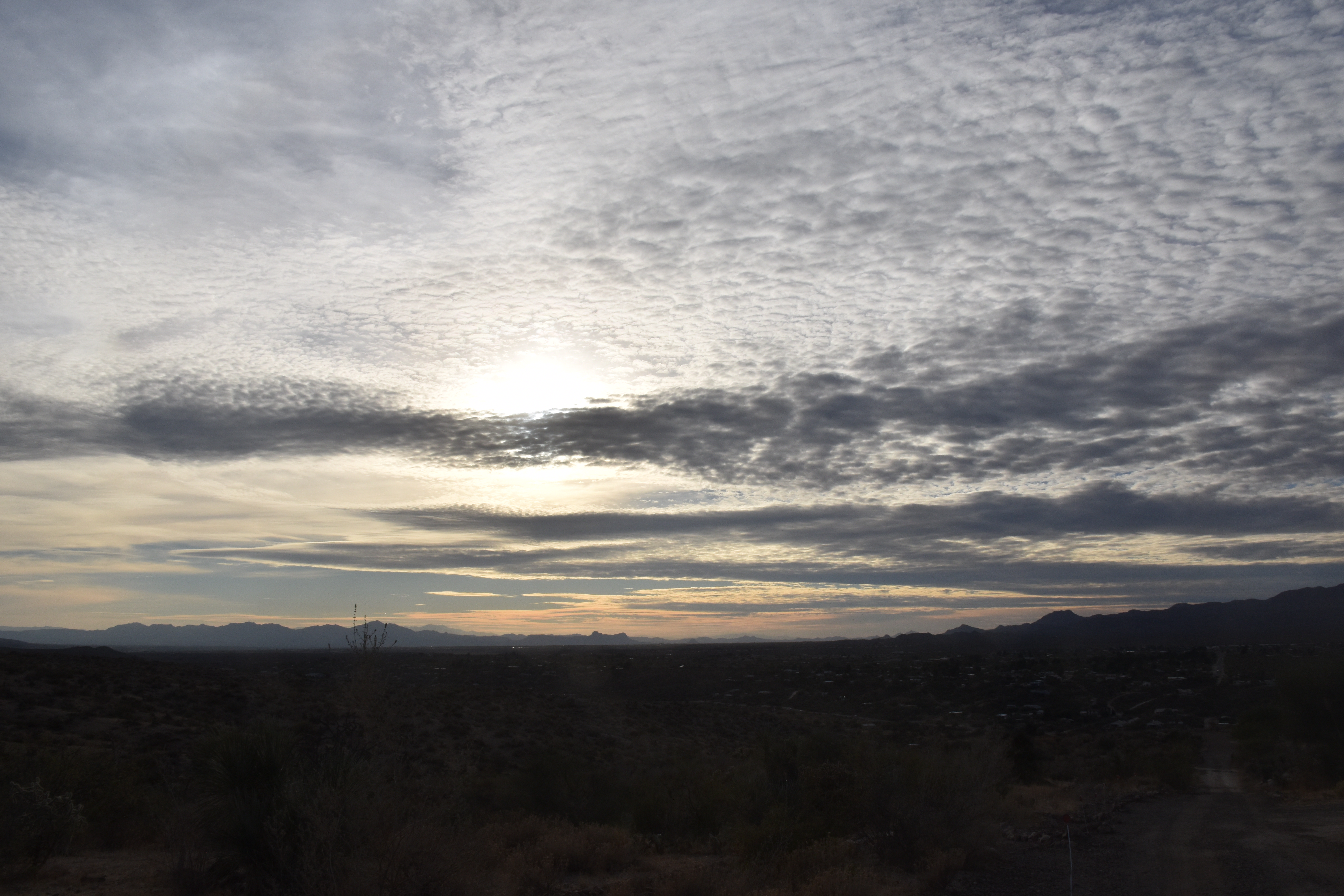
High cold ones that are headed this way in a curvilinear path. Image was made at 5 AM AST, annotation later.
That means that a deep Altostratus overcast will be in place by tomorrow with a load of virga and sprinkles, not really much rain since the bases will also be cold and…high. Top possible rain amount from these high cold ones is a tenth of an inch, but more likely will be traces. Chance of a trace in the area? Oh, about 99% IMO.
But that’s not our full rain destiny.
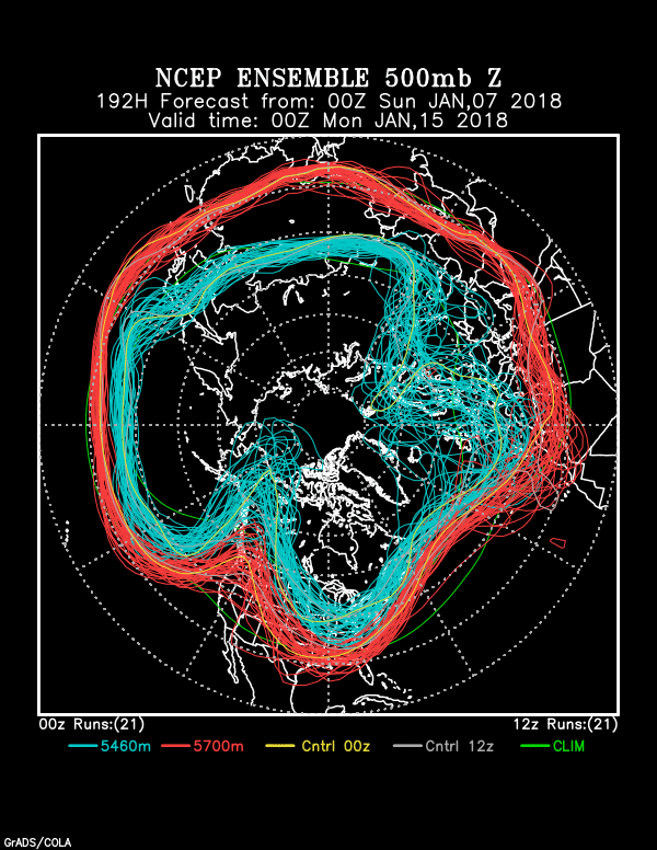
On the horizon, only a week from now, is the likelihood of a significant rain. Check the models and the spaghetti:
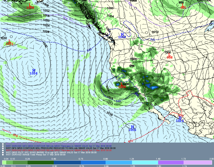
Valid at 5 PM AST, March 16th. You don’t need the precip prediction for this day when the 500 millibar pattern is like this, the core of the wind at that level south of Tucson. Its not a sufficient criterion for rain, but a necessary one in the cool half of the year. (Only about 5% of the rain in TUS falls outside of this criterion in the cool half of the year.
Here’s the rain prediction which I have not looked at until posting now to make the point you don’t need to look at it:
Where the model thinks it will have rained in the 6 h prior to 5PM AST on March 16th. I hope you’re happy now.Valid at 5 PM AST March 16th. Blueish lines of cold and rain (546 decameter geopotential height contours) way down the Cal coast, and somewhat bunched (confidence indicator) for a major trough to affect all of Arizona, keep the current greening underway.
Would say the chances of measurable rain from this “incoming” are at least 90%; i. e., virtually certain. (Note that “virtually certain” is not the same as 100% certain, but its damn close.)
Problems with hoster and connections to hoster continue–must wait seconds to see what I’ve typed, then have to go back and correct the gibberish. So, not doing much as a result.
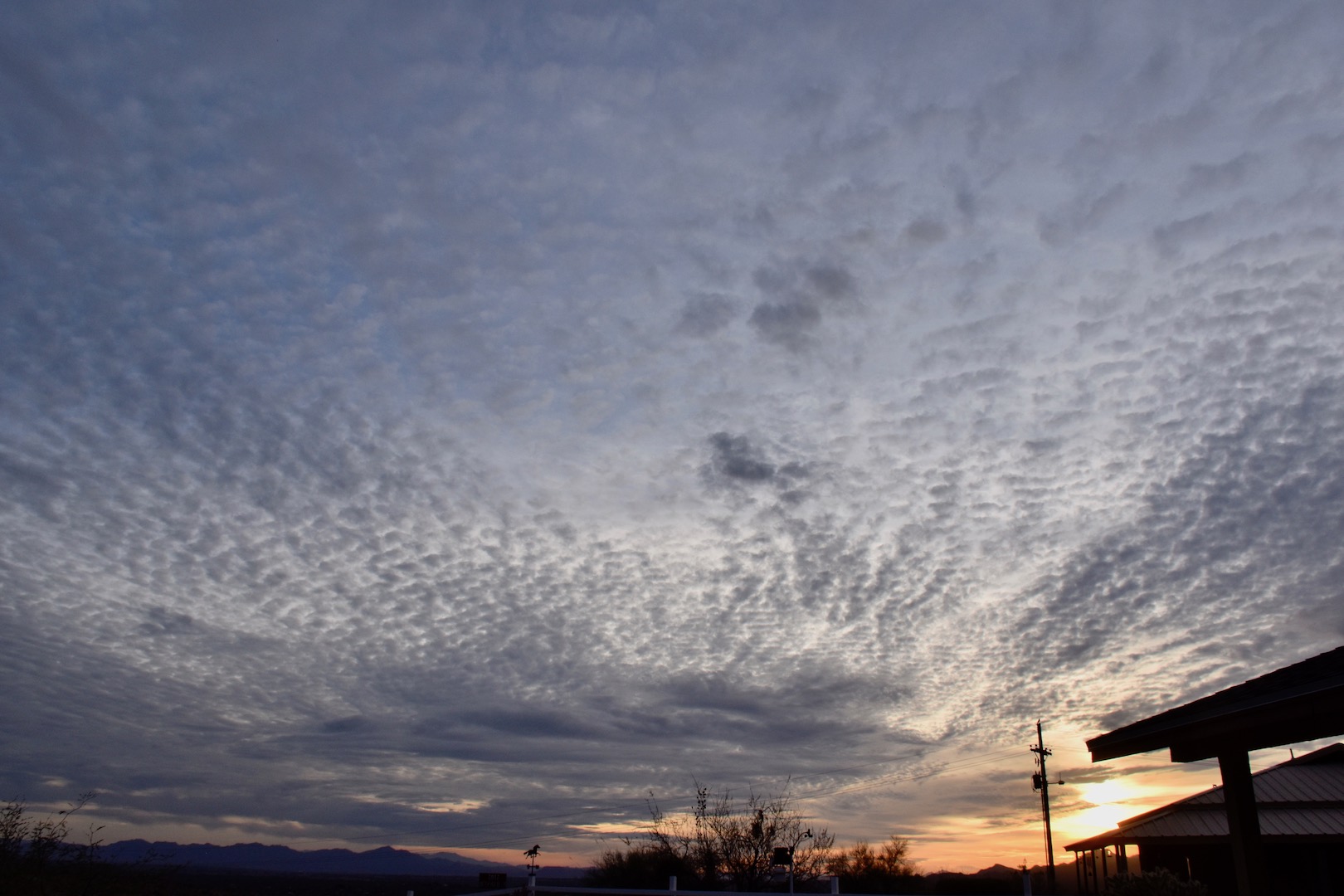
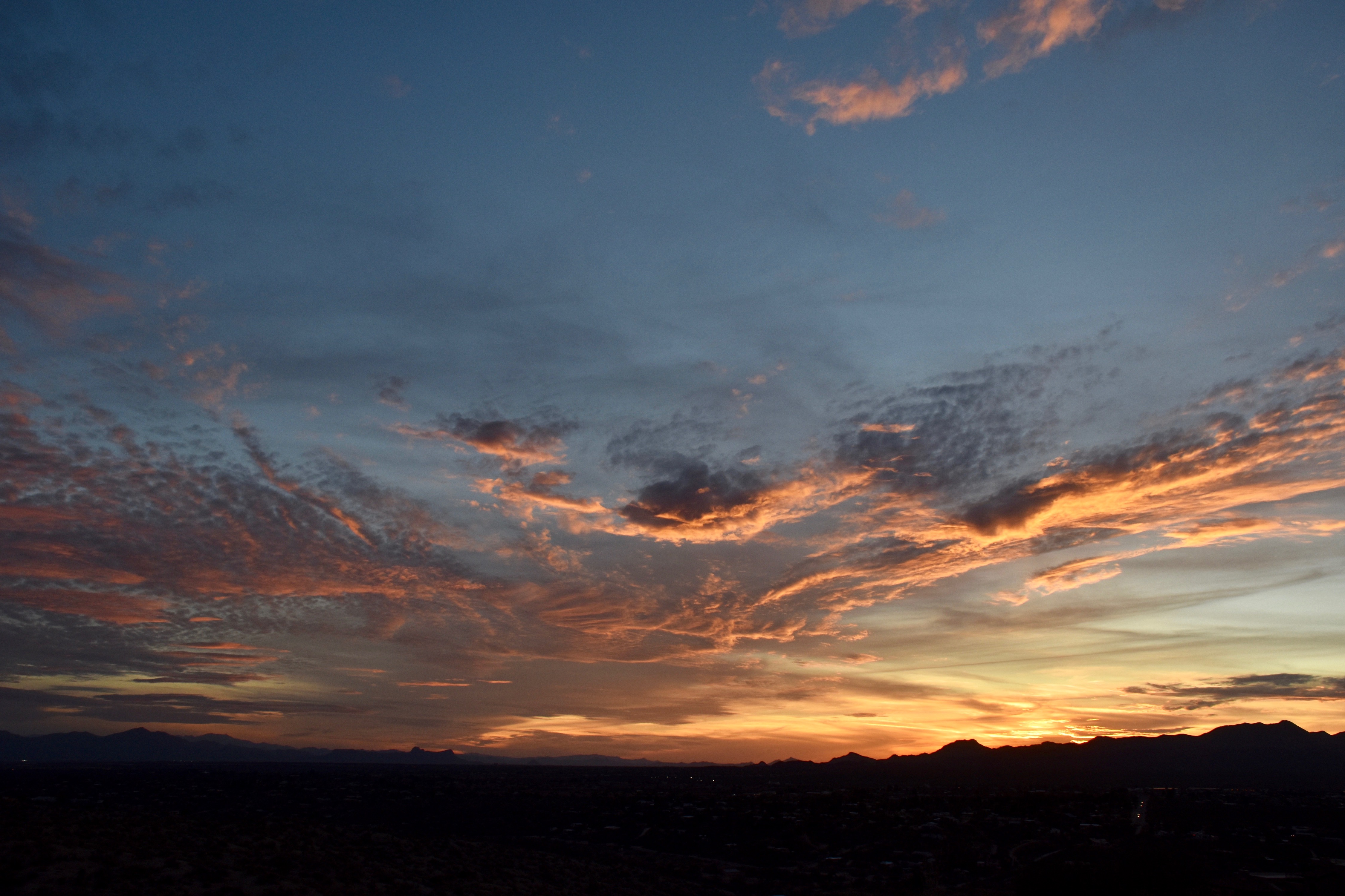
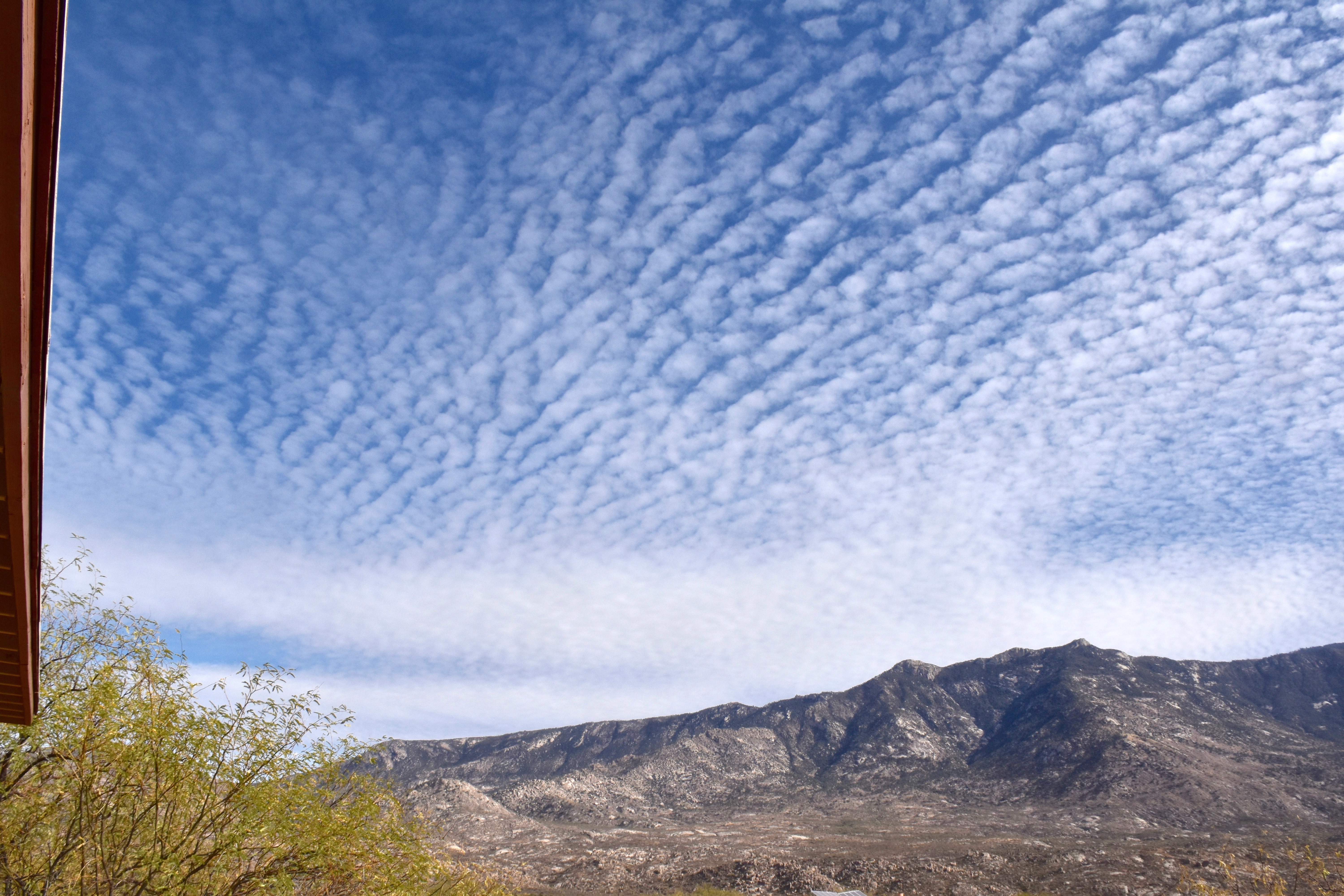
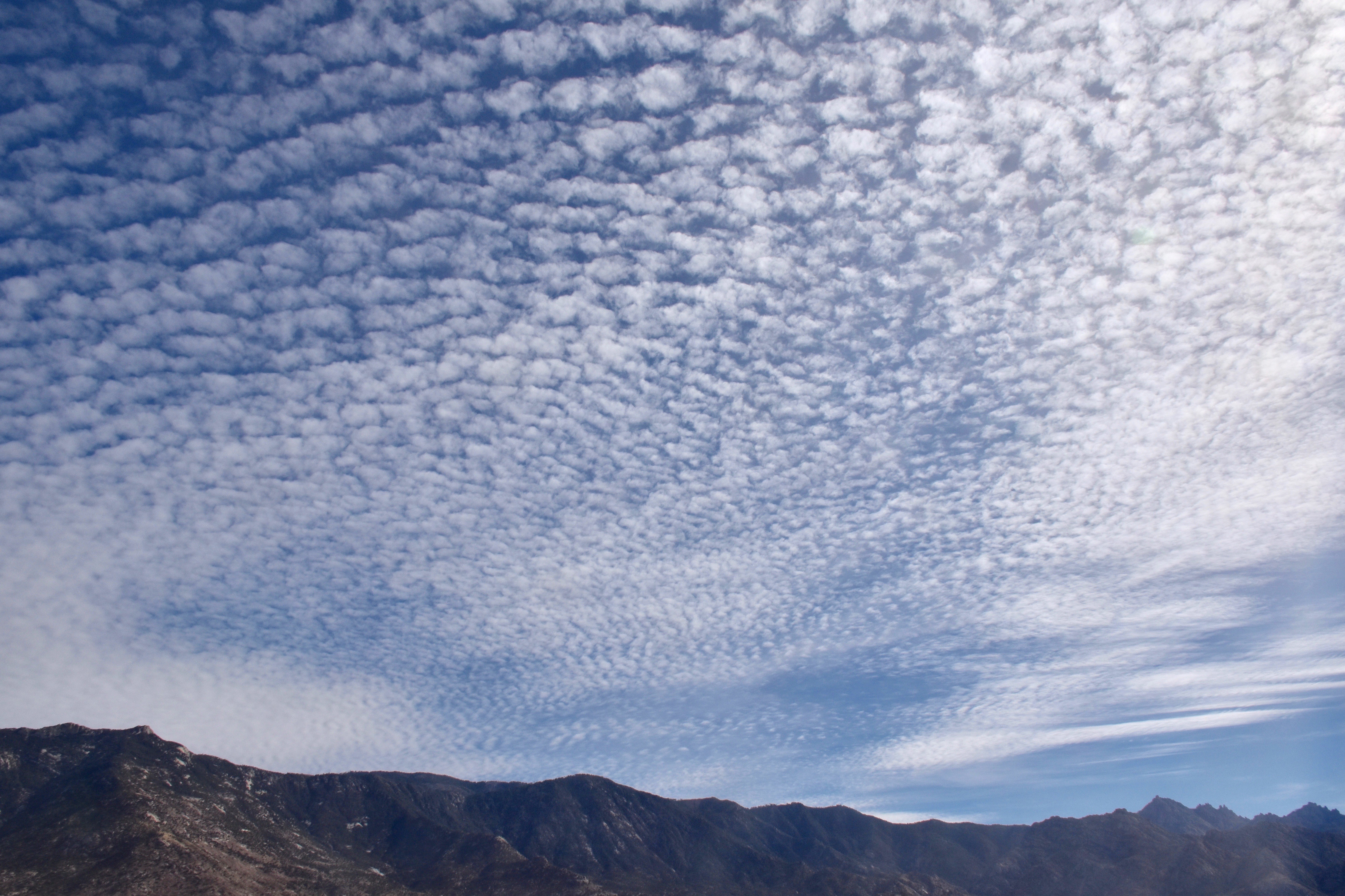
But here are a couple of cloud shots from yesterday anyway:
6:17 PM. Altocumulus perlucidus appearing to spread out, though likely a perspective tomfoolery. Thin Cirrostratus above.6:39 PM.
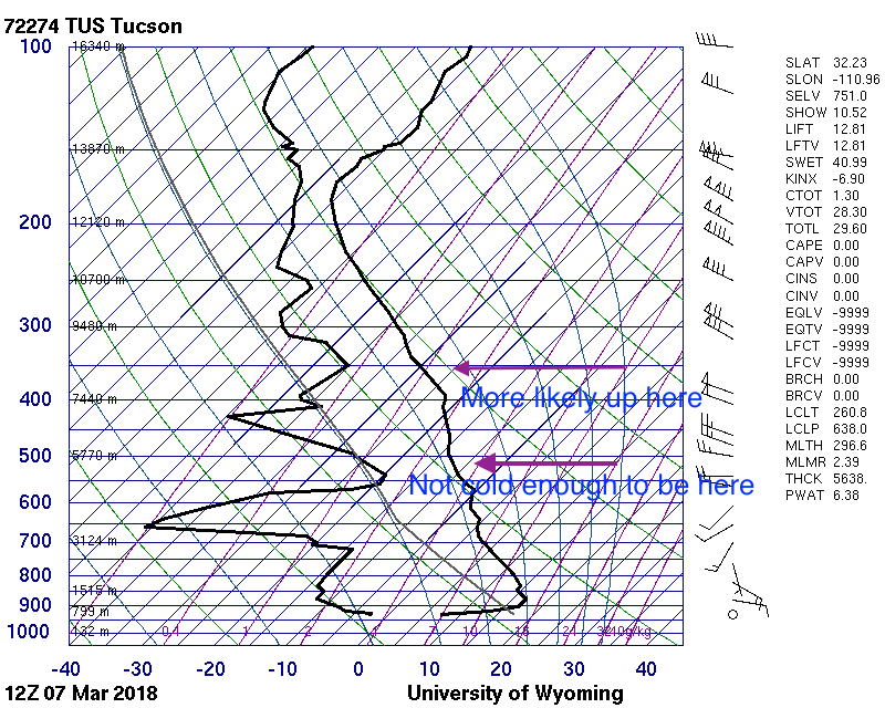
Addendum: Coupla of days ago saw the rare “Cumulo-cirrus” clouds, ones that appear to be Cumulus but are fakes, up at Cirrus-levels. You might call them Cirrus castellanus. I feel these are worth sharing so that the young cloud maven person doesn’t embarrass himself or herself when making a cloud call to friends and neighbors, as you would do. They occurred on March 7th between 11:30 AM and Noon. Can you tell, upon “zooming big” that these are mostly ice clouds? If droplets were present they were there for only a short time, thus (is that still a word?) indicating that these rag clouds were at very low temperatures.
Some sounding detective work below
The 5AM AST sounding for March 7th. The sliver of moist air at 16,000 feet above sea level is not deemed the source of those rag clouds.5 PM AST, March 7th sounding with writing on it.
“Rain on tap” does not refer to a microbrew, for those who’ve accidentally stumbled onto this site.
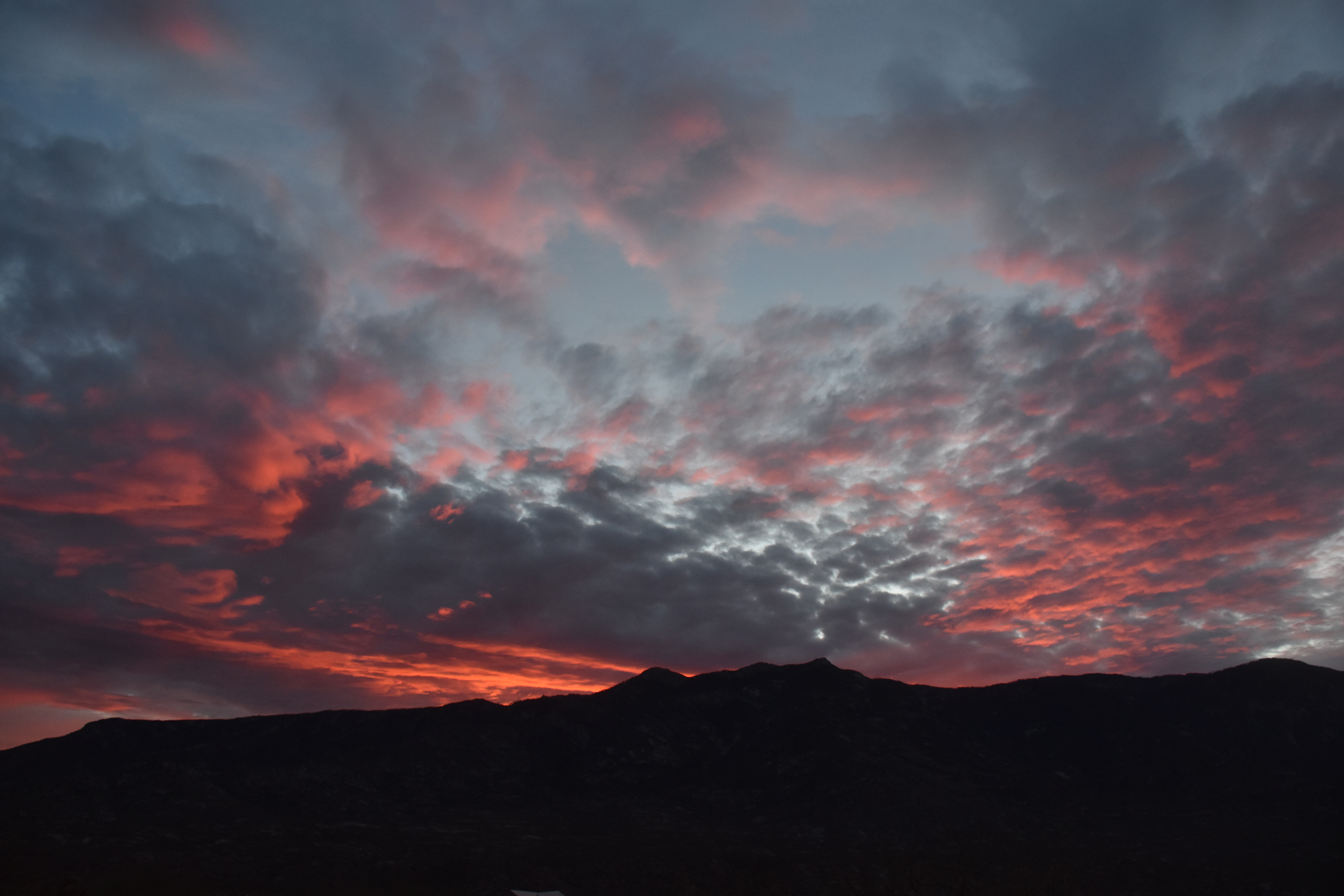
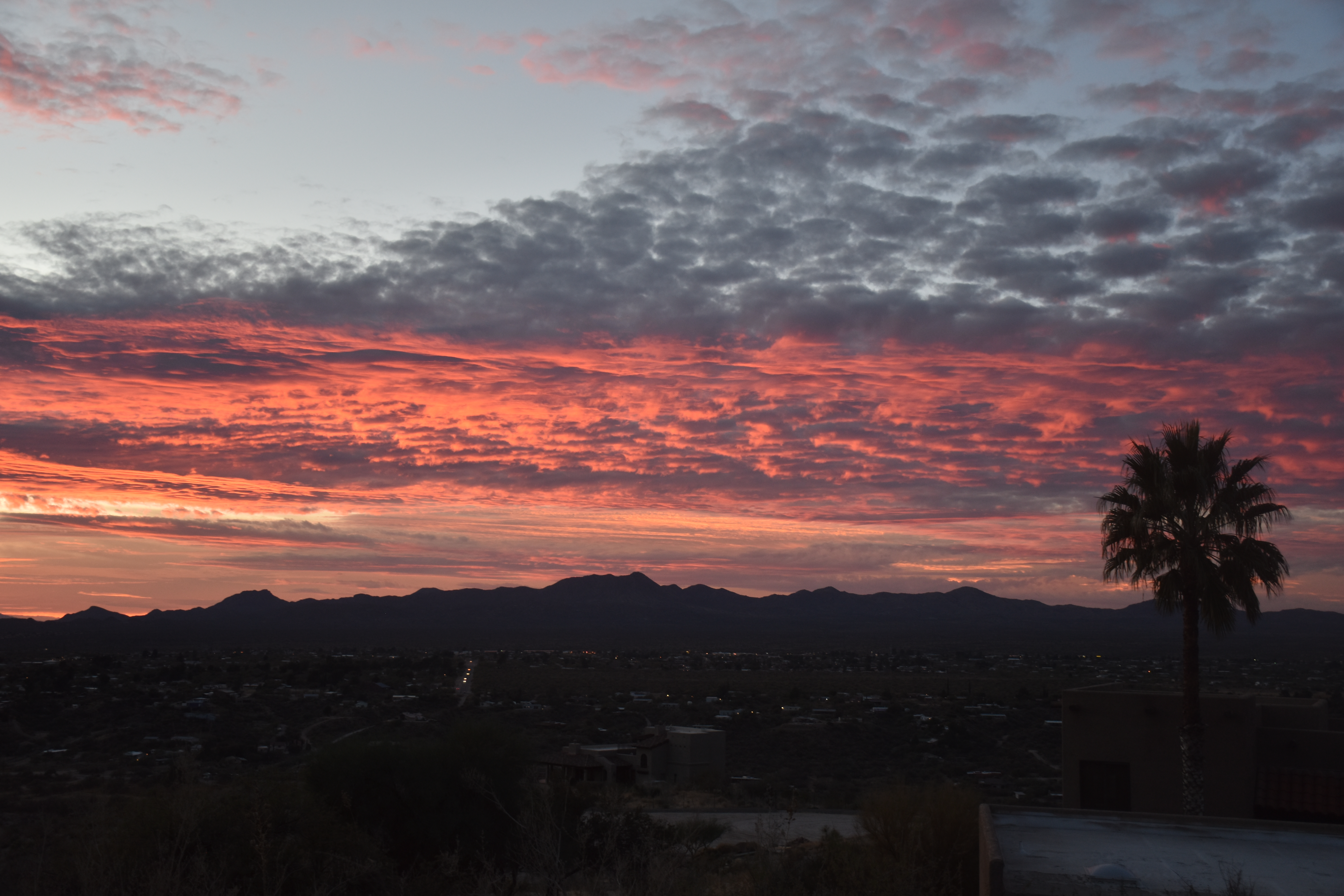
Our nice sunrise and sunset, featuring supercooled1 Altocumulus clouds:
7:22 AM.7:26 AM.7:29 AM. Ice crystals trail down from this region of cloud cover toward the north. Was it hers or ours? This Altocu layer was at -15°C (about 4°F), cold enough for some natural ice, but not as prolific as this. The fact that the ice does not trail downward much indicates the crystals in this virga were really small, also suggesting a non-natural event since an aircraft can produce thousands per liter of ice crystals, none of which can grow to very large sizes. Maybe ours?9:20 AM. Well, what’s a day in Arizona with supercooled Altocumulus without an ice canal caused by an aircraft. So, they were occurring yesterday. We don’t see them much in the summer because the Altocumulus clouds are warmer.
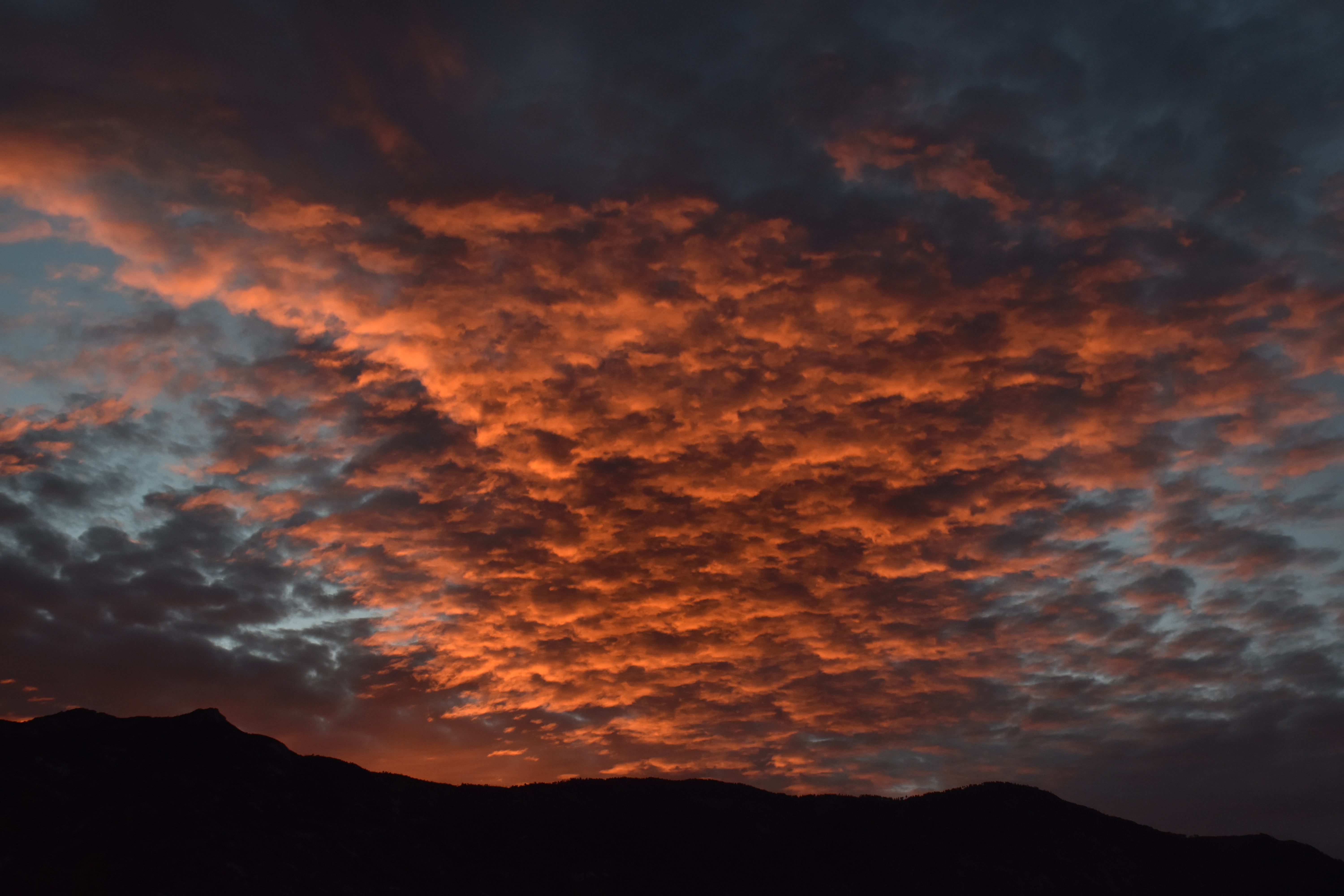
4:36 PM. Our steady diet of Altocumulus yesterday is topped here by a veil of CIrrostratus, all leading one to expect a colorful sunset.5:52 PM. So pretty again….
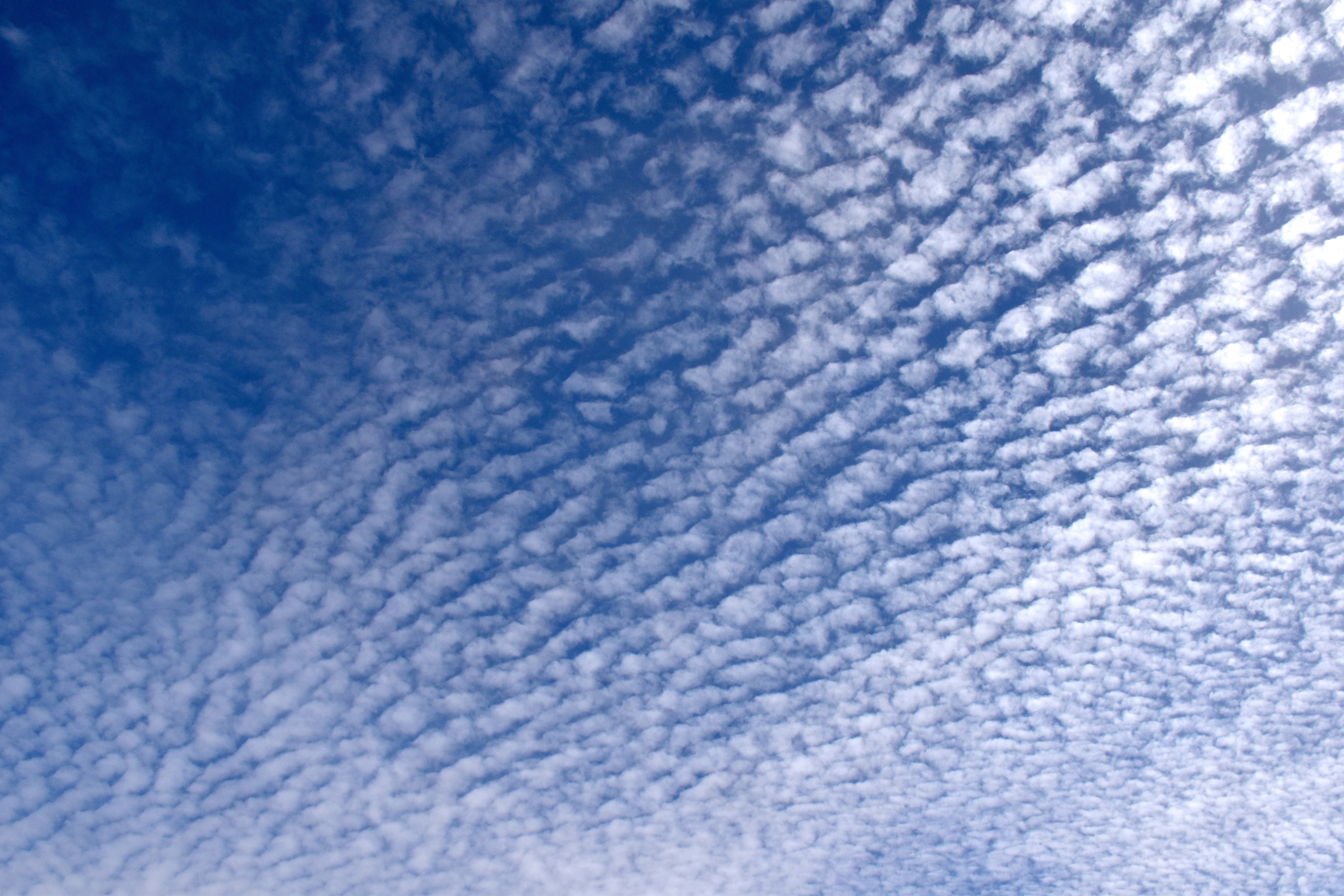
A swatch of Altocumulus perlucidus translucidus (sorry, that’s the way we talk around here) passed over Catalina early yesterday afternoon, each “unit” nearly perfectly evenly spaced with its fellow cloud element creating a brief period of cloud awe for those Catalinans (or is it, “Catalina-ites”? “Catalinians”? Who knows, who cares?). Here it is, in case you work indoors and missed it. It was truly a fabulous sighting!
1:16 PM.1:16 PM. Starting to take too many pictures of the same thing!1:16 PM.1:16 PM, of course. So pretty.
The afternoon was marked by a melange1 of middle clouds:
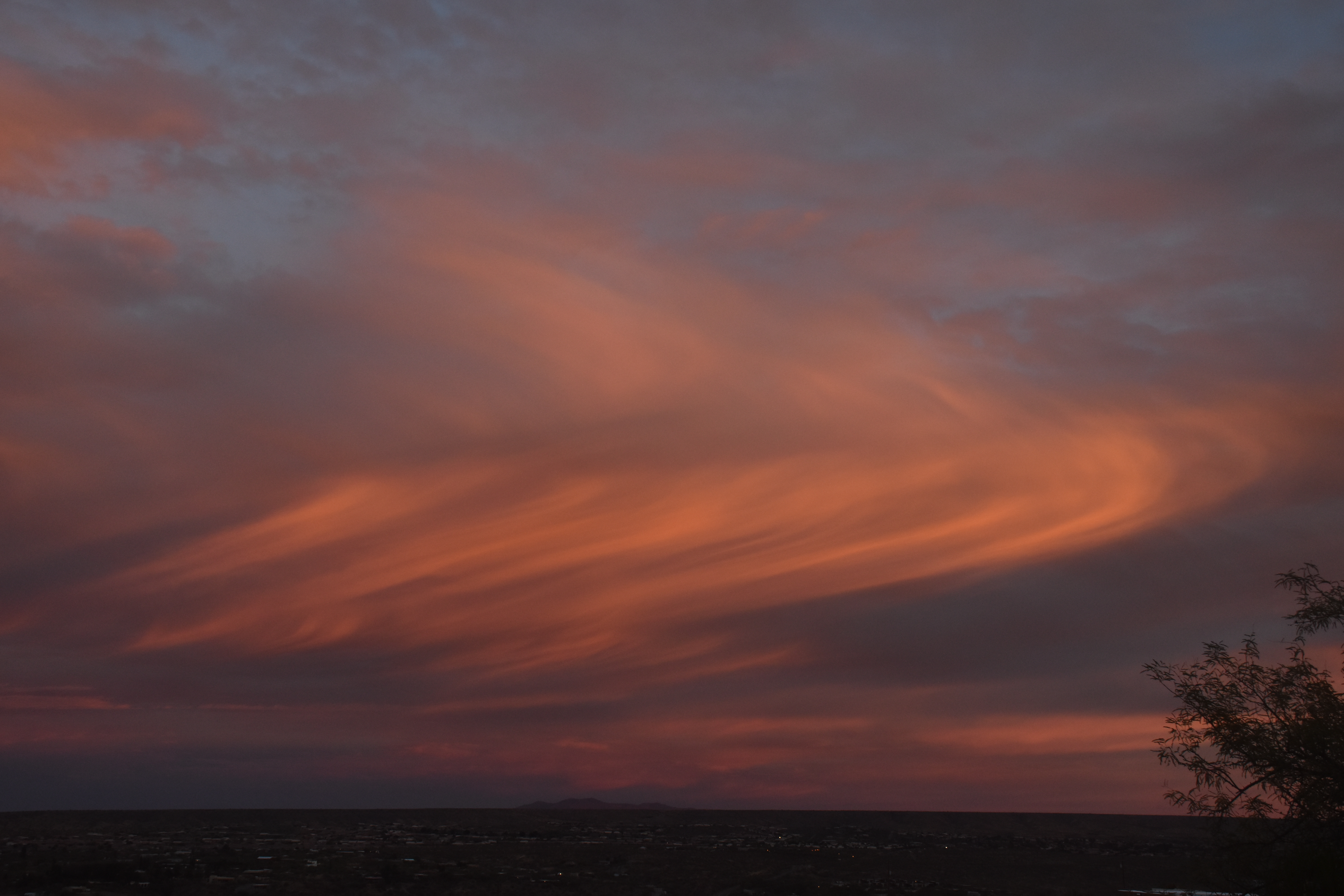
1:52 PM. Altocumulus opacus with a Cirrostratus above.3:11 PM. Some equestrians on horses (haha) went by the house. Sometimes we focus too much on just clouds here, and so we offer the reader who visits here an occasional relief from cloud fatigue.3:12 PM. Those equestrians were being shaded by a Altcumulus perlucidus and by an overcast of Cirrostratus. If you look real hard, you can see a faint halo. The Cirrostratus was thickening upwind as an upper level wave approached and was increasing the amount of rising air aloft over us. The Altocumulus clouds also thickened toward sunset. See below.5:07 PM. Heavy Altocumulus approached from the SW, keeping the sun from under-lighting the Altocumulus as it went down, so no flaming sunset last night. The Cirrostratus overcast continues. All in all, a fine day for Catalinians!
The weather just ahead
The local TEEVEE met men are, of course, pounding out the good news rain is just ahead for Catalina. Looks like, oh, 100% chance to CMP (Cloud Maven Person) starting after midnight Tuesday to Wednesday. How much?
This is a potent, but fast moving trough. Maybe will have only 2-4 h of rain with the passage of the cold front and its rainband. But, coming from the sub-tropics, should have a appreciable rain band with it.
I would expect rainrates to reach “moderate” as the heart of the band goes by for a coupla hours, anyway. Moderate rain is defined by the NWS as 0.1 to 0.3 inches per hour. So, only two hours of moderate rain should be at LEAST 0.2 inches, and most likely more.
We’re thinking here that there’s a 90% chance of more than 0.15 inches, and a 90% chance of less than 0.70 inches. So, averaging those two leads to a best estimate in CMP’s opinion of 0.425 inches! Wow. Nice.
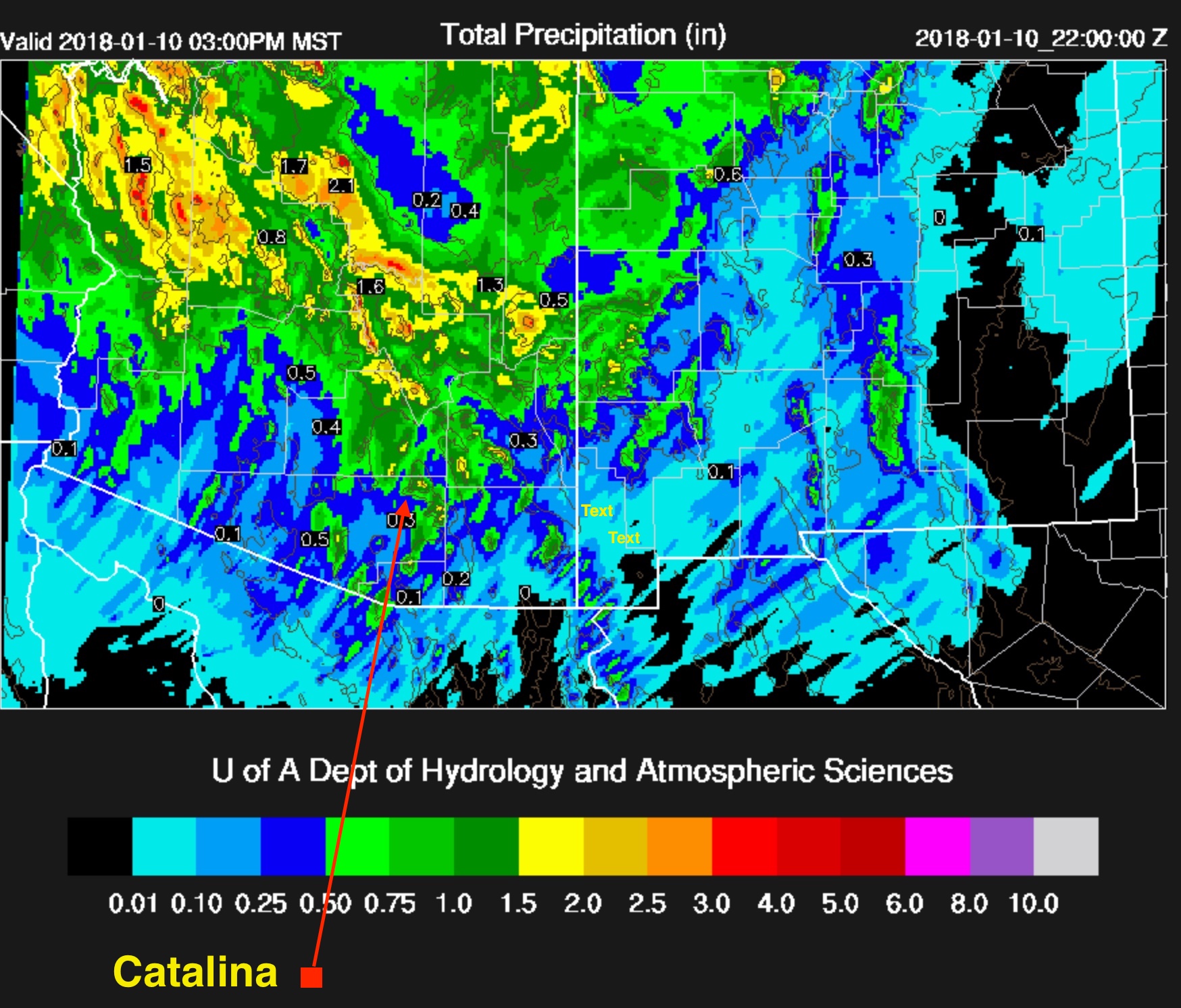
Now, I will look at the U of AZ nested model and see what it thinks. Kind of game we play here, seeing how a seat of the pants forecast, made over a coupla minutes, measures up to a computer model with billions if not trillions of calculations:
Cumulative rainfall ending at 3 PM AST Wednesday afternoon. Catalina is in the GREEN, indicating that the Beowulf Supercluster thinks we’ll have over half an inch (Ms Mt. Lemmon, over an inch!) I am so happy!
The weather way ahead
After the nice rain just ahead, we have to get through the week-long dry spell before we move into a new stormy regime. First, a spaghetti depiction of the ridge after our nice storm:
Valid at 5 PM on the 14th. Huge ridge has stacked up along the West Coast, making it look like the drought will continue ad nauseum. You’ll be discouraged when the middle of January comes around (though by then, everyone will know this is a straw ridge, will collapse in almost hours from this time from the outputs made in real time then.)
Here’s what’s been exciting for a few days now, and below, from last evening’s global model output:
Let’s see what the actual and very latest model run from IPS Meteostar has for us:
From the 11 PM AST last evening global model output this big boy. Unlike so many prior troughs that were bogus this winter at this time ahead (two weeks), this one has spaghetti support and will be real!!! And, it won’t be the only one!!! I’m shouting again!!!
How much these coming rains can benefit our spring wildflower bloom and spring grasses I don’t know, but I sure hope they can resuscitate what otherwise will be a dismal spring.
Expecting a snow event during the “new regime” that takes over after mid-month, too. Be ready!
Honestly, I gave up on the chance of rain overnight into this morning at sunset yesterday due to the absolutely clear skies. And, like you, woke up to not one cloud within a 100 miles! How could this be, given the synoptic situation? Started slicing apples for some humble pie, but then, when looking at a radar and cloud loop (this one from IPS MeteoStar) saw that lower clouds had magically erupted to our west before midnight, and by the time they got here in the early morning hours, had little showers coming out of them!
I did not park my own dusty car out from the carport, either. I thought I would at LEAST see a pile of clouds on Ms. Lemmon, too, this morning! Sure wrong there. Here are a couple of images from what has to be considered a tiny weather miracle:
Chances of rain increasing (imagine!), for just over a week from now as actual model outputs begin reflecting what spaghetti (the many outputs) was indicating, i.e., a big upper trough in the West-Great Basin area. At the time that spaghetti was indicating that, the actual model outputs were not, indicating that they were outliers.
Check this out from last night. Since this model output is more in agreement with that crazy spaghetti plot, it inherently has more credibility, and is likely not an outlier model run. That what the NOAA spaghetti factory is used for, getting a handle on those runs that might be wild, and those that are more likely to verify.
Its valid on the morning of May 8th and shows a trough coming out of the Pacific ahead of the one from the Pac NW, shown at this time over northern Cal. The hope here would be that the one from the SW would have a generous amount of sub-tropical clouds with rain in them.
6:04 AM, 28 April. About the only lenticular seen. Oh, well, there were a few weak ones off to the north, but that was it. CIrrostratus is the higher cloud, too thin to be Altostratus.
Cloud shots will be posted later this morning of the next day….. (i didn’t get to is as I had planned)
12:52 PM, April 28. There can hardly be a better shot of Stratocumulus. While it looks dark, it was partly because of the Cirrostratus or Altostratus overcast; it was that thick, not thick enough to reach temperatures where ice would form in it, and rain would come out. And no rain did, and soon this whole overcast was gone, as was the higher Cirrostratus that shadowed it.4:09 PM. No ice came out of these clouds, but they did allow those beautiful sunny highlights on our Catalina Mountains.4:40 PM. Its remarkable how after weeks and weeks of no rain that so much of our mountains and desert vegetation remains as green as it is.
Yesterday afternoon, the 29th. Here’s what shallow, icy clouds look like, reflecting the unusually cold air above us.
4:44 PM, April 29th.5:43 AM this morning. In an unusually timely post, here’s a leftover ice puff from yesterday over there beyond Charouleau Gap. You’d be guessing, if you cared, that the tops of both of these icy clouds was colder than about -20° C (4°F) since there seems to be so much ice.
The End
PS: Chance of rain still holding for the 8th. See below for new depiction of big “cutoff” vortex over AZ from last evening’s model run:
We’re often confused with the California island, Catalina, and even places in Spain. Google “Catalina” and see if I am lying again. Oh, maybe that was Catalonia, SP…
Nevertheless, isn’t it time to think about a new name for our “Census Designated Place”, Catalina? In fact, at one time, each Catalina island and our Catalina, each had a marina to further confuse things by adding superficial similarities….
Think about it.
Some sunrise scenes among too many available to the writer from his camera card:
Let’s look at the Tortolita Mountains.Cirrocumulus on the fade.Highlighted Cirrocumulus.About as complex as a patch of Cirrocumulus could be. It did seem there were TWO levels of Cirrocu here, which might help explain criss-crossing patterns.Nice Altocumulus lenticularis in the usual spot downwind of Lemmon when the flow is from the W-SW up there.Wide angle view of our spectacular sunrise. How you experienced it live.
Now, for sunset color:
5:47 PM. Will think of something later.
As you may know, there is some violent weather hitting the West Coast, California in particular. Let’s see what the Reno office of the NWS has to say about the incoming storm:
“…BLIZZARD WARNING IN EFFECT UNTIL 10 AM PST WEDNESDAY…
...WINTER STORM WARNING IN EFFECT FROM 10 AM WEDNESDAY TO 4 AM
PST THURSDAY...
THE NATIONAL WEATHER SERVICE IN RENO HAS ISSUED A BLIZZARD
WARNING, WHICH IS IN EFFECT UNTIL 10 AM PST WEDNESDAY. THE WINTER
STORM WARNING IS NOW IN EFFECT FROM 10 AM WEDNESDAY TO 4 AM PST
THURSDAY.
* TIMING: DANGEROUS BLIZZARD CONDITIONS DUE TO HEAVY SNOW AND
STRONG WINDS WILL CONTINUE TODAY THROUGH WEDNESDAY MORNING.
PERIODS OF MODERATE TO HEAVY SNOW WILL CONTINUE THROUGH
WEDNESDAY NIGHT.
SNOW ACCUMULATIONS THROUGH THURSDAY MORNING: 5 TO 10 FEET ABOVE 7000 FEET WITH 3 TO 7 FEET AT LAKE TAHOE LEVEL.(Note: The large font size, the capitalization, suggest, as we know, that the writer is screaming, which I am.)
* WINDS: SOUTHWEST 20 TO 30 MPH WITH GUSTS TO 60 MPH THROUGH
WEDNESDAY MORNING. SIERRA RIDGE GUSTS OVER 100 MPH.
* SNOW LEVELS: BELOW LAKE LEVEL...MAY BRIEFLY RISE TO 6500 FEET
THIS AFTERNOON BEFORE FALLING AGAIN.
* IMPACTS: DANGEROUS LIFE THREATENING BLIZZARD CONDITIONS WITH
NEAR ZERO VISIBILITY WILL EXIST FOR TRAVEL AND OUTDOOR
ACTIVITIES WITH HEAVY SNOW ACCUMULATION ON ALL SIERRA ROADS.
PRECAUTIONARY/PREPAREDNESS ACTIONS...
THIS IS A LIFE THREATENING SITUATION. DO NOT ATTEMPT TO TRAVEL!
ROAD CREWS AND FIRST RESPONDERS MAY NOT BE ABLE TO RESCUE YOU.
STAY INDOORS UNTIL THE SNOW AND WIND SUBSIDE. EVEN A SHORT WALK
COULD BE DEADLY IF YOU BECOME DISORIENTED1."
As we know, extremely heavy snows in the Sierras can trigger cannabalism, It is our sincere wish that those affected by this severe storm curb his or her appetite for humans, i.e, that cannibalism does not break out in the Reno-Tahoe area, or ANYWHERE (capitalization for emphasis) in the Sierras during this terrible storm or its aftermath.
The End
————————– 1Thanks to Prof. (emeritus) Roger Pielke, Sr., Colo State, for passing this warning along. His son, a great scientist as well, btw, has the exact same name, and that’s why THIS Roger goes by “senior.” Thought you’d like to know that.
Yesterday, after an ordinary beginning,, finished in a spectacular, if likely artificial way. Let us work our way through yesterday’s cloudulations:
7:39 AM. I thought this was a cute display by this little cloud, making its own little shadow rays as the sun made its way up from behind the Catlinas.7:40 AM. But what kind of cloud is it? It, to these eyes, is all ice, but LOOKS like an Altocumulus cloud. But those clouds are all or mostly comprised of liquid drops. And you can see that this little guy is well BELOW a higher layer of ice cloud, we might call CIrrostratus, or a thin Altostratus. Oh, well, let’s move on to something explicable….
7:41 AM. Hmmmm. Quite a linear virga feature over there. There are THREE cloud layers evident here, a thin Altocumulus layer, that dark cloud on the left, and patch of what I could call, Altostratus extending from the left corner to the right corner, and a thin layer of CIrrostratus on top.7:41 AM. Let’s go zooming and check it out…. Though we don’t know for SURE, anytime you see this kind of linear virga anomaly, you should be smelling aircraft exhaust. Now, when you think about our fabulous sunset last evening and what that looked like, take a closer look at this photo.
Later that morning…..
10:53 AM. It was nice to see low clouds topping Sam Ridge at dawn yesterday, the lower boundary layer air (where convection takes place) moist for a change. Later they devolved into small Cumulus (humilis and fractus).3:29 PM. A day with mostly ice clouds on top of Catalina, but here, off in the distance below the Cirrostratus, is an invading layer of Altostratus and Altocumulus that will set the stage for sunset glory later. You may be able to detect a faint halo, upper center. By the way, Cirrostratus typically deepens downward to morph into Altostratus, usually an ice cloud, too, but is deep enough to produce gray shading, and when its really thick or has embedded droplet clouds, hides the sun.4:02 PM. Yep, moving right in. This is a very complex scene. There’s aCirrostratus ice layer. upper right quadrant , on top of everything. Below that, what appears here as a distinctly lower separate layer, a mix of Altocumulus (those dark cloudlets composed all or mostly of liquid droplets) and Altostratus (mostly or all ice, the smudgy more diffuse dark areas) . We can never forget that Altocumulus can morph into Altostratus, which would then be called, “Altostratus altocumulotransmutatus.” Tell that to your friends! (Well, maybe not.)4:15 PM. Caught this bumpy aircraft contrail at CIrrus levels. Look how how the exhaust and water vapor that formed this, though output from an aircraft in a steady state, how the wing tip vorices (apparently) get entertwined at regular intervals with more exhaust and water vapor in those blobs.
But let’s go zooming up to flight level and take a closer look for a second:
A “mammatus” (or as the ladies like to call it. a testicularis contrail (the resemblances are pretty good). Almost certainly this is due to combining wing tip vortices. Many aircraft now have devices to defeat wing tip vortices, phenomenon that reduce flight efficiency. In both cases above, the ice particles have not grown enough to produce fallstreaks. These images tell us that SOME aircraft that produce ice in supercooled Altocumulus clouds, as we in Catalina have seen lately, are likely to have bunches of ice trails rather than a continuum if produced in a uniform cloud, anyway.
Now, where was I? Got mammatus on my mind again. I love mammatus so much… Oh, yeah, that sunset yesterday…..
5:13 PM. Ran out to check sunset status, and saw this feature advancing rapidly toward Catalina.5:18 PM. Zoomed view; getting close to passing overhead. You might be able to notice that these pretty regularly spaced trails are BELOW the Altocumulus clouds, and there’s a clearing that’s been produced. All evidence of an artificial production of these trails. But belng below the Altocu, you might also have started to wonder whether the setting sun would light them up….
And the sun did its job….producing one of the greatest sunset scenes we’ve seen in a long time, even if phony (haha):
5:23 PM. Not zoomed, still a few minutes away to overhead passage. Very exciting to think this was going to pass overhead!5:23 PM. Zoomed view. Again the pretty regular spacing is circumstantial evidence that nature didn’t do it.5:25 PM. Thank you sun! Looks pretty round again, which is good.5:27 PM. Oh, so pretty.5:27 PM. Zooming again. Wow.5:28 PM. Another view of the same thing.5:28 PM. Our trails compared to the rest of the Altocumulus deck. Not much going on elsewhere in the way of natural virga.5:29 PM. Taking WAY too many photos of the same thing. Out of control… Here I demonstrate that with another photo of the same thing.
5:30 PM. After the trail hoopla, it was time to concentrate on the fabulous sunset taking place to the southwest of Catalina.5:30 PM. Zooming in on interesting features; long trails, one with a clearing above it. Was it another aircraft-induced trail of ice and clearing above it? Probably. The trails to the left aren’t as obviously produced by an aircraft, but I do think so anyway in this burst of objectivity. Recall that I have been trained as a “scientist” and don’t care if I am wrong, but only about truth, as best as I can make it out.
Finally, let look at the TUS sounding for last evening, see how cold those Ac cloud were with the ice trail in them:
Results of the Tucson rawinsonde balloon launch yesterday at about 3:30 PM. Goes up at about 1,000 feet a minute, so takes about 100 minutes to get to 100, 000 feet. They pop somewhere around that height or a little above. THought you like to know that. They have a little parachute to that when they come down, they don’t bonk you too hard. Once in awhile people find them in remote areas downwind. You can send them back in to the NWS, too!
The astounding thing here, something that goes against everything I believe about clouds, is that it is indicated that the Altocumulus, lacking much natural ice, was at -30° C! Yikes! No wonder aircraft were producing ice trails and stuff yesterday afternoon.
You have to conclude there were almost no natural “ice nuclei” up there at, oh about 24,000 feet above sea level. This is not the first time for such an occurrence of liquid clouds sans much ice at low temperatures1, but they are rare IME. This would never occur in a boundary layer cloud, that is, one where material from the earth’s surface is getting into the clouds, like the omnipresent dust, or biogenic ice nuclei.
The weather ahead
Some “fantasy” storms with rain in them for Catalina, are now seen on the model predictions beyond a week. Spaghetti is favoring this new development now. So, something to keep an eye on.
The view from here? Precip here is “in the bag” because going on subjective feelings, I really want to see a good rain here!
The End
——————————
1The famous John Hallett said he saw an Altocumulus lenticularis sans ice at -35°C in a conference preprint! Rangno and Hobbs (1986) claimed to have detected droplets in Altocumulus like clouds at the top of a storm on the Washington coast at -44°C. Their claim, first published in a conference preprint, was later rejected by the J. Atmos. Sci.
7:25 AM arrives as usual. Seeming radiating bands of Altostratus stream toward Catalina (little too thick and gray to be “Cirrus”). They also appeared so smooth as to resemble lenticular clouds.1:14 PM. Since its summer again in Arizona in late October, not surprising to see afternoon Cumulus clouds originating in air from the Tropics clustering over our mountains again.1:38 PM. The curved brightening at the bottom of this otherwise normal halo is likely a “lower tangent arc.”1:40 PM. Zooming in with excitement here. Is it really a lower tangent arc? Not positive, but will go with that description anyway.2:59 PM. That Cirrostratus thickened into Altostratus (usually, btw, due to the bottom of the cloud lowering) and at the same time the lower moisture, evidenced by these Cumulus and Stratocumulus clouds, also increased. However, none of these lower clouds got cold enough to produce ice, so likely tops were warmer than -10°C (14°F).
4:32 PM. Mix of Altostratus and Altocumulus clouds, with just remnants of the lower Cu. Here it appears that a liquid layer of Altocumulus now resides at the bottom of the Altostratus, or may be embedded in it. The globular masses in the middle of this photo represent droplet clouds that appear to have merged into a plate. In the distance, the telltale sign of lowering tops: only droplet clouds, with a occasional splash of virga can be seen.
5:23 PM. Just a little before a great sunset, which I missed due to a social engagement, the shallow Altocumulus droplet clouds are plainly evident around the sun’s position. Above to center, the backside of the deeper Altostratus clouds with much higher tops, is about to pass over us. Here you can see, how much lower the Altocumulus cloud fragments are than the Altostratus layer as they are illuminated by the sun (upper center highlighted clouds).
All in all, a pretty pleasant day with interesting clouds passing by, though ultimately disappointing since at one time, this was to be a day with showers here. Oh, well, that’s weather forecasting for you.
Another minimal chance for showers comes up in the middle of next week…
A horse photo will always enhance a blog about clouds. Expecting a little uptick in readership due to this ploy, maybe will break out of the single digit column.
Not much happened early on, a thin film of Cirrostratus covered much of the sky, delaying the expected development of convection, as would be evidenced by the formation of Cumulus clouds, until mid-afternoon.
But they did form, mostly to the S through W of Catalinaland, upwind of us, and eventually rumbled in on their last legs as weak thunderstorms with gushes of sprinkles and gusty breezes, maybe ones over 15 mph!
Over there in Marana and Avra Valley, those places upstream of us, some spots got more than half an inch. But, i it seems this year that storms die when they move toward Catalina, and especially, toward MY house and its many raingauges (3).
Still, it was nice to feel cool breezes, air chilled by falling rain, even if elsewhere.
Here are a few dull and disappointing cloud shots from yesterday, including one with a horse:
10:56 AM. Horse looks ahead, examining the vellum of Cirrostratus cloud overhead, wondering if it means anything. If this was Seattle, such a layer would thicken and lower into a steady rain within hours 70% of the time. Pretty true for most higher latitude locations in the cooler time of the year. (This was horsey’s first true trail ride, going up and down rocky gullies with loose rocks along side the Sutherland Wash. Previously this horse had spent most of its 14 years in a small corral so this was all pretty new to him; rider tension high.)2:49 PM. A soothing gray of Altocumulus undercut the layer of Cirrostratus. Building Cumulus clouds can be seen toward the Mexican border on the horizon. Pusch Ridge is in the foreground. As you can see, no virga is falling from those Altocumulus clouds, so they must be pretty “warm”, warmer than about -10° to -15° C at cloud top.3:38 PM. Looking suggestive of rain here in Catalina. However, these storms were in the late, dissipating stage. Note too how the anvils have merged with the Cirrostratus layer and lean far out from the storms toward us, helping to cool the ground, ruin the chances of new Cumulus buildups ahead of them.4:19 PM. Not much going on over the Catalinas. Notice how broken up into light and dark patches these otherwise dark looking lower clouds are. Shows there’s no hope for any buildup out of them, though, lower clouds like these under precipitating Altostratus cumulonimbogenitus (that higher cloud here which is really the result of anvils) can help sprinkles get to the ground. That’s because drops or snowflakes falling out of the higher cloud, won’t evaporate while falling though these clouds (representing saturated air with respect to water).4:33 PM. Nice shaft, some cloud-to-ground lightning strokes toward south Tucson, but who cares? Wasn’t moving this way, and would be mostly dissipated by the time it got here anyway.4:57 PM. Some rain with an occasional lightning outrage did reach the southern parts of the Catalinas, eventually making it all the way to Ms. Mt. Sara Lemmon where 0.24 inches was recorded. SPKLS fell in Catalina.5:42 PM. Last gasp, last chance for rain here, dying shower with some new bases to the right, offer another slight hope that the new stuff will develop into showers like this one. It didn’t.
Still have rain chances last few days of Oct into early Nov.
Actually, there are no thoughts about the Super Bowl here. The title was just another cheap attempt to attract a reader that might be both cloud-centric AND a football fan, creating a moneyful increase in web traffic for this blog.
First you had your Cirrus, the highest of all clouds except for stratospheric nacreous clouds which kind of mess things up up there by eating ozone. We will not display n-clouds.
Cirrus, as you know, ALMOST always precedes lower clouds since they’re moving so much faster than the lower ones. So we get a sequence of clouds before it starts to rain that generally is the same, over and over again as in that movie about weather, Ground Hog Day. But let us ramble on…
First, patchy Cirrus, then maybe a sheet of Cirrostratus, then the lower stuff as Cirrostratus thickens downward to become that gray sheet called Altostratus. Throw in a few Altocumulus clouds that become a sheet underneath, and voila, your in Seattle, with rain on the doorstep. Yep, that’s the Seattle, and well, the Middle Latitude Pre-Storm Cloud Sequence (MLPSCS)2.
7:41 AM. Birds on the wire, waiting for the storm, notice the invading Cirrostratus fibratus. Low smog plume moves NW out of TUS and into Marana again (at very bottom of image).
10:49 AM. What a fine example of Cirrus spissatus (Cis spis) trailing larger ice crystals, certainly these would be “bullet rosettes”, looking something like a cholla bud, except the spines that stick out all over in this type of ice crystal look like hexagonal columns radiating out of a tiny center crystal. The ones NOT falling out are likely stubby solid columns, plates, prisms, and “germs”, the latter not really germs, but tiny, amorphous ice crystals not having grown a particular shape yet, all too small to have appreciable fallspeeds like the bullet rosettes. A whole sheet of this cloud having so much ice falling out would constitute what we would call, “Altostratus”, gray and deep.
11:46 AM. Another interesting scene. Are these Cirrus clouds spreading out, or is it perspective? Note bank of thick Cirrus on the horizon, too. (I think they were actually spreading out some.)12:49 PM. Here comes the next lower layer, Altocumulus clouds. However, note that ice formed in or just above this layer of Altocumulus, indicating that although it is one comprised of droplets (liquid) it is VERY cold. What is your next thought? HTCs (High Temperature Contrails) or “APIPs”, where aircraft that fly through them seed them by producing huge numbers of ice crystals due to extra cooling provided by over the wing flow, jet exhaust water producing extreme supersaturations, or prop tip cooling. Cause hasn’t been quite nailed down, but cooling is the leading suspect where the air is cooled to -40 C or so, and ice has to form in moist conditions.2:26 PM. With the Altocumulus and Cirrocumulus displays came periods of iridescence in the clouds, indicating tiny droplets less than 10 microns in diameter. There were more grandiose displays, but they were so gaudy my photos looked fake.
4:04 PM. Out ahead of the invading sheet of Altocumulus were these CIrrocumulus clouds with a cool herring bone pattern (“undulatus”). While called, “Cirrocumulus”, these clouds were actually at the same level as the invading Altocumulus clouds shown in the next photo. Its the fineness of the granulation that makes us refer to them as “Cc” clouds, even when they are in the middle levels, and not truly high clouds as the prefix “Cirro” would suggest.
4:09 PM. The invading sheet of Altocumulus perlucidus translucidus (no shading, honey-comb, flocculent pattern). On the horizon, Seattle-like solid veil of Cirrostratus, something that’s pretty rare here. This was an exciting scene because of the advancing layers, the darkening on the horizon, in the context of the major rain ahead.4:17 PM. You have to have ice in your veins if this shot doesn’t give you goose bumps. So pretty, all that uniform flocculation3 up there in Altocumulus perlucidus translucidus.4:24 PM. I can feel that you want more flocculation…
4:31 PM. Maybe just one more… Feeling pretty great now now that I’ve flocculated you so many times today. Three or four is about my limit.5:08 PM. APIP line, or HTC (“High Temperature Contrail”)–ones not supposed to occur at the temperature of this Altocumulus perlucidus translucidus, but they do anyway. Last evening’s TUS sounding pinned this layer at -24 C (-11 F!). Note that no other ice can be seen falling from these very cold clouds. The “castellanus” appearance of a contrail is extremely unusual, and may indicate a sharp decline in temperature at the level the aircraft flew. However, then it begs the question about why the Ac clouds aren’t turreted, at least, SOME. You’ll probably have to take CM’s word that its an ice trail. Note indication of a hole in the droplet cloud at far left of trail. That’s a clue.5:08 PM. To the southwest and west, layers of Altocumulus, some having turrets, and with a beautiful veil of CIrrostratus above, advance on Catalina. I love shots like this, though sans color, due to their rainy portent, even though our rain is not supposed to being for another 24 h, or this evening.
The weather just ahead
Of course, everyone, including media weathercasters, are all over the incoming stupendous storm event. For a more technical discussion, here’s one by Mike L., U of AZ forecasting expert, who got excited enough about our storm to come to send out a global e-mail. I think you should read it, though I left out all the graphics. I’ve already been too graphic today.
———–Special Statement by Mike L———————————-
“A very unusual heavy precipitation event is forecast for the next few days across Arizona and New Mexico as extremely moist air interacts with multiple short waves. As seen in the below data from the NWS, the maximum monthly IPW for Jan is about 28-29mm. If the various WRF forecasts verify, the upcoming storm will set new a new January IPW record.
The 12z WRFGFS indicates very high moisture levels being advected towards Arizona due to a low latitude low located west of the Baja spur. While IPW has slowly decreased from the previous storm over much of the area, La Paz is seeing a upturn in observed IPW.
As seen below, at 5pm today, some convection is forecast near to the low. Lightning data has indicated there has been some strong convection during the day today. Model initializations are normally suspect so far from any upper air stations, but it seems that both the NAM and GFS seem to have the intensity and location initialized well. One item of note is that during the past few days, the models have had a trend of moving the heaviest precipitation back to the west. Initially, the heaviest band was well in to NM whereas you’ll see later, it is now over much of eastern/central Arizona.
By late tomorrow afternoon, the low has only moved eastward slightly, but IPW continues to increase over NW Mexico and into Arizona. Precipitation begins mainly over the higher terrain of eastern Arizona.
By Wednesday morning, the mid level low has intensified as a strong short wave dives down behind the mean trough along with CAA into the back side.
Significant synoptic scale lift is present over southern Arizona and into northern Mexico by this time.
Extreme IPW is forecast to be present during the morning hours on Friday and combined with the favorable dynamics, widespread moderate to heavy rain is predicted. As the low becomes cut off, there will be an extended period for precipitation.
Precipitation rates are forecast to be above .25″/hour in some locations during the morning hours.
Partial clearing is forecast by Friday afternoon which allows some heating. Combined with cooler air aloft and high IPW, moderate amounts of CAPE are present during the afternoon.
By later in the afternoon, as Bob Maddox pointed out, convection forms and results in some locally heavy precipitation.
Tucson’s vertical profile is quite impressive with 700 J/Kg of CAPE and some vertical shear to support organized convection. Hail is also a threat.
Convection continues into the evening over southern Arizona with a continued threat of hail and some lightning.
The 3 day QPF is very impressive with widespread 1 inch amounts with some areas receiving over 3 inches. Some of these areas are associated with the strong convection present on Friday afternoon/evening. Confidence is low to medium due to the lack of upper air data and lack of run to run consistency as discussed previously. Also, the output in this discussion was solely from the 12z WRFGFS. The WRFNAM from last night had the heaviest precipitation somewhat to the east. It will be informative to see the next suite of model runs overnight to see if this westward trend ceases. There is a chance that it could continue and the heaviest precipitation is actually farther west than depicted below.
Very little of this precipitation falls as snow except at the very highest elevations, above 9k feet due to the sub tropical air-mass and lack of cold air.
Note that this discussion will only be available for organizations who are (or have) supported the Arizona Regional Modeling Program. This change will take effect before next monsoon season. Private individuals not associated with commercial/governmental agencies will continue to receive the discussions. If your agency would like to support the Program, please email me for details. “
————–End of special statement by Mike L—————————
The End!
1Let us not forget Simon and Garfunkel’s telling descriptions of Patterns of life; they repeat in clouds, too. (Pretty funny lead in commercial where Bryant Gumbel is asking, “What is the internet?”)
2Back in the old days when cloud forms were used to tell weather, Cirrostratus sheets, those high thin sheets, often with a halo, foretold rain 70% of the time here in the US (see Compendium of Meteorology, 1951). Deserts don’t much see this sequence. Cirrus are mostly meaningless in them, just indicating some withering tail of a system with rain that’s far away most of the time.
Like scientific opinion1, climate change happens. You may not know this, but only 15,000 to 20,000 years or so ago, a blink of an eye in light years, the earth was gripped by an Ice Age. No “hockey stick” handle back then! Snow and ice piled up over a kilometer deep on top of the Space Needle in Seattle. And the polar ice cap extended to places like Cahoga Falls, Ohio, while burying the Great Lakes, which didn’t exist.
NOW, of course, we’re in an “Interglacial” period called the Holocene, where its nice and toasty, for the most part, the way we like it as a people. Really, human beans do not like Ice Ages; they can really die off in a hurry2 and have to repopulate themselves afterwards! Well, I suppose that part might be fun.
The forecast models are foretelling something in the way of a flashback in the way of a pressure pattern over nearly ALL of North America that might well have been the average pressure pattern day after day during an Ice Age (there have been many), the last one, at its peak, not surprisingly, was called, “the Last Glacial Maximum.” I’d call it that, too.
Here are a coupla panels from the venerable Enviro Can computer model with its FOUR panels of weather. Take a look at the pressure patterns in the right side panels, you may have to use a magnifying glass, both showing the predicted sea level pressure pattern. These forecast maps are astounding to C-M and will, therefore, be likewise to you, too: a high pressure area so expansive with cold dense air that it covers millions of square miles, even more in square kilometers, maybe billions, since the kilometer is a smaller Euro unit of measurement that makes everything seem farther away when you’re driving to someplace and the distance is in Euros. (hahaha, just kidding folks).
Valid Monday, December 29th at 5 AM AST. Giant high pressure cell has formed in the Canadian Northwest Territories, and its leading edge is affecting the US from COAST TO COAST! I am pumped, don’t high pressure regions this big this too often in NA. In eastern Asia, e,g, China, where all our stuff is made, and Siberia, this big a high is SOS in the wintertime. So, we’re seeing a bit of eastern Asia wintertime conditons, too.
Valid just 24 h later, 5 AM AST, Tuesday, December 30th. Temperatures in some mountain valley locations in MT could be as low as -60 F. NE flow aloft, behind the upper low, will provide exceptionally dry air above the surface layer, and that will allow whatever “heat”, and we use this word, advisedly, to efficiently escape from the surface after nightfall. So, clear skies, dry above you, no wind (as in a valley) down, down, down plummets the temperature.
So, we have an historical treat coming when the average temperatures every day in the US were 15-20 F lower during the Last Glacial Maximum! (Ugh.) The oceans were at lot smaller then, too, because a lot that water was piled up on top of the Space Needle, etc.
You might have noticed in these panels that the Ice Age-like conditions are plummeting rapidly southward, and big trough is starting to curl over the interior of the Pac NW. Yes, since we are still in the Trough Bowl, that curling air pattern, containing frigid air is headed toward Arizona, and will be here or not in early January.
Why a bifurcated statement?
Models are confused. Two model runs, only 6 h apart (5 PM and 11 PM AST last evening have the low center aloft for the SAME time, January 1st at 5 AM AST over a) Pebble Beach Golf Course, Carmel, CA; b) over Gallup, NM! How funny, outrageous, and frustrating is that? See below:
Valid at 5 AM AST, January 1st, New Year’s Bowl Day. With the amount of cold air with this system it would likely be snowing in lower elevation places north of SFO. Also, it would rain on the Duck-Seminole bowl game in Pasadena, CA.Also Valid for January 1st at 5 AM AST. But which one will be right?
========Learning Module=================
But, we are “gifted” with an opportunity to learn about chaos in the atmosphere, aren’t we, that is, those times when little errors can lead to huge differences in future states.
So, to resolve this weather conflict, and lose a few more readers, we go to the NOAA spaghetti factory, and examine the “Lorenz plot” for this time period and see which one is looney:
Valid 12 h before the maps above, New Year’s Eve, December 31st at 5 PM AST.
Well its pretty obvious that the goofy one is the one having the low over SFO and vicinity. Most of the circulation pattern has a center in Arizona somewhere. But this interpertation means that extremely cold air is likely to invade at least the northern half of Arizona as January begins. The good side is that there would be substantial, and later, reservoir filling snows in the mountains, and a good chance of substantial rain here in Catalina as the year begins.
The end of maybe solving a prognostic conundrum.
Today’s weather
Well, its all “out there” by your favorite weathercaster, and they all do a pretty darn good job, and so no use hacking over what’s already known by everybody except to say that the jet streak at 18,000 feet (500 mb), that core that circumscribes precip from no precip areas during our winters, passes over Catalina (our area) around 5 PM AST according the latest model run.
And that’s, too, when the models expect the first rain around Catalina to arrive. As before, this ain’t gonna be too much unless we get real lucky, top amount likely below a quarter on an inch between 5 PM today and the end of possible showers later tomorrow afternoon.
And of course, there’ll be lots of wind, maybe gusts to 40 mph today, a windshift to the NW here when front goes by overnight, with a temperature drop of about 10 degrees almost simultaneously. Expect a frosty Lemmon on Friday morning when the clouds part.
The interesting part is that echoes and clouds will appear out of nowhere as that big trough expands southward, cooling the air aloft, allowing cloud tops to rise to ice-forming levels. Also, if you go there now, you will see giant clear slots between those middle and high clouds that passed over last evening until right now (Ac castellanus visible to SSW now), and a tiny band in west central Arizona, and the echo-producing clouds in the NW part of the State. Those unstable-loooking clouds will be gone soon.; they’re more from tropical locations.
Keep an eye on that little band in the middle; it may turn into a bona fide rainband as clouds add onto it, widens and thickens. That’s probably what’s going to bop us this evening with rain.
Expecting to see a nice lenticular cloud downstream from the Catalinas today. They’re common AHEAD of the jet core since the air is much more stable then, resists lifting and so you get cloud pancakes that hover over the same spot. How you log them if you see any.
Will we see our usual, “clearing before the storm”? This is when middle and high clouds depart, there’s a big clearing followed by an inrush of low, precipitating clouds. Not sure, but will look for it if that little band of middle clouds ends up as only that as it passes by today. The invasion of low clouds would follow that. Too much speculating today!
Yesterday’s clouds
3:42 PM. Cirrus fibratus thickening to Altostratus toward the horizon, invade sky as big trough approaches, upper ridge skiddadles.3:50 PM. Looking at Cirrus and CIrrostratus advancing over the Catalinas.5:20 PM. Your yesterday’s sunset. Heavy ice cloud shield advances on southern Arizona, Cirrostratus with Altostratus in the distance, the thickening NOT due to perspective. Hope you caught that.
Finally, the End. I’m sure you’re glad, too, if you got this far!
——————————-
1Remmeber back in the late 1960s and early 1970s when it was widely believed that a new ice age may be at hand because the earth had been cooling off for a coupla decades? It was also being pointed out that an ice age could onset in a hundred to a few hundred years from past ice age onsets! Yikes. Scary times on earth then when the Beatles were popular.
2Of course, if you were to die in an Ice Age, you might end up being well-preserved and then people would see what you looked like, the hair style you had, tattoos, etc, as we’ve seen with a few dead people that have been found from those glacial times. I guess that’s something positive to say about cold times.


