The story of a coming out science “party” for a young, under-credentialed worker who has found that his greatest expertise is finding fault in the work of others. But he now, for the first time, must defend his work overturning that of the leading scientists in his field “at conference.”
STORY BOARD
- Not a horror movie, but a science story that reveals the human element in science. Our protagonist is a shy, under credentialed weather forecaster who takes on the best scientists in their field but must pass through a frightening mental hoop before demonstrating at a conference that one of their published cloud seeding successes was illusory. Well, I guess it could be a movie, one with a scary part…
- This cloud and weather-centric protagonist has already taken the famous scientists on in the published literature in May 1979 when his first ever paper appeared in a journal reanalyzing one of their most important experiments. But he must now defend his work in person at a large conference in Banff, Alberta, Canada, in October 1979. This will be his first presentation at a scientific conference, his “coming out party.”
- However, an advance program for the Banff conference is also published in May 1979 and it reveals that our protagonist’s findings will be addressed by the famous scientists right before he gets up to present them! Colloquially, “WTF”?
- In September 1979, he learns from his lab chief that the famous scientists are, indeed, working on a new analysis of the experiment that our protagonist will discuss at Banff. Palpitations and dread levels rise. He writes to the famous scientists inquiring about this new analysis of their experiment, but receives no reply.
- Our protagonist lives a nightmare few months before the conference, wondering even if he should go and be humiliated as he expects. He is not on a credential par with those scientists at any level. He is just an ordinary meteorologist and weather forecaster with no advanced degree, one of the very few with only a bachelor’s degree presenting at the conference.
- Our protagonist redoes his published paper, looking for errors he might have made, or ones that the reviewers might have missed, ones that will surely be emphasized at the conference. He doesn’t find any.
- He does go to the October conference filled with terrible dread anyway, bur his allies, the director of his group, and a supporting prof are with him.
- Late in the afternoon before his presentation the next day, one of the famous scientists tells our protagonist that they won’t be discussing his paper after all before he gives it. They acknowledge, behind the scenes, that they, “screwed up.”
- The story ends on a happy note. There is no criticism of his paper.
- Our protagonist also realizes that his awful 1975 gaffe in a local newspaper story about the work of the famous scientists may have given them an understandable motive for some “payback” as the months of dread, intentional or not, seem now to have been.
Note: There is some real bawling described in this saga by our protagonist concerning the journal publication hurdles that one must go through. In his case, because his controversial work overturning the published research of others was done on his own initiative, “time and dime,” there is an awful lot of emotional “ownership” in what happens.
If you are now like I was in this long ago, “anxiety chapter” of my life, one that so many of our citizens are likely experiencing today due to so many unwise changes being foisted on our country, the war in the Middle East, etc., I highly recommend this video on anxiety:
Art
==================================================
————-The Nightmare before Banff—————-
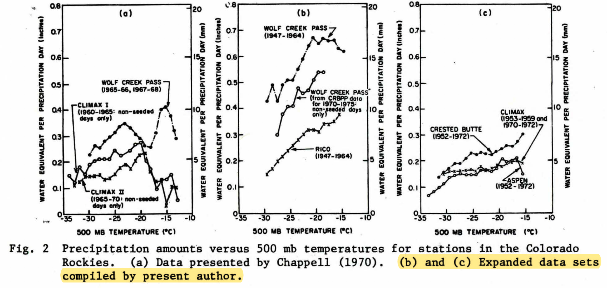
The program for the October 1979 Banff 7th Conference on Planned and Inadvertent Weather Modification came out in the Bulletin of the American Meteorological Society (BAMS) in May 1979. My talk there was going to be a coming out party for me because it was going to be my first presentation at a conference. Previously, I had just run a microphone around at a conference for those who had questions after a talk. And I was going to present at a joint meeting of both the Planned and Inadvertent Weather Modification crowd, and the “Statistics in the Atmosphere” crowd, too; in other words, in front of a big audience of top scientists. May 1979 was the same month that my peer-reviewed paper reanalyzing the Wolf Creek Pass experiment (WCPE) came out as the lead article in the J. Appl. Meteor. That was the work I was going to summarize at Banff.
But what I saw in the May BAMS program for the October conference terrified me. The famous leaders of the Colorado State University (CSU) cloud seeding experiments, Prof. Lewis O. Grant, and their statistician, Dr. Paul W. Mielke, Jr, were going to discuss my paper before I gave it!
Yikes!
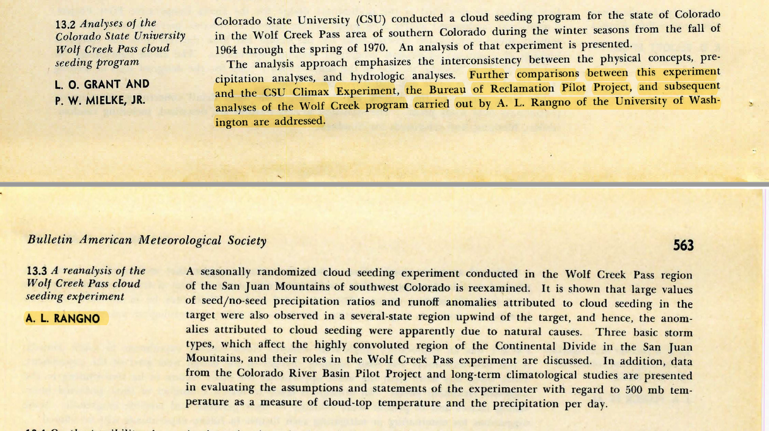
Mielke and Grant were at the top of the mark in the world of cloud seeding/weather modification and had published several papers describing their prestigious cloud seeding successes at Climax and Wolf Creek Pass, Colorado.
I wondered, too, how the program organizers could allow this sequence.
I was going to be humiliated, I was sure, due to errors that I had made, but did not, or could not recognize due to my own bias or ignorance. Maybe I had not even copied down runoff or precipitation data in my dozens of “pen and ink” spreadsheets correctly from the volumes of government published data, the source of my analyses.1
I had palpitations off and on from the time I read that BAMS program until the day before my talk at Banff. I just could not imagine how horrible it was going to be; I repeatedly envisioned that my truly limited skills were going to be exposed. I was sure I would have nothing to say when I got up to speak after Professor Grant and Dr. Mielke had spoken and had surely decimated my reanalysis. I would be standing there, I imagined, with my mouth open, maybe apologizing for errors. It would be similar to that 3rd grade trauma with Ann Stone, a never forgotten humiliation!2
I would go to movies, “Serpico” comes to mind, and right in the middle, I would think about Banff, and my heart would seem to want to burst out of my chest, the palpitations were so strong. I feel lucky I didn’t keel over during those months before Banff. My heart is pounding right now and I am shivering as I flesh out this chapter of my life. This must seem silly to more experienced people I suppose.
September 1st, 1979: dread increases.
I learn from Prof. Peter Hobbs, the director of my group, that a new analysis of the Wolf Creek Pass experiment is being worked up by the seeding experimenters at Colorado State University. I write to their leader, Professor Lewis O. Grant, and ask him about the new analysis, but I get no reply. Now I am positive all the faults that I missed in my paper will be shown up, that my presentation will be shown to be severely flawed and worthless before I give it!
I often thought, too, that I just wouldn’t go to Banff, though my allies at the University of Washington, Profs. Peter Hobbs and Lawrence F. Radke, were going, so that wasn’t really wasn’t an option. Prof. Hobbs was also going to present my Colorado work that showed that there was no basis for the foundation of the CSU cloud seeding claims that supported huge increases in snow due to seeding when the 500 mb (hPa) temperatures were equal to or higher than -20°C, a temperature level that the experimenters had misperceived as ones that were a proxy for cloud top temperatures.
Prof. Hobbs had reviewed my Wolf Creek Pass experiment (WCPE) manuscript drafts, too, when I started bringing them in from home, but he did not know how reliable my work was; Prof. Hobbs was a facilitator/editor of publications that originated within his group. He also did not allow papers to go out from his group without his purview. While improving drafts submitted to him, he usually became a co-author, and sometimes the lead author, as on Hobbs and Rangno (1978, a reanalysis of the Skagit Project) and again on Hobbs and Rangno (1979, “Comments on the Climax and Wolf Creek Pass Experiments”).
The WCPE was the third in a trifecta of cloud seeding successes reported by CSU scientists that formed an imposing edifice of cloud seeding successes. They appeared to reinforce one another, and the Climax experiments had been specifically called out by our best scientists as cloud seeding successes (e.g., the National Academy of Sciences (NAS) in 1973, Warner 1974). Prof. Hobbs had been a member of the NAS panel that had praised the CSU cloud seeding work and it was also cited in his popular 1977 graduate level book with Prof. J. M. Wallace, “Atmospheric Science: An Introductory Survey.”
Moreover, the WCPE cloud seeding success, whose preliminary results were being presented to the Bureau of Reclamation’s cloud seeding division in 1969, was the reason why the massive Colorado River Basin Pilot Project (CRBPP) took place centered on Wolf Creek Pass. Greater potential increases in snow due to cloud seeding were being reported by CSU scientists in the WCPE as a characteristic of storms in southwest Colorado in the San Juan Mountains than in northern Colorado where their highly regarded Climax randomized experiments had taken place.
The CRBPP remains as the nation’s costliest randomized orographic cloud seeding experiment. In my opinion, the Bureau of Reclamation made many efforts to “do it right” by randomizing it, having others who did not know the if a random decision had been called, measure the precipitation each day.
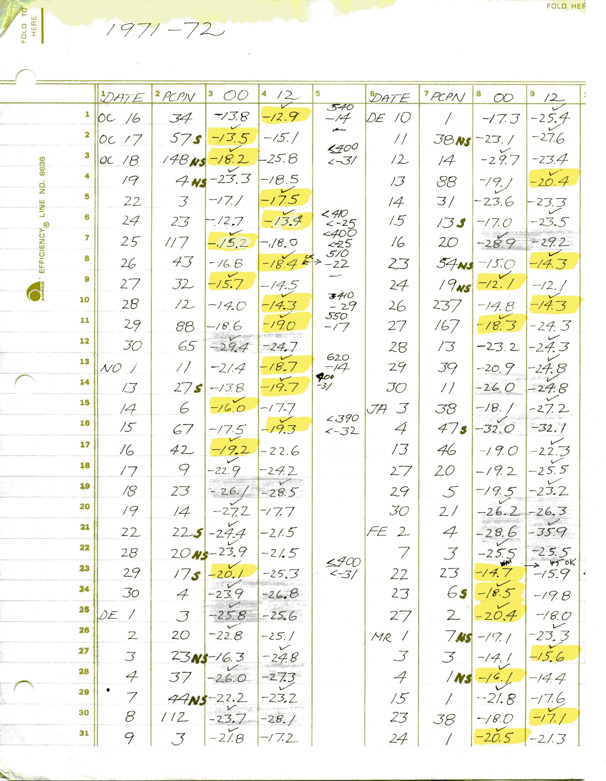
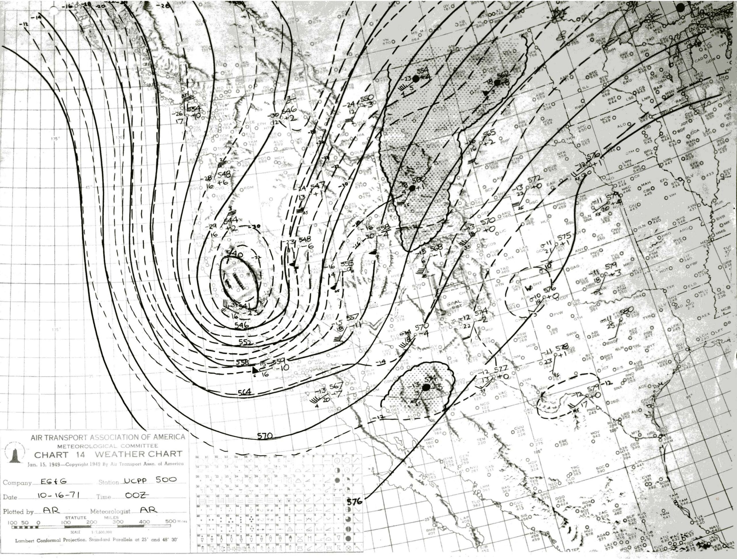
Prior to carrying out the reanalysis of the WCPE, I had been a forecaster with the CRBPP for all its operating winters from 1970/71 through 1974/75, the only meteorologist to have been with it the whole time. I had been, Acting Project Forecaster during its first season following the departure of Project Manager, Paul T. Willis, and Assistant Project forecaster for the remaining seasons. I drew the morning and evening weather maps3and made forecasts five days a week as Assistant forecaster, and seven days a week as Acting Project Forecaster for most of the 1970/71 season.[2] Namely, I had something to do with most of the random calls for an “experimental day” in the CRBPP.
I knew I had to go to Banff or forever be noted as a coward and take whatever Professors Grant and Mielke delivered no matter how humiliated I might be.
—————–
There were no personal computers in those days of the mid-1970s, of course; I was using a $100 Texas Instrument handheld calculator for statistics and correlations from the dozens of pen-and-ink spreadsheets9 I had made copying raw data from the CRBPP, runoffs from geological survey books, and from NOAA Climatological Data and Hourly Data publications. Sometimes I would have to enter a pair of numbers to get correlations three times if the second one didn’t produce the same result as the first cycle. That, too, was a nightmare and so frustrating when it happened.
Due to that May 1979 program in BAMS, I redid the whole WCPE published paper from scratch thinking there must be a serious problem. I didn’t find one, but still, I thought, SOMETHING must be wrong with it and I was going to hear about it at Banff!
———————
Some regrettable, necessary background that might have contributed to the BAMS program sequence I saw: payback?
A careless and inappropriate metaphor that I said to a newspaper reporter at the end of a recorded interview became a secondary headline in the Durango Herald newspaper in November 19754: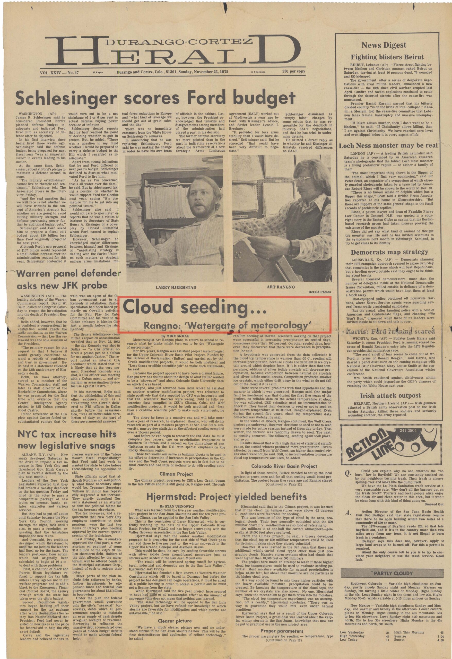
Cloud Seeding… Rangno: ‘Watergate of Meteorology.’”
Since Watergate was a burglary by political actors, I had carelessly implied criminal activity had taken place in the reporting of CSU’s cloud seeding work! Yikes!
What I had meant was that if the CSU work was overturned it would be a “big deal” since it had led to the funding of the massive CRBPP. Watergate was on everyone’s mind in 1975, and what I said just came out without a lot of thought.
The reporter, Mike McRae for the Durango Herald, and who had told me after our long interview that I could review his article before it came out, canceled my pre-pub review the evening before, saying, “Trust me, Art.”
I left for Fresno, California, the next day for short term employment with Atmospherics, Inc., a cloud seeding company, and did not see the Herald article until a week after it appeared. It was sent to me by a Durango friend and E. G.&G., Inc., co-worker.
I couldn’t sleep after I saw it.
How that Durango newspaper headline happened: a cautionary tale for young scientists who might deal with the press.
The reporter who recorded my November 1975 interview within the confines of the Durango Herald offices told me I would get to review his article before it appeared, an unusual offer. I wanted to make sure that what I told him was accurately portrayed. I had been cautious in what I said, and that was reflected in the full article.
However, the evening before it was to appear and a day on which I was traveling to Fresno, California, the reporter, Mike McRae, called to say that I wouldn’t be able to review his writeup beforehand after all. He assured me it would fine with those magic words: “Trust me, Art.”
But after I saw it in Fresno, I couldn’t sleep, as you would imagine. The body of the piece was accurate, but that secondary headline; oh my. I was expecting to hear from CSU lawyers at any time!5
Why was I interviewed in the first place?
I had previously written a critical piece concerning the obstacles to successful cloud seeding that were encountered during the CRBPP that perhaps McRae had seen in the spring of 1974 in a Telluride, CO, magazine, the Deep Creek Review. Unknowingly, the reporter was also setting me up for publication of two contrasting views of cloud seeding; mine and the CRBPP Project Manager, Mr. Larry Hjermstad, a seeding partisan who went on to form a very successful cloud seeding company in Colorado, Western Weather Consultants.
I had no problem with the idea of, “contrasting views” when I saw the paper. It’s what the public should see so that they can take the best path forward when there are questions about something.
Those nationally recognized CSU experiments, lauded by our best individual scientists and the National Academy of Sciences[3] itself, had led to the multi-million-dollar CRBPP, still the mostly costly such mountain cloud seeding experiment ever undertaken ($40-50 million in 2020 dollars). So, in fact, it would be a scientific story of great magnitude if the CSU cloud seeding successes reported on many occasions in peer-reviewed journals, were illusory.
When I was interviewed in November 1975, the CRBPP had ended in the spring of 1975 without proving cloud seeding had increased snowfall. It had been widely expected beforehand that the CRBPP would confirm the CSU results with as much as 50% increases in snowfall on seeded days and something like 250,000 additional acre-feet of runoff even though it had been randomized.
But instead of questioning the validity of the successes on which the CRBPP was based, it was believed, and published in the journal literature on several occasions, that it was the conduct of the CRBPP as well as design flaws that caused it to fail. It was an odd interpretation to me due to the discrepancies in the CSU hypotheses revealed during the CRBPP.
However, blaming the faulty conduct of the CRBPP did remove blame from the sponsor of the CRBPP, the Bureau of Reclamation’s cloud seeding division, and the reviewers of those faulty manuscripts that allowed ersatz claims of great cloud seeding successes to reach the peer-reviewed journals in the first place.
When I next saw “Mike the Reporter” in a Durango supermarket, he advised me, “Never trust a newspaper reporter.”
Q. E. D.
——————–
Consequences of the 1975 Durango Herald article
Mike McCrae’s story was to have a major impact at CSU and was to save me a lot of work (at least for a while). The story reached the National Science Foundation that had partially funded the prior cloud seeding experiments by CSU scientists. They wanted to know from them, “What’s going on?”6
Moreover, I had stated in the Durango Herald article that I was going to reanalyze ALL three of the major CSU cloud seeding experiments! What was I thinking? I had no idea how much work that was going to be. I just felt something had to be done by someone, even if it was by an under-credentialed weather forecaster. But, I “knew the territory” and the weather patterns as a forecaster virtually like no one else. And it was becoming clear that the ”narrative” for the failed CRBPP was design flaws and poor execution on the part of the E. G. & G., Inc. seeding team that I was a part of.
CSU scientists, perhaps concerned over an outsider reevaluating their experiments, beat me to it.
The Apology and Request for Data from Colo State University
After returning from Fresno, California in early December 1975, I drove to CSU to apologize in person for my newspaper gaffe to Prof. Lewis O. Grant, leader of the CSU seeding experiments. But I also went there to obtain data from their cloud seeding experiment at Wolf Creek Pass. I had come to believe it was suspect as a success due to the many discrepancies and obstacles to cloud seeding that were encountered during the CRBPP.
Prof. Grant was extremely gracious in our meeting in accepting my apology and supplied the data I requested; he was that kind of guy.
Updating Prof. Lewis O. Grant on my reanalysis
During the winter of 1975/76 and after my visit to CSU, I remained in Durango to work on the reanalysis of the WCPE, living off my savings (no skiing!). I passed Prof. Lewis O. Grant, progress reports as I moved along on my reanalysis over the following two years. I had promised him I would do this when I met with him in December 1975 in exchange for the CSU data.
He was actually encouraging me as I forwarded my “progress” reports to him—yes, again, he was that kind of guy. Prof. Grant wrote at one point that I had found “something important” as the WCPE unraveled. But after a while he stopped responding to my reports and I stopped sending them.
1976: Joining Peter Hobbs’ Cloud Physics Group
By September 1976, after that self-funded “sabbatical” in Durango during the winter of 75/76, I had been hired by Prof. Peter V. Hobbs to be a part of his “Cloud Physics Group” at the University of Washington when a member of his airborne research group left.7
I had called Prof. Larry Radke in his group in August 1976 about the Cloud Physics Group’s airborne study in Durango that had taken place during the spring of 1974. Prof. Radke informed me that there was a job opening in Prof. Hobbs group and, “Was I interested in applying for it?” I was, and I was interviewed over the phone by Prof. Hobbs soon afterwards and got hired!
In August I was hired into his group as a “Flight Meteorologist” taking the place of Mr. Don Atkinson who had resigned to go back to school. I also had an offer from Atmospherics, Inc., to work more short-term cloud seeding programs for them around the world.
I took the offer from Prof. Hobbs.
I wasn’t sure I was skilled enough to be in academia under a world class scientist like Prof. Hobbs. I wasn’t sure, either, how I would do flying in their 1939 manufactured B-23 research aircraft. I had been on one of their flights during their 1974 research project in Durango and, surprisingly, didn’t get motion sickness.
I started at the University of Washington in mid-September 1976, and continued to work with the data of the Wolf Creek Pass experiment at home and on my own time at the UW. Prof. Hobbs, ebullient about cloud seeding at the time I arrived due to just having finished the successful “Cascade Project,” a non-randomized seeding experiment, took a great interest in the drafts of manuscripts I began to bring in, editing them and revamping them, namely, using his great skills to improve my drafts.
Prof. Hobbs had just been a member of the National Academy of Sciences (1973) and in composing their optimistic report on the Climax, CO, experiments, had written a similar optimistic, “Personal Viewpoint” in 1975 in Sax et al.’s review of weather modification in the J. Appl. Meteor.
Banff: The Nightmare Ends
In a hallway of the convention center in Banff where the talks were going to be given, I ran across Prof. Grant coming my way the evening before my talk. He said, “Art, I’m not even going to talk about Wolf Creek.” I was relieved but wasn’t sure what was going to happen. I still don’t know why Prof. Grant or Dr. Mielke didn’t tell me this months or weeks in advance. I was their nemesis, of course, and maybe it was as simple as that. Or, maybe I was being punished for the awful Durango Herald headline? Who could blame them?
The next day despite what Prof. Grant had said, I was so nervous and sweating before my talk, that I grabbed a can of deodorant and sprayed my hair and forehead with it by accident before walking over to give it. I thought I had grabbed a can of hairspray!
I opened my talk by telling the 300 or so scientists in the “joint meeting” audience that Wednesday about what I had done due to my nerves, spontaneously using it as my intro at this, my first conference presentation. I followed this with a quip, “At least now my forehead won’t sweat.” It got a good laugh, I relaxed some, and got through the 10 min talk that had caused so much stress beforehand.
I ended my talk on what I hoped was a conciliatory note: “Who wouldn’t have believed that all this wasn’t due to cloud seeding?”, referring to the large runoff anomalies of the three seeded seasons of the WCPE reported by Grant et al. 1969, later by Morel-Seytoux and Saheli (1973). The chances that they were due to natural causes could be rejected with a 99% confidence level (the same level as the Skagit Project that was also misperceived as a cloud seeding success).
But, soberingly enough, it was beyond a doubt that natural storm factors are what had created those WCPE runoff anomalies that looked so much like the result of cloud seeding. The key mistake by the experimenters in both the WCPE and the Skagit project s was NOT declaring controls in advance of operations.
It was at this meeting that Dr. Paul Mielke, Jr., told me later that, “we screwed up.” What a terrific guy he was to say that!
Banff ended on a high note. I often think how horrible it would have been if I had, indeed, “chickened out” due to the recurring fear I had after the Banff program came out.
October 1979: All that the CRBPP had been based on was gone after Banff
Retraction of the of the key Climax, CO, randomized wintertime cloud seeding successes first appeared in March 1979 (J. Amer. Stat. Assoc. by Prof. P. W. Mielke, Jr.); the results appeared to be part of a statewide pattern and not localized to Climax. The results were verbally retracted by J. O. Rhea at Banff in October 1979.8 This occurred after so-called “downwind” increases in snowfall on the same days as seeding had seemed to have increased snow so much at Climax were found to be due to a natural bias. Upslope winds that favored more snow on seeded days at downwind locations from Climax were more prevalent on those days (Meltesen et al. 1978) compromising the downwind seeding claims.
So, within six months in 1979, March through October, all that the CRBPP had been based on, which included my WCPE reanalysis published in May, was gone! It can be argued that Mike McRae’s 1975 article set off a major chain reaction.
It was regrettable that the 1979 Banff program summary by Semonin and Hill, finally published in 1981 in BAMS, failed to acknowledge the historic retractions, or the critical unreliability of the Climax experimenters’ claims about cloud top temperatures that was presented by Prof. Hobbs. Perhaps Semonin and Hill did not actually attend the conference? Or forgot what had taken place?
However, Semonin and Hill, while missing those key elements, did take note of the historic “leafletting” of conference attendees by the CSU experimenters. In their leaflet they claimed that the Hobbs and Rangno (1979) critique of the foundations of the CSU experiments got it wrong and defended their work. This is the only conference that I know of in which pre-session conflictive leafletting has been conducted.
The emotions surrounding journal work done on your own time and initiative
I am guessing that many young scientists, excited about their work, have had this experience with their first manuscript.
The manuscript of the WCPE reanalysis was sent out in March 1978, almost two and a half years after I began working on it in November 1975. Prof. Peter Hobbs took a great interest in my unfunded work once I arrived in his group and told him about it after I was hired in September 1976.
Prof. Hobbs did not permit articles to be submitted to journals from members of his group without his going over them. Due to Prof. Hobbs experience and editorial gifts, the drafts I brought in from home were steadily improved.
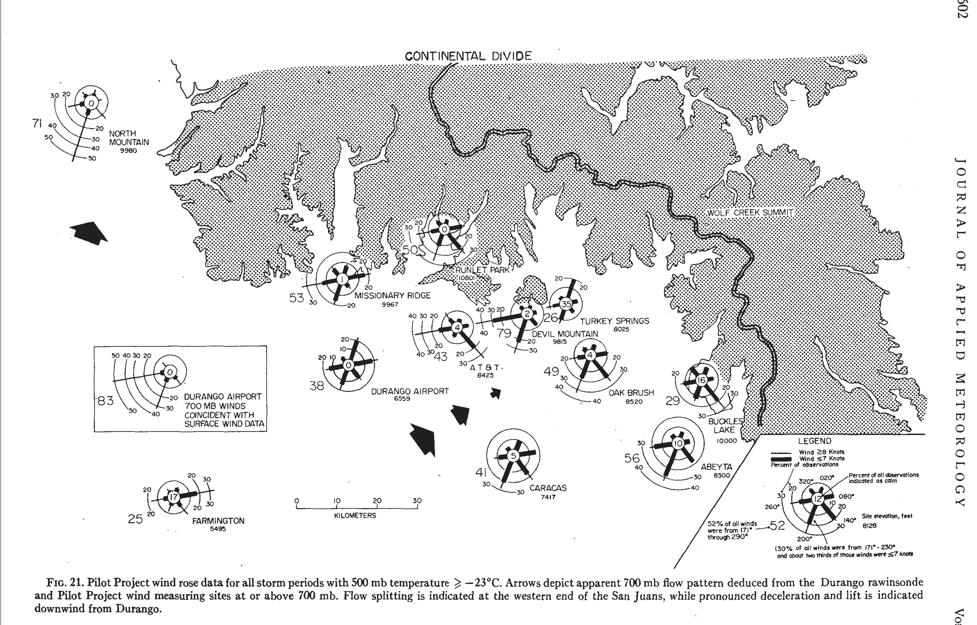
I had even done my own drafting of all of the 21 figures in the WCPE reanalysis, to give you an idea of the magnitude of this overall effort that I was so bonded to. Here’s an example of one I did from the 1979 WCPE reanalysis publication:
As anyone could imagine, doing your own research, drafting your own figures, brings more “ownership” and emotional attachment than might be the case with funded research. This became only too clear when the long-awaited reviews of my reanalysis of the WCPE came back in a manila envelope in August 1978, sent from Dr. Bernard A. Silverman, the editor for this manuscript for the Amer. Meteor. Soc.’s Journal of Applied Meteorology.
It took me a week to open that envelope. More palpitations; would my manuscript be rejected or accepted?
Eventually, I opened it and read the first review that Dr. Silverman had placed on the top of what turned out to be three reviewers’ assessments of my manuscript.
That first reviewer recommended, “reject.”
The reviewer had written that I had no business doing a reanalysis of the CSU work; I didn’t have the background to do it and the paper should be rejected. There was no real criticism of the contents of my manuscript. Nevertheless, I wept uncontrollably, shaking; I was going to fail in my monumental effort.
That “reject” reviewer was only too correct concerning my lack of a technical background to do what I had tried to do. But it was also clear to me after several years after 1975, that a better credentialed researcher was not going to be looking into the original CSU experiments the massive CRBPP had been based on. That would have been risky. It was much better for all involved to walk away from the CRBPP, claiming it was not conducted properly, rather than to learn that millions were spent conducting it due to prior reports of cloud seeding increases in snow that were illusory.
I showed a graduate student friend, Tom Matejka, that first reviewer’s reject letter. Tom, laughing, drew the following cartoon of how he thought that reviewer saw me:
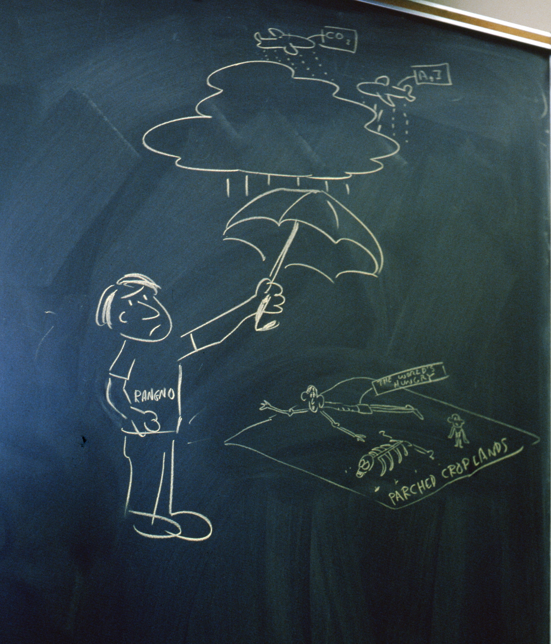 I still treasure this political cartoon by Tom.
But, unknown to me at this same time, CSU cloud seeding researchers were on the brink of retracting their results for the more prestigious Climax experiments.
My five-season experience as a forecaster, and having worked under orographic precipitation specialist, J. Owen Rhea, during the CRBPP gave me the knowledge and wherewithal to do it. It may sound “crackpotty”, but I felt I had a responsibility to do it since no one else was going to and I “knew the territory.” I couldn’t just walk away from it. All that was learned during the CRBPP strongly suggested there could not have been snow increases due to seeding in the prior CSU experiments.
============
It took me about another week to look at the other reviews contained in that manila envelope Silverman had sent as I pondered the size and effort I had put into what surely was going to be Anand content in enormous failure. I am sobbing right now remembering that time; tears flowing!9 Where did this come from? I haven’t thought about this chapter of my life in decades, but it’s like the same exact feelings I had so long ago have body-slammed me as I write about them! Maybe I need a grief counselor…
When I finally had the courage to look at the other reviewers’ assessments, they both recommended, “accept” with revisions.
I wept uncontrollably again. I was going to “get in” after all, though it would now be without Prof. Hobbs purview in carrying out “revisions” required by the reviewers. Why did Prof. Hobbs wash his hands of my effort at this point? Answer: over the placement and content in an acknowledgement.
————
Professor Hobbs washes his hands of the WCPE manuscript before the final submission
By the time that the reviews had come in, Prof. Peter Hobbs had washed his hands of my manuscript. Prof. Hobbs had written an acknowledgement for himself and had placed it ahead of that for J. Owen Rhea whom I had originally placed first. Owen Rhea was the initial lead forecaster for the CRBPP, and later, Acting Project Manager under whom I worked. I had learned so much working for him concerning orographic precipitation patterns. I don’t recall that I had thanked Prof. Hobbs in those early drafts after he improved them. I only have a 1977 draft, prior to Peter’s scrutiny in which this acknowledgment appeared in which I REALLY wanted to thank the CSU’s Prof. Grant and his staff:
“Acknowledgements. The author would like to thank Paul Willis of the National Hurricane Research Laboratory and Dr. J. Owen Rhea of Colorado State University who, as Project Manager and Project Forecaster, re spectively, for the first season of the Pilot Project, provided many insightful and illuminating discussions of the Colorado State University cloud seeding experiments which helped inspire this paper. I would also like to thank Professor Lewis O. Grant and the staff of Colorado State University for their unhesitating cooperation and willingness to examine “both sides of the coin.” Appreciation is also given to Mr. Larry Hjermstad of Western Weather Consultants in Durango for his cooperation in providing climatological data and copy facilities at a low cost, and Mr. Travers T. Ward for copying it all.”
The 1979 acknowledgement in the WCPE reanalysis publication was this:
“Acknowledgments. The author wishes to extend his deepest appreciation to Dr. J. Owen Rhea for his in valuable encouragement, comments and criticism during the course of this research. Particular thanks is also due Professor Peter V. Hobbs whose cogent editing and restructuring of this paper greatly improved its presentation and coherence. A review by Dr. Colleen A. Leary also improved the intelligibility of this paper. I would also like to thank Professor Lewis 0. Grant and the staff of Colorado State University for their unhesitating cooperation and willingness to supply data and, other information relative to the WCPE. Appreciation is also extended to the Bureau of Reclamation, Division of Atmospheric Water Re sources Development, and to Mr. Larry Hjermstad for supplying data relative to the Colorado River Basin Pilot Project. The author is also indebted to Mr. Travis T. Ward of Durango for his copying of the numerous copies of Climatological Data requested by the author.”
Peter Hobbs also suggested at one point that he would normally be a co-author after editing and improving the presentation of manuscripts like mine. I didn’t take the hint; maybe I should have?
I journeyed on and the revised version of the manuscript went to the journal in the fall of 1978 without Peter Hobbs’ expert purview. I had now alienated perhaps my only ally, certainly the most important one.
Speculation on the fallout from the acknowledgement kerfuffle with Prof. Hobbs
The above happenstance may also explain why Prof. Hobbs took first authorship on the reanalysis I did of the Skagit Project (Hobbs and Rangno 1978) done on my own initiative, but while at work in Prof. Hobbs’ group. It was submitted to the journal after the WCPE manuscript was submitted but was accepted and published ahead of it. I then I became concerned that it might appear that Prof. Hobbs had directed me, a little-known player in the weather mod game, in the WCPE paper that was to follow. It would make sense that a grand player in the weather mod arena like Prof. Hobbs had directed an under credentialed subordinate on how to reanalyze cloud seeding experiments.
An inappropriate authorship sequence was the case, too, in the work I did that undermined the foundations of the Climax and Wolf Creek Pass experiment that was published as, “Hobbs and Rangno” 1979, J. Appl. Meteor. Prof. Hobbs even presented this work as a sole authored work at the International Conference on Cloud Physics at Clermont-Ferrand. I acceded to these authorship acts, though they were unsettling. Only recently did I blow a gasket when I discovered this caption under Figure 2 of Hobbs (1980):
Issues of credit and authorship within Prof. Hobbs’ group have persisted right up until today (2021), when a senior faculty member, formerly in Prof. Hobbs’ group, could not cite a paper on rainbands where Prof. Hobbs was the lead or sole author because he had not done the work and knew who did. I know that a reader at this point would say, “Get over it!” Sorry, can’t.
ALR, with a life story vignette by someone who only wanted to forecast weather when he came to Durango. Thanks for reading it, if you do.
==============FOOTNOTES========================
1An example of a pen and ink spreadsheet I did in the late 1970s for those younger researchers who can’t imagine such a thing. You can’t imagine how many of these kinds spreadsheets I did in support of the WCPE reanalysis! Dozens at least. Bottles of Shaefer’s ink were consumed!
2I remembered, Ann Stone, and that third grade math humiliation where Ann was to add up a column of five of the same number, and I was to multiply that number by five, all this with both of us at the blackboard in front of the class. I was to demonstrate how much faster multiplying something was than adding up a column of the same number. I couldn’t do that multiplication while Ann finished quickly.
6J. O. Rhea, Prof. Grant’s grad student, personal communication, 1975.
3The Bureau of Reclamation specified that the seeding contractor, E. G. & G., Inc., personnel draw their own regional surface, 700 and 500 hPa weather maps rather than rely on National Weather Service facsimile maps. I was a good weather map drawer/artist. Since it’s fall, I will use this map with a bit of humor in it.
4Recently, having a different perspective, I have deemed this Durango Herald article as a tongue-in-cheek, “Historic Moments in Weather History: “Art Rangno EXPLODES onto the weather mod scene”, a title meant to generate a smile. I was to work on reanalyses and critical commentaries on cloud seeding experiments for the next 45 years! Still am! What is the matter with me? Get a life! Haha, sort of.
5That was to happened later….several years later, and had to do with asking for an investigation of some possible real science crime; withholding results that might have prevented the multimillion dollar CRBPP randomized cloud seeding experiment from taking place.
7I was going to take the place of their, “Flight Meteorologist,” Don Atkinson, who later confided in me that he thought the job I was going to take, his, was a “dead end.” Atkinson was resigning to go get his master’s degree in business administration. He eventually returned as the business administrator for the University of Washington’s Atmos. Sci. Department.
8Rhea presented for Grant et al. who was officially listed as the presenter.
9That surprise grief attack happened a few months ago when I first started rehashing this “life chapter” after forgetting about for so many decades. I seem more inured to emotions about this as I go through draft today.


