About real clouds, weather, cloud seeding and science autobio life stories by WMO consolation prize-winning meteorologist, Art Rangno
Regime change still ahead, as are more Cal blasters
Check it out, spaghetti1 lovers:
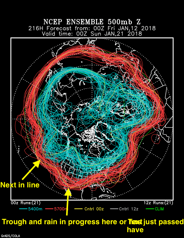
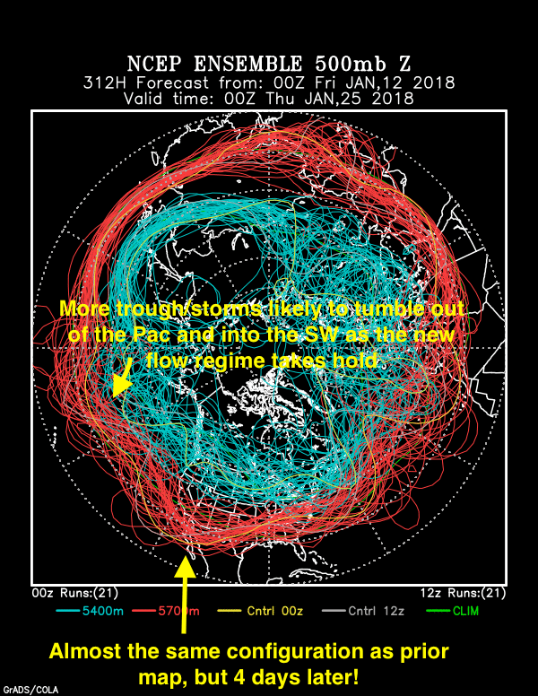
Valid at 5 PM AST, January 20th. Bulges toward the Equator indicate areas of stormy weather in “troughs” and we’re in one! Will January have above average rain in Catalina? I think so now. How much is that? Oh, only 1.53 inches and we have 1.10 inches now.Valid at 5 PM AST on January 24th. A second trough with its stormy weather, or threat thereof, is indicated for Arizona and the SW! These storms look strong coming into California, representing good news for filling reservoirs after the early winter drought, but bad news for mudslides in those huge burned areas. The last storm produced 4-7 inches in 24 h, with rainrates sometimes exceeding an inch an hour, about as high as they get in wintertime in Cal.
So, enjoy the warm, dry spell we’re in now, if that’s what you like and that is why you are in old AZZY, since you probably won’t be as happy after the 20th or so.
Pretty excited about this change coming up, one that will break five months of below average rainfall here in Catland with January’s total likely to be above average now! Yay for desert greening, too, that soul-filling spring phenomenon we all need as much of as possible.
The End
—————————- 1You can go here and see the whole sequence from the NOAA spaghetti factory (aka, ensemble factory).
Author: Art Rangno
Retiree from a group specializing in airborne measurements of clouds and aerosols at the University of Washington (Cloud and Aerosol Research Group). The projects in which I participated were in many countries; from the Arctic to Brazil, from the Marshall Islands to South Africa.
View all posts by Art Rangno