About real clouds, weather, cloud seeding and science autobio life stories by WMO consolation prize-winning meteorologist, Art Rangno
Mid-month outlook: December 2018 to close out on a wet note (or notes)
Mr. Cloud Maven person doesn’t have to tell you, the advanced Cloud Maven Juniors, where he gets such an outrageously distant forecast that most meteorologists are afraid to make; it originates with clustered lines on something we call the “ensembles”, plots representing the greatest advance in computing and weather forecasting since the Intel 486 chip could be had at 386 prices. In case you don’t believe me again…..
Here’s what I am talkin’ ’bout, the “ensembles” or fondly, “spaghetti plots” for 5 PM AST, the 27th of December, two weeks from now:
The red lines are about where the middle and southern edges of the core of the jet stream is, so, its going to be way south of us, “way” being at least a few hundred miles in its average position by then. That means RAIN here! “Whey” is something else, we don’t what; you should make that clear if you’re pronouncing this exact forecast to someone.
We ignore immediate weather and the possibility of rain on the 16th and again on the 18th ; the TV men and women of weather always have that well-covered.
Looks to be shaping up to be a very good spring wildflower season I’d say. Tell your friends.
The End, except for some recent cloud photos:
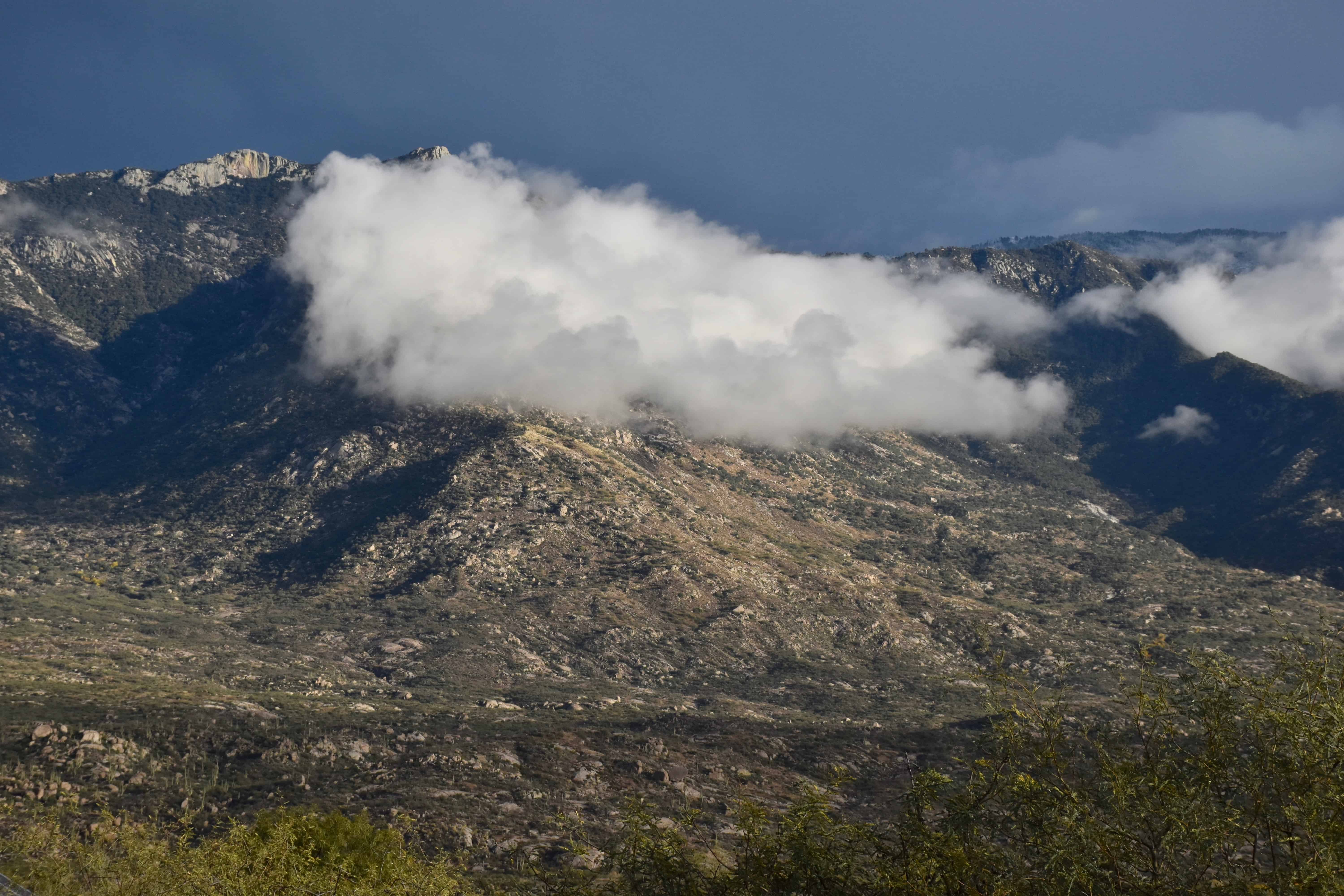
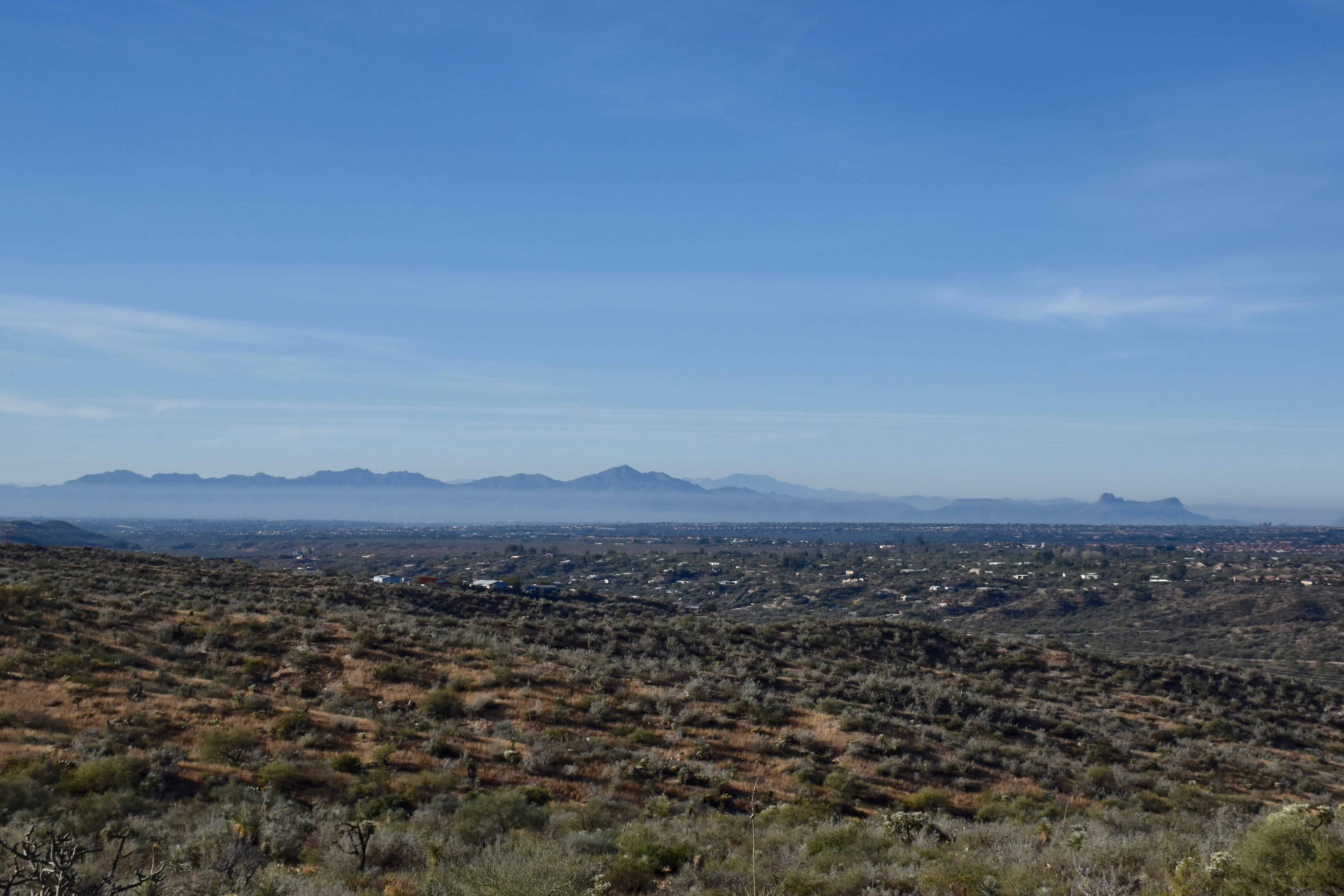
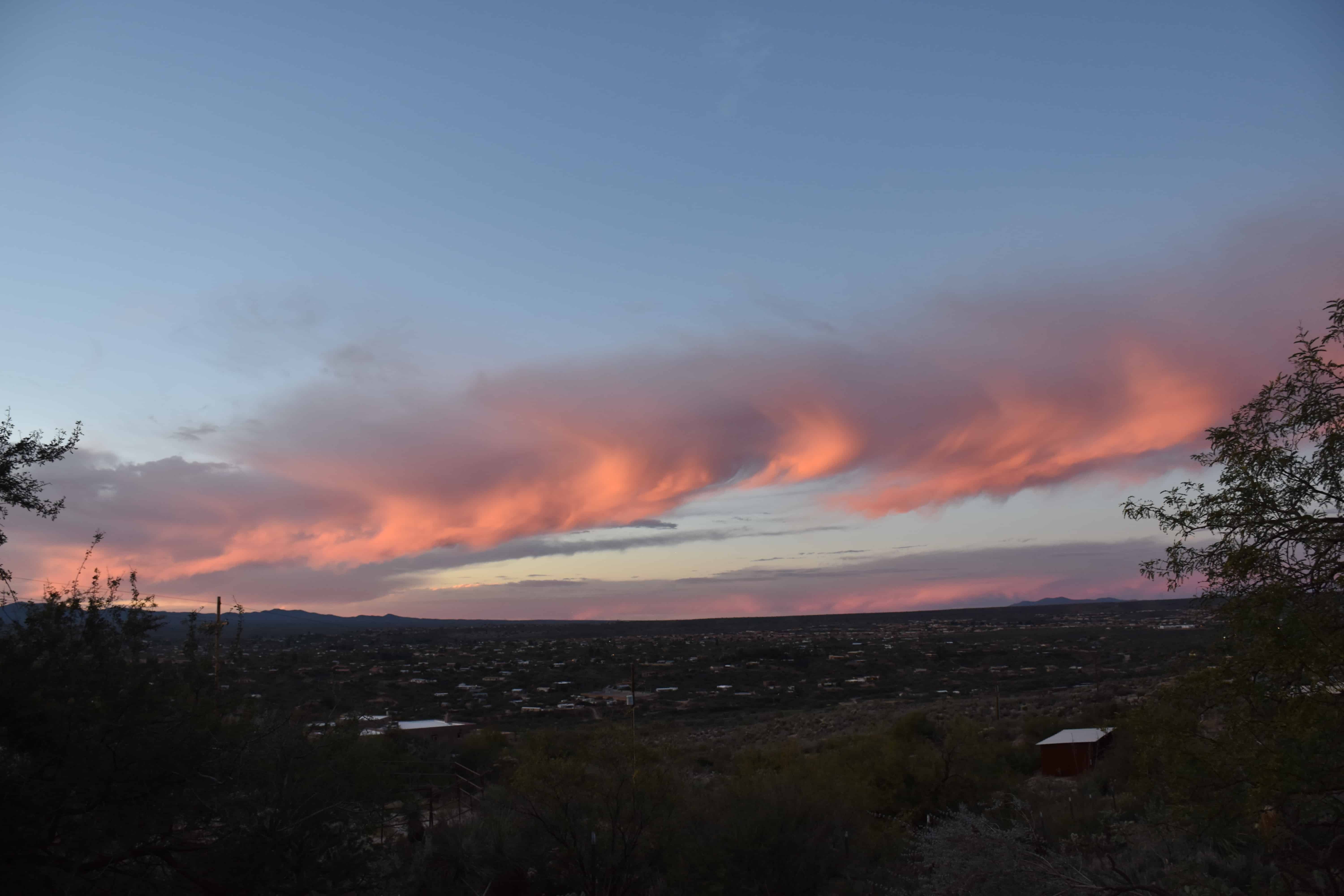
From a few days ago, little fluff-fluff cloud on Samaniego Ridge.Be thankful we live in Catalina. Here the TUS urban plume exits TUS borne on SE winds toward Continental Ranch and points W and N. Rarely affects Catalina. Sometimes this urban plume is referred to as the Mark Albright smog plume, named after a well-known U of WA meteorologist who accidentally bought a house over there.December 11th. A band of Cirrus spissatus with almost regular virga trails graced the evening sky.
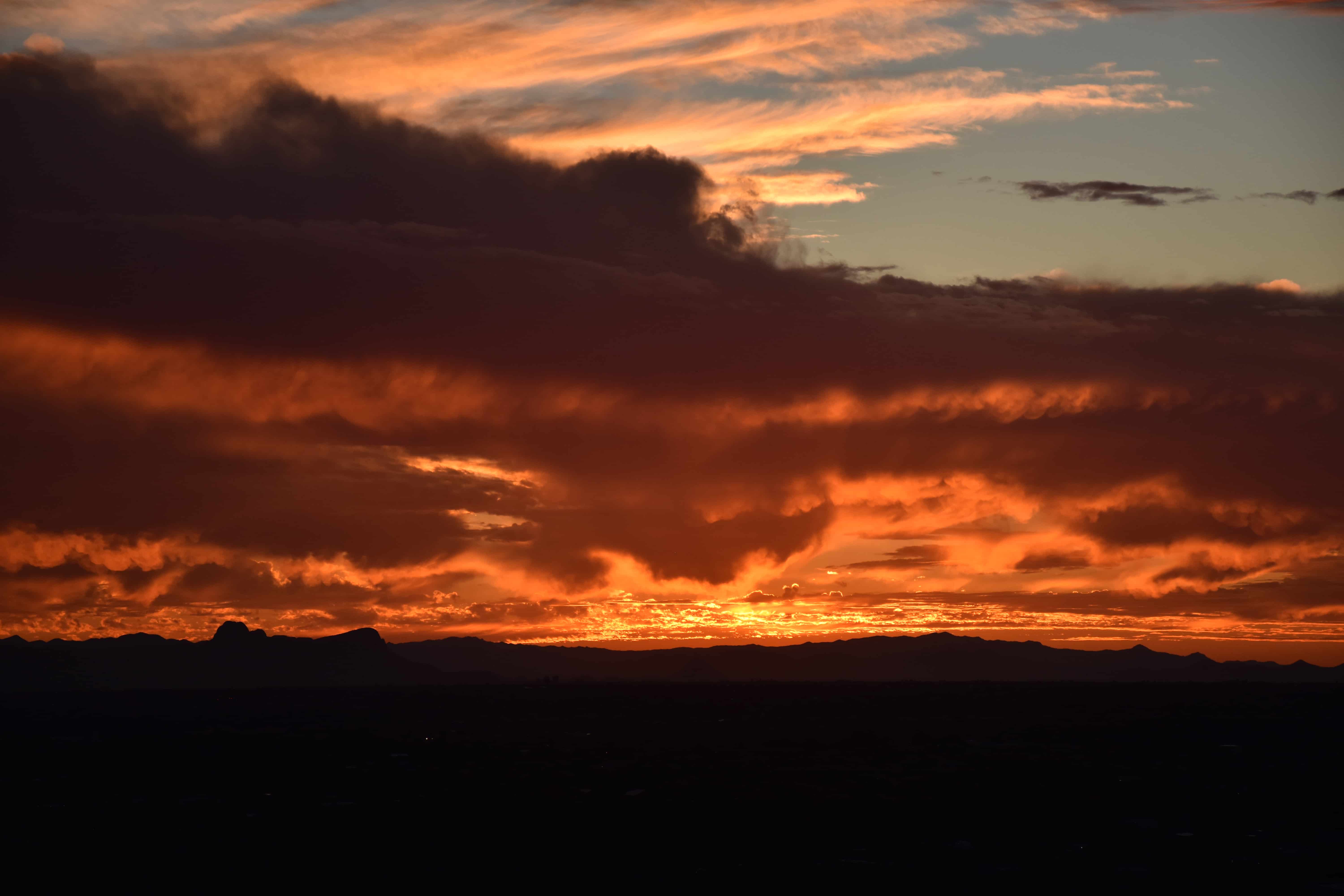
Finally, also from December 11th, this beauty:
Altocumulus castellanus with heavy virga trails. As a cloud maven, you would estimate cloud top temperatures are less than -20°C, and probably closer to -30°C.
Author: Art Rangno
Retiree from a group specializing in airborne measurements of clouds and aerosols at the University of Washington (Cloud and Aerosol Research Group). The projects in which I participated were in many countries; from the Arctic to Brazil, from the Marshall Islands to South Africa.
View all posts by Art Rangno
3 thoughts on “Mid-month outlook: December 2018 to close out on a wet note (or notes)”
Thanks for taking the rain from us , Art. We have had enough for the whole month now.
Thanks for the photos Art and reminder about the old, expensive computers.
I particularly like the top photo because of all the rock outcroppings. I suppose the higher elevation stuff is Mt. Lemmon, but the boulders in the foreground seem much lower. It would be fun to wander around and scramble on those boulders.
We still have melting snow here from a few big snowstorms (for the Seattle area, anyway). For more on ice and snow, I post at http://www.storyofsnow.com/blog1.php
Jon
Thanks, Jon. That image out of Computer Shopper, still makes me gasp at how much we were willing to pay for such little potential. Of course, it was huge potential back in the day!
 Right out of Computer Shopper magazine, too! You can’t find deals like this today, that’s for sure.
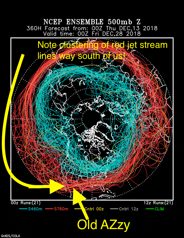
Thanks for taking the rain from us , Art. We have had enough for the whole month now.
Thanks for the photos Art and reminder about the old, expensive computers.
I particularly like the top photo because of all the rock outcroppings. I suppose the higher elevation stuff is Mt. Lemmon, but the boulders in the foreground seem much lower. It would be fun to wander around and scramble on those boulders.
We still have melting snow here from a few big snowstorms (for the Seattle area, anyway). For more on ice and snow, I post at
http://www.storyofsnow.com/blog1.php
Jon
Thanks, Jon. That image out of Computer Shopper, still makes me gasp at how much we were willing to pay for such little potential. Of course, it was huge potential back in the day!
a