Comprehensive “Reply” to a “Comment” on the “Review of the Colorado River Basin Pilot Project”

First, as a subterfuge to gain more than one or two readers, this priceless photo taken recently on our porch of our dog, Cody, doing a “play bow” for a free range cow that’s drinking out of his kiddie pool.  Tell  your  friends…Full title:  

A Review and Enhancement of the “Comment” by B. Geerts and P. Adhikari on “Great Expectations: A Review of the Colorado River Basin Pilot Project—The Nation’s Most Expensive Randomized Orographic Cloud-Seeding Experiment” by A. L. Rangno and D. S. Schultza

aCentre for Atmospheric Science, Department of Earth and Environmental Sciences, and Centre for Crisis Studies and Mitigation, University of Manchester, Manchester, United Kingdom

This post is linked to in a short published “Reply” in  the AMS’ journal, Weather, Climate and Society.  The full article is here:

https://journals.ametsoc.org/view/journals/wcas/17/3/WCAS-D-24-0076.1.xml?rskey=OsFQ7b&result=24

Corresponding author and sole writer of the short and this “comprehensive” Reply:  Arthur L. Rangno, art.rangno@gmail.com

Geerts and Adhikari (2025), hereafter “GA25,” have provided graphics of long-term cloud and precipitation characteristics for the San Juan Mountains where the Colorado River Basin Pilot Project (CRBPP) took place.

The comments of GA25 are a subset of a major computer driven analysis of SLW over the entire western United States by Adhikari et al. 2025, an article that could be considered one of the most important in support of cloud seeding activities ever published due to its scope and because of calculations indicating appreciable supercooled liquid water (SLW) over so many western mountain ranges.  Absent a critique of GA25 as here, a subset of Adhikari et al. (2025[1]), the latter’s results are likely to be taken prima facie as showing widespread cloud seeding potential.  In doing so, Adhikari et al.’s (2025) results, if flawed, could trigger widespread, but ineffectual seeding operations.  This “Reply” falls under the rubric described by Changnon and Lambright (1990):  “Honest controversy is essential for progress in science” and here is some, in long form.

GA25 point that their findings are dependent on the cloud model they employed. In this Reply, we will check the accuracy of that model against in situ observations made in support of the CRBPP.  Too, we know from the checkered history of cloud seeding that reports of cloud seeding potential deserve extra scrutiny.  Too often we have been misled by exaggerated claims, even from academic sources,  such as those that led to the CRBPP,  and most recently by those that led to disappointing randomized seeding results in Wyoming (Rasmussen et al. 2018) and Israel (Benjamini et al. 2023).   In essence, “the beat goes on.”

This magnitude of this Reply, too, is inspired by the recent editorial in Weather and Forecasting by Bunkers et al. 2023 that encourages such exchanges and as such, that they should provide interesting new information for the journal reader.  This has been done.

This “enhanced” Reply is organized in the following way: A brief review of the findings reported from the CRBPP that are relevant to GA25; an evaluation of the claim by GA25 that ice particle concentrations are solely a function of cloud top temperature;  the CRBPP precipitation climatology is contrasted with that in GA25, and lastly; a rudimentary evaluation of the existence of a non-precipitating, relatively deep, low-based cloud that is required to explain all of the prior successes that the CRBPP was based. There is also a brief description of CRBPP spring storms because those differ appreciably in their onset from the RS25 diagram (4b) that was more typical of fall and winter storms.

  1. Was the seeding potential indicated by model computed radiometer values  when 500 hPa temperatures were >-23°C  realized during the CRBPP?

The great expectations from seeding when the 500 hPa temperature was >-23°C were not realized in the CRBPP (Rangno 1979, Fig. 18).  In the only test of the Grant et al. 1969 criterion under which large seeding increases in snowfall (50-200%) in the Wolf Creek Pass experiment,  Rangno (1979) found that in the CRBPP there was no viable indication of increases in snowfall on such days.  However, if present, the appreciable SLW calculated by GA25 was not generally available to CRBPP ground seeding operations in the first two months of the DJFM period due to frequent deep stable layers (e. g., Marwitz et al. 1976, Rangno 1979, Marwitz 1980).

In contrast to early and mid-winter storms, there was virtually no impediment to vertical dispersion of ground released plumes of silver iodide during the latter part of the CRBPP operations, March through mid-May.  An examination of this period by GA25 and the result of random seeding during this period could make an interesting follow up study as a test of the “appreciable” SLW hypothesis when the 500 hPa temperature is >-23°C.

Too, springtime storms onset differently than in the fall and winter archetype shown in RS25, 4b.  In the spring, storms were generally not preceded by vast, lowering layers of high and mid-level clouds having high and cold cloud tops as were the fall and wintertime storms (e.g., Medenwaldt and Rangno 1973, Fig. 4.2).  Rather, they onset with increasing cloud forms such as higher based Cumulus and Stratocumulus whose bases lowered while tops rose, and ice and virga began to appear in them as an upper trough approached (Medenwaldt and Rangno 1973, 1974, Hjermstad et al. 1975).

2.  Airborne measurements in support of the CRBPP differ substantially from those deduced in model calculations by      GA25 on when seeding potential exists

GA25’s findings inadvertently raise questions about the usefulness of airborne studies and also the validity of  model calculations in GA25 that indicated when appreciable SLW is supposed to be present.

Why?

The University of Wyoming research team flew ~45 h in support of the CRBPP during its final season (Marwitz et al. 1976, Marwitz 1980, Cooper and Marwitz 1980, Cooper and Saunders 1980, Cooper and Vali 1981).  They asserted from their measurements that the seeding potential was near the end of storms when relatively shallow orographic clouds, under cooling aloft, became more convective and therefore, contained more SLW than in the early stages of storms.  In the early, warm, stable stage of the storms, Cooper and Saunders (1980) wrote: “During early storm stages the precipitation developed primarily by diffusional growth of ice crystals.”  They did not encounter “appreciable” SLW as the model used by GA25 calculated under those conditions.  Rather, they found that in the early stage of storms, the SLW content averaged “<0.1 g m-3.”  The lack of rimed ice particles supports the view of limited if any SLW during this stage.  Quoting from Marwitz et al. (1976, p52): “The stable stage of the San Juan storms is therefore unseedable, because there is negligible liquid water present and because the seeding material cannot the cloud level from the ground-based generators.”  The stable stage referred to by Marwitz et al. was when the initial precipitation bearing cloud shields arrived in the San Juan mountains and when 500 hPa temperatures were almost always >-23°C, and usually with much colder cloud tops. In the latter cold phase of the CRBPP storms, the Wyoming team reported that SLW averaged 0.5 to 1 g m-3 in relatively shallow orographic clouds with moderate top temperatures or  5-10 times greater SLW than in the early stage of storms.

Also,  the early stage of storms was characterized by chaotic surface and low-level winds (Marwitz 1980[1]), a condition that hampered targeting from ground seeding releases while the cold stage was much less so.

For these several reasons, the Wyoming team deemed the early warm portion of storms unsuitable for cloud seeding.

Thus, the Wyoming team’s conclusions on what storm stage is best for cloud seeding are diametrically opposed to those of GA25.  GA25 concluded that the warm, early portion of storms marked by 500 hPa temperatures >-23°C, had the most cloud seeding potential due to appreciable model calculated SLW, twice as much, GA25 stated, as their calculations indicated for the cold stage of storms when hPa 500 temperatures were <-23°C.

——footnote concerning the Wyoming analyses of surface winds——-

[1] Marwitz (1980) and Marwitz et al. (1976) produced maps showing a “convergence” zone during the early portions of storms.   Marwitz was contrasting CRBPP surface reporting stations with elevation differences of about 2000 feet (650 m) to arrive at the ersatz idea of a convergence zone.  No convergence zone is seen in the streamline analyses by the E. G. & G, Inc., forecasting team (e.g., Medenwaldt and Rangno 1973) who realized the effect of elevation differences from the reporting stations could lead to the misperception of a surface-based convergence zone.  Marwitz was alerted to this problem by the writer.

——end of footnote——-

The differences between GA25 and the Wyoming team’s results could be laid to several factors inherent in airborne research, in a defense of GA25’s calculations. Limited airborne sample volumes, limited flight durations on a relatively few storm days, and the inability in IFR situations to sample in the lowest elevations above the ground, all of which could have contributed to why the Wyoming researchers concluded that the cold stage of the storms was the one with seeding potential, not the warm one.  Thus, even with as much contrast as they reported in seeding potential, the Wyoming team’s results must be considered, “suggestive,” not conclusive.  More in situ and radiometer measurements are critically needed to validate the GA25’s model calculations due to their importance regarding future cloud seeding operations.

In a further comment regarding the seeding potential indicated by GA25, Vardiman and Hartzell (1976) reported that rimed particles were usually present at the top of Wolf Creek Pass regardless of the temperature at 500 hPa.  Their report suggested that some SLW is escaping the precipitation process on the west slope of Wolf Creek Pass and may represent some seeding potential that was not realized during the CRBPP.  Their findings, moreover, agree with those of Hindman (1986) concerning SLW at mountain tops in the Colorado Rockies.

3.  The factors that affect model calculations of appreciable radiometer SLW in storms with 500 hPa temperatures >-23°C

 Spuriously low ice particle concentrations output by the model used by GA25 (Thompson and Eidhammer 2014), would lead to appreciable SLW not consumed by ice particles.  What is the concentration of ice particles that the model produces over and upwind of the San Juans with cloud tops at -20°C?  How do they compare to the concentrations encountered by the Wyoming team?  This critical information is not displayed or known by GA25; nor is it displayed in Adhikari et al. 2025, the latter the progenitor study of which GA25 is a subset.  A request by this writer for benchmark Thompson and Eidhammer (2014) model calculated ice particle concentrations at -10°C, -20°C, and -30°C for comparison purposes with the Wyoming CRBPP measurements and this in other field programs could not be accommodated by GA25, nor from Adhikari et al. 2025 (B. Geerts, personal communication, November 2025).

As was learned from the many models evaluated for the prediction of orographic precipitation by Liu et al. 2011, accurate model microphysics are critical in the assessment of seeding potential.

One definite problem in the Thompson and Eidhammer model is that the onset of ice in “maritime” clouds is at -13°C, a far lower temperature than has been observed in numerous maritime cloud studies over the preceding 50 years.   Ice onsets routinely  in such clouds at temperatures as high as -4°C (e.g., Mossop et al. 1967, 1968, Ono 1971, Hobbs 1969, 1974, Hobbs and Rangno 1985, 1990, 1998, Rangno and Hobbs 1991, 2005).  Due to this oversight, model calculated SLW will be too high in maritime and near maritime locations in the parent article by Adhikari et al. 2025 along the West Coast of the United States because ice will not onset in model clouds until top temperatures are -13°C.

But what about ice formation in the CRBPP ?

Figure 1, in effect a reality check, shows an example of a shallow orographic cloud’s rapid evolution into a glaciated mass after the formation of all SLW upwind edge.  This photo demonstrates how orographic clouds can rapidly convert to ice clouds and is for the purpose of showing how important it is for a model to do what nature does.  Figure 1, too, is a virtual replication of the orographic cloud described by Cooper and Vali (1981) for an orographic cloud in the San Juan mountains with a top at -20°C, about the same as the cloud top temperature in the photo.  Too, the Cooper and Vali studied cap cloud  evolved into an ice cloud just like this one, except for having a thin SLW top.  Cooper and Vali measured a maximum of 100 per liter concentration of ice particles downwind from the cap cloud’s leading SLW edge.  The model used by GA25 and by inference, Adhikari et al. 2025, should reflect this evisceration of SLW across barriers in clouds with similar top temperatures of about -20°C if model ice particle production is reasonably accurate.

Figure 1.  A cross-section lifecycle of a shallow orographic cloud passing over the La Plata Mountains northwest of Durango, CO, during the CRBPP, that illustrates how liquid water at the upstream edge of the cloud (leftmost) is consumed by the rapid formation of high concentrations of ice particles as the cloud air moves downwind (center and right).  Ice concentrations are estimated by the author to be in the 10s to 100 per liter by the density of the ice cloud.  Photo by author taken at 1200 MST, 31 March 1974, a CRBPP experimental seeded day (Medenwaldt and Rangno 1974; Elliott et al. 1976) with southwesterly flow from the surface through 500 hPa.  Cloud tops were estimated in real time by this writer to lie be between 16,000 and 17,000 feet Above Sea Level which would have made top temperatures of about -20°C. The 500 hPa temperature was -21.4°C at 1045 MST decreasing to -24.0°C by 1410 MST.  The La Plata Mountains are upwind of the CRBPP target.

Similar comparisons to measurements from airborne research besides those made during the CRBPP can be examined at the several other barriers examined by Adhikari et al. (2025) that would help to establish the critical reliability of “model ice concentrations” (e.g., those in the Cascades by Hobbs 1974, 1975, Hobbs and Atkinson 1976).

4.  Do ice particle concentrations increase as cloud tops get colder as stated by GA25?

Yes and no.  GA25 make the general statement that “natural ice crystals become increasingly appreciable at lower temperatures.”  This is not the end of the story.  We know from the CRBPP airborne studies that no ice formed in those rare San Juan Mountain clouds with tops >-10°C (Cooper and Saunders 1980, Fig. 11b).  At temperatures between -10°C and -19°C in measurements near cloud tops, Cooper and Saunders did find from a “very limited sample,” indeed and as asserted by GA25, that ice crystal concentrations increased linearly with lower crystal origin temperatures from 2 to about 50 per liter.

Disruptions of a relationship between cloud top temperatures and initial ice particle concentrations arise after the formation of the initial ice crystals, usually near cloud top.  The ensuing deterioration of that relationship is due to fragmentation of crystals via collisions with other ice crystals(Vardiman 1978), the breakup of delicate crystal forms when growing to larger sizes, or due to collisions with cloud droplets during riming (Dye and Hobbs 1968),  crystal collisions with graupel, or “unknown mechanisms.”  Quoting Cooper and Saunders (1980) from ice crystal data collected at levels below cloud top in the CRBPP: “The observed ice crystal concentrations were far above the corresponding ice nucleus measurements, and the discrepancy could not be attributed to known ice multiplication processes.”

Furthermore, the assertion of a relationship between cloud top temperature and ice nucleus concentrations expected to be activated at cloud top has been refuted on many occasions (e.g., Hobbs 1969, Auer et al. 1969, Vardiman and Hartzell 1976[1], Grant et al. 1982, Rangno and Hobbs 1986, Korolev et al. 2003).

Grant et al. 1982 in an inventory of orographic clouds wrote: “In general, the largest values of crystal concentrations are observed within the lowest levels of the clouds.  These observations are not consistent with the concept of ice nucleation occurring to a greater extent at the lowest temperatures (i.e., cloud top) followed by crystal fallout.” The Grant et al. statement was extremely important because it was Grant’s 1968 findings that ice particle concentrations were a function of cloud top temperature that helped lead to the CRBPP and during it, caused the change to cloud top temperatures from that at 500 hPa for two seasons before it was abandoned.

As an early example of the lack of a relationship between cloud top temperatures and ice concentrations was reported by Borovikov (1968) who wrote: “Should the phase of a cloud depend on temperature only the frequencies of liquid phase of clouds of different forms might be the same at any temperature. However, our data does not prove this idea.” (Italic “data” inserted by this writer in place of “Figure 5” for clarity.)

  • Simple cloud observations also refute the idea of increasing ice particle concentrations with lowering cloud top temperatures.  Altostratus and Nimbostratus have been observed to have SLW (Altocumulus-like) tops of -25°C to < -30°C (Cunningham 1957, Hobbs and Rangno 1985, Rauber and Tokay 1991, Korolev et al. 2003).   This once unexpected situation has been termed, “the upside-down storm” because the very coldest portion of the cloud system is SLW and the warmer portions are all or mostly ice crystals. A vignette of the “upside down” storm can be seen in Altocumulus clouds trailing virga as here:

Observations of SLW-topped stratiform clouds with very low top temperatures are a direct refutation of the idea that “natural ice crystals become increasingly appreciable at lower temperatures” as GA25 assert. No water-topped layer clouds at the low temperatures cited above could exist if the GA25 assertion was true, and by inference, if the model they used was reliable in predicting ice particle concentrations.  Furthermore, the ice particle concentrations falling out of such clouds are not in the tens to thousands per liter as they might be as derived from computer model calculations of ice concentrations from clouds with temperatures as low as those above, but are modest (e.g., Hobbs and Rangno 1985).  If these upside-down situations cannot be replicated in the model used by Adhikari et al. 2025 and GA24, what does it mean for their model and cloud seeding potential?  More or less? Is seeding a liquid layer at cloud top viable?

Finally, porous, all ice clouds such as transparent versions of Altostratus (i.e., translucidus, see photo) and Nimbostratus (the latter occasionally produced inconsequential snowfall in Durango) are clouds low in ice particle concentrations even with extremely low cloud top temperatures located at Cirrus levels.

In sum, there is a general lack of correlation of ice particle concentrations and cloud top temperatures except in the very early stages of ice formation in some clouds before secondary ice processes kick in and, in essence, seed clouds.

——footnote——

[1] Most of the cloud top temperatures used by Vardiman and Hartzell (1976) in forming their statement were from the La Plata County airport rawinsondes, and the reliability of those over Wolf Creek Pass is questionable.

—-end of footnote——

5.  On CRBPP storm synoptics as described by GA25

GA25 state that “warm” periods (500 hPa temperatures >-23°C) represent those under “upper-level ridging and pre-frontal conditions.”  This is mainly true in the late winter and spring. The characteristics of fall and early winter storms depart from this description (e.g., Rangno 1972[1]).  Every hour of precipitation during all the phases of the five storms described by Rangno, pre-trough to post-trough passage, occurred with 500 hPa temperatures >-23°C.  This was not an unusual sequence; storms in the early portion of the CRBPP snow accumulating season, mid-October through December) because they are generally warmer throughout than those in late winter and spring.  In the spring,  a trough at hPa 500 in the mean occupies the interior of the western US (Crutcher and Meserv 1970[2]).

6.  When does the heaviest snow fall in the San Juans?

Figure 4 in GA25 indicates that most snow falls when the 500 hPa temperatures are  <-23°C during their study period of DJFM and that the heaviest rate of precipitation also falls during this condition.  This contrasts with several studies on when the heaviest precipitation occurs.  Here it is presumed that the heaviest daily precipitation events also contain the heaviest rates of precipitation.  Grant et al. (1974) stated: “A peak in the daily snowfall appears in the -21°C to -24°C class interval while the running mean indicates a peak around -20°C to -21°C.”  The Grant et al. data were based on the unseeded daily amounts in the first two winters of the Wolf Creek Pass Experiment (Figure 40, p69).  Hjermstad (1970, p53) expanding upon  Grant’s findings analyzed eight Nov-Apr seasons of 24 h, non-seeded days data, reaching virtually the same conclusions; snow water equivalent amounts were nearly identical in the 500 hPa categories of  -16°C to -20°C, as they were in the -21°C to -25°C.  There was no decrease as in amounts as 500 hPa temperatures increased as suggested by the graphics of GS25.   Moreover, amounts decreased at 500 hPa temperatures <-25°C.

Rangno (1979), and Hobbs and Rangno (1979) in long term studies of several Rockies NOAA cooperative stations for November through April, also found that the heaviest average daily precipitation fell at 500 hPa temperatures >-23°C.

The above studies used interpolated rawinsonde data from nearby NWS stations.  GA25 do not disclose how they obtained 500 hPa temperatures for hourly SNOTEL data over the San Juan Mountains. Thus, differing methodologies may have influenced these different conclusions such as not using the actual NWS rawinsonde data.

These studies beg the question, too, that if there was a wider examination of the snow accumulating season in the San Juan Mountains, such as that planned for the CRBPP (mid-October through mid-May), would a different conclusion have been found by GA25 regarding when the heaviest snowfalls occur?

——footnotes——–

[1] The first official report finding that cloud top temperatures and those at 500 hPa were not correlated.  An appendix quoting this finding is provided at the end of this “Reply.”

[2] For this reason, March is the coldest month aloft in general in the West and wettest snow water equivalent month at Wolf Creek Pass, CO, over its period of record, 1958-2001.

—–end of footnotes——-

7.  GA25 observed that the CRBPP targeted less frequent warm storms rather than the more frequent ones that occur under low 500 hPa temperatures.

This was what was intended for the CRBPP because the less frequent storms with >-23°C 500 hPa temperatures were reported to be those when seeded, apparently produced extremely large (50-200%) increases in snow via cloud seeding in the Wolf Creek Pass experiment.  Those with <-23°C 500 hPa temperatures had no apparent seeding potential (i.e., Grant et al. 1969, 1974).

8.  Was the supercooled, non-precipitating cloud responsible for all the Wolf Creek Pass and Climax cloud seeding successes real?

Determining the climatologically representative hours of non-precipitating, relatively thick, low-based cloud SLW over a potential target represents a baseline of cloud seeding potential.  The most viable element of the work that the CRBPP was based on was the statement by Chappell (1970): “seed clouds, not precipitation.”  Chappell wrote that because all the successes in the Colorado State University cloud seeding experiments that led to the CRBPP were due to making non-precipitating clouds apparently precipitate virtually like natural storms (e.g., Chappell et al. 1971).  In retrospect, it was a red flag.

The idea of seeding such a non-precipitating supercooled cloud with no guidance on when it might occur had a major effect in the CRBPP first season’s operations.  With no guidance, it was thought that non-precipitating clouds might accompany “close calls” when a trough was expected to pass by with only a small chance of precipitation.  No one knew. With a hardwired time to draw decisions in the first year by 9 AM,  and the experimental day ending at 11 AM on the next, and the criterion being precipitation occurring “anywhere” in the target, decisions were drawn “fast and loose.” Moreover, due to the delayed start of the first season’s operations until December 1970, forecasters were urged by the sponsor of the CRBPP to not miss an opportunity for a random draw.  The result was many more zero precipitation days in the first season’s experimental days compared to later seasons when more experience accrued, and a policy of having a more substantial chance of precipitation for the draw of an experimental day was implemented by new E. G. & G., Inc., management.

Preceding the CRBPP, there had been extensive studies of the precipitation climatology of the Wolf Creek Pass and Climax regions (e.g., Grant et al. 1969).  However, there had not been a cloud climatology study, one that would have revealed that a non-precipitating, thick, SLW-loaded, low-based orographic cloud was largely fictitious and would have exposed the spurious nature of the reported increases in snowfall due to seeding in the Colorado State University experiments on which the CRBPP depended.

In intensive, visual observations for the full seasons of the CRBPP beginning with the 1972/73 operating season by this writer attempted to document all instances of low, relatively thick, non-precipitating clouds.  The documentation of such a cloud was sought during the third season because the outcome of the CRBPP depended solely on such a cloud and the CRBPP was now failing after but two seasons in producing evidence that cloud seeding was increasing snowfall on seeded days. And because such a cloud did not appear to exist.

Low cloudiness that was at least 2,000 feet (about 650 m) in estimated depth that did not form ice and was not visually precipitating was kept track of during all daylight hours of all days of the CRBPP for three full seasons.  Examples of the cloud classifications are shown in Medenwaldt and Rangno (1973, 1974) and in Hjermstad et al. (1975).   These observations with cloud thickness estimates also appear on those days chosen as experimental days.  The result of those several thousand observations was that such cloudiness constituted but 8-12 % (about 80-100 h in each season), and generally occurred in short durations of an hour or two and in limited coverage.

If these relatively shallow non-precipitating clouds were in the same proportion at night, and were not spotty in coverage, and they could be made to precipitate at 0.01 inches per hour it would represent, in a perfect seeding scenario where no opportunities are missed, a water equivalent potential of ~2 inches each season with no randomization and 1 inch in a 50-50 randomized experiment.

In contrast, the 50-50 randomized CRBPP was expected to produce 7.7 inches of extra water equivalent precipitation per season seeding non-precipitating clouds based on Grant et al. 1969, as documented in RS25.  Nevertheless, while much less than expected, there appears to be some realizable potential for cloud seeding to increase snowfall in the San Juans.

Those thousands of visual observations, primitive as they were, were supported by the University of Wyoming’s findings years later that ice onset in CRBPP clouds with top temperatures as high as -10°C to -12°C leaving little room for non-precipitating supercooled clouds over the San Juan mountains.  These inferences are not valid for lower elevation barriers than the San Juans.

REFERENCES

Adhikari, P., B. Geerts, S. Tessendorf, L. Xue, and T. Schneider, 2025: Climatology of cold-season supercooled liquid water and glaciogenic cloud seeding potential in the western United States, according to a 4 km resolution climate reconstruction. Journal of Appl. Meteor. and Climatology, 64, 1215-1231.   https://doi.org/10.1175/JAMC-D-24-0246.1

Auer, A. H., D. L. Veal, and J. D. Marwitz, 1969: Observations of ice crystals and ice nuclei observations in stable cap clouds.  J. Atmos. Sci., 26, 1342-1343. https://doi.org/10.1175/1520-0469(1969)026%3C1342:OOICAI%3E2.0.CO;2

Borovikov, A. M., 1968:  Preprints, Cloud Phys. Conf., Toronto, Amer. Meteor. Soc., Boston, 290-294.

Bunkers, M., W. Ashley, S. Bieda, K. Calhoun, B. Kirtman, K. Kosiba, K. Mahoney, L. McMurdie, C. Potvin, Z. Pu, and E. Ritchie, 2023:  Editorial, Wea. Forecasting, 38, 633-636.  https://doi.org/10.1175/WAF-D-23-0051.1

Chappell, C. F., 1970: Modification of cold orographic clouds.  Atmos. Sci. Paper No. 173, Dept. of Atmos. Sci., Colorado State University, Fort Collins, 196pp. (Available from the Western Waters Digital Library, Special Collections, University of Washington).

________., L. O. Grant, and P. W. Mielke, Jr., 1971: Cloud seeding effects on precipitation intensity and duration of wintertime orographic clouds.  J. Appl. Meteor., 10, 1006-1010. https://doi.org/10.1175/1520-0450(1971)010%3C1006:CSEOPI%3E2.0.CO;2

Cooper, W. A., and J. D. Marwitz, 1980: Winter storms over the San Juan mountains.  Part III.  Seeding potential. J. Appl. Meteor., 19, 942-949.  https://doi.org/10.1175/1520-0450(1980)019%3C0942:WSOTSJ%3E2.0.CO;2

__________, and C. P. R. Saunders, 1980: winter storms over the San Juan mountains.  Part II. Microphysical processes.  J. Appl. Meteor., 19, 927-941. https://doi.org/10.1175/1520-0450(1980)019%3C0927:WSOTSJ%3E2.0.CO;2

__________, and G. Vali, 1981: The origin of ice in mountain cap clouds.  J. Atmos. Sci., 38, 1244-1259.      https://doi.org/10.1175/1520-0469(1981)038%3C1244:TOOIIM%3E2.0.CO;2

Crutcher, H. I., and J. Meserv, 1970: Selected-level heights, temperatures and dew point temperatures for the Northern Hemisphere. Naval Wea. Service, Report NAVAIR 50-1C-52 (revised)

Cunningham, R. M., 1957: A discussion of generating cell observations with respect to the existence of freezing or sublimation nuclei.  In Artificial Stimulation of Rain, H. Weickmann, Ed.  PerGA25mon Press, NY., 267-270.

Elliott, R. D., Shaffer, R. W., Court, A., and J. F. Hannaford, 1976:  Colorado River Basin Pilot Project Comprehensive Evaluation Report.  Final Report to the Bureau of Reclamation,  Aerometric Research, Inc., Goleta, CA.  641pp. (Available from the Western Waters Digital Library, Special Collections, University of Washington).

Geerts, B., and P. Adhikari, 2025: Comment on “Great Expectations: A Review of the Colorado River Basin Pilot Project—The Nation’s Most Expensive Randomized Orographic Cloud-Seeding Experiment.” Wea. Climate and Soc., in press.

Grant, L. O., 1968: The role of ice nuclei in the formation of precipitation.   Proc. Intern. Conf. Cloud Phys., Toronto, Amer. Meteor. Soc., 305-310.

________, Chappell, C. F., Crow, L. W., Mielke, P. W., Jr., Rasmussen, J. L., Shobe, W. E., Stockwell, H., and R. A. Wykstra, 1969:  An operational adaptation program of weather modification for the Colorado River basin.  Interim report to the Bureau of Reclamation, Department of Atmospheric Sciences, Colorado State University, Fort Collins, 98pp.  (Available from the Western Waters Digital Library, Special Collections, University of Washington).

_________, Chappell, C. F., Crow, L. W., Fritsch, J. M., and Mielke, P. W. Jr., 1974:  Weather modification: a pilot project.  Final Report to the Bureau of Reclamation, Contract 14-06-D-6467, Colorado State University, 98pp plus appendices. (Available from the Western Waters Digital Library, Special Collections, University of Washington).

_________, DeMott, P. J., and R. M. Rauber, 1982: An inventory of ice crystal concentrations in a series of stable orographic storms.  Preprints, Conf. Cloud Phys., Chicago, Amer. Meteor. Soc., Boston, MA. 584-587.

Hindman, E. E., 1986: Characteristics of supercooled liquid water in clouds at mountaintop sites in the Colorado Rockies.  J. Appl. Meteor. 25, 1270-1279. https://doi.org/10.1175/1520-0450(1986)025%3C0180:AAWBOA%3E2.0.CO;2

Hjermstad, L. M., 1970:  The influence of meteorological parameters on the distribution of precipitation across central Colorado mountains.  Atmospheric Science Paper 163, Atmos. Sci. Dept., Colorado State University, 86pp.(Available from the Western Waters Digital Library, Special Collections, University of Washington).

________, A. L. Rangno, and R. A. Medenwaldt, 1975: Colorado River Basin Pilot Project Comprehensive Atmospheric Data Report, 1972-1973 Season.  Report to the Bureau of Reclamation, E. G. and G., Inc., Durango, CO.  961pp.  (Available from the Western Waters Digital Library, Special Collections, University of Washington).

Hobbs, P. V., 1969: Ice multiplication in clouds. J. Atmos. Sci., 26, 315-318.https://doi.org/10.1175/1520-0469(1969)026%3C0315:IMIC%3E2.0.CO;2

__________, 1974: High concentrations of ice particles in a layer cloud. Nature, 251, 694-696. https://doi.org/10.1038/251694b0

__________, 1975:  The nature of winter clouds and precipitation in the Cascade mountains and their modification by artificial seeding.  Part I.  Natural conditions.  J. Appl. Meteor., 14, 783-804. https://doi.org/10.1175/1520-0450(1975)014%3C0783:TNOWCA%3E2.0.CO;2

__________, and D. G. Atkinson, 1976: The concentrations of ice particles in orographic clouds and cyclonic storms over the Cascade mountains. J. Atmos. Sci., 33, 1362-1374. https://doi.org/10.1175/1520-0469(1976)033%3C1362:TCOIPI%3E2.0.CO;2

__________, and A. L. Rangno, 1979: Comments on the Climax randomized cloud seeding experiments.   J. Appl. Meteor., 18, 1233-1237. https://doi.org/10.1175/1520-0450(1979)018%3C1233:COTCAW%3E2.0.CO;2

_________, and ________, 1985: Ice particle concentrations in clouds. J. Atmos. Sci., 36, 2523-2549. https://doi.org/10.1175/1520-0469(1985)042%3C2523:IPCIC%3E2.0.CO;2

__________, and _______, 1990: Rapid development of ice particle concentrations in small polar maritime cumuliform clouds. J. Atmos. Sci., 47, 2710-2722.  https://doi.org/10.1175/1520-0469(1990)047%3C2710:RDOHIP%3E2.0.CO;2

__________, and _______, 1998:  Microstructures of low and middle-level clouds over the Beaufort Sea.  Quart. J. Roy. Meteor. Soc., 124, 2035-2071. https://doi.org/10.1002/qj.49712455012

_________, L. F. Radke, J. R. Fleming, and D. G. Atkinson, 1975: Airborne ice nucleus and cloud microstructure measurements in naturally and artificially seeded situations over the San Juan mountains in Colorado.  Research Report X, Cloud Physics Group, Atmos. Sci. Dept., University of Washington, Seattle, 98195-1640. Available at: https://carg.atmos.washington.edu/sys/research/archive/colorado_seeding.pdf

Korolev, A., G. A. Isaac, and J. Hallett, 2003:  Ice particle habits in stratiform clouds.  Quart. J. Roy. Meteor. Soc., 129,  19-38.  https://doi.org/10.1256/qj.01.203

Liu, C., K. Ikeda., G. Thompson, R. Rasmussen, J. Dudhia, 2011: High-resolution simulations of wintertime precipitation in the Colorado headwaters region: sensitivity to physics parameterizations. M. Wea. Rev., 139, 3533-3553.  https://doi.org/10.1175/MWR-D-11-00009.1

Marwitz, J., 1980: Winter storms over the San Juan mountains.  Part I.  Dynamical processes.  J. Appl. Meteor., 19, 913-926. https://doi.org/10.1175/1520-0450(1980)019%3C0913:WSOTSJ%3E2.0.CO;2

_________., Cooper, W. A., and C. P. R. Saunders, 1976:  Structure and seedability of San Juan storms.  Final Report to the Bureau of Reclamation, University of Wyoming, Laramie, WY, 324 pp. (Available from the Western Waters Digital Library, Special Collections, University of Washington).

Medenwaldt, R. A., and A. L. Rangno, 1973: Colorado River Basin Pilot Project Comprehensive Atmospheric Data Report, 1972-1973 Season.  Report to the Bureau of Reclamation, E. G. and G., Inc., Durango, CO.  965pp. (Available from the Western Waters Digital Library, Special Collections, University of Washington).

__________, and A. L. Rangno, 1974: Colorado River Basin Pilot Project Comprehensive Atmospheric Data Report, 1972-1973 Season.  Report to the Bureau of Reclamation, E. G. and G., Inc., Durango, CO.  1074pp. (Available from the Western Waters Digital Library, Special Collections, University of Washington).

Mossop, S. C., Ono, A., and Heffernan, J. K., 1967:  Studies of ice crystals in natural clouds. J.    Res. Atmos., 1, 45-64.

_______, Rushkin, R. E., and J. K. Heffernan, 1968:  Glaciation of a cumulus at approximately -4° C.  J. Atmos. Sci., 25, 889-899. https://doi.org/10.1175/1520-0469(1968)025%3C0889:GOACAA%3E2.0.CO;2

Ono, A., 1971:  Some aspects of the natural glaciation process in relatively warm maritime clouds.  Memorial Volume of the late Prof. Syono.  A special issue of the J. Meteor. Soc. Japan, 49, 845-858.

Rangno, A. L., 1972: Case study on some characteristics of the specially monitored storm episodes within the Colorado River Basin Pilot Project.  Special Project Report to the Bureau of Reclamation, 105pp. (Available from the Western Waters Digital Library, Special Collections, University of Washington).

__________, 1979:  A reanalysis of the Wolf Creek Pass cloud seeding experiment.   J. Appl. Meteor., 18, 579–605. https://doi.org/10.1175/1520-0450(1979)018%3C0579:AROTWC%3E2.0.CO;2

__________, and P. V. Hobbs, 1986: Deficits in ice particle concentrations in stratiform clouds with tops <-30°C.  Preprints, 23rd Conference on Radar Meteorology and the Conference on Cloud Physics, Snowmass, CO, Amer. Meteor. Soc., Boston, 20-23.

__________, and __________, 1991: Ice particle concentrations in small, maritime polar cumuliform clouds. Quart J. Roy. Meteorol. Soc., 118, 105-126. https://doi.org/10.1002/qj.49712051705

_________, and P. V. Hobbs: Further analyses of the Climax cloud-seeding experiments.  J. Appl. Meteor., 32, 1837-1847, 1993. https://doi.org/10.1175/1520-0450(1993)032%3C1837:FAOTCC%3E2.0.CO;2

__________, and __________, 2005: Microstructures and precipitation development in cumulus and small cumulonimbus clouds over the warm pool of the tropical Pacific Ocean.  Quart. J. Roy. Meteorol. Soc., 131, 639-673.  https://doi.org/10.1256/qj.04.13

__________, and D. M. Schultz, 2025: Great Expectations: A Review of the Colorado River Basin Pilot Project—The Nation’s Most Expensive Randomized Orographic Cloud-Seeding Experiment. Wea. Climate Soc.https://doi.org/10.1175/WCAS-D-24-0076.1

Rauber, R. M., and A. Tokay, 1991: An explanation for the existence of SLW at the top of cold clouds. J. Atmos. Sci., 48, 1005-1023. https://doi.org/10.1175/1520-0469(1991)048%3C1005:AEFTEO%3E2.0.CO;2

Thompson, G., T. Eidhammer, 2014: A study of aerosol impacts on clouds and precipitation development on a large winter cyclone. J. Atmos. Sci., 71, 3626-3658.  https://doi.org/10.1175/JAS-D-13-0305.1

Vardiman, L., 1978: The generation of secondary ice particles in clouds by crystal-crystal collisions. J. Atmos. Sci., 35, 2168-2180. https://doi.org/10.1175/1520-0469(1978)035%3C2168:TGOSIP%3E2.0.CO;2

___________, and C. L. Hartzell, 1976: Investigation of precipitating ice crystals from natural and seeded winter orographic clouds.  Final Report to the Bureau of Reclamation, Western Scientific Services, Inc., 129 pp. (Available from the Western Waters Digital Library, Special Collections, University of Washington).

APPENDIX

From the Summary and Conclusions section of Rangno (1972):

“A.  Cloud system top variation

The meteorological evidence accumulated in these five samples is.in essential agreement with the data compiled during the 1970 -71 operating season with respect to cloud system tops, namely, that they are highly variable within relatively short times {even within the same storm) and that the 500 mb temperature exhibits little skill in predicting cloud top temperatures. For example, as the sounding data for these storm periods demonstrates, some of the coldest cloud tops are observed with some of the warmest 500 mb temperatures and vice versa when the clouds are shallow.  In fact, it is difficult to escape the conclusion from these soundings that the 500 mb temperature is the least likely temperature of the cloud tops at any particular moment, and that the 500 mb surface merely forms the fulcrum point about which the tops continually oscillate suggesting a bimodal distribution.”

More March rain ahead; and not so far ahead

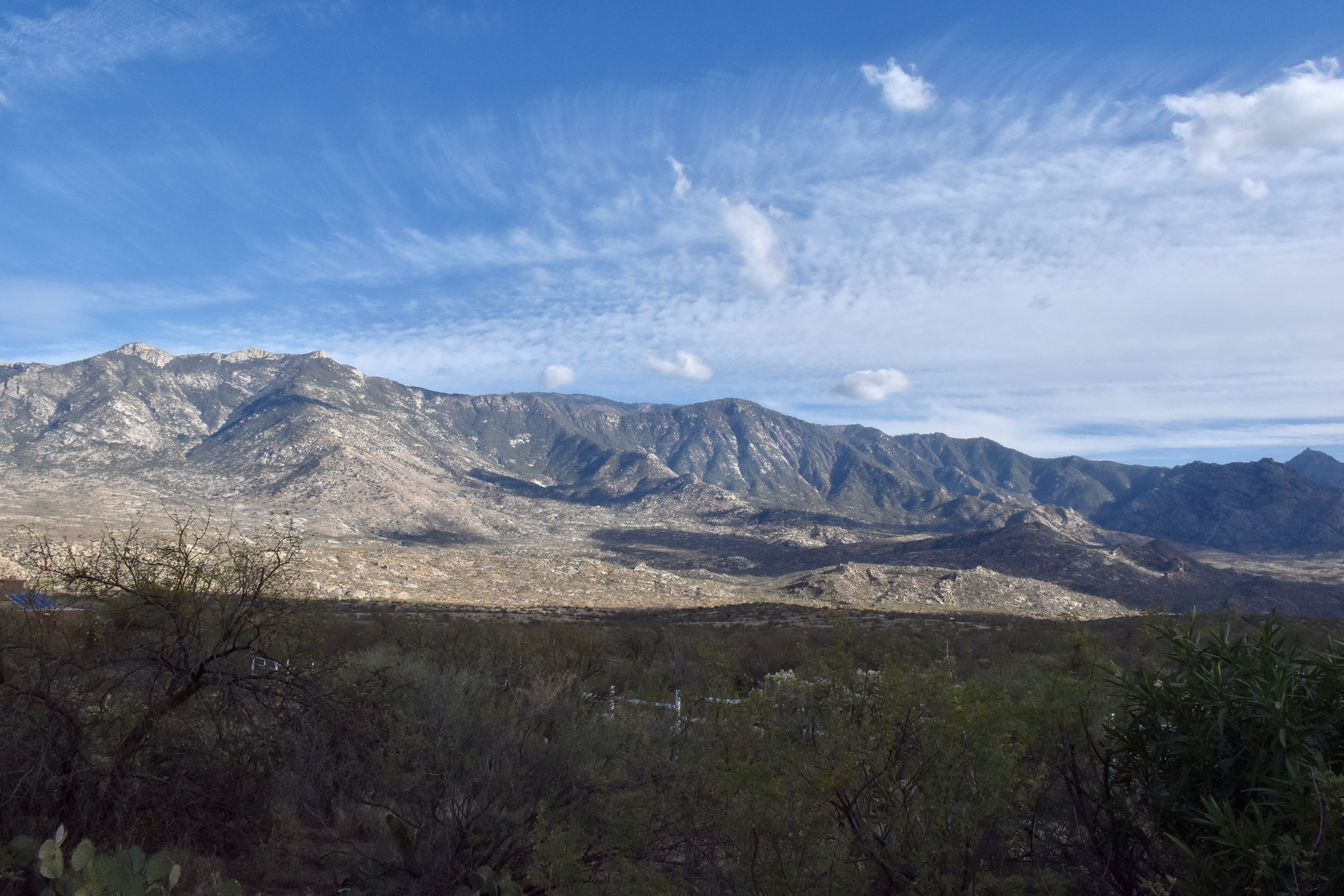
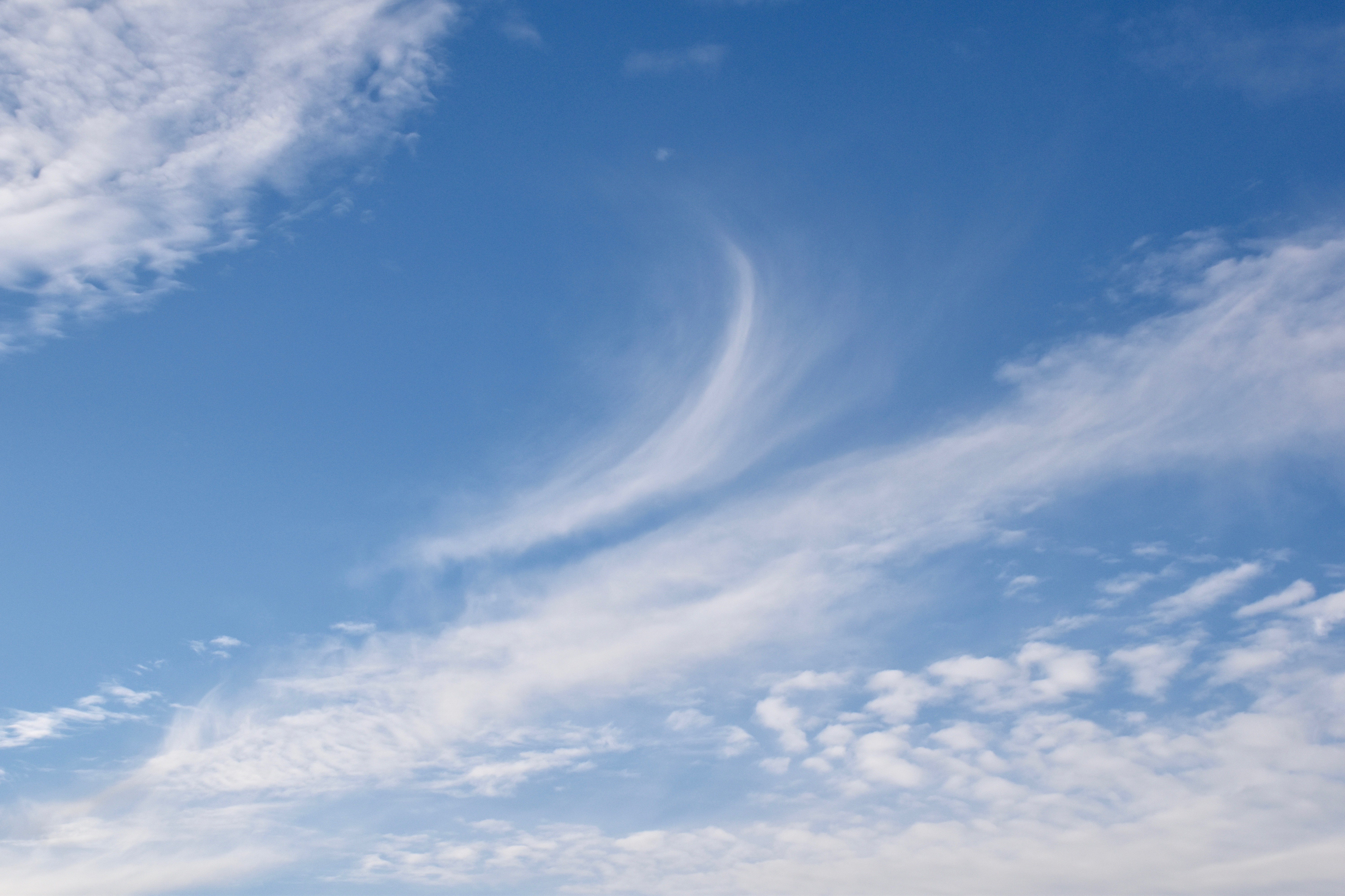
High cold ones that are headed this way in a curvilinear path. Image was made at 5 AM AST, annotation later.

That means that a deep Altostratus overcast will be in place by tomorrow with a load of virga and sprinkles, not really much rain since the bases will also be cold and…high.  Top possible rain amount from these high cold ones is a tenth of an inch, but more likely will be traces.  Chance of a trace in the area?  Oh, about 99% IMO.

But that’s not our full rain destiny.

On the horizon, only a week from now, is the likelihood of a significant rain.  Check the models and the spaghetti:

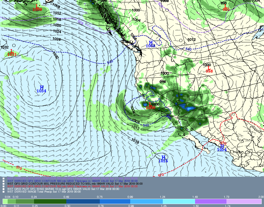
Valid at 5 PM AST, March 16th. You don’t need the precip prediction for this day when the 500 millibar pattern is like this, the core of the wind at that level south of Tucson. Its not a sufficient criterion for rain, but a necessary one in the cool half of the year. (Only about 5% of the rain in TUS falls outside of this criterion in the cool half of the year.

Here’s the rain prediction which I have not looked at until posting now to make the point you don’t need to look at it:

Where the model thinks it will have rained in the 6 h prior to 5PM AST on March 16th. I hope you’re happy now.
Valid at 5 PM AST March 16th. Blueish lines of cold and rain (546 decameter geopotential height contours) way down the Cal coast, and somewhat bunched (confidence indicator) for a major trough to affect all of Arizona, keep the current greening underway.

Would say the chances of measurable rain from this “incoming” are at least 90%; i. e.,  virtually certain.  (Note that “virtually certain” is not the same as 100% certain,  but its damn close.)

Problems with hoster and connections to hoster continue–must wait seconds to see what I’ve typed, then have to go back and correct the gibberish.  So, not doing much as a result.

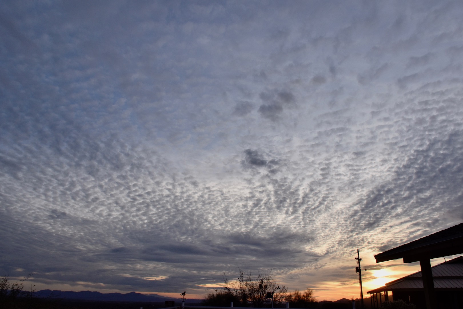
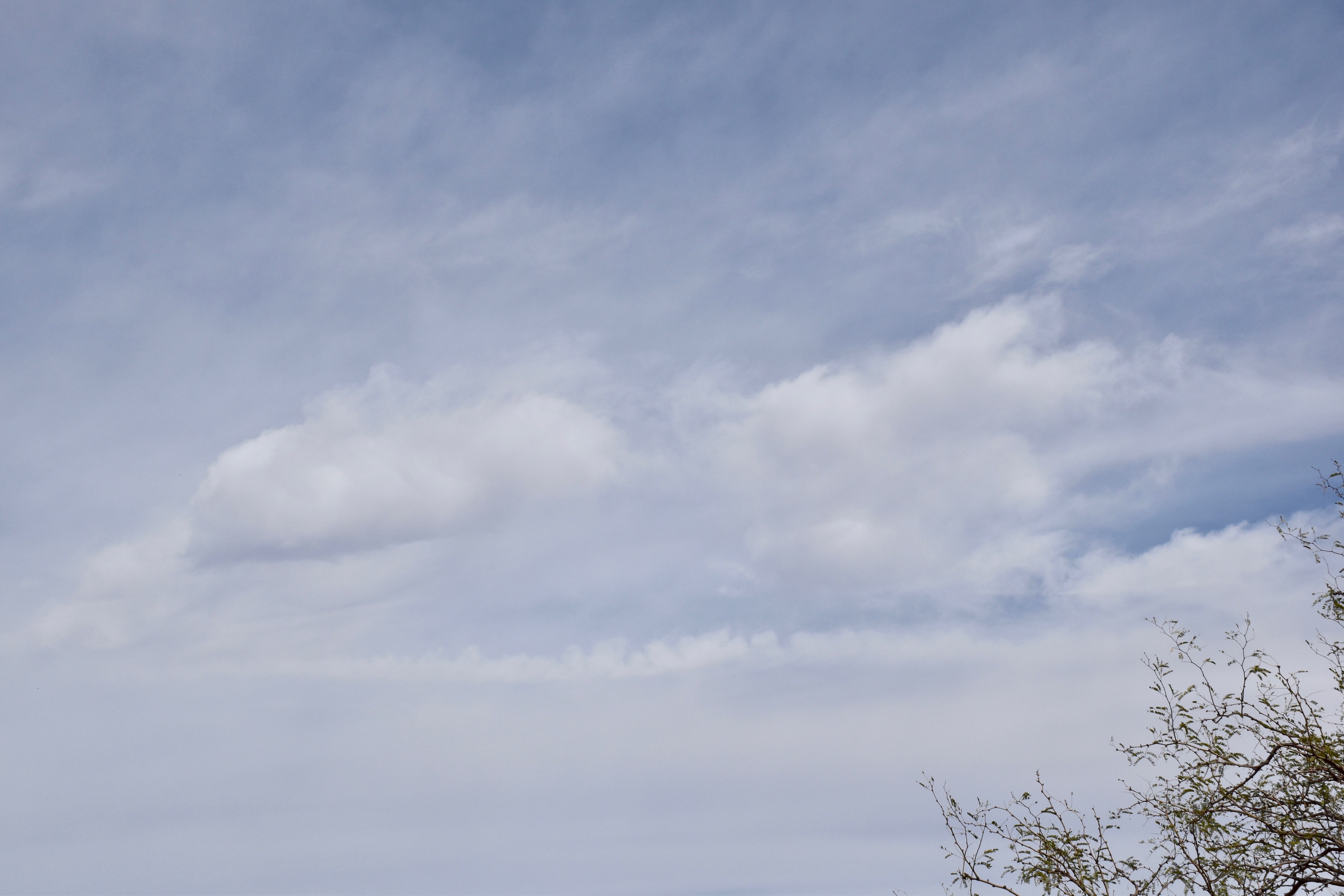
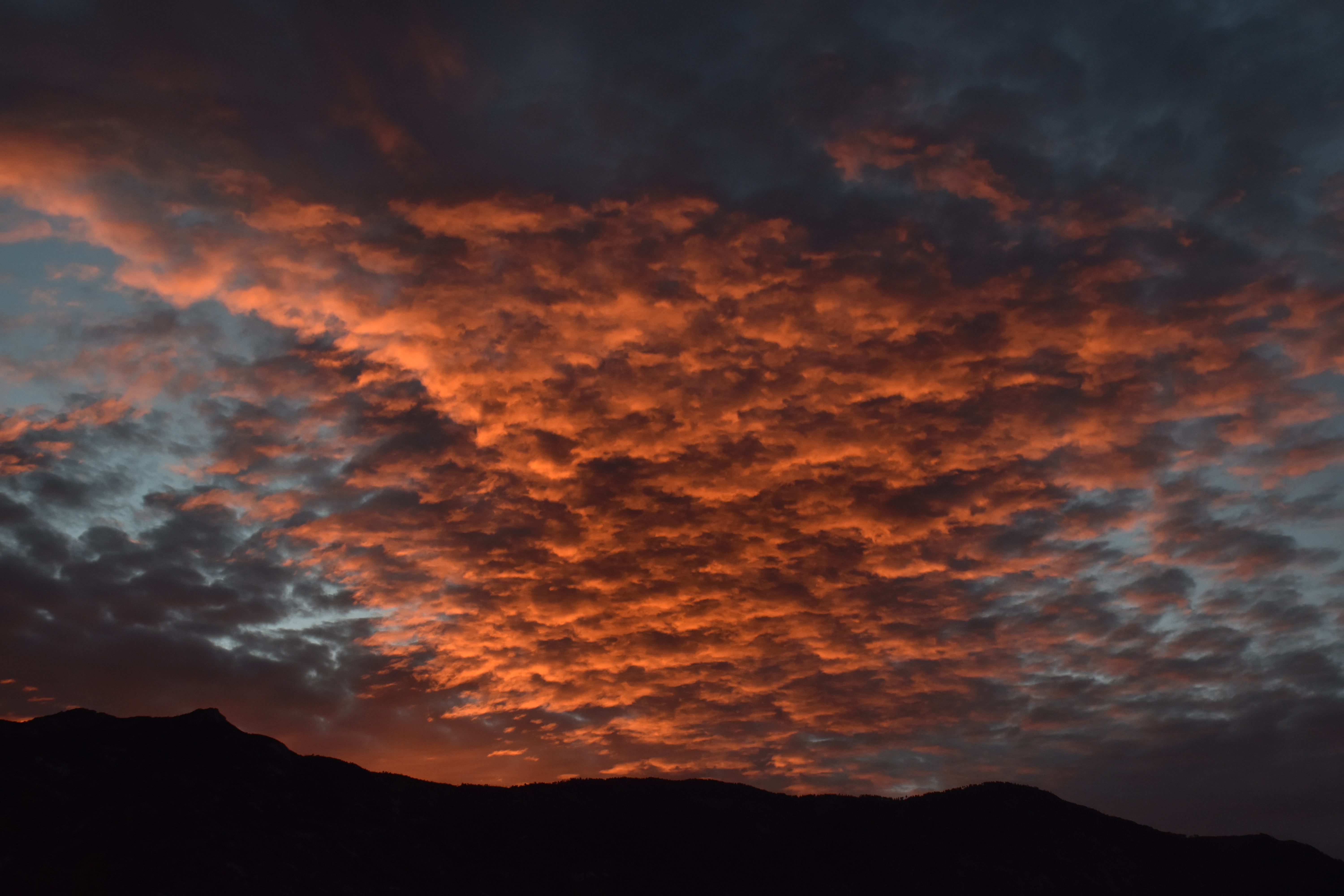
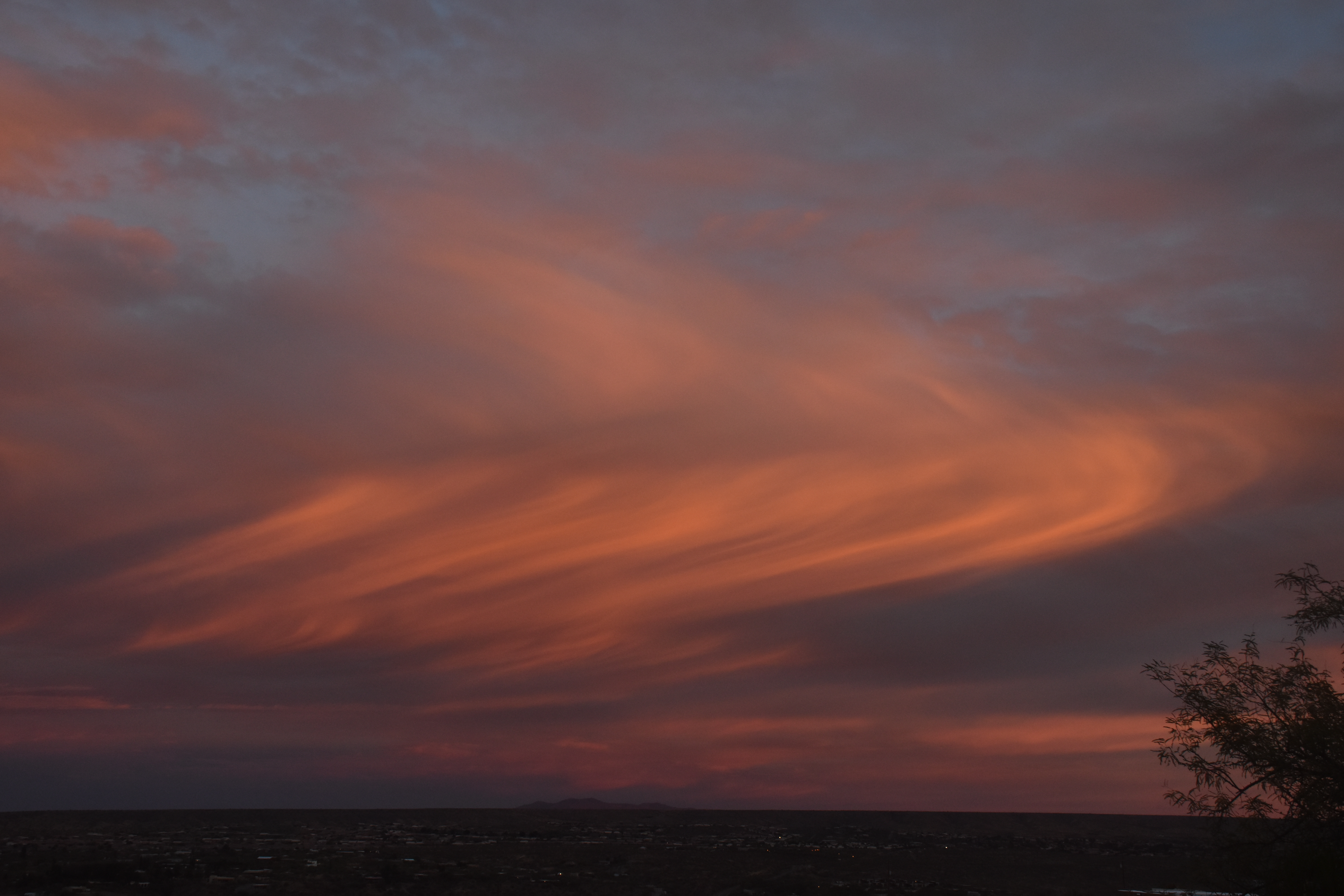
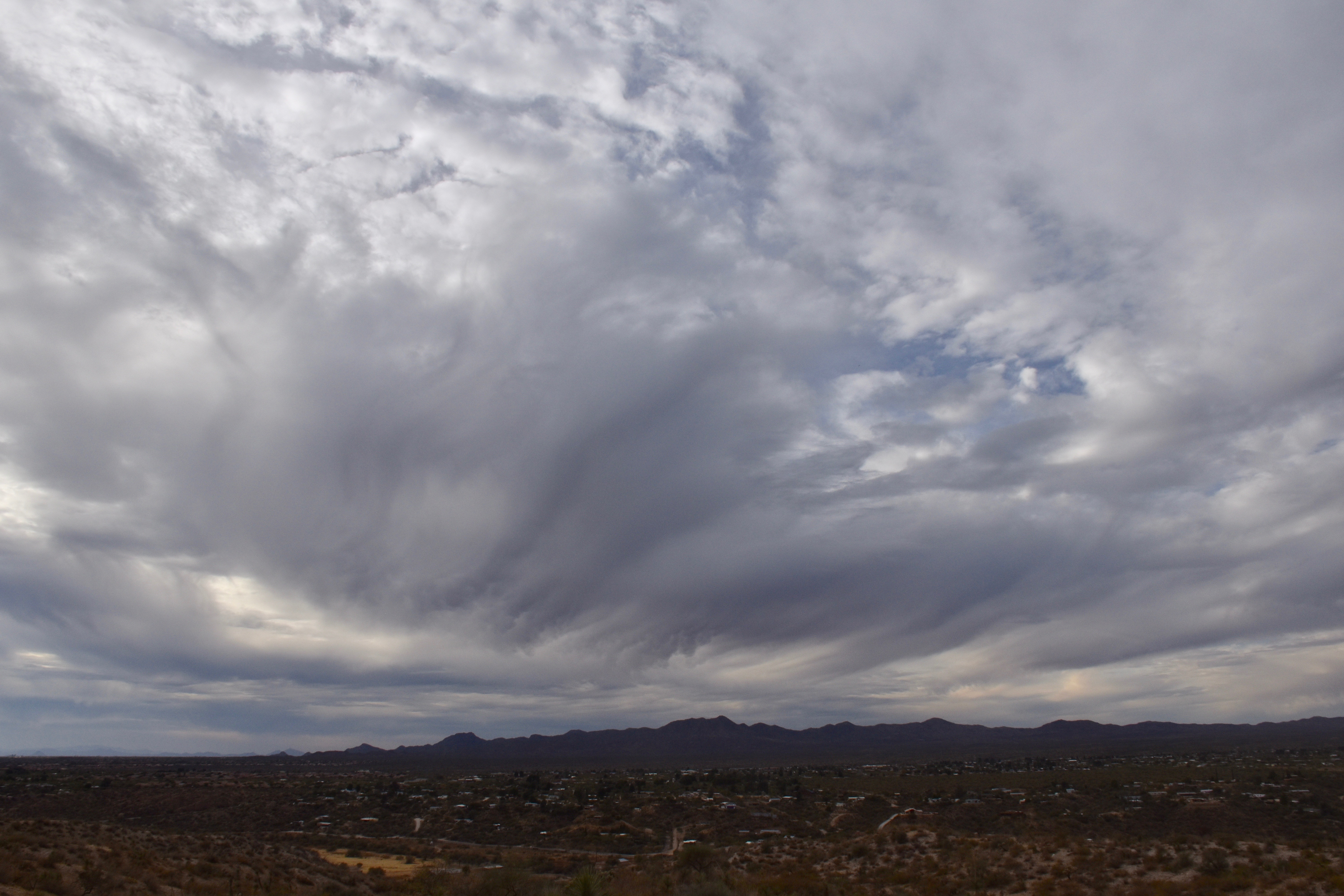
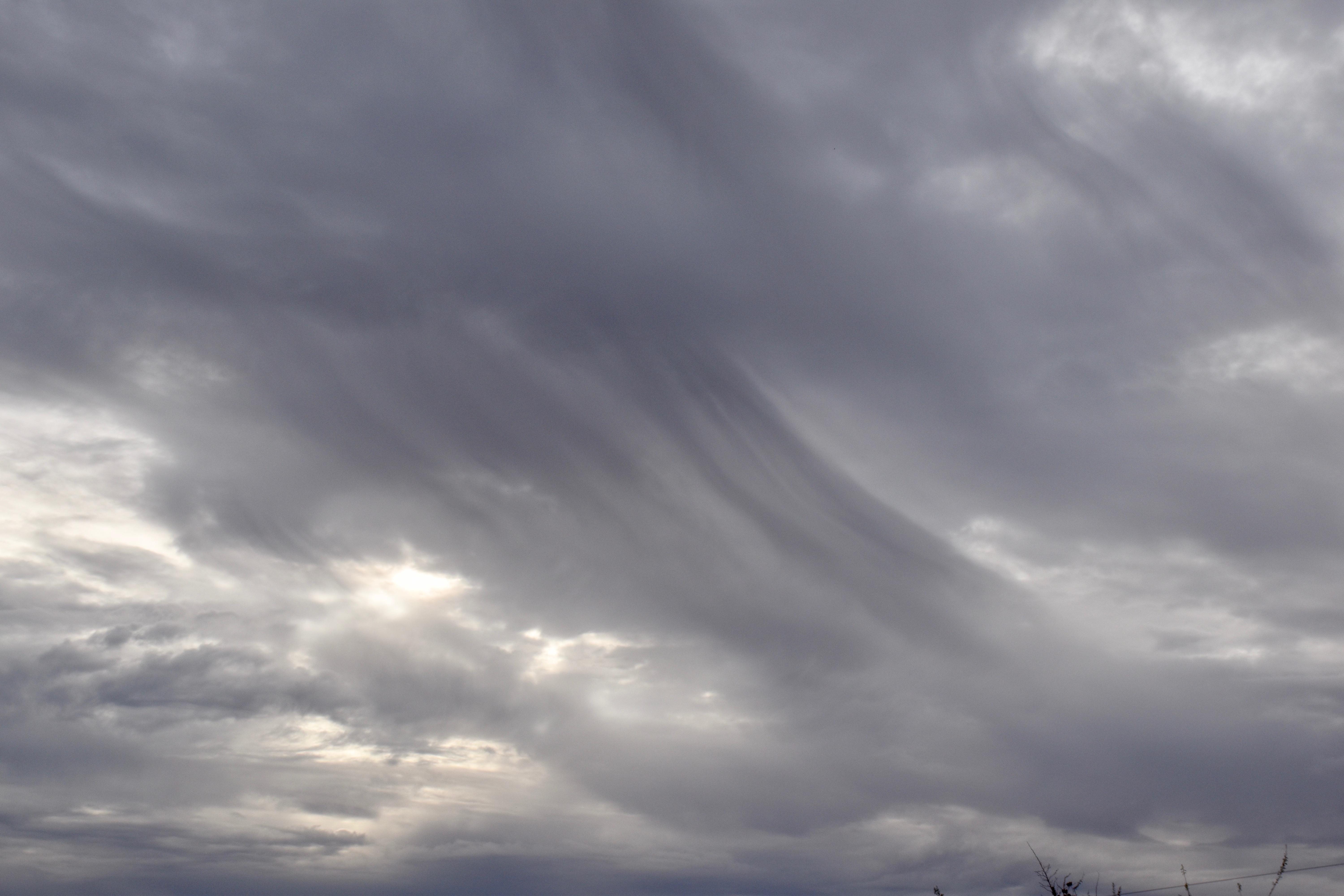
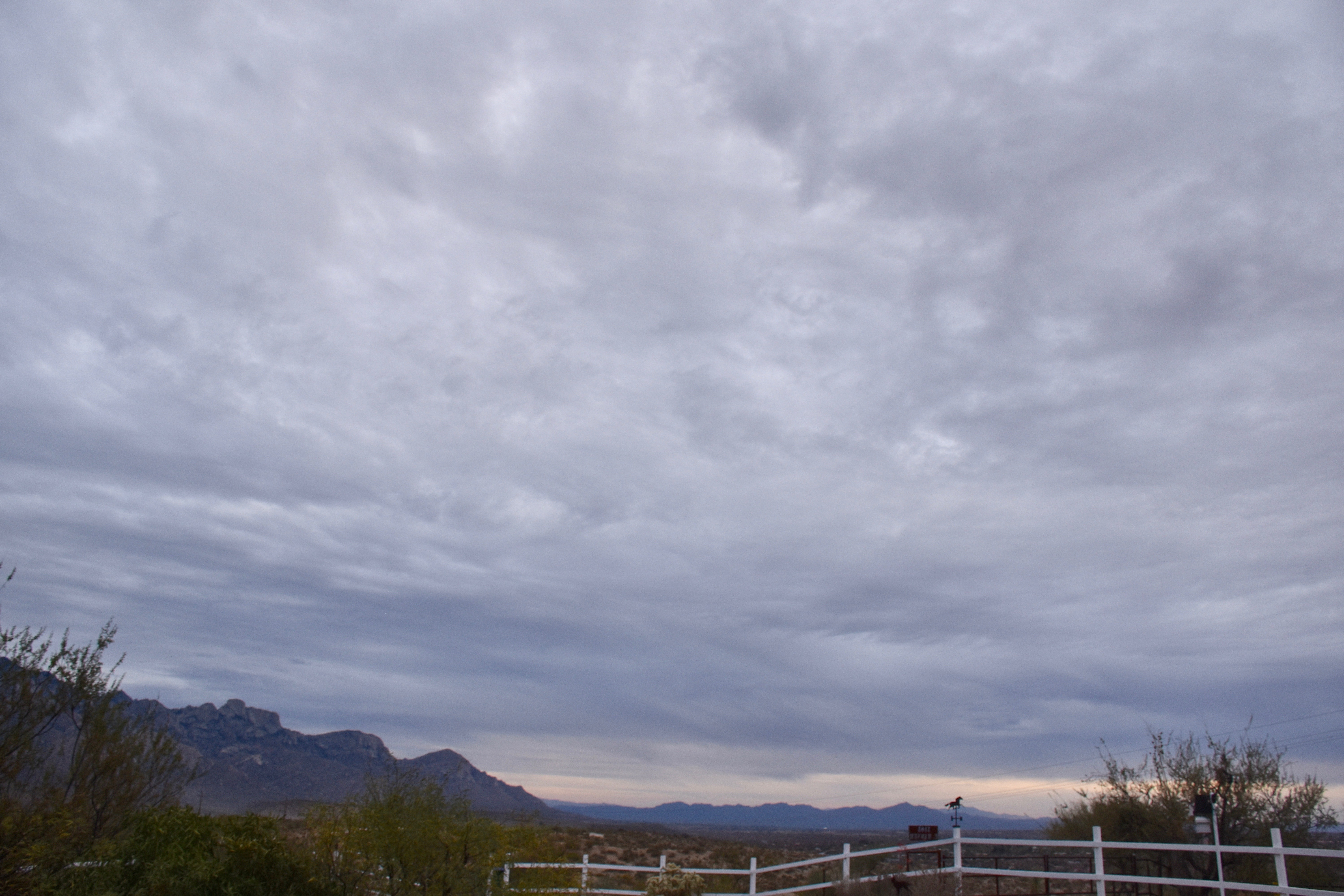
But here are a couple of cloud shots from yesterday anyway:

6:17 PM. Altocumulus perlucidus appearing to spread out, though likely a perspective tomfoolery. Thin Cirrostratus above.
6:39 PM.

Addendum:  Coupla of days ago saw the rare “Cumulo-cirrus” clouds, ones that appear to be Cumulus but are fakes, up at Cirrus-levels.  You might call them Cirrus castellanus.  I feel these are worth sharing so that the young cloud maven person doesn’t embarrass himself or herself when making a cloud call to friends and neighbors, as you would do.  They occurred on March 7th between 11:30 AM and Noon.  Can you tell, upon “zooming big” that these are mostly ice clouds?  If droplets were present they were there for only a short time, thus (is that still a word?) indicating that these rag clouds were at very low temperatures.

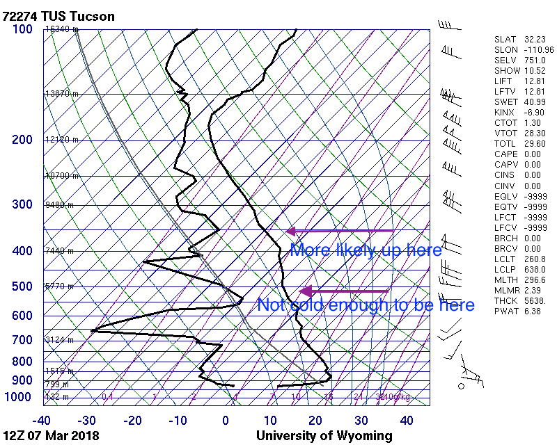
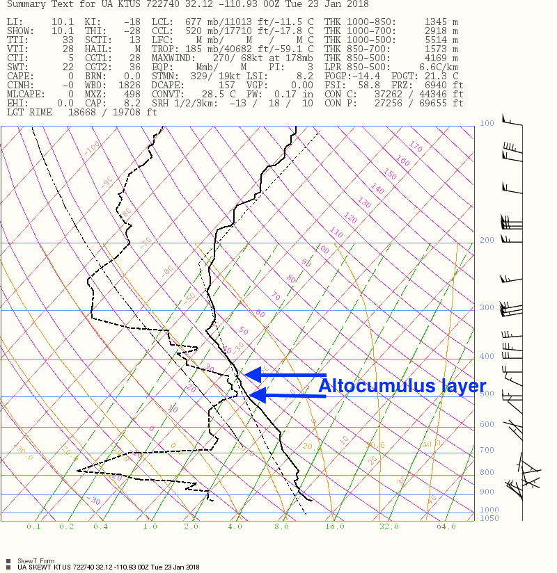
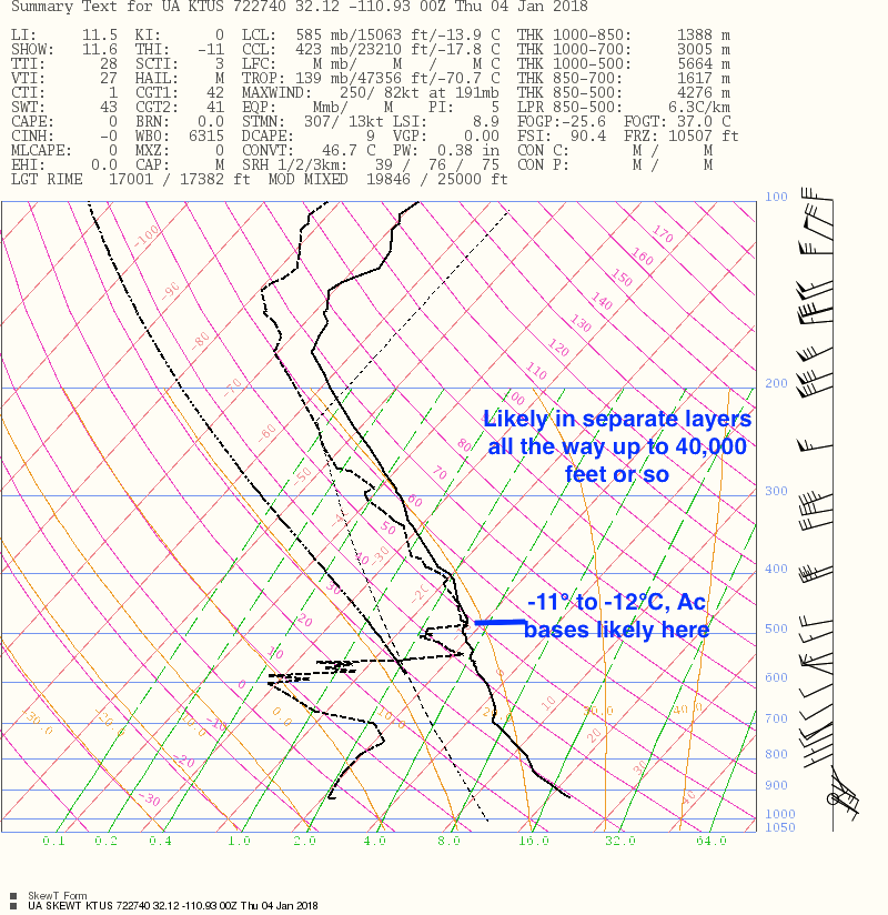
Some sounding detective work below

The 5AM AST sounding for March 7th. The sliver of moist air at 16,000 feet above sea level is not deemed the source of those rag clouds.
5 PM AST, March 7th sounding with writing on it.


The End

Another day with Altocumulus clouds, and what else? The usual: aircraft-produced ice canals

They seem to go together every time we have Altocumulus clouds; aircraft flying through them create holes or canals!  Have been photographing this phenomenon since the early 1980s, and I have not seen it so consistently occur every time there was a flake of Altocumulus around as has been the case here this winter!  Its likely because our Altocumulus clouds have mostly been so cold, having temperatures lower than -15° C.    Mid-level Altocumulus clouds can range in temperature from well-above freezing to below -30° C.

What was unusual about yesterday afternoon, if you caught it, was that you could make out the aircraft producing  the “high temperature contrail” (aka, APIPs), a four engine prop aircraft flying just under the bottom of the Altocumulus layer.    Even if you see a contrail in the Altocu, you can almost never make out the aircraft type for sure because its too high or in the clouds.   But, because of our cool spell, those cold Altocumulus clouds were lower than usual, around 15,000 feet off the ground, or near the 500 millibar pressure level.   The temperature at the bottom of this layer was -21° C.  See annotated NWS sounding, courtesy of IPS Meteostar,  below:

The National Weather Service sounding launched from the U of AZ about 3:30 PM, near the time that the “high temperature” contrail was being produced. A slight amount of Altocumulus was over and downwind of the launch site.

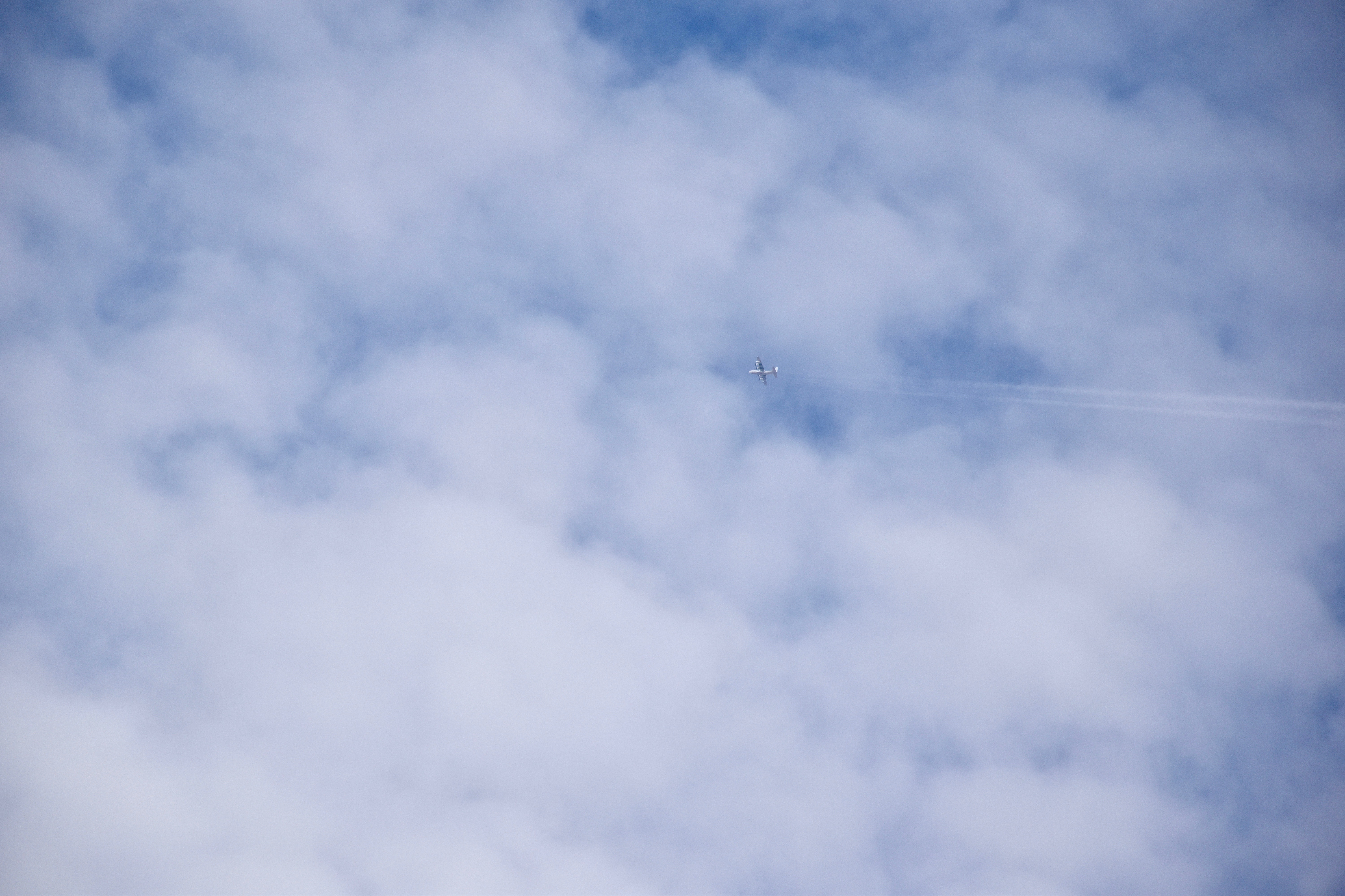
Here’s your aircraft shot, full size so’s you can really zoom in and see those engines:

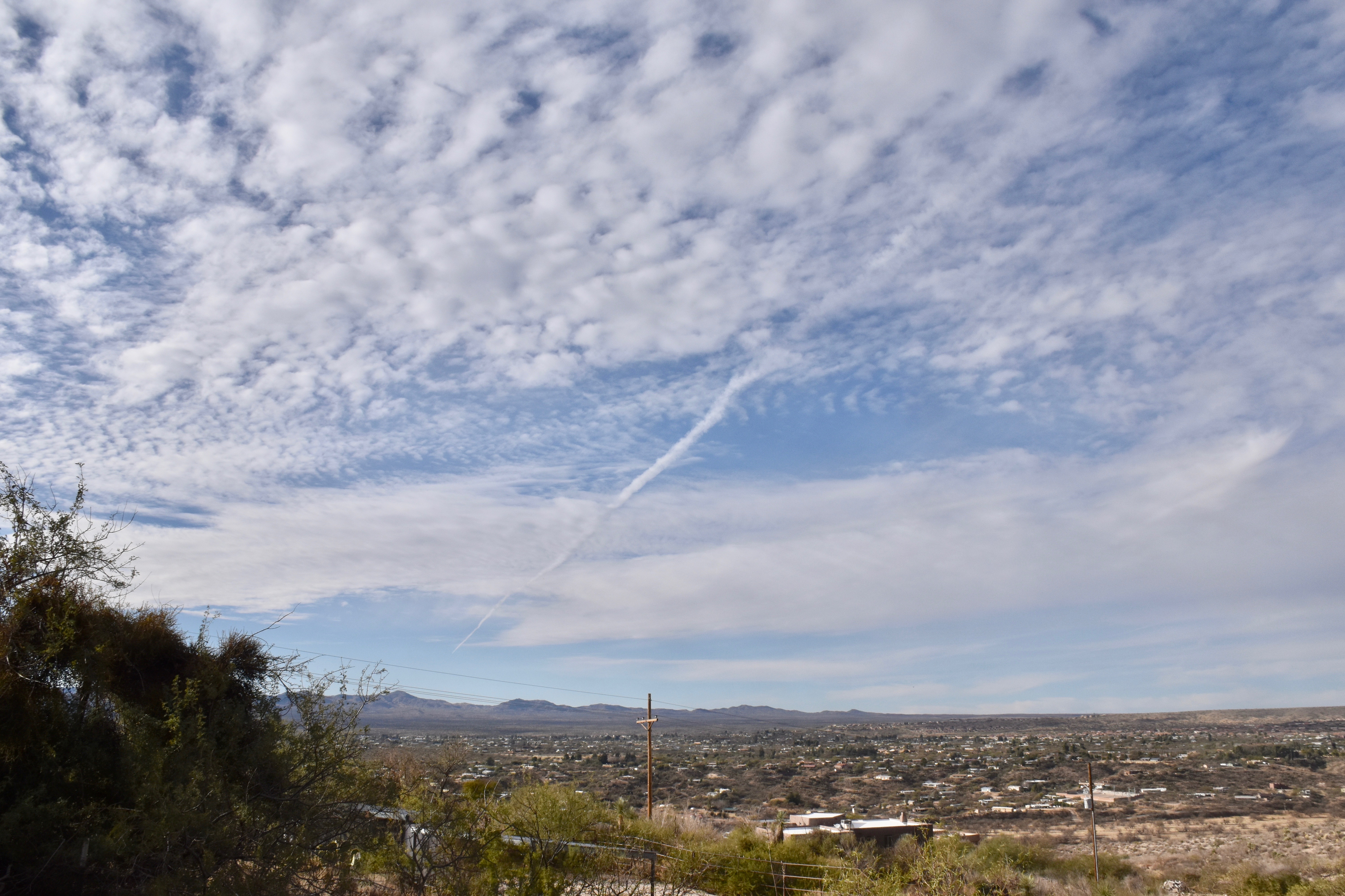
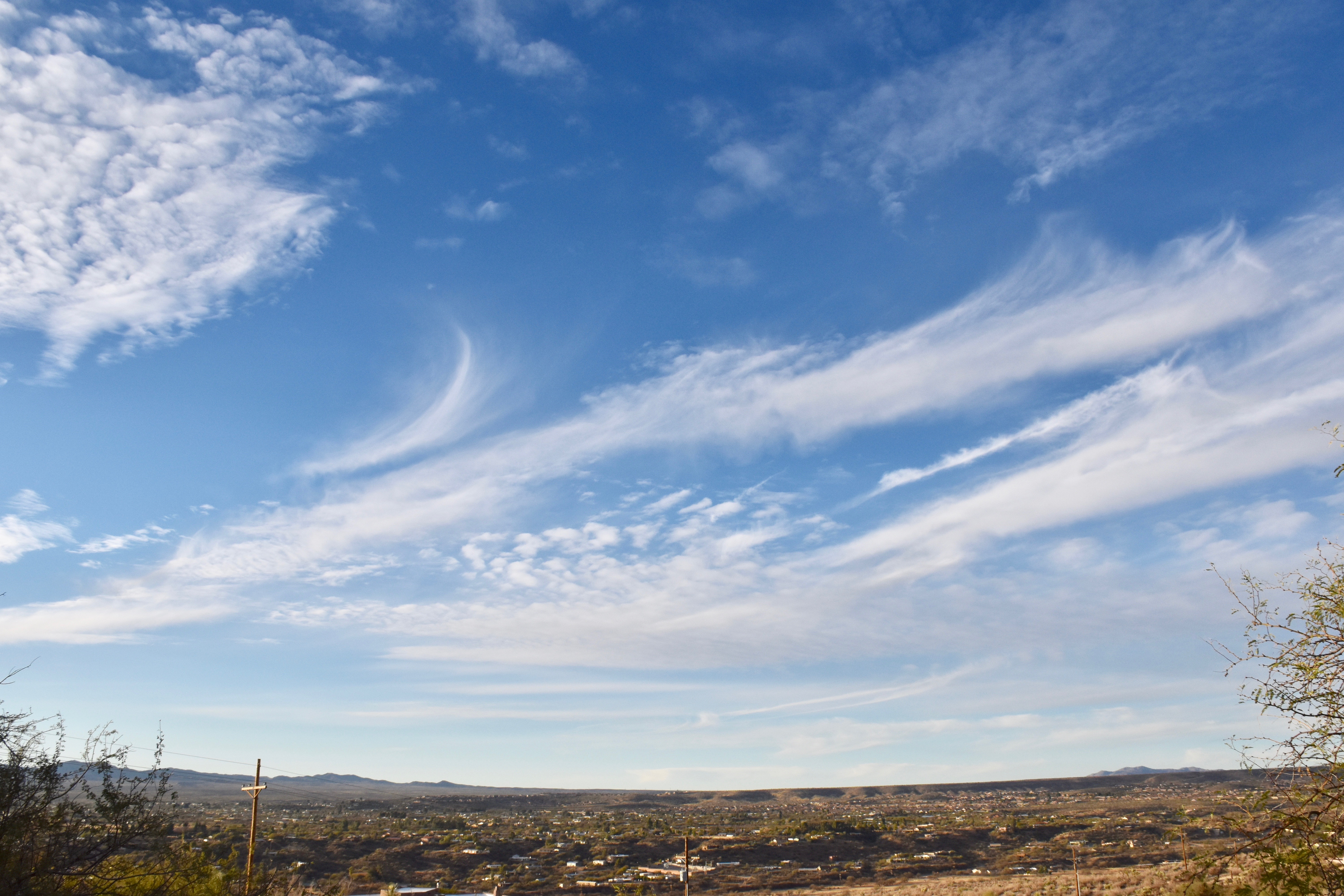
3:37 PM. A four prop engine aircraft flies just below (maybe 100-300 feet is all) the base of the Altocumulus layer and left a LONG contrail.
3:37 PM. The long contrail behind that plane. Note that it goes into clear air; cloud droplets not required.  Looks exactly like a normal contrail, those produced by jets at temperatures lower than -35°C when the air is moist.
3:44 PM. That contrail now extended from horizon to horizon. it appeared that he climbed through this layer on the way out.  The broadening  with visual evidence of ice is in the upper right hand corner.
4:16 PM. Now the classic ice canal is obvious in our Altocumulus layer.  More aircraft produced ice is present as well.
4:16 PM. Zooming in on a segment of this canal shows that while its completely ice, there are no virga trails showing. Am guessing that those prop engines produced prodigious numbers of ice crystals via prop tip cooling to below -40°C, where homogenous nucleation of ice occurs (producing prodigious concentrations of ice crystals, maybe tens of thousands per liter in the immediate lee of the prop tip).  Here the crystals have spread out due to turbulence, but there are just too many competeing for the available vapor to produce crystals big enough to have much of a fall speed.
5:12 PM. Due to the low windspeed at cloud level, just 15 knots or so, this ice canal was visible for more than an hour and a half. It was remarkable how close to natural Cirrus looked at that time. It would be almost impossible to assign this ice to the level of the Altocumulus. Check the close up, next.
5:12 PM.  Cirrus uncinus homogenitus (I’m not kidding. that would be the name for this Cirrus, having been produced by man (well, or a woman pilot, of course).
5:13 PM. Unperturbed Altocumulus perlucidus translucidus (the latter, little or no shading due to thinness of elements).
5:14 PM. Shadow drama on the Catalina Mountains from those Altocumulus clouds, made even more interesting by the presence of a weather station in the photo.


S

5:58 PM. The setting sun illuminates that last bit of the aircraft-produced ice canal (“homoCirrus” on the right).  This was probably the longest viewing time for any such event over one location, again due to the light winds up there.

The weather ahead, WAY ahead

Not a single model run since two days ago has produced a big trough in the SW US, in complete opposition to the interpretation of spaghetti ensemble output at that time.  This would be, IMO, one the greatest busts of all time (not for me, of course), but for spaghetti ensembles (I was only foretelling what they told me), spaghetti considered to be one of the great forecasting advances of all time when computers became powerful enough to produce them in a timely manner.

If we believe these later model runs, it will be relatively hot and dry here, not cold and wet, as was suggested here.

But being of a stubborn nature,  Cloud Maven Person is not yo-yo-ing on his forecast just yet.  Surprises are almost certain  in these model runs, since spaghetti still supports troughing beyond 10-12 days…  Standing by  for model yo-yo-ing….

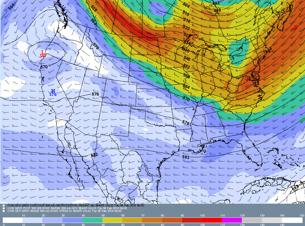
A laugher (???) below from our very latest computer run (from IPS Meteostar again). This map in incredible in the lack of jet stream activity over most of the US!

This 500 millibar map is based on global data from 11 PM AST. last evening.  Its valid for February 7th, 11 PM AST, way out there.   This is a remarkably quiet map for wintertime in the US! Can it possibly be right? Hope not, at least in our area.

The End

Sutherland Heights logs 0.22 inches yesterday; Jan now at 1.32 inches; average is 1.60 inches, water year at 1.71 inches

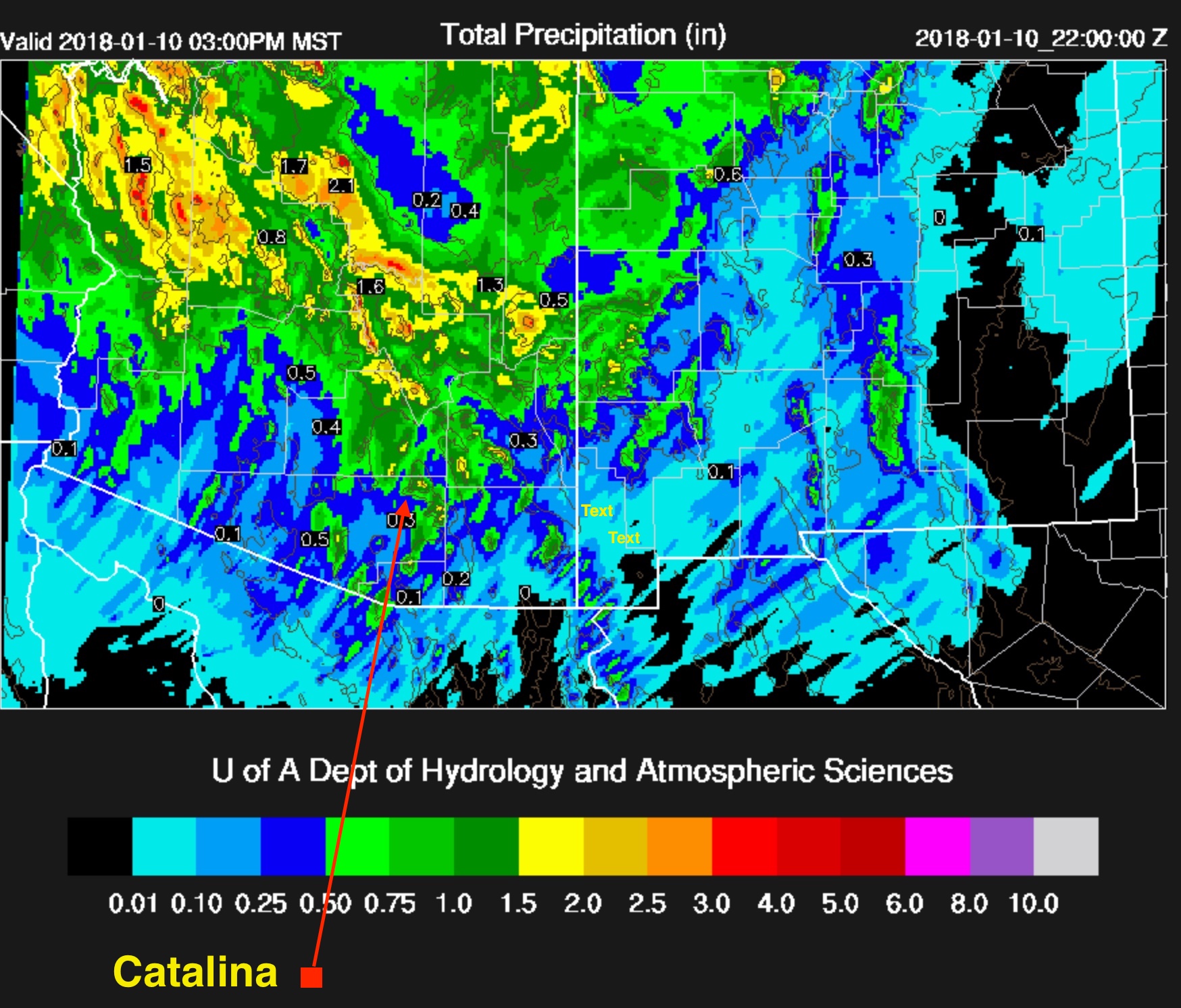
0.22 inches was, indeed. how much rain fell in the form of drops  from Nimbostratus clouds yesterday as a modest little rain band generated by a rapidly moving trough swept through during the afternoon.  Regional precip values can be found here.  Our local area got the most, up to about a quarter of an inch, as often happens in marginal storms.

Yesterday’s storm marked the beginning of the new, more normal weather regime for southern Arizona, as has been blabbed about here in recent weeks.  No more week after week of droughty weather with temperature far above normal, the kind of weather that has marked this whole fall and winter so far!  I. e., “Thank you very much, a snowbird might say,  but get the hell out!”,  the rest of us might conjure up, thinking about the needs of our  desert’s wildlife and vegetation.

Indications are now that below normal temperatures and above normal precip are ahead for us and all of Arizona in late Jan and early February.

The evidence for these claims?

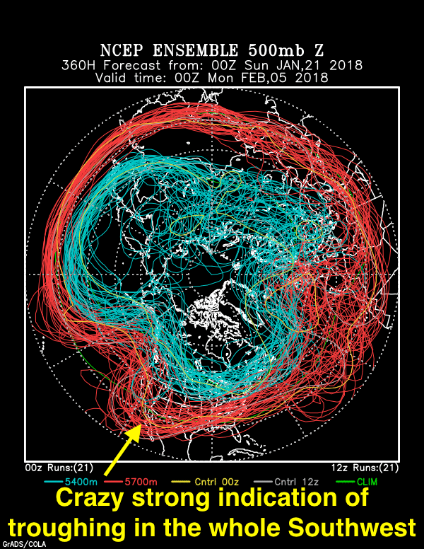
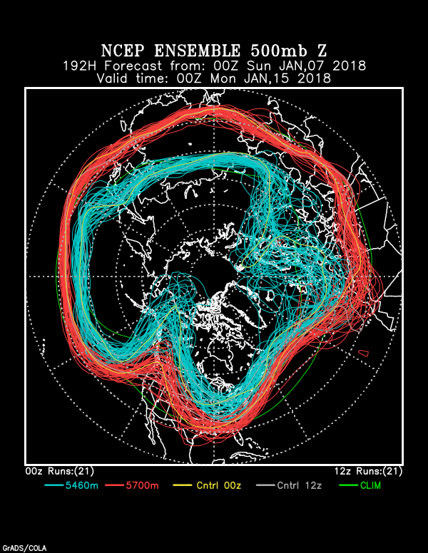
Below, the stunning, jaw-dropping evidence for this seemingly outlandish assertion in the form of an ensemble (spaghetti) plot generated by NOAA last night.  I have followed these charts for almost ten years now, and I cannot remember when such a strong signal (clustering of flow lines) 15 days out has occurred before in our region.

So, excessively excited this morning when I saw it!  Its been annotated with excitement text.

This troughy pattern begins to take place on January 30th.  Until then, a strong but dry cold front with a lot of wind comes by in a few days, on the 25-26th.

Valid at 5 PM AST, February 4th. You can pretty much count on a trough hereabouts in two weeks. Since the blue lines, the colder portion of the jet stream,  do not dip down this way so much, our troughiness likely would be in the form of something we call a “cutoff low.”   A full latitude trough extending from the “blue jet” up there in Canada, instead of a “cut off”, would be excessively cold.  We probably don’t want that anyway.
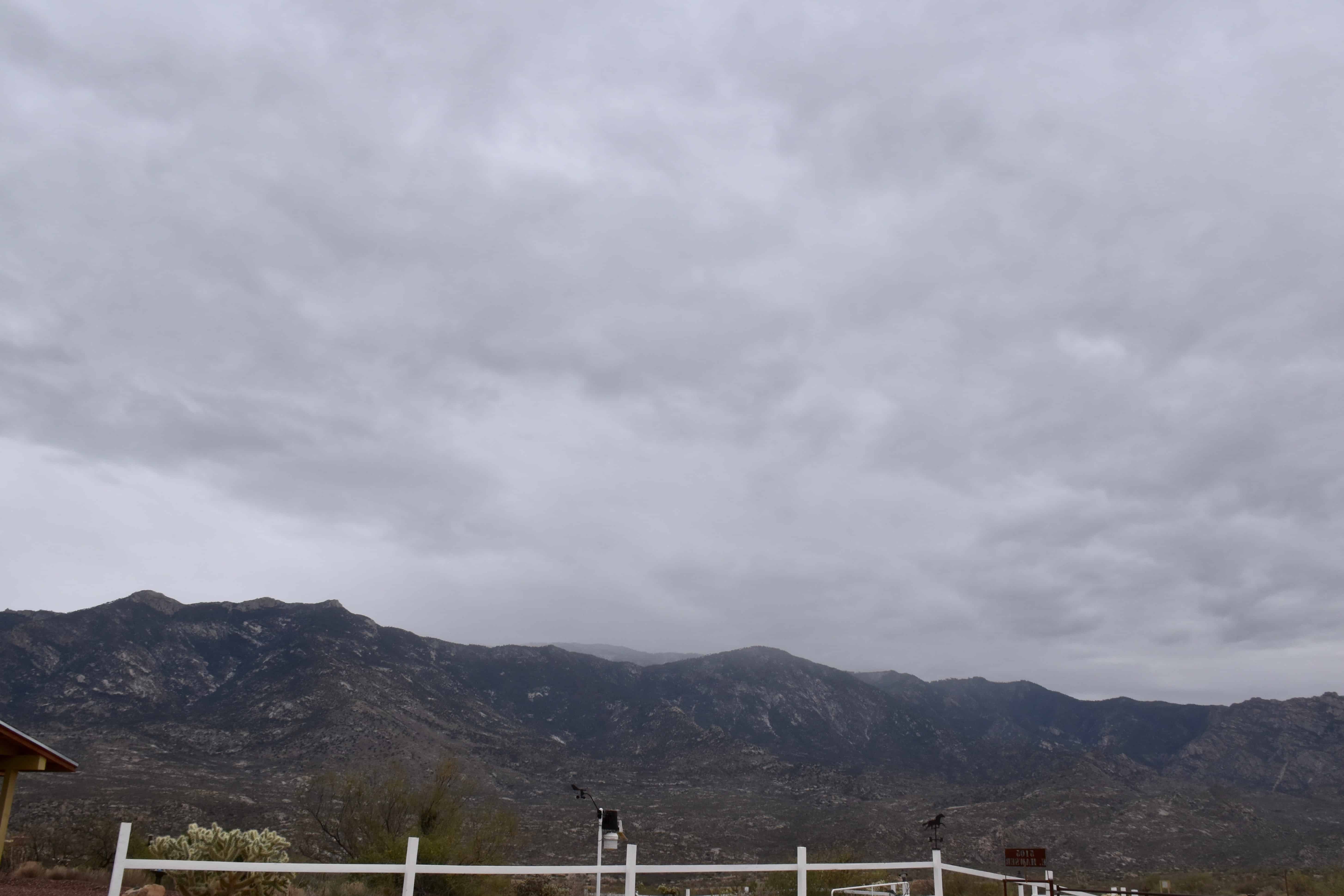
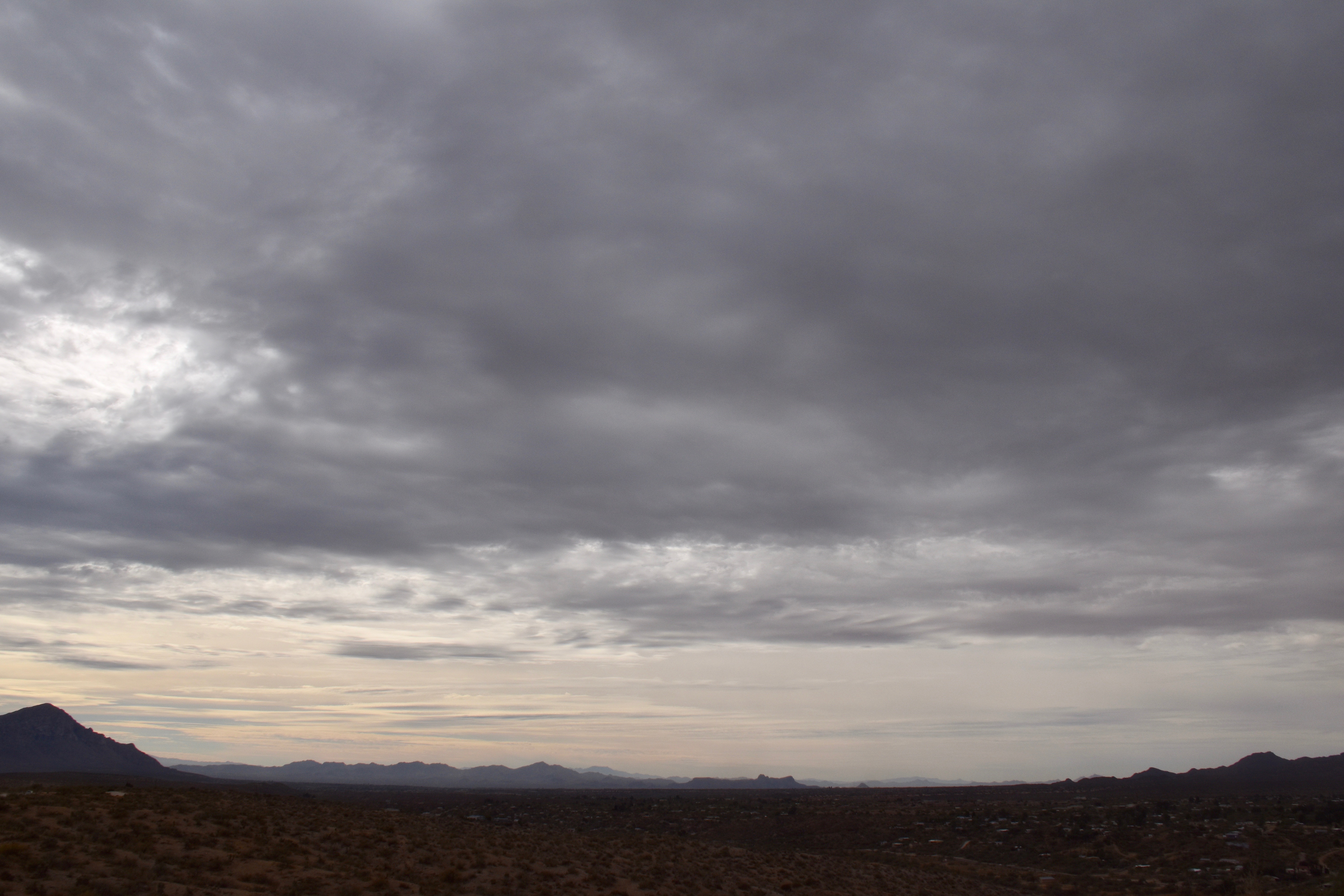
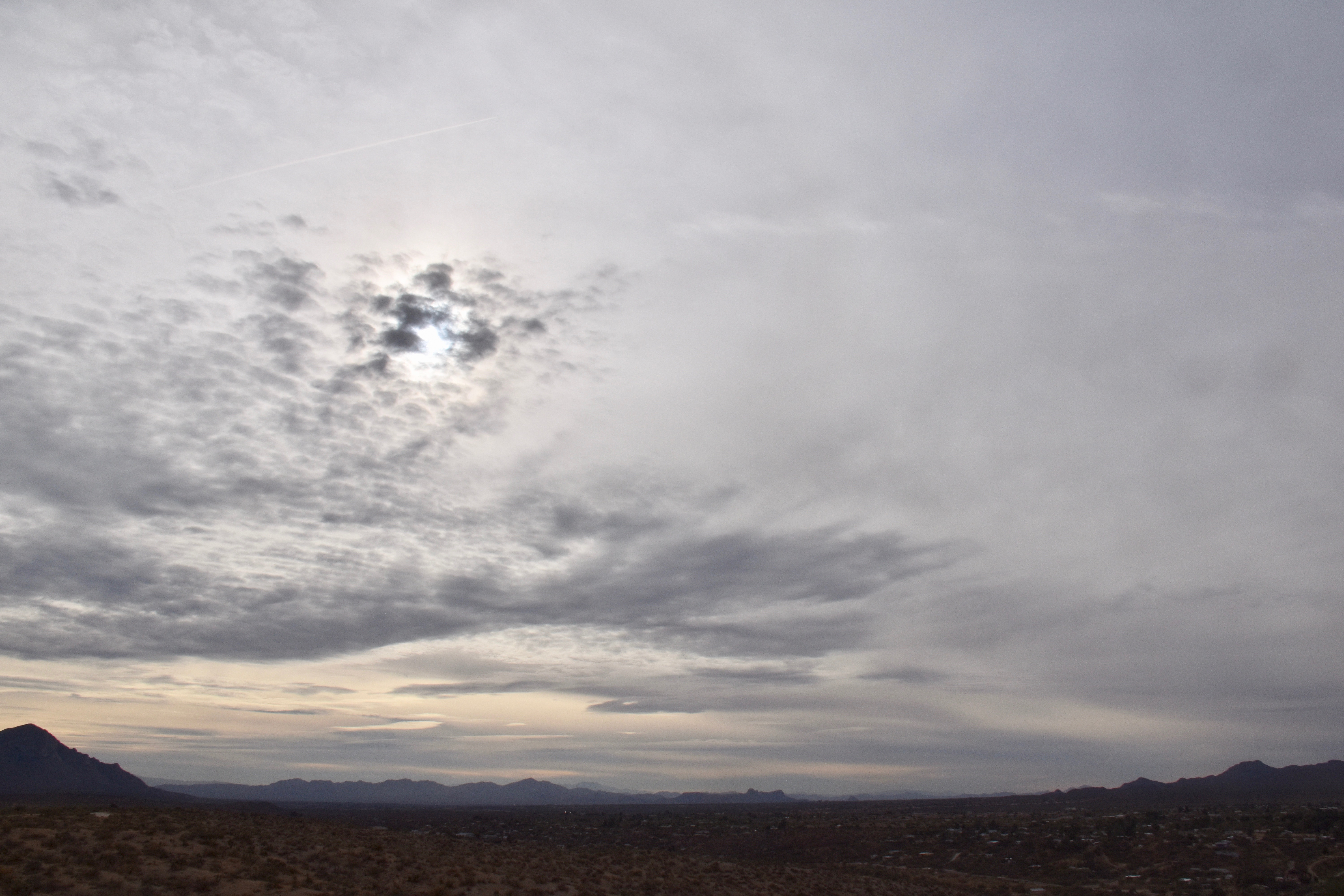
 Yesterday’s clouds

The whole interesting, if excessively gray story is shown below:

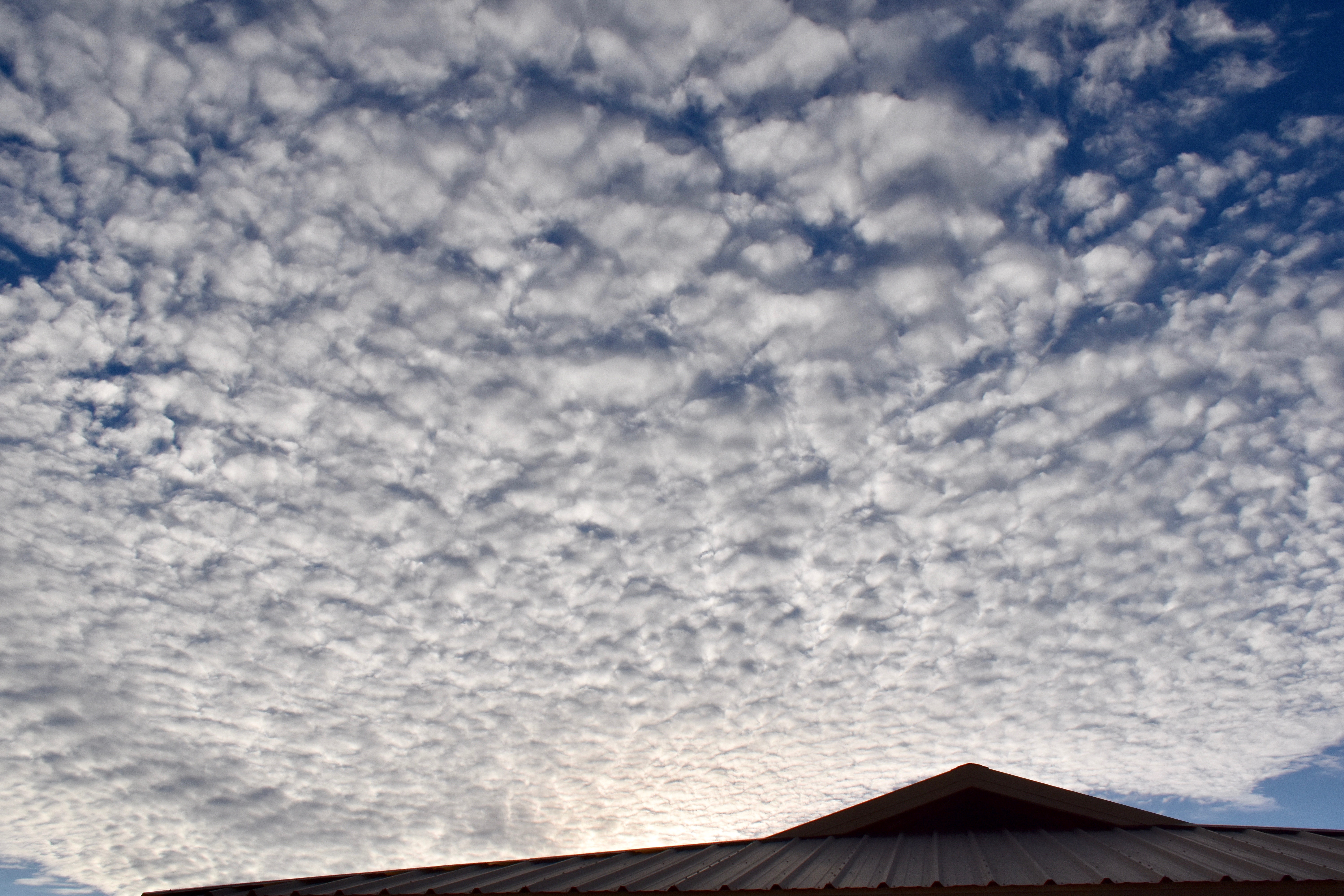
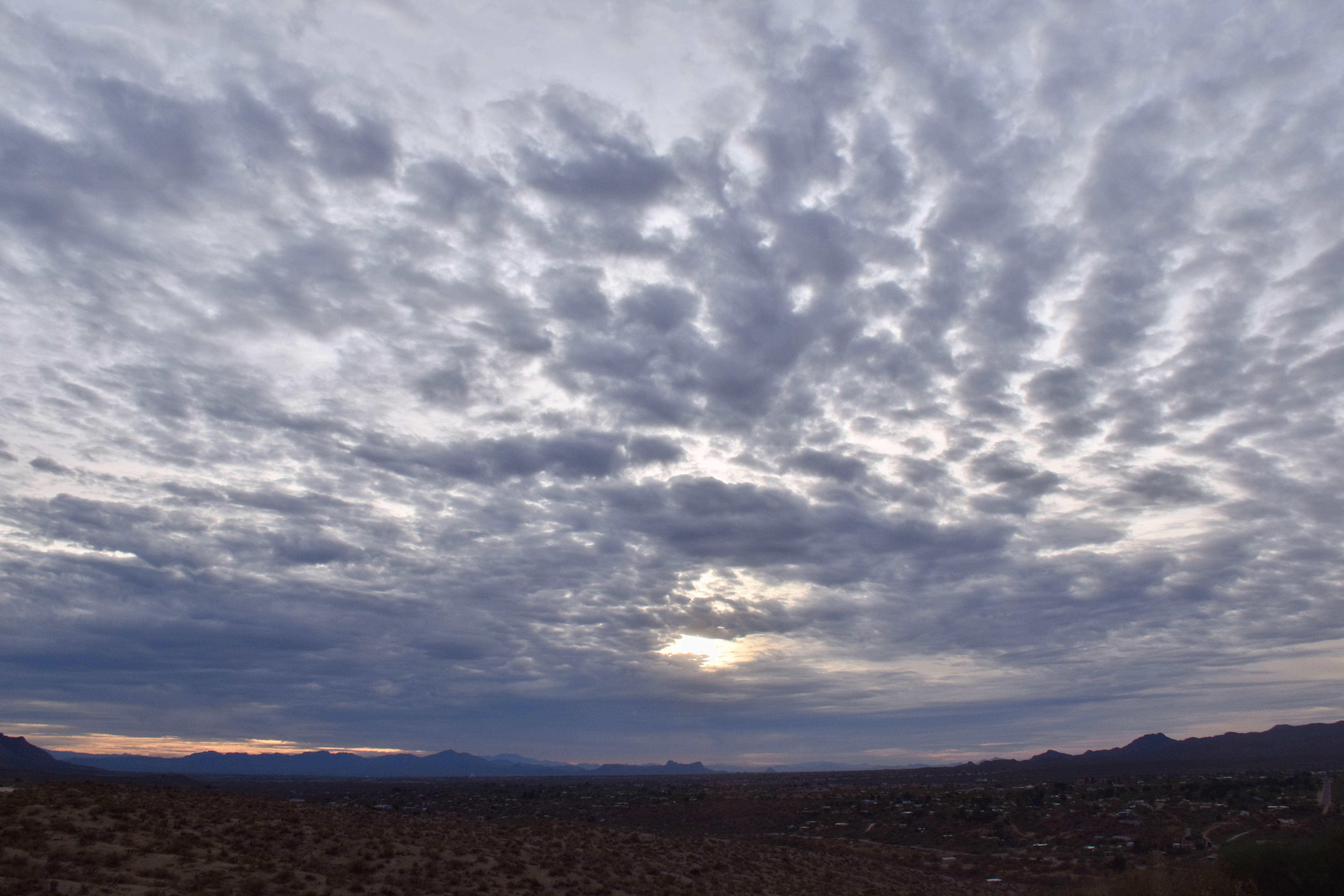
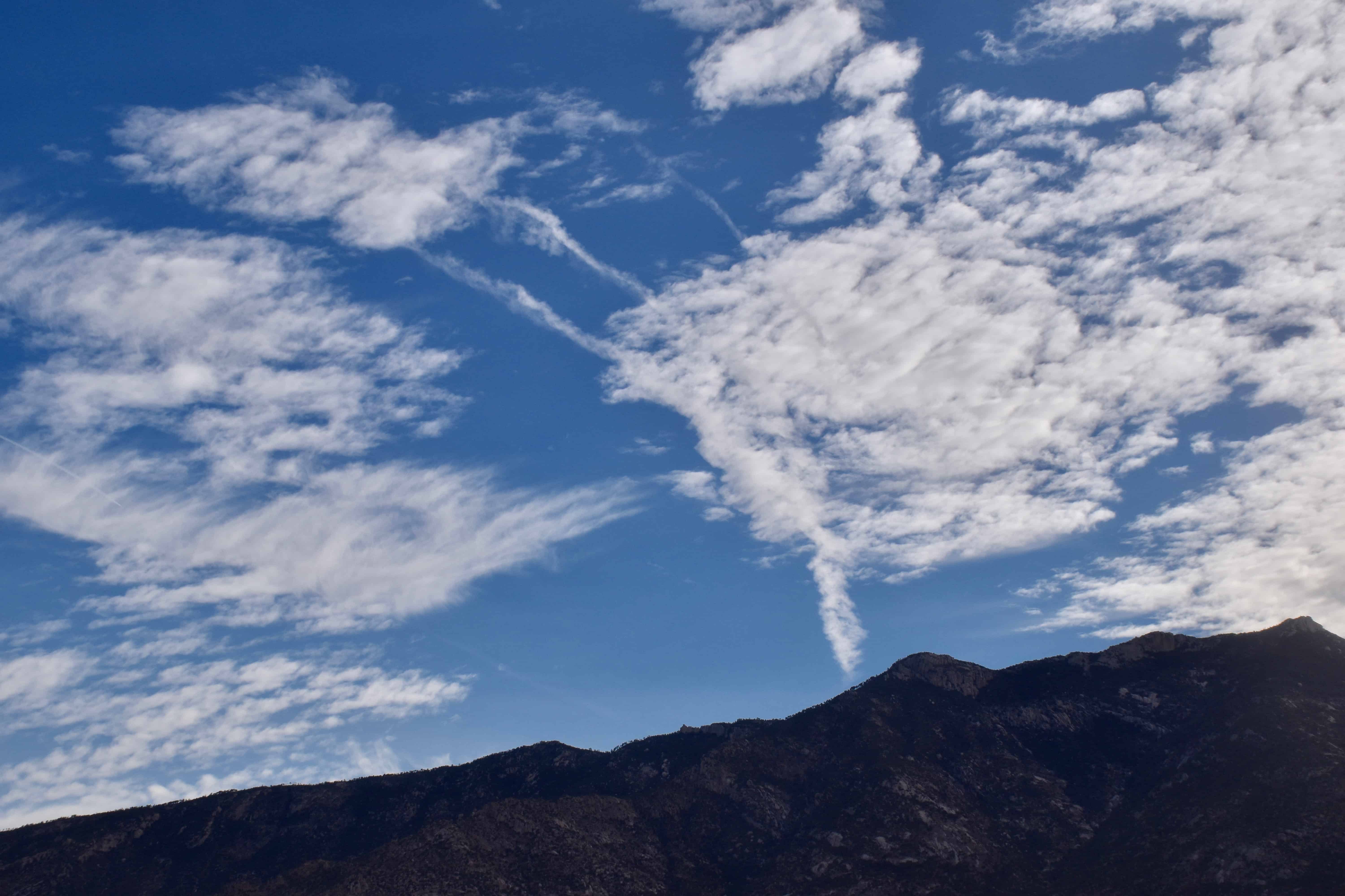
7:24 AM. It was breezy already, and with Cirrus underlain by Altocumulus lenticularis clouds in the lee of the Catalina Mountains, you knew that a storm day was ahead without turning on your favorite TEEVEE weatherman.
8:53 AM. With Cirrus and Altocumulus spreading rapidly from the SSW, lenticulars downstream from the mountains, the wind gusting to 25-35 mph, you knew a great gray cloud day was in store!
11:32 AM. Before long, an entire sheet of Stratocumulus spread over the sky, making you sure that rain would fall.
12:50 PM. First drops begin to fall on Sutherland Heights. That layer of Stratocumulus appeared to be deepening as it approached from the SSW to where the tops were getting just cold enough upwind of us to produce ice and snow that melted into those sparse drops.  Not enough ice /snow formed to hide the bases, though, in virga.
1:26 PM. Snow begins to fall on the Lemmon.
2:04 PM. Lower Stratocumulus clouds begin to show up below the original deck that overran us.


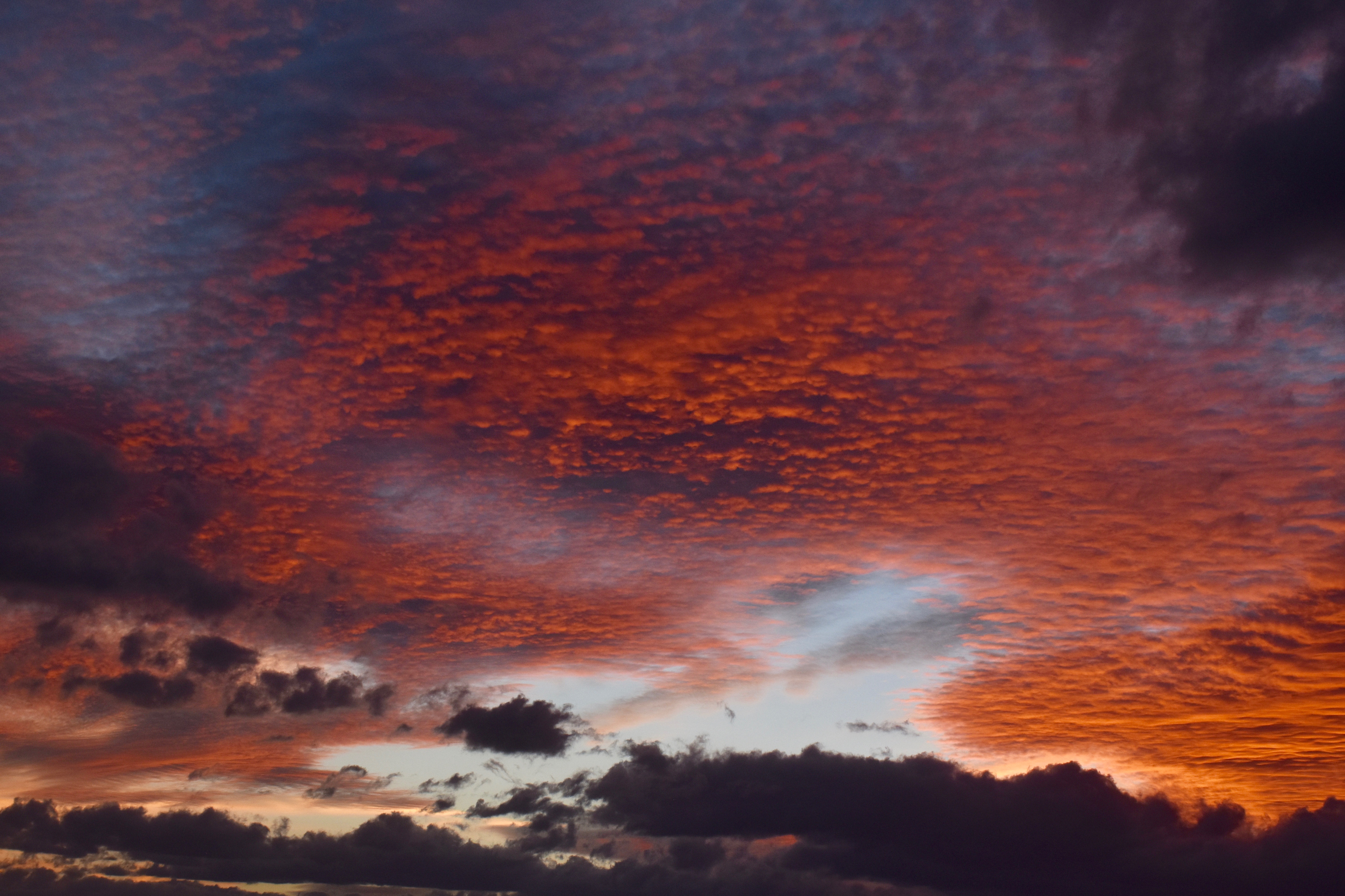
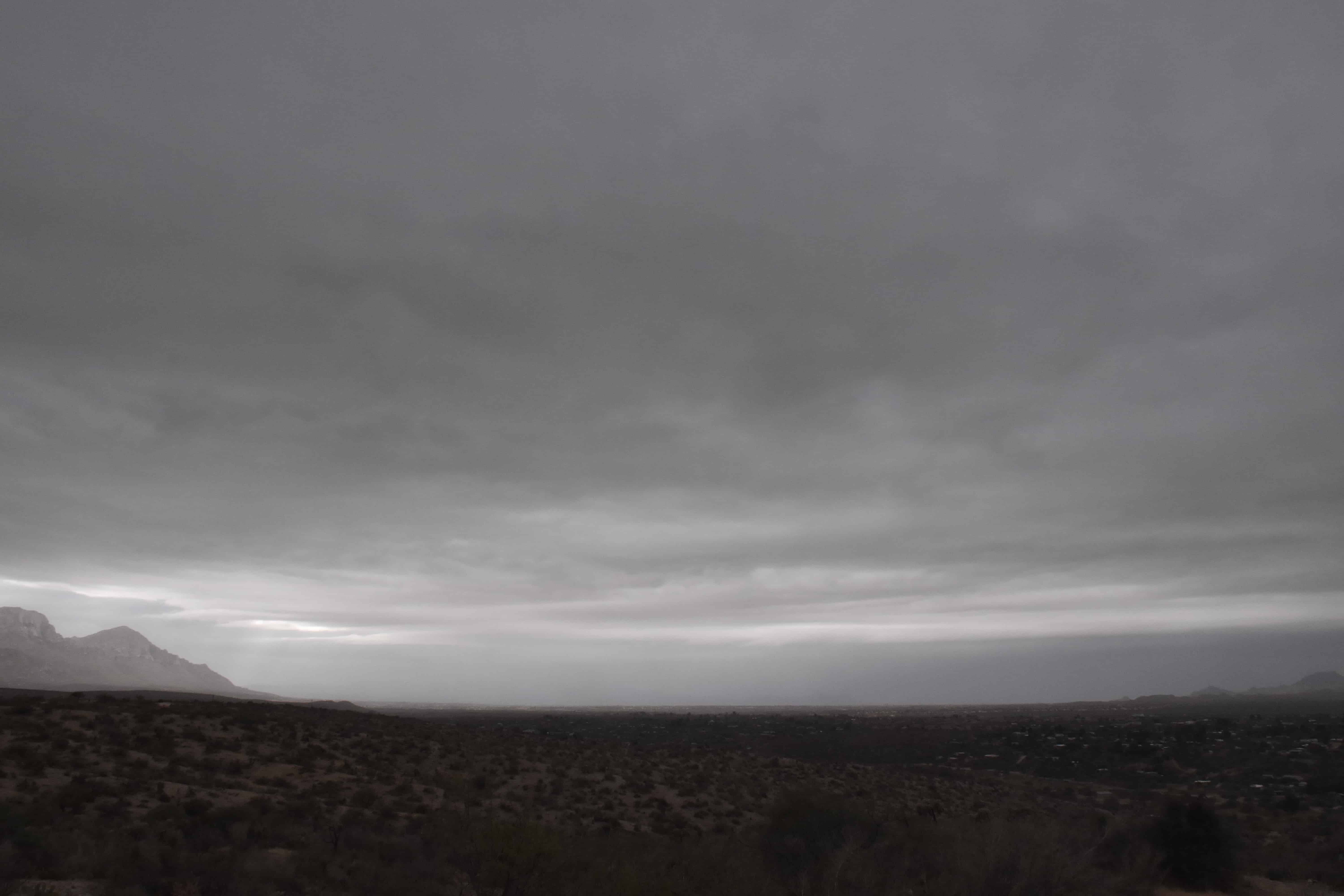
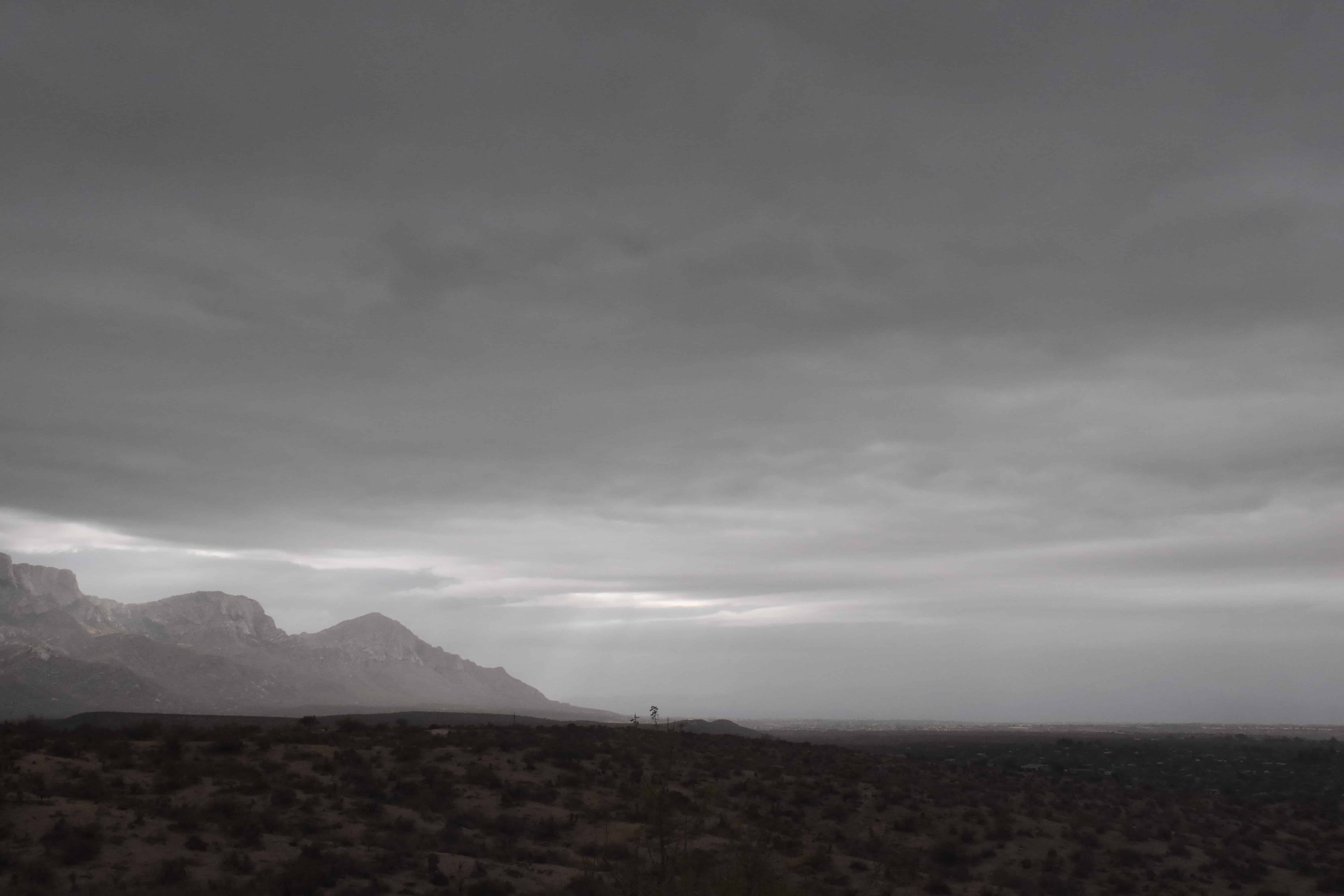
3:16 PM. Pretty and dramatic.  Stratocumulus piling up over and upwind of our Catalina Mountains/Pusch Ridge.
3:19 PM. Oh, so pretty.
3:27 PM. Crazy, I know, but I thought these scenes were so pretty!
3:28 PM. As that rain band approached there were some nice lighting highlights.
3:40 PM. Here comes that rain band  across Oro Valley/Marana.
4:19 PM. A truly great scene for a desert; mountains partially obscured in precipitation.
4:19 PM. Nimbostratus. Its hard to get a better photo of rainy Nimbostratus than this. Drops coming off the roof, NOT raindrops, can also be seen.  This was at the peak of the rain, too!  Very exciting.
5:54 PM. Sunset Stratocumulus, hold the ice. Yet, that Stratocumulus was cold, way below freezing.


The weather way ahead

The title sums up where we are now.  Will we go have more rain? Oh, yeah.  But not right away, as you already know.


Sun and Altocumulus clouds combine to provide a colorful sunrise and a sunset on the same day! Rain on tap!

“Rain on tap” does not  refer to a microbrew, for those who’ve accidentally stumbled onto this site.

Our nice sunrise and sunset, featuring supercooled1  Altocumulus clouds:
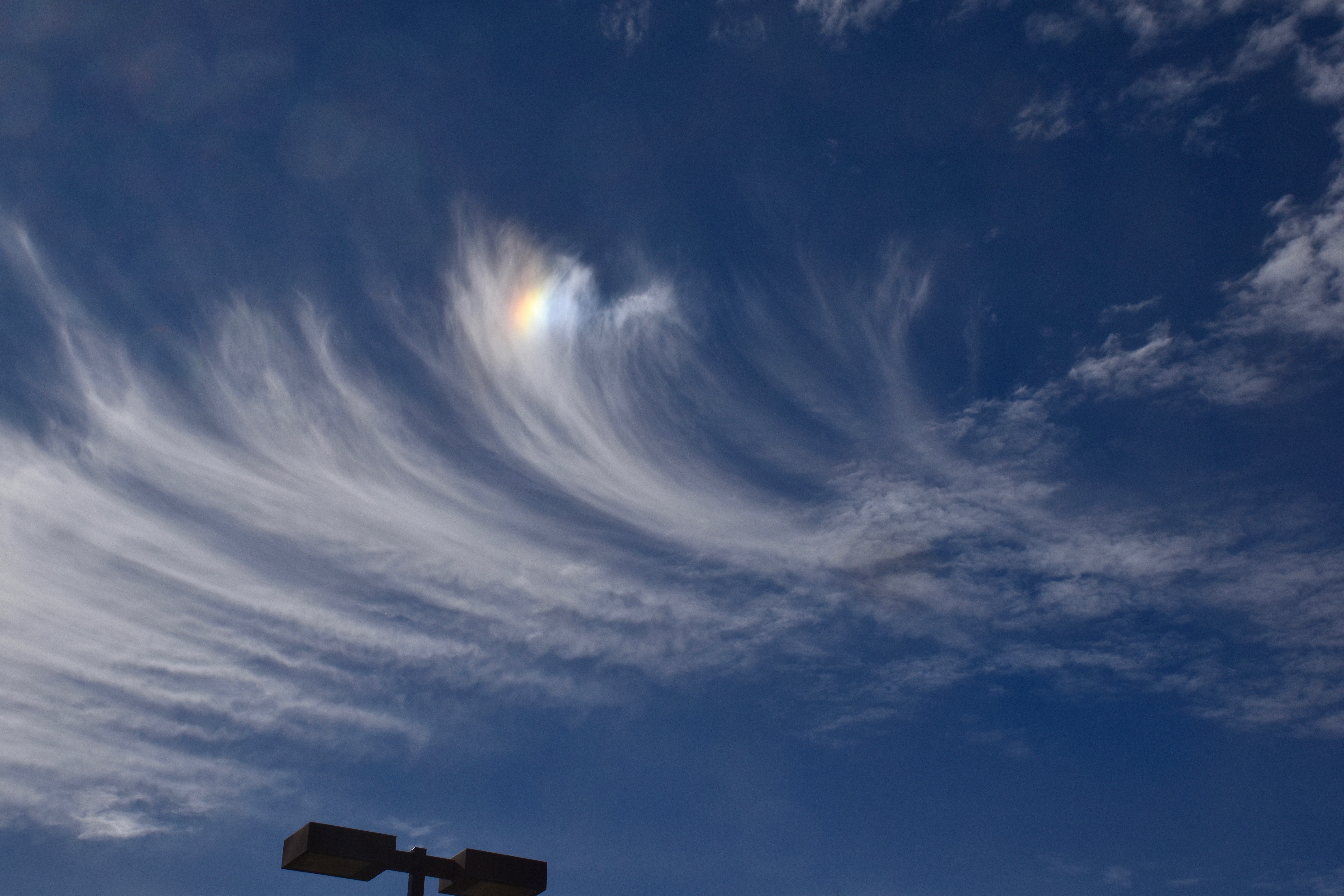
7:22 AM.
7:26 AM.
7:29 AM. Ice crystals trail down from this region of cloud cover toward the north. Was it hers or ours? This Altocu layer was at -15°C (about 4°F), cold enough for some natural ice, but not as prolific as this. The fact that the ice does not trail downward much indicates the crystals in this virga were really small, also suggesting a non-natural event since an aircraft can produce thousands per liter of ice crystals, none of which can grow to very large sizes. Maybe ours?
9:20 AM. Well, what’s a day in Arizona with supercooled Altocumulus without an ice canal caused by an aircraft. So, they were occurring yesterday.  We don’t see them much in the summer because the Altocumulus clouds are warmer.


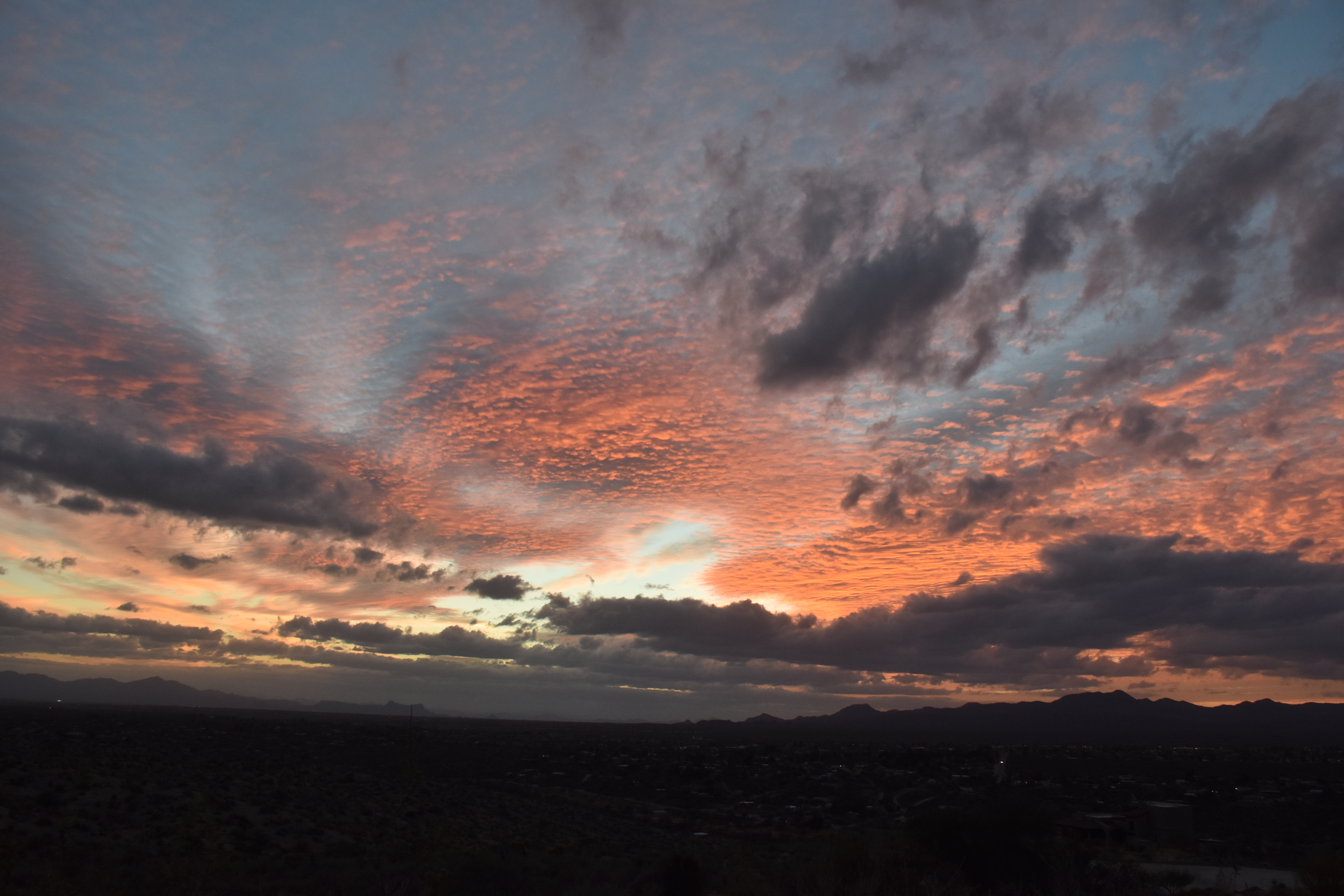
4:36 PM. Our steady diet of Altocumulus yesterday is topped here by a veil of CIrrostratus, all leading one to expect a colorful sunset.
5:52 PM. So pretty again….


5:52 PM. Wider view of the same scene.


Rain on tap?  Oh, yeah….finally.  One forecaster friend is predicting 0.5 inches!  How nice would that be?  The rain will likely begin toward midnight–check it here from our nice U of AZ Weather Department.

Looking for more rain in AZ after mid-month, toward the 20th.

The End

Cloud patterns excite Catalinans; storms continue to pile up for January

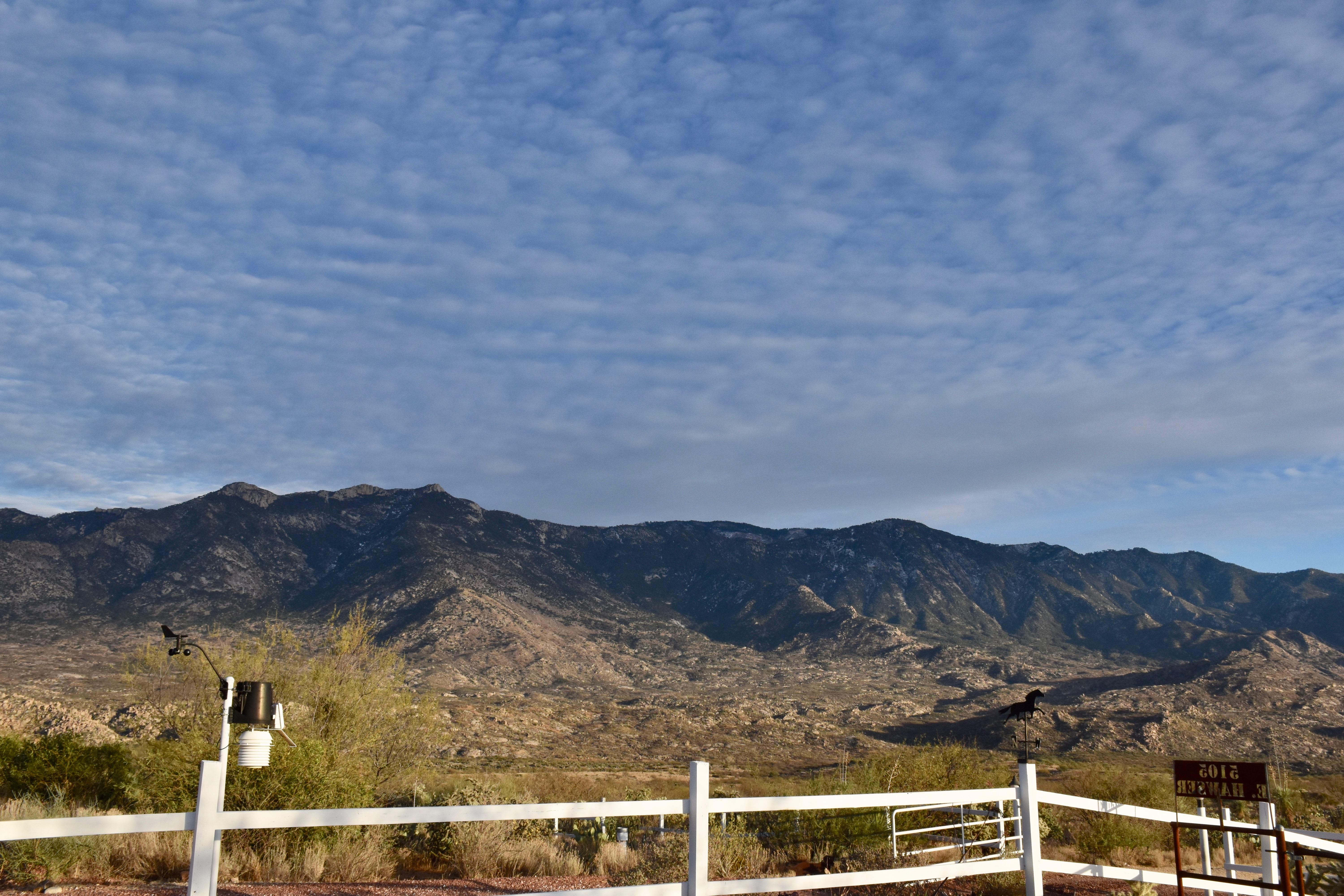
A swatch of Altocumulus perlucidus translucidus (sorry, that’s the way we talk around here) passed over Catalina early yesterday afternoon, each “unit” nearly perfectly evenly spaced with its fellow cloud element creating a brief period of cloud awe for those Catalinans (or is it, “Catalina-ites”?  “Catalinians”?  Who knows, who cares?).  Here it is, in case you work indoors and missed it.  It was truly a fabulous sighting!

1:16 PM.
1:16 PM. Starting to take too many pictures of the same thing!
1:16 PM.
1:16 PM, of course.  So pretty.

The afternoon was marked by a melange1 of middle clouds:

1:52 PM. Altocumulus opacus with a Cirrostratus above.
3:11 PM. Some equestrians on horses (haha) went by the house.  Sometimes we focus too much on just clouds here, and so we offer the reader who visits here an occasional relief from cloud fatigue.
3:12 PM. Those equestrians were being shaded by a Altcumulus perlucidus and by an overcast of Cirrostratus.  If you look real hard, you can see a faint halo.  The Cirrostratus was thickening upwind as an upper level wave approached and was increasing the amount of rising air aloft over us. The Altocumulus clouds also thickened toward sunset.  See below.
5:07 PM. Heavy Altocumulus approached from the SW, keeping the sun from under-lighting the Altocumulus as it went down, so no flaming sunset last night. The Cirrostratus overcast continues. All in all, a fine day for Catalinians!

The weather just ahead

The local TEEVEE met men are, of course, pounding out the good news rain is just ahead for Catalina.  Looks like, oh, 100% chance to CMP (Cloud Maven Person) starting after midnight Tuesday to Wednesday.  How much?

This is a potent, but fast moving trough.  Maybe will have only 2-4 h of rain with the passage of the cold front and its rainband.  But, coming from the sub-tropics, should have a appreciable rain band with it.

I would expect rainrates to reach “moderate” as the heart of the band goes by for a coupla hours, anyway.  Moderate rain is defined by the NWS as 0.1 to 0.3 inches per hour.  So, only two hours of moderate rain should be at LEAST  0.2 inches, and most likely more.

We’re thinking here that there’s a 90% chance of more than 0.15 inches, and a 90% chance of less than 0.70 inches.  So, averaging those two leads to a best estimate in CMP’s opinion of 0.425 inches!  Wow.  Nice.

Now, I will look at the U of AZ nested model and see what it thinks.  Kind of game we play here, seeing how a seat of the pants forecast, made over a coupla minutes, measures up to a computer model with billions if not trillions of calculations:

Cumulative rainfall ending at 3 PM AST Wednesday afternoon. Catalina is in the GREEN, indicating that the Beowulf Supercluster thinks we’ll have over half an inch (Ms Mt. Lemmon, over an inch!) I am so happy!

The weather way ahead

After the nice rain just ahead, we have to get through the week-long dry spell before we move into a new stormy regime.  First, a spaghetti depiction of the ridge after our nice storm:

Valid at 5 PM on the 14th. Huge ridge has stacked up along the West Coast, making it look like the drought will continue ad nauseum.  You’ll be discouraged when the middle of January comes around (though by then, everyone will know this is a straw ridge, will collapse in almost hours from this time from the outputs made in real time then.)

Here’s what’s been exciting for a few days now, and below, from last evening’s global model output:

Let’s see what the actual and very latest model run from IPS Meteostar has for us:

From the 11 PM AST last evening global model output this big boy. Unlike so many prior troughs that were bogus this winter at this time ahead (two weeks), this one has spaghetti support and will be real!!! And, it won’t be the only one!!! I’m shouting again!!!

How much these coming rains can benefit our spring wildflower bloom and spring grasses I don’t know, but I sure hope they can resuscitate what otherwise will be a dismal spring.

Expecting a snow event during the “new regime” that takes over after mid-month,  too.  Be ready!


The End

Artifact skies

I use that expression not only to draw attention to myself since my name is Art, or, “Artie boy” to mom, but also because I had a role in bringing this phenomenon to the attention of the scientific community; that is, that an aircraft could glaciate portions of clouds at temperatures as high as -8°C.  This in a peer-reviewed article  so controversial it was rejected twice by journal reviewers  before “getting in “(pdf here)!  Some background on why this happened is found in a footer way down below….

Its common knowledge today that an aircraft can produce in essence a contrail in clouds at temperatures down to about -10°C and must be avoided when researchers are sampling the same cloud over and over at below freezing temperatures.

Back to the beginning:

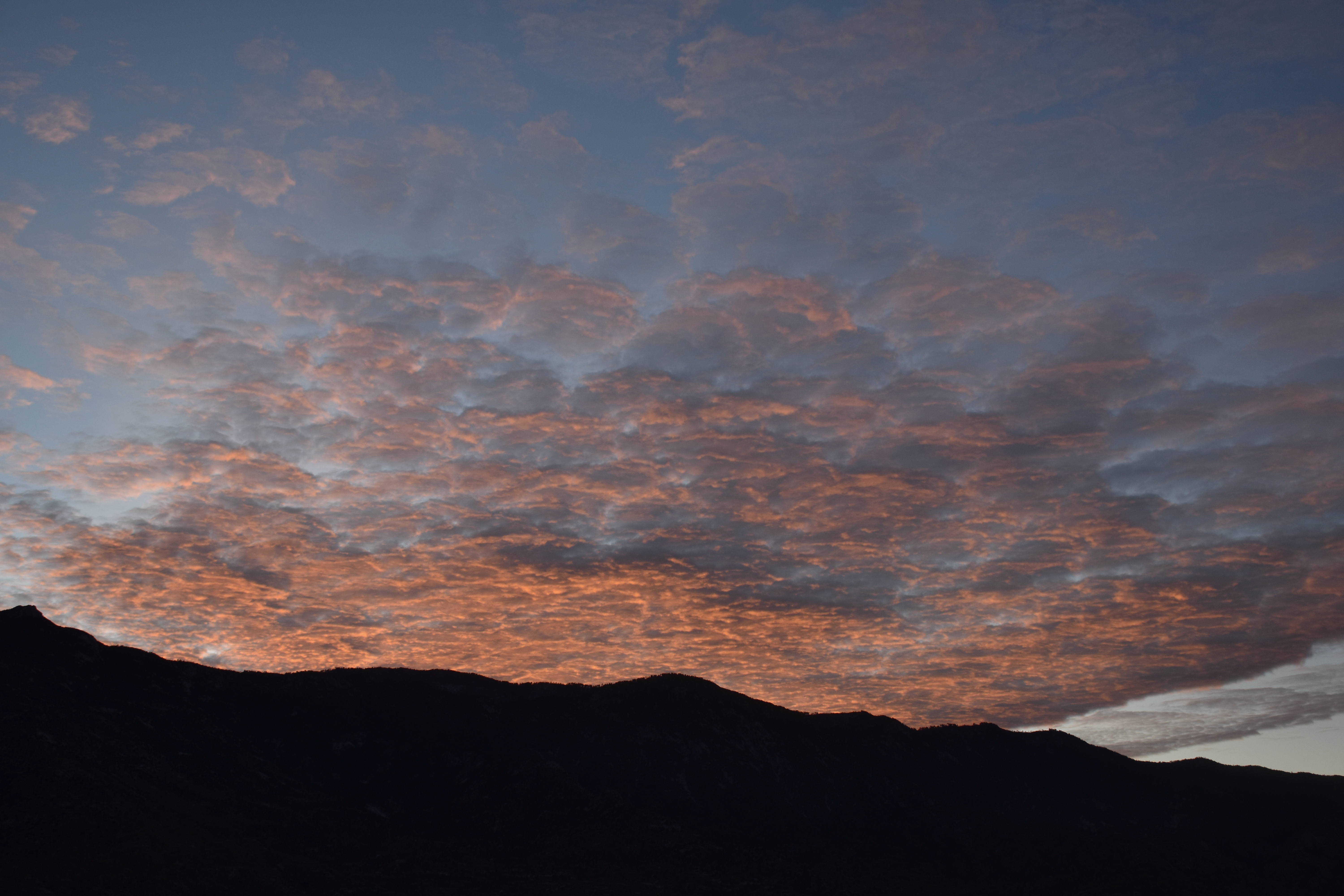
The day began well enough with a nice sunrise over the Catalinas:

7:28 AM. Really cold Altocumulus perlucidus lurks over the Catalinas.   The sounding suggests that this layer was at -26̂°C, and yet no ice or virga is present.  This is not unusual.  Ice tends to form more readily when the droplets in clouds are larger–these were likely tiny, 10-15 microns in diameter, and, being a layer high in the atmosphere, not connected to the ground, meant there would be a dearth of ice-forming substances like dirt, well, kaolin mineral particles.
8:01 AM. Well, OK, for the really sharp-eyed cloud maven juniors, yes there was a trace of ice here and there in those clouds.

Here’s the early morning National Weather Service  balloon sounding from the U of AZ:

This sounding was launched about 3:30 AM AST yesterday morning. During the day, the bottom of the Altocumulus clouds lowered and got a little warmer, but still plenty cold for aircraft ice production.

Then, as the Altocumulus layer filled in from the west, the aircraft effects roared to life.  An example from yesterday, one that passed right overhead of little Catalina!

10:01 AM. A parch of aircraft-induced ice in this Altocumulus perlucidus translucidus composed of supercooled droplets otherwise, is about to pass overhead of Catalina.


10:08 AM. High temperature contrails rip through a Altocumulus perlucidud translucidus layer up around -25°C.
10:10 AM. Looking for some optical fireworks here, such as a tangential arc (halo curving the wrong way), but only a hint of one showed up. Can you see it?
11:23 AM. Another clearing with ice below it is seen just SW of Catalina from the parking lot of Basha’s where I went to get some cottage cheese.
11:33 AM. Sun dog (parhelia) lights up in the ice patch above after I came out of Basha’s with some cottage cheese.  Note to writers;  little, seemingly irrelevant details like what you bought in a supermarket makes your writing come alive for the reader.
1:21 PM. There’s another couple! They were just everywhere yesterday!
3:52 PM. Later as the moist layer deepened and lowered further, there was ice aplenty, but it was impossible IMO to tell whether it was au natural or aircraft-induced. Surely, some was due to aircraft penetrations of supercooled clouds. However, when the air is rising enough, a hole or ice canal may not appear since droplets can reform rapidly.
3:52 PM. Looking more to the west where the long trails of ice are more visible.
4:14 PM. I feel asserting here. I assert that this one is from an aircraft, but with droplet backfill that prevented a hole from forming.  Looks like “phony” virga to me, and, of course, to you, too, as a certified member of the cloud maven society.
5:21 PM. Interestingly nearly all virga disappeared about this time, certainly nothing extraordinary that led to the suspicion of aircraft induced ice. The sounding suggests that the higher temperatures that the Altocumulus layer was at may have been the reason. See below…
The U of AZ balloon sounding launched at 3:30 PM suggests the bases of the Altocu have dropped down to about 18,000 feet above sea level, 15,000 feet or so above Catalina, and are much warmer, and thicker than when the day started as we could see.


The weather ahead

More interesting middle and high clouds, probably a great sunset/sunrise or three, but no rain, just virga.  The present mass of middle clouds passing over has some virga and sprinkles, but that’s about it  from this episode.  No real support yet for a change in our dry, warmer than normal weather regime in spaghetti plots though one trough a week or so out is forecast to bring a little rain.

The End


Some background on “APIPs”

This phenomenon had been shot by photographers for decades, yep, DECADES,  BUT, it was believed (apparently) by those doing cloud research, that it only happened at very low temperatures such as those when the normal contrails we see occur (at temperatures lower than -35°C), viz.,  it was ignored.

Another factor was that all of the rare photos of this phenomenon, dubbed “Aircraft Produced Ice Particles” (APIPs, by yours truly, though not the greatest name)  appeared in lay or quasi-lay publications and were likely missed by those with big Ph. Ds. who only read technical journals.  An example of this was on the cover of  the Bulletin of the American Meteorological Society in 1968, a cover shot which drew the greatest amount of reader comments that the journal had ever seen!  They went on for a couple of months, some suggesting that the ice and hole in cloud was due to a meteorite!

Also, it was a rare case indeed when the photographer could report the temperature at which it occurred. 

Altocumulus in transition; water to ice

I was thinking how great yesterday was for you.  Started out with a spectacular sunrise (lasted just a couple of minutes), and then you could watch for pretty much the WHOLE day, orographically-formed Altocumulus opacus and castellanus transition to ice crystal clouds (in this case, Altostratus with virga and some mammatus) right before your eyes!

Sunrise:

7:16 AM. Flecks of Altocumulus clouds below Altostratus.

After sunrise….this odd scene below of an extended Altocu lenticular cloud:

7:33 AM.
12:24 PM. Altocumulus opacius shedding ice as they moved westward across Oro Valley.
3:01 PM. Altocumulus castellanus forming just upwind of the Catalinas, moving toward the west (to the left in this photo). No ice is falling out yet, though tiny ice crystals are likely starting to form.
3:01 PM. Looking farther downstream from the prior photo. Some ice is beginning to show up and fall out (center and left side of photo).
3:02 PM. Looking still farther downwind, those Altocumulus clouds are mostly glaciated, that is, mostly consist of ice. This transition has taken about 10 minutes of travel downwind. The sounding near this time, indicated that tops a little downwind of the U of AZ campus release site, were about -27°C (-17°F). However, tops were likely rising some small amount in this region downwind of the Catalinas, and so were almost surely, even a little colder than that.
4:33 PM. Nice example of what some of the Altocumulus castellanus looked like yesterday. That tallest turret will fall back. Its partner is just to the right, one that was previously as high, but fell back, its load of ice crystals drifing down. Some of the ice in the taller one is still being held up there until it, too, collapses. A error in aircraft sampling can occur if you don’t realize that tops have collapsed from lower temperatures, such as when collecting ice concentrations in the collapses one. You could easily assign a cloud top temperature that was too high; would not reflect the temperature at which they really formed.

More “pretties” below; yesterday’s sunset:

The afternoon sounding from the U of AZ campus.

The End

Cirrus uncinus scenes for a lifetime, well, mine, anyway

I hope you had a chance to venture out late yesterday morning and see some of the most spectacular Cirrus (uncinus) displays with HUGE streamers that you will ever see.

The early Cirrus cloud were nothing very special, not showing clues about what was to happen a few hours later:

7:46 AM. A complex sky with Altocumulus on the right and various species of Cirrus such as Cirrus spissatus, center.

But by mid-morning, racing in from the west, these:

10:58 AM. From the Rillito Bridge at Swan, this amazing scene with Cirrus uncinus and those gigantically long tails of ice!
11:08 AM
11:08 AM. Mimics trees in a way, both reaching upward.
11:14 AM.
11:12 AM. From the Rillito Bridge at Swan again.  Kind of running around like a chicken with its hat off!  The heads of the Ci unc are overhead.
11:11 AM.
11:14 AM. One final shot.

—————

There was an interesting  contrail distraction later that day.  Are these “castellanus” crenelations, or is it perspective?  Those knobs are usually pointed downward due to the action of the wingtip vortices that take them downward behind the plane.  Maybe they’re just sloped down at us, not puffed up.

1:10 PM.

—————-

Late in the day some Altocumulus advanced from the west, providing a nice sunset, but a layer once again impacted by aircraft holes.   Can you find them (with their trails of ice slanting downward?)

5:38 PM.

The End

Well, there is still a chance of some rain late in the month, late or after the TG holiday weekend…..  FIngers crossed.   Poor wildflower seeds.